codeman3 Posted January 23, 2006 Share Posted January 23, 2006 I was just wandering what everybody uses there GPS's for? Is it just strictly for caching, or on the water or land or for work please share even those who just look. Quote Link to comment
+PerfectPair Posted January 23, 2006 Share Posted January 23, 2006 Caching, Trips, boating, offroading. Quote Link to comment
+Quoddy Posted January 23, 2006 Share Posted January 23, 2006 I seldom drive anywhere unfamiliar either in my truck, car, or ambulance without the auto-routing on. It really allows full concentration on the road and not on trying to figure out exactly where I'm at and where the next turn will be. I particularly like the distance to next (turn) feature as it gives me a real idea of how long/far before I'm going to make any turn off the road I'm on. Quote Link to comment
+Bill & Tammy Posted January 23, 2006 Share Posted January 23, 2006 Finding my car in the Wal-mart parking lot Quote Link to comment
+Airmapper Posted January 23, 2006 Share Posted January 23, 2006 First I turn it on, clear the warning screens........ You mean there are thing you cannot use a GPS for? Quote Link to comment
+Pablo Mac Posted January 23, 2006 Share Posted January 23, 2006 I use mine to pretend I'm on the phone while hunting caches in an HMZ (High-Muggle Zone; you heard it here first). PS: This is my 200th forum post. Quote Link to comment
+RockyRaab Posted January 24, 2006 Share Posted January 24, 2006 Actually, Pablo, using your GPSr as a fake phone is a whole lot like a lampost cache: it's clever the first time you think of it. But it's been done since Jeremy said "What's GPS?" Quote Link to comment
+Mule Ears Posted January 24, 2006 Share Posted January 24, 2006 I was just wandering what everybody uses there GPS's for? Is it just strictly for caching, or on the water or land or for work please share even those who just look. Makes a dandy pedometer for exercise walks. Quote Link to comment
Lowsky Posted January 24, 2006 Share Posted January 24, 2006 Well, lets say I'm in the middle of the woods and I find a nail. Well my legend makes a swell hammer. However, you can only use it as a hammer after that. { bummer} Quote Link to comment
+Pablo Mac Posted January 24, 2006 Share Posted January 24, 2006 Actually, Pablo, using your GPSr as a fake phone is a whole lot like a lampost cache: it's clever the first time you think of it. Yes, it's clever once for me as a cacher, but since the muggles outnumber us many times over, it's more of a perpetual cleverness than an LPC. You can fool that one, and that one, and them over there, too, etc. We repeatedly fool them with the oldest trick in the book! Speaking of LPC's, I have been asked to repeat what some have called a clever twist to the lampost cache; too bad I can't share the details here that caused many cachers repeated attempts (it took one guy eleven tries) to find it! Quote Link to comment
+JohnTee Posted January 24, 2006 Share Posted January 24, 2006 Just the usual, "It's a toy I gotta have!" Hunting/Fishing - my original purpose Geocaching - now another hobby/sport! Travel - wish my eTrex Legend had better maps I want to put it on my electric R/C car and clock its top speed JohnTee Quote Link to comment
bogleman Posted January 24, 2006 Share Posted January 24, 2006 Started out in 97 with a basic etrex for marking hunting trails, stands, and so I would not get lost when in an unknown area. Still use the GPS (now a new model)for hunting and it is easier now being able to see on the maps where I am an where the areas are that I marked. I also like to leave it on when I am out driving around just to see where I went and how fast I went. Quote Link to comment
SGT Superman Posted January 24, 2006 Share Posted January 24, 2006 Originaly used mine to hunt down rocket and mortar impacts in Iraq so we could do counter fire. People would call in the general grid location and off I go. Quote Link to comment
+rover-r-us Posted January 24, 2006 Share Posted January 24, 2006 hiking,caching,work Quote Link to comment
+mb3 Posted January 24, 2006 Share Posted January 24, 2006 I used it to see how fast the plane was moving yesterday. Before that I used it to get me all over Philadelphia. Quote Link to comment
+bobbarley Posted January 24, 2006 Share Posted January 24, 2006 Mark and map infected trees for removal, make trail maps, determine shortest bike route to work. Quote Link to comment
+ThatXrayGuy Posted January 24, 2006 Share Posted January 24, 2006 I initially bought my Etrex Vista C for hiking then I learned about geocaching. Now I do more geocaching than hiking I like to take my GPSr along with me even when not geocaching/hiking and to places I'm familiar with because it's cool to get a bird's eye view of where I am. I bought the Mapsource Topographical maps at the same time I bought my GPSr so sometimes the streets aren't accurate but now I know that most of the little creeks and streams I cross everyday actually have names Steve Quote Link to comment
Clan Riffster Posted January 24, 2006 Share Posted January 24, 2006 We got our first GPSr, (a Garmin 12, I believe), many moons ago, when I got lost, bowhunting in Ocala National Forest. Fortunately, I was bright enough to stop at the first "road" I came to once I realized I was lost. They found me snoozing bright & early the next morning. Since then I've used it for kayak fishing, more hunting, and at work, searching for other folks lost in the woods. Quote Link to comment
nobby.nobbs Posted January 24, 2006 Share Posted January 24, 2006 you mean they have other uses as well???? Quote Link to comment
+JohnTee Posted January 24, 2006 Share Posted January 24, 2006 Just the usual, "It's a toy I gotta have!" Hunting/Fishing - my original purpose Geocaching - now another hobby/sport! Travel - wish my eTrex Legend had better maps I want to put it on my electric R/C car and clock its top speed JohnTee I'll have to add one more use . . . I was out hiking a trail today, looking for a place to hide my first cache. Went to Wally World to get some 35mm film cannisters (NO, not for micro-caches ) to put CITO bags into. Will stock my cache with a few of those. At W.W., I realized I did not have my phone; slip-in holster was tipped forward and EMPTY. Went back to the truck to look and got a real sinking feeling when I didn't find it there. Back to the park I was hiking in. Walked the backroute on my GPS and found my phone. Would you believe it was in the last place I looked?! JohnTee Quote Link to comment
rainbowsfancy Posted January 25, 2006 Share Posted January 25, 2006 I use mine for conditioning my horse for long-distance trail races. I attach it to her breast collar and check the stats at the end of a training ride, or at the periodic vet checks during a race. Also very good to get a decent elevation profile on the hill work. I also use it while hiking, biking, and caching, of course! -RF Quote Link to comment
+VO2WW Posted January 25, 2006 Share Posted January 25, 2006 Original reason was for hunting (trails, stands, points etc), than hiking in no trail areas and to keep track of time, distance, stopped/moving time etc, than Geocaching, followed by car travel instead of paper maps, now bird watching site marking, boat navagiation, speed checks of all sorts, elevation ckecks, marking homes of people or places we visit occassionally. measuring distance, clock/alarm clock, sunrise/set times, almost as important as my PDA!!!! Quote Link to comment
+DaigleFamily Posted January 25, 2006 Share Posted January 25, 2006 Finding my car in the Wal-mart parking lot Hey I never thought of that------ Quote Link to comment
+Thrak Posted January 25, 2006 Share Posted January 25, 2006 I use it for caching of course. It was also AMAZINGLY wonderful for my last trip to Montana and back. I loved the thing. I'm very glad I got a unit that autoroutes and sprang for the maps as well. Extremely cool. I can't use mine as a fake cell phone though. It's a GPSMAP 76CS and it's just way too big to make a convincing cell phone. I did have one lady ask if I was "recording the bird songs" one early morning though. Quote Link to comment
+Lone Duck Posted January 25, 2006 Share Posted January 25, 2006 Errr... navigation? Certainly not a doorstop. Just today I used it for a cross country drive. I also use it often to find where I parked when I'm in a huge lot like at the airport, or I go to some event. Quote Link to comment
+Team Land Rovers Posted January 25, 2006 Share Posted January 25, 2006 I actually bought mine for work first, then discovered geocaching after a friend told me about it. I work in Real Estate in a rural area. I use the GPS to find people's lots when they are interested in selling. Surprisingly, many people don't know where the land they own is located out here. There are places out here that have no street signs, and no markings. So with a combination of a real estate program for aerials, google earth and GPS, I can find the lots. Not quite as fun as geocaching, but a fun way to spend part of your work day. Quote Link to comment
+Night Stalker Posted January 25, 2006 Share Posted January 25, 2006 i bought my first gps for geocaching. It was a pretty basic model so thats all it did. Then I upgraded to the 60CS. Don't know what I would have done without it. I travel all the time for work. My company has decided that neverlost costs to much in our rental cars, so now I preload maps of the area I will be working and then pre-enter the address for my motel and for my work location. This saves a lot of time and angst, and leaves more time for caching. Quote Link to comment
genseeker Posted January 25, 2006 Share Posted January 25, 2006 Hmmm, GPS used for Genealogy cemetery locations, birdwatching sites, independent travel off sheeple trails, fishing, and since my sense of direction bites. Get help when and where ya can. genseeker "life is a gamble, a game we all play..."GS Quote Link to comment
+JDandDD Posted January 25, 2006 Share Posted January 25, 2006 Makes a dandy pedometer for exercise walks. Works great for walks. Use the autorouting all the time to navigate through unfamiliar areas. Use a GPS set at 5 second intervals for track recording to make fairly accurate trail maps. Its also fabulous for finding your car in a theme park parking lot. JDandDD Quote Link to comment
backpackermt10 Posted January 25, 2006 Share Posted January 25, 2006 Geocaching, school, and backpacking Quote Link to comment
+cache_test_dummies Posted January 25, 2006 Share Posted January 25, 2006 There is a plan in the works to provide cell phone coverage across large portions of North Dakota using balloons. The idea is that some electronic gear is suspended below a balloon which is launched up into the jet stream, and as the balloon travels across the state, it provides cell phone coverage over an area of hundreds of square miles. When the balloon reaches the other side of the state, the gear is dropped with a parachute so it floats safely to the ground. Then, using GPS technology, 'bounty hunters' will retrieve the electronic gear, and return it to be used for another trip. I haven't actually done this yet because the system is not in place, but if possible I'd like to use my GPSr to become one of the bounty hunters. One complication is that I don't live anywhere near North Dakota. Article Quote Link to comment
+wesleykey Posted January 25, 2006 Share Posted January 25, 2006 I use it to see how fast I'm walking or runnig or driving, what my average speed is, how far I have walked, driven or whatever. I use it as a compass. I use it as a writing surface when signing micro logs......... On occasion I even go geocaching with it. Quote Link to comment
Broadwing Posted January 25, 2006 Share Posted January 25, 2006 Originally, I got mine to mark locations for hunting and fishing. Now, besides 'caching, I use it for the above, as well as keeping track of distance walked while hunting and for work when I travel to track mileage! As a youth worker, I also use it as a teaching tool as part of geography and as a fun activity for at-risk students. Quote Link to comment
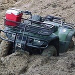
+Airmapper Posted January 26, 2006 Share Posted January 26, 2006 I have used my AirMap for the following: Aircraft Navigation Road Trips, Navigating cities like Nashville, Chattanooga, Evansville.... ATV, also mapped trail system for ATV. Hunting Fishing/ Kayaking. Marking areas fished, and put in's. Hiking in the woods, walking in cities. Rough property surveys, measured an 80+ acre plot. Giving people directions, finding peoples houses, (address feature) finding places to eat/ sleep/ get gas (POI Database) GEOCACHING And maybe a few other things. All in all I have gone over 10,000 miles using my Airmap 500. Quote Link to comment
Colonel Mustard Posted January 26, 2006 Share Posted January 26, 2006 Being into genealogy, I started using mine to mark locations of ancestor graves. It's especially useful to refind graves on huge cemeteries and in family plots that risk getting overgrown and might disappear one day. I've also used it to document some artifact finds on old historic sites with the local Historical Society. Quote Link to comment
+Prairie Dog Posted January 26, 2006 Share Posted January 26, 2006 Well first and foremost I use it for Geocaching. That is the reason I bought it. Since then though, I have used it for navigation in the car and in cities when I didn't know my way around. One really neat use is to use it as a speedometer while snowboarding. I clipped it on my backpack and bombed the hill. I went like 48 MPH, cool! Another use is to measure distance in feet for Disc Golf or Frisbee throws. It's not perfect accurate for this, but it gives you a pretty good idea of how you're throwing. Quote Link to comment
+teald024 Posted January 27, 2006 Share Posted January 27, 2006 I originally bought it to use with my quad in the trails. Found Geocaching when searching out the unit I wanted to buy. Now I use it much more frequently to cache and getting me to unknown places in the car. Quote Link to comment
+daiichi Posted January 27, 2006 Share Posted January 27, 2006 I originally got a PDA with a GPS so that I can view aerial maps when I'm mountain biking. I hate getting to a fork in the trail--and not knowing which one I ought to take. Aerial photos (and to a much lesser extent, topo maps) made my biking time much more efficient. Someone saw my GPS and pointed me to geocaching.com. I tried it out... and voila! Hooked. Though I hunt for caches whenever I can, I ALWAYS take my GPS with me biking--the original intent is still the primary one. Quote Link to comment
+Wandering Bears Posted January 27, 2006 Share Posted January 27, 2006 My wife bought it for me so I wouldn't get lost wandering the woods of WV chasing deer, bear and turkeys. Later I found out about "our little game." But I pretty much use it every time I can. Quote Link to comment
+ArchaeologyMan Posted January 27, 2006 Share Posted January 27, 2006 In addition to GC I also use mine for work. Quote Link to comment
+wandererrob Posted January 27, 2006 Share Posted January 27, 2006 I use mine for all my navigational needs whether it's in the car, the woods, on the water. I also use it to track my progress when I'm walking, hiking, etc. as it tells me how far I've gone, average speed, elevation, yada yada yada... and of course for geocaching and lately a bit of benchmark hunting. I carry it on me all the time now. Quote Link to comment

Recommended Posts
Join the conversation
You can post now and register later. If you have an account, sign in now to post with your account.
Note: Your post will require moderator approval before it will be visible.