+icefall5 Posted March 7, 2006 Share Posted March 7, 2006 (edited) Find a place somewhere in the US on Google Earth that you want to share and share it! Make sure it has the caches from the KML through gc.com! I picked this one because it's near my house. **Note to Mods**- I don't think this violates any rule, but sorry if it does! (Obviously) if this violates any rule, feel free to lock it! :) Edited March 7, 2006 by icefall5 Quote Link to comment
Keystone Posted March 7, 2006 Share Posted March 7, 2006 **Note to Mods**- I don't think this violates any rule, but sorry if it does! (Obviously) if this violates any rule, feel free to lock it! :) The popular and long running What/Where? thread in the Off Topic forum is a place where you can post just an aerial photo of a landmark, building, etc. and people try to guess what it is. That has nothing to do with geocaching, but is fun for those who choose to participate. I mention it so that this thread doesn't turn into a duplicate. So long as everyone follows the OP's request to show Google Earth photos with geocache information shown, then that's ON topic and could also be fun. Quote Link to comment
Pto Posted March 7, 2006 Share Posted March 7, 2006 Here is a shot of St. Paul MN's Como Park- where 5 of my hides are hidden- the others are by other cachers. Nothing too special, just a nice shot of the park, golf course, etc- Quote Link to comment
+The Leprechauns Posted March 8, 2006 Share Posted March 8, 2006 Here are the caches around downtown Pittsburgh. The two on the right are mine. I think it's cool that you can get four icons within an easy walking distance if you visit for a sporting event. That's Heinz Field on the left, home of the Super Bowl Champion Steelers, and PNC Park on the right, the nicest minor league baseball team home in the world. And, of course, the "Golden Triangle," ending at Point State Park, the point where the Allegheny River (top) and the Monongahela River (bottom) meet up to form the Ohio River. The caches shown on the photo are covered by this bookmark list. Quote Link to comment
+One of the Texas Vikings Posted March 9, 2006 Share Posted March 9, 2006 About 20 Miles North of Houston. Near Lake Houston. Quote Link to comment
cad-guy Posted March 9, 2006 Share Posted March 9, 2006 I have used google earth, but these pics look different. How do you get the GC icons to show up. I usually download the waypoint and open the .loc file in GE and I get a generic dot. Just wondering how you get it to look like that....sorry if I've gone off topic. Quote Link to comment
+robert Posted March 9, 2006 Share Posted March 9, 2006 I have used google earth, but these pics look different. How do you get the GC icons to show up. I usually download the waypoint and open the .loc file in GE and I get a generic dot. Just wondering how you get it to look like that....sorry if I've gone off topic. There's a link to it in your profile, if you go to http://www.geocaching.com/my .... look on the right-hand side. This will download the Google/Geocaching.com KML file and add a checkbox to Google Earth (in the panel on the left) so you can get to them without going through gc.com each time. Quote Link to comment
+briansnat Posted March 9, 2006 Share Posted March 9, 2006 My house (next to that small, ovalish lake in the center). 14 of the caches are mine and one is my wife's Quote Link to comment
BRTango Posted March 9, 2006 Share Posted March 9, 2006 (edited) My house (next to that small, ovalish lake in the center). 14 of the caches are mine and one is my wife's I just realized... I have a TB sitting in one of your caches, Indefatigable (not in your picture). It must be a pretty tough one this time of year. Only one attempt in the logs since the TB was dropped of last August. I'm planning on going after it next time I drive through the area (probably next month). Edited March 9, 2006 by BRTango Quote Link to comment
Team Firebird Posted March 9, 2006 Share Posted March 9, 2006 This is stone mountain, a geologial odity near us. Quote Link to comment
+M-T-P Posted March 9, 2006 Share Posted March 9, 2006 I'm surprised that nobody has shown off some really cool 3D terrain of Google Earth. The first one is of a cache called Rocky Horror on the edge of a rocky slope somewhat near these bridges. The cache icon appears closer to the bridge than it really is because of the KML's ambiguity. The second one is a virtual near Hoover Dam. Quote Link to comment
BRTango Posted March 9, 2006 Share Posted March 9, 2006 The Stone Mountain pic is a really cool one with the 3D terrain: Quote Link to comment
+briansnat Posted March 9, 2006 Share Posted March 9, 2006 My house (next to that small, ovalish lake in the center). 14 of the caches are mine and one is my wife's I just realized... I have a TB sitting in one of your caches, Indefatigable (not in your picture). It must be a pretty tough one this time of year. Only one attempt in the logs since the TB was dropped of last August. I'm planning on going after it next time I drive through the area (probably next month). Ouch, that's a real tough cache. If nobody finds it in winter it will be a long time before someone else attempts it Actually I can probably rescue it because the cache itself is easily accessible, its the multi stages that take it over tough terrain. Quote Link to comment
BRTango Posted March 9, 2006 Share Posted March 9, 2006 My house (next to that small, ovalish lake in the center). 14 of the caches are mine and one is my wife's I just realized... I have a TB sitting in one of your caches, Indefatigable (not in your picture). It must be a pretty tough one this time of year. Only one attempt in the logs since the TB was dropped of last August. I'm planning on going after it next time I drive through the area (probably next month). Ouch, that's a real tough cache. If nobody finds it in winter it will be a long time before someone else attempts it Actually I can probably rescue it because the cache itself is easily accessible, its the multi stages that take it over tough terrain. If you wouldn't mind rescuing him, I'd greatly appreciate it. I'd love to see him get back out into the world. Thanks a ton!! Quote Link to comment
+4leafclover Posted March 9, 2006 Share Posted March 9, 2006 Here are the caches around downtown Pittsburgh. The two on the right are mine. I think it's cool that you can get four icons within an easy walking distance if you visit for a sporting event. That's Heinz Field on the left, home of the Super Bowl Champion Steelers, and PNC Park on the right, the nicest minor league baseball team home in the world. And, of course, the "Golden Triangle," ending at Point State Park, the point where the Allegheny River (top) and the Monongahela River (bottom) meet up to form the Ohio River. The caches shown on the photo are covered by this bookmark list. I was in that park!!!! way beofre caching existed, tho.... Quote Link to comment
+rowanf Posted March 9, 2006 Share Posted March 9, 2006 This is push pins rather than cache symbols because the Mac version of Google Earth doesn't work (I had to go back to the beta). The cache icons appear but seem to have server problems and disappear leaving nothing as soon as you move. *sigh* At least with the pins I can see where the caches are even if there isn't any other info. This is the Stanford Campus in Menlo Park, CA Quote Link to comment
+5winters Posted March 9, 2006 Share Posted March 9, 2006 Mount Borah the tallest point in Idaho, my goal is to climb it someday. The caches are along the trail. The portion of trail after the second cache is called "chicken out ridge" cool Quote Link to comment
+ByrnedFish Posted March 11, 2006 Share Posted March 11, 2006 Good ol' Honeoye Falls NY Quote Link to comment
+Adventure.AS Posted March 11, 2006 Share Posted March 11, 2006 High Park in Toronto with three of my caches. Quote Link to comment
+HBmamaG Posted March 11, 2006 Share Posted March 11, 2006 The Stone Mountain pic is a really cool one with the 3D terrain: That is awesome! Quote Link to comment
+Maingray Posted March 11, 2006 Share Posted March 11, 2006 Chapel Hill, North carolina. Go Heels! Quote Link to comment
Team Shard Finder Posted March 11, 2006 Share Posted March 11, 2006 This is the AMARC ( Aircraft Maintenence and Regeneration Center ) in Tucson, AZ. See Link The Boneyard Quote Link to comment
+MtnRubi Posted March 11, 2006 Share Posted March 11, 2006 Caches as far as the eye can see. I love living here! Quote Link to comment
+Quoddy Posted March 12, 2006 Share Posted March 12, 2006 A recent group hike in the snow (Tracklog in aqua). Twelve caches - 27 cachers! Quote Link to comment
+_BBQ_ Posted March 13, 2006 Share Posted March 13, 2006 I took this pic near Pheonix Az in South Mountain Park. The top one is from my digital camera and the bottom one is from the same position in Google Earth. I think it really shows off how great this software is. Real: Google Earth: Quote Link to comment
+icefall5 Posted March 13, 2006 Author Share Posted March 13, 2006 I took this pic near Pheonix Az in South Mountain Park. The top one is from my digital camera and the bottom one is from the same position in Google Earth. I think it really shows off how great this software is. Real: Google Earth: I think that's great. The top pic looks a little digitized (and DON'T say "Well, duh! It's from a digital camera!). Quote Link to comment
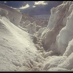
+icefall5 Posted March 13, 2006 Author Share Posted March 13, 2006 I was just exploring GE and I thought "Hmmm... I haven't looked at Everest in a while..." I am literally obsessed with Mt. Everest (the highest mountain in the world at 29,035 feet tall) and I want to climb it someday. I opened it with the KML file and boy was I surprised! There is a cache on Mt. Everest!!!!! It's amazing!!!!! Who woulda thunk there would be a cache on Everest?! YEAH! For the cache page, click here. Quote Link to comment
+icefall5 Posted March 13, 2006 Author Share Posted March 13, 2006 Here's one of Mt. Saint Helens: Quote Link to comment
+icefall5 Posted March 13, 2006 Author Share Posted March 13, 2006 Here's yet another one. If the NPS banned caching in their parks, my question is- why is this cache in Yellowstone? Oh, by the way- this pic is of Yellowston National Park. Quote Link to comment
+scavok Posted March 15, 2006 Share Posted March 15, 2006 An entrance to the rocky mountains via Boulder, CO at one of my favorite scenic overlooks. As cool as G.E. is, it doesn't do it justice Quote Link to comment

Recommended Posts
Join the conversation
You can post now and register later. If you have an account, sign in now to post with your account.
Note: Your post will require moderator approval before it will be visible.