+Ernmark Posted January 4, 2009 Posted January 4, 2009 (edited) On June 17, 2004 - BDT posted unto the Forums the following text (also known as topic 73525): "Some benchmark pictures are really excellent! Sometimes I "set as background" one for my computer for a while, until I find another really good one. I propose a thread here for posting really good benchmark pictures, either your own or someone else's. Contest rules: (yeah I know, I'm always proposing so many rules; ... anyway...) 1. No intersection stations (the station IS the tower, building, etc.) Why? Well they all look pretty good, but they're not really all that 'benchmarky'. 2. The disk has to be at least vaguely visible in the picture. No - 'view from', 'the area', etc. with no PID marker in it. Why? It's gotta be a Benchmark picture! 3. It has to be a PID in the database, or at least one of its reference marks or its azimuth mark (in case they don't have their own PID). 4. No closeup of just the disk. (Come on, it's just a disk - where's the nice scenery?)" And in keeping up this great yearly tradition, I'd like have the honor of kicking off another great year of hunts, finds, & info (and of course photos) by starting this 2009 thread - also, in the tradition of pulling pictures from the gallery that were taken by other benchmarkers .....I submit the first picture - a nice seasonal photo by our own Harry Dolphin: KV4911 WATNONG 2 (RM2) Special thanks to the Dolphin for freezing his fins off to bring this picture to us while we sit inside w/ our computer & beverage! Edit (1st of 2009) to add Dolphin lingo to above sentence. Edited January 4, 2009 by Ernmark Quote
+89SC Posted January 4, 2009 Posted January 4, 2009 (edited) Here's a some more snow and how often do you see a description like this: JW1052 "0.58 METER (1.9 FT) NORTHWEST OF THE NORTHWEST CORNER OF THE CONCRETE BASE OF A LARGE ARTILLERY SHELL" Edited January 4, 2009 by 89SC Quote
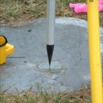
Mesa Mike Posted January 4, 2009 Posted January 4, 2009 My favorite so far is for a USGS benchmark (here) that doesn't show up in the online database: Quote
+Ernmark Posted January 4, 2009 Author Posted January 4, 2009 ..SOMEone's gotta ask: is that your chair? At any rate, sure beats the view from my chair! Quote
+chiknlips45 Posted January 4, 2009 Posted January 4, 2009 (edited) Did you know Frosty is a Benchmark Hunter? MD0583 found durning an escape to MI during the holidays. Edited January 4, 2009 by chiknlips45 Quote
+Ernmark Posted January 7, 2009 Author Posted January 7, 2009 (edited) Here's an 'unusua'l one from the Benchmark Gallery: X 211 (HT1496) by batch218 (...did the whole NGS party return from the last recovery?) Edited January 7, 2009 by Ernmark Quote
+Klemmer Posted January 7, 2009 Posted January 7, 2009 That's cool! I think the NGS datasheet needs to be updated, basically like the fourth finder wrote. OK, well, it suppose it could be cleaned up a bit for the official US Government database: "... 22 FEET NORTHEAST OF THE CENTER LINE OF A DRIVEWAY SOUTHEAST TO FARM YARD AND A BARN, 28 1/2 FEET SOUTHEAST OF THE CENTER OF THE SOUTHWEST END OF A CONCRETE SIDEWALK LEADING TO A HOUSE, 7 FEET BEHIND AN UNDEAD GUARDIAN FROM HELL ARMED WITH A KALASHNIKOV AKM-TYPE VARIANT." Quote
+DJKing Posted January 10, 2009 Posted January 10, 2009 Well. I'm new to the forums and each year i've got more interested in benchmarking. Recently found a 1898 drill hole BM so that was cool. Reading rules not sure what a PID is but if my pic doesnt meet them i'm sorry. Heres one i wanted to share. Its Benchmark: HP0164 and i was first to log. Which inst to uncommon out in Nevada. Quote
+Geoides Posted January 10, 2009 Posted January 10, 2009 (edited) HT3452 (DAVIS) situated on the top of Gun Placement No.1 of the former Army's gun battery casemate at Fort Funston. HT3042 (SOUTH TWIN 2) situated on the south peak of Twin Peaks in San Francisco. Edited January 11, 2009 by Geoides Quote
AZcachemeister Posted January 18, 2009 Posted January 18, 2009 Here's one y'all might enjoy. I saw this one the first time back in '04, but I wasn't interested in benchmarks at the time. That pointy thing in the center of the photo is Weaver's Needle, a prominent landmark that plays a big part in the Lost Dutchman's Mine legends. Picket Post, DU2044 by AZcachemeister Quote
+Mr.Skully Posted January 18, 2009 Posted January 18, 2009 Out looking for old RailRoad Benchmarks found this marker in an old corral. Quote
+Klemmer Posted January 19, 2009 Posted January 19, 2009 Here is a beautiful view down Laguna Canyon in Southern California, and of the calm Pacific Ocean. Sometimes it is actually pacific (as it was named). But not very often. The benchmark is an Orange County Surveyor vertical bench mark, designation 3Z-45-71. It isn't in the NGS database, but I thought the picture worth it. The picture was taken January 11, 2009, when most of the rest of the country was.... umm.. a little bit colder? Quote
+RadioKrafter Posted January 19, 2009 Posted January 19, 2009 (edited) Here is GV1913 located in Petersburg, VA. Its on the abutment of a railroad bridge where the CSXT goes over the Norfolk Southern main line between Norfolk, VA and Roanoke, VA. This is also a historic area which added to the hunt. This would approximately be the western flank of the Army of Northern VA during the defense of Petersburg, VA. The Battle of the Crater took place approx 3 miles to the NE. RadioKrafter Chesapeake, VA Edited January 19, 2009 by RadioKrafter Quote
2oldfarts (the rockhounders) Posted January 21, 2009 Posted January 21, 2009 John went solo today, as I had to work on his day off. He did ET U 231 He did tell me when I got home that he just doesn't climb the hills as fast as he used to. Poor old man. That is Navajo Mountain and a tad of Lake Powell to the right, in this shot. This is our back yard area to play in. Shirley~ Quote
+malnut Posted January 25, 2009 Posted January 25, 2009 My friend Mega Scooter took this photo while on the hunt for a benchmark named Hold near a rock quarry. Unfortunately the quarry's activity has nearly disturbed a RM. If you look closely you can see Mt. Hood on the horizon. This thread is filled with killer photos! Keep up the good work. —Malnut— Quote
+AndrewRJ Posted January 26, 2009 Posted January 26, 2009 My friend Mega Scooter took this photo while on the hunt for a benchmark named Hold near a rock quarry. Unfortunately the quarry's activity has nearly disturbed a RM. If you look closely you can see Mt. Hood on the horizon. This thread is filled with killer photos! Keep up the good work. —Malnut— Looks like a very nice columner basalt outcrop as well. Quote
+GEO*Trailblazer 1 Posted January 26, 2009 Posted January 26, 2009 HE0934 REEDS HE0183 Z 20 HE0983 SHERIDAN AZ Quote
+89SC Posted January 28, 2009 Posted January 28, 2009 (edited) I love the old courthouses. This one is in Ripley, WV. HX2454 Edited January 28, 2009 by 89SC Quote
+Shorelander Posted February 2, 2009 Posted February 2, 2009 After a bit of a hiatus: BATH (TU0563) LUCK RM 1 (TU0560) Three views of 3 13 (TU0334) Quote
+dtshaw66 Posted February 7, 2009 Posted February 7, 2009 AU0640 Gate stop looking into Jackson Square and St. Louis Cathedral, New Orleans. AU0639 Different gate stop, looking into the square from the side. Quote
southpawaz Posted February 19, 2009 Posted February 19, 2009 If there are any race fans in here, this one's for you. I coincidentally captured in the background NASCAR haulers of Dale Earnhardt Jr. (left) and Jeff Gordon (right) when I took this shot of DW0778 yesterday. Quote
+NorthWes Posted March 22, 2009 Posted March 22, 2009 NorthWes' first benchmark recovery of spring... ...UV4686 SUNSHINE - east of Talkeetna Alaska. Fifteen degrees above zero - sunshine - no wind - 1923 mark- great partner - Denali in view... heavenly! Quote
2oldfarts (the rockhounders) Posted March 28, 2009 Posted March 28, 2009 I was just going over your logs and pictures once again and I think this next picture is The Best! (I hope you don't mind my posting it in this thread?) Now we all get to see what NorthWes looks like. And that is definitly a snow bonus if I ever saw one. That is if NorthWes wants to log it in the 'settings contest'. Shirley~ Quote
+billwallace Posted March 28, 2009 Posted March 28, 2009 Benchmark hunting on a snowmobile would be awesome!! Quote
+NorthWes Posted April 7, 2009 Posted April 7, 2009 Benchmark hunting on a snowmobile would be awesome!! LOL! I hadn't realized Shirley had put THAT picture up on this thread! I have to tell you, I've only found a few while snowmobiling (we Alaskans call it 'snowmachining' - a local cultural quirk). It's a bit problematic - if there's snow enough to ride, the mark is usually buried! Some are on wind-swept outcrops (like this one), but sometimes... It's a kick to set up for this kind of hunt, I'll admit. The route had been on paper for several years now, but I had to get the right combo of deep enough snow, sunshine (I won't ride mountains on a flat light day), and wind conditions to make the trip feasible. Plus - a minimum of one partner is necessary for safety reasons... on this day my newest son-in-law was delighted to get invited along, and did a dandy job at actually finding the main disk. I've ridden this area on and off for over twenty years, and the added bonus of newer high-performance snowmachines made the hillclimbs getting to this outcrop quite easy (actually, really fun!). I've got my eye on several others, but must exercise care as they're in zones with a higher potential for avalanches. We were having so much fun heading up the Placer River towards Spencer Glacier last weekend that I completely forgot about looking for TT0293 as we zoomed under its setting. My track log shows that on the exit route we skirted between the railroad tracks and the rock outcropping where TT0295 is located. We were ripping along to meet factory reps and ride the 2010 line of certain brands of 'snowmobiles' and literally forgot all about looking for these two marks! Criminal... Transiting the Alaska Railroad under the setting for TT0293 along the well-beaten path on the Placer River - March 28 2009. Quote
+Team_Fitz Posted April 9, 2009 Posted April 9, 2009 I must say those are much better pictures than I have taken while benchmarking. Awsome! Quote
+NorthWes Posted April 13, 2009 Posted April 13, 2009 Well... it was a 'not found' report following our search for UV4687 Bald Mountain. We had decent weather, but there was still a stiff snow drift right on top of the mark. So we dug; we found 'loose rocks' so packed with snow and ice we couldn't move them. After twenty minutes at ground zero we gave up and returned to the delights of riding on spring snow. It was 43 degrees when we loaded the machines up about 3 hours after these photos were taken. So this is a sub-genre known as 'not found' photos - but the journey to the search was a blast, and the scenery was out of this world. The search party dug with avalanche search shovels - we ended up removing all the snow, but couldn't move most of the rocks we found. The old tower is at left, with Denali on the far horizon... Quote
+NorthWes Posted April 24, 2009 Posted April 24, 2009 (edited) One of the most scenic areas in North America... Beachside at the Beaufort Sea looking north to Prudhoe Bay West Dock #2; mark, witness post and digging tool in foreground. A lovely spring day on Alaska's North Slope! Mark recovered 4-23-2009. TT3579 - 949 7649 D TIDAL - A National Ocean Survey Tidal Bench Mark Disk - 1976. Recovery of scaled mark and photograph by the Ladybug Kids (from Valchorbanks AK) Edited April 24, 2009 by NorthWes Quote
+Ladybug Kids Posted April 25, 2009 Posted April 25, 2009 (edited) One of the most scenic areas in North America... Beachside at the Beaufort Sea looking north to Prudhoe Bay West Dock #2; mark, witness post and digging tool in foreground. LOL! I wish I had a digging tool! I had to bust up the foot thick top crust of snow with my steel toed work boots and strip the suspension gear out of my hard hat to make a scoop for the soft stuff. Imagine my chagrin to discover the mark under only two inches of snow two or three feet west of the orange NOAA witness post and (what I assume is) the original steel witness post. It was +5° F with a stiff breeze that dropped the windchill to -10° F, but I couldn't pass it up. Edited April 25, 2009 by Ladybug Kids Quote
+skeezicks Posted April 25, 2009 Posted April 25, 2009 Here are a couple: "spokane" benchmark in Montana "Bend" benchmark...had to find it with my metal detector Quote
+Ladybug Kids Posted May 9, 2009 Posted May 9, 2009 (edited) UW7828, Chugach State Park, Anchorage, Alaska, recovered today. Edited May 9, 2009 by Ladybug Kids Quote
+Mega Scooter Posted May 17, 2009 Posted May 17, 2009 QE2398 SLICK In the Oregon Coastal Range. MS Quote
+shorbird Posted May 26, 2009 Posted May 26, 2009 Here's a picture of AD2724(P 317) in Lake Worth, FL. The ocean is always spectacular to see, although I'm not sure about that foot! Quote
+shorbird Posted May 26, 2009 Posted May 26, 2009 AA0661(872 3918 TIDAL 1 1975) in Grassy Key, FL. Quote
+Black Dog Trackers Posted May 28, 2009 Posted May 28, 2009 I saved a few really nice benchmark pictures .... 204 by chaps42 B 499 by nvtriker W 275 by hotrod205 at the base of a solar powered river gauge U 92 by 2/3 Marine ANDGEE by Banshee$$ R 97 by lost02 ROTTEN by southpawaz2 Quote
southpawaz Posted May 28, 2009 Posted May 28, 2009 I saved a few really nice benchmark pictures .... ROTTEN by southpawaz2 Glad you liked that one. Similar to another photo I posted in this thread, this is a "two-fer", the mountain in the background is CZ1943 PICACHO PEAK. Quote
+Ernmark Posted May 31, 2009 Author Posted May 31, 2009 ..another nice one from AZ: USGS R13 1933 by dcrep Quote
+dcrep Posted June 2, 2009 Posted June 2, 2009 ..another nice one from AZ: USGS R13 1933 by dcrep Glad you enjoyed the photo. For anyone familiar with the area, the tallest peak in that photo (a bit right of center) is the Four Peaks, 50 miles away. Quote
+Black Dog Trackers Posted June 16, 2009 Posted June 16, 2009 another excellent batch.... TRG12 1948 by dcrep YA 1 by sjkimmel99 MOG RM2 by dcrep Marblehead Neck - USED STA NECK ELEV by king.hubi PARK POINT 8572.31 by NorthWes R 33 by dukemartin MARBLEHEAD NECK RM2 by king.hubi Cold Shivers Point - USGS CC11 1934 by king.hubi RV 25 RDGRR by shorbird Quote
+Klemmer Posted July 19, 2009 Posted July 19, 2009 From 10,834 ft San Jacinto to 11,500 ft San Gorgonio. Hope to be on top of San Gorgonio in August. Hope I can get the reverse photo of this! Quote
+Mega Scooter Posted July 19, 2009 Posted July 19, 2009 Here are some shots from PC0984 SCOTT 1904 Quote

Recommended Posts
Join the conversation
You can post now and register later. If you have an account, sign in now to post with your account.
Note: Your post will require moderator approval before it will be visible.