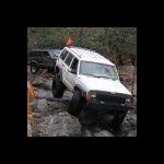
+Lunatic728 Posted January 28, 2008 Share Posted January 28, 2008 Ok so while I was searching for a cache it listed a benchmark within 10' of the cache. The benchmark listed is LY1373, but while browsing my map software there was another one listed in the exact same spot LY2878. I did view the updated data sheets from the USGS and there is nothing listed as one or the other being destroyed. LY1373 Designation is listed as "U 278" LY2878 Designation name is what is stamped on the disk. USGS listed as not being found in 1994 not a big deal because I have found others that were listed as not found. Now for the confusing part it says "NO STAMPING ON DISK" Only a note saying the Benchmark is 3' East of the old benchmark. I think the disk was reset and given a new PID # and no note on the LY1373 datasheet. But before I log the did not find on the LY1373 I thought I would ask here first, since I value the information given in this forum. Here is a picture of the disk in question. And how should I report this the USGS? Destroyed? Poor? Did not find? Thanks Lunatic728 Quote Link to comment
+Black Dog Trackers Posted January 28, 2008 Share Posted January 28, 2008 Well you're right, this is a confusing situation. Problems: 1. The disk found is stamped with the correct designation and date, but the datasheet says no stamping. 2. The datasheet history shows monumentation by PADT, but the disk is an NGS disk. #2 is no big deal because the PADT may have had some NGS disks to use. This situation has been pointed out before as a fairly typical thing. #1 is usually a clue that the wrong disk was found since its stamping didn't agree with what the datasheet says. The thing here is of course that the stamping matches the designation. I'd report this a as a FOUND of LY2878 (the reset mark) and include in your recovery note that the stamping is U 278 RESET 1984 and that the logo is NGS. Since the mark is scaled, it might be helpful to include location measurements for this disk from your GPSr. Let Deb at the NGS figure this one out. In my opinion, new STAMPING and LOGO fields should be added to the datasheet for this mark. Quote Link to comment
+PFF Posted January 28, 2008 Share Posted January 28, 2008 In 2005, a survey party working for PA D.O.T. visited the site. They did not find the 1961 disk. However, they found LY2878 in good condition, and they established a new elevation with a tie to two nearby stations. Perhaps they added the stamping on this visit--or it might have been done on a previous visit. LY2878 is officially named as a RESET in the NGS database. In 2005, there was only one disk in existence. Otherwise, the survey party would have reported finding both stations (versus reporting one as Not Found). Therefore, I think it is safe to say that you found LY2878. Nice find! -Paul- Quote Link to comment
Bill93 Posted January 29, 2008 Share Posted January 29, 2008 I concur with PFF. The 2005 reports are on the NGS (not USGS) old disk data sheet and new disk data sheet Did you check the measurements on the data sheets? Confirming the distance from the center of the road might clinch the case. LY1373'IN SOUTH EAST END OF CONCRETE BRIDGE, 2 FEET SOUTH OF BRIDGE RAIL, LY1373'12 FEET EAST OF CENTERLINE OF SECONDARY ROAD LY2878'LOCATED 3 FEET EAST OF OLD BENCH MARK, LOW STATION AHEAD, RIGHT SIDE. LY2878'ALONG SCRANTON BY-PASS FROM THE OVERPASS OVER MAIN STREET IN DICKSON If you log this with NGS, you might want to point out a typo. My calculator says that 285.411 meters is 936.39 ft, not 939.39 ft. (Going the other way, 939.39 ft = 286.327 m which would not be a likely mistake.) LY2878'PENNDOT SURVEY BY JMT SURVEYS ESTABLISHED A NEW ELEVATION OF 285.411 LY2878'M(939.39 FT). SURVEY TIED INTO B 56 (PID LY1338) AND S 278 (PID LY2878'LY1369). Overall, this is probably worth an email to Deb. Quote Link to comment
+Harry Dolphin Posted January 29, 2008 Share Posted January 29, 2008 Every dolphin has, of course, different fish to fry. Different reasons for doing what they do Penndot does what Penndot does. Which may, or may not, fit in with what NGS does. Somewhere, I have a nice picture of a Penndot disk with nothing stamped on it. Oh, well. Don't ask about NJGS. Bad dolphin! Quote Link to comment
+Lunatic728 Posted January 29, 2008 Author Share Posted January 29, 2008 LY2878'PENNDOT SURVEY BY JMT SURVEYS ESTABLISHED A NEW ELEVATION OF 285.411 LY2878'M(939.39 FT). SURVEY TIED INTO B 56 (PID LY1338) AND S 278 (PID LY2878'LY1369). And here is the even odder thing. JMT also logs his finds on Geocaching.com and he logged both LY1373 and LY2878. I was really confused when I started this post but now it is getting clearer. I will go back and get some proper measurements, take some pictures and let the GPSr settle out before marking it. This is one bridge that you don't have to worry about traffic its never been used. The bridge to no where. Thanks for all the great responses. Lunatic Quote Link to comment
Bill93 Posted January 29, 2008 Share Posted January 29, 2008 (edited) I was feeling obnoxious this morning so I sent a message to everybody who logged a found on LY1373 telling them it was really LY2878. I don't often do this, but it seemed like EVERYBODY was logging the wrong disk until Lunatic came along and questioned it and it irritated me to see so many wrong logs. Edited January 29, 2008 by Bill93 Quote Link to comment
mloser Posted January 29, 2008 Share Posted January 29, 2008 Reminder to self: Stay on Bill93's good side! Quote Link to comment
2oldfarts (the rockhounders) Posted January 29, 2008 Share Posted January 29, 2008 Here's another question about LY1373. From the description "DISK DRILLED IN HORIZONTAL,". Does this mean the disk is set vertical? If the hole for the stem is horizontal, that would put the disk vertical. Hmmm? John Quote Link to comment
+Black Dog Trackers Posted January 29, 2008 Share Posted January 29, 2008 Bill93 - Go for it Bill93 ! You could do 98 more messages on this one! (5 are correct and 98 are wrong.) I guess I should send a note to NGS since I actually did go there. There are probably higher numbers than 98 out there. Quote Link to comment
2oldfarts (the rockhounders) Posted January 29, 2008 Share Posted January 29, 2008 I was feeling obnoxious this morning so I sent a message to everybody who logged a found on LY1373 telling them it was really LY2878. I don't often do this, but it seemed like EVERYBODY was logging the wrong disk until Lunatic came along and questioned it and it irritated me to see so many wrong logs. Any replies yet? Quote Link to comment
+pgrig Posted January 29, 2008 Share Posted January 29, 2008 Some of the mis-guided Mt. Washington "finders" have (judging from their photos) really cute little kids who "found" it with them. I think they should escape being "bronzeswackered" by Bill93. [Glad I didn't venture up there myself .] Quote Link to comment
mloser Posted January 29, 2008 Share Posted January 29, 2008 John, From the description "DISK DRILLED IN HORIZONTAL,". Does this mean the disk is set vertical? If the hole for the stem is horizontal, that would put the disk vertical. Hmmm? All the disks I have found with "DISK DRILLED IN HORIZONTAL" in the description have had the DISK horizontal (like 98 percent of them are). Quote Link to comment
+Harry Dolphin Posted January 29, 2008 Share Posted January 29, 2008 Bill93 - Go for it Bill93 ! You could do 98 more messages on this one! (5 are correct and 98 are wrong.) I guess I should send a note to NGS since I actually did go there. There are probably higher numbers than 98 out there. Besides which, it's a lot more fun to do the Webcam Cache that's only 128' away!!! But watch out for the cache owner. He's said to be cranky and insists on a photo taken by the webcam to log that cache... Only 53 wrong finds on this benchmark... LY2611 Quote Link to comment
+Lunatic728 Posted January 29, 2008 Author Share Posted January 29, 2008 I will still have to do some more investigation into both marks. I will email Deb the descrepincies noted in this topic. I thank everybody for their replies. Sometimes I enjoy the research more than the hunt. Quote Link to comment
+TheBeanTeam Posted January 30, 2008 Share Posted January 30, 2008 Some of the mis-guided Mt. Washington "finders" have (judging from their photos) really cute little kids who "found" it with them. I think they should escape being "bronzeswackered" by Bill93. [Glad I didn't venture up there myself .] I was bronzewackered by another benchmarker some time back. At first I was mad but then after looking at it I was glad he mentioned that I was wrong. I was able to go back and clarify my "find". His mention that I had not found the mark made me come in and visit the forum threads for benchmarking and boy have I learned a lot from you Bronzewackers over the past few years. Most are like I was/am. Uneducated on the finer points of benchmarking. I am proof that a good bronzewacking can have a positive outcome (I think). Thanks to BuckBrooke, Bronzewacker Supreme. He caused me to delve into this obsession much more deeply by putting his nose into my business. I miss BuckBrooke. Quote Link to comment
+Black Dog Trackers Posted January 30, 2008 Share Posted January 30, 2008 that cache... Only 53 wrong finds on this benchmark... LY2611 You put in a this ain't it! note like I did and yet they don't seem to be listening.It's a true test of a real benchmarker to see if they read ALL the recovery notes before deciding whether or not they've found it. Quote Link to comment
+Lunatic728 Posted January 30, 2008 Author Share Posted January 30, 2008 I am still new to Benchmarking, so I am trying to start off on the right foot so to speak. I try to pride myself in completing a task. I once logged 1 a DNF because I was going off of the log before mine. Well it bothered me and I learned about datasheets and other clues through this forum. I then read the datasheet and went to the location and came away with a nice find. LY1330 Looking for Benchmarks is alot harder than it seems, it all comes down to the details. Quote Link to comment
+Holtie22 Posted January 30, 2008 Share Posted January 30, 2008 Only 53 wrong finds on this benchmark... LY2611 Also one misguided claim by a demented dolphin that "LY2604 is not at the actual Tri-state Point. The actual point where New York, New Jersey and Pennsylvania meet is in the middle of the Delaware River." Sorry, Harry, but the Tri-state point is exactly what it claims to be. Quote Link to comment
+Harry Dolphin Posted January 31, 2008 Share Posted January 31, 2008 Also one misguided claim by a demented dolphin that "LY2604 is not at the actual Tri-state Point. The actual point where New York, New Jersey and Pennsylvania meet is in the middle of the Delaware River." Sorry, Harry, but the Tri-state point is exactly what it claims to be. Yes, dear. Dolphin admits to being demented. (Okay. Dolphin glories in being demented.) I have not seen any evidence to dispute my claim that the borderline between New Jersey and Pennsylvania is the middle of the Delaware River. Is there any evidence to convince me otherwise? Quote Link to comment
Papa-Bear-NYC Posted January 31, 2008 Share Posted January 31, 2008 (edited) Yes, dear. Dolphin admits to being demented. (Okay. Dolphin glories in being demented.) I have not seen any evidence to dispute my claim that the borderline between New Jersey and Pennsylvania is the middle of the Delaware River. Is there any evidence to convince me otherwise? Here Harry, read this: http://www.getnj.com/boundary/njborderintro.shtml Here's the crux: "At the present time [sept. 8, 1874,] there is a large loose rock marked as described in the law of 1772, and the Commissioners Report of 1774, lying on the west bank of the Hudson near latitude 41 deg. N. Its weight must be several tons; it has no appearance of having been moved; and it is recognized in the vicinity as marking the eastern end of the Division line between New Jersey and New York. It is about 80 chains from the present old Sneden house at Sneden's Landing, is in line with several mile monuments and thus nearly answers the location as described in the Commissioners Decision. There is no monument at the west end of the boundary (At the current time it is marked by the Tristate Monument, editor's note), and no written description of any mark made to fix the point. There was however a mark on the bare limestone rock at the junction of the Nevesink and the Delaware. It was on the nearly flat rock; below high water mark, but usually uncovered. It was in the form of a crow-foot, and was plainly cut into the rock, and worn smooth by long exposure to the stream and the weather. It was recognised by those living near there as the point of meeting of the New Jersey, New York and Pennsylvania boundaries. Its location in regard to the streams was in accordance with the decision of the Royal Commission, and it was in a line with several of the mile monuments. Considering these two points to be the ones agreed upon by the Commission in 1769 and determined by the Astronomers and Surveyors at that time, the work to be done now, was to trace a straight line from one of these to the other; and then to measure the distance of each of' these mile monuments f'ron the line now traced, and make the proper description and report. For ascertaining the Geographical positions of these points and the direction and length of the straight line between these we are indebted to the Supt. of the U. S. Coast Survey, who at the requst of this Board detailed officers to make the necessary observations and computations, and has. now furnished us the results of their work as embodied in the following communication. U. S. Coast Survey Office, Washington, May 18, 1874. " Edited January 31, 2008 by Papa-Bear-NYC Quote Link to comment

Recommended Posts
Join the conversation
You can post now and register later. If you have an account, sign in now to post with your account.
Note: Your post will require moderator approval before it will be visible.