

Lunatic728
-
Posts
20 -
Joined
-
Last visited
Everything posted by Lunatic728
-
So I can find Geocaches through right clicking on Mapsource, but I would like to find benchmarks the same way. I have edited the geocaches.wlx file to solve the problem. Now I do get the correct lat and lon input, but it just brings me to advanced search page for benchmarks. I think the problem is the advanced search page where you have to select "to search by cords" box. Does anybody know how to work around this or maybe somebody solved this problem before. I did do a search without luck. Thanks in advance. Lunatic
-
A Monument to the "Smiley" Family
Lunatic728 replied to 2oldfarts (the rockhounders)'s topic in Benchmarking
Most of the "named" PID's are for the property owners where the stations sit. The others are for the area where they are located. Springer Named for Isabelle Springer, the land owner. ROAR This one I have no clue on how they named it? George I have no clue why its named George, its in the middle of nowhere. -
I also have a Toshiba 17" laptop that I take with me everywhere I go. What I carry with me. Good laptop bag 400 watt power inverter Garmin GPS 18 USB GPS with Nroute USB Cable for my Garmin 60c Spare cat5 patch cable for those hotels that don't have WiFi I also carry a large beach towel that I have over the seat just like a seat cover and then place the laptop under the towel, just to keep it out of prying eyes. The only drawback to a 17" laptop is it is heavy and carrying it through an airport can be kind of tiresome. Other than that I love having a laptop with me.
-
Thanks for the information. I knew this was the right place to ask.
-
Howdy all, I am looking for old Topographic maps from 1840 to 1885 for the North East section of Pa. I have found some from 1891 and later but can't find anything earlier. Thanks
-
Springer (LY2725) Moosic, Pa. Not so much of a great view, or interesting location. I first searched for this one 6 months ago and could not find the last RM. So after the long winter I found it after another 4 hrs of searching. Now granted I have not found many but this is the first one that the rock was chisled so the mark would have a flat surface. Tuff to walk around in or even find a benchmark 1' below the surface.
-
Here is a great cache in NEPA. The gravity Not far from the gravity is this great cache. Edge of the ledge
-
I am still new to Benchmarking, so I am trying to start off on the right foot so to speak. I try to pride myself in completing a task. I once logged 1 a DNF because I was going off of the log before mine. Well it bothered me and I learned about datasheets and other clues through this forum. I then read the datasheet and went to the location and came away with a nice find. LY1330 Looking for Benchmarks is alot harder than it seems, it all comes down to the details.
-
I will still have to do some more investigation into both marks. I will email Deb the descrepincies noted in this topic. I thank everybody for their replies. Sometimes I enjoy the research more than the hunt.
-
And here is the even odder thing. JMT also logs his finds on Geocaching.com and he logged both LY1373 and LY2878. I was really confused when I started this post but now it is getting clearer. I will go back and get some proper measurements, take some pictures and let the GPSr settle out before marking it. This is one bridge that you don't have to worry about traffic its never been used. The bridge to no where. Thanks for all the great responses. Lunatic
-
Ok so while I was searching for a cache it listed a benchmark within 10' of the cache. The benchmark listed is LY1373, but while browsing my map software there was another one listed in the exact same spot LY2878. I did view the updated data sheets from the USGS and there is nothing listed as one or the other being destroyed. LY1373 Designation is listed as "U 278" LY2878 Designation name is what is stamped on the disk. USGS listed as not being found in 1994 not a big deal because I have found others that were listed as not found. Now for the confusing part it says "NO STAMPING ON DISK" Only a note saying the Benchmark is 3' East of the old benchmark. I think the disk was reset and given a new PID # and no note on the LY1373 datasheet. But before I log the did not find on the LY1373 I thought I would ask here first, since I value the information given in this forum. Here is a picture of the disk in question. And how should I report this the USGS? Destroyed? Poor? Did not find? Thanks Lunatic728
-
I can usually get pretty close with the "beast" and then after that I use leg power. It does now sport a 9500 lb winch.
-
Get some pink masonary string and tie knots every foot or 2 or if you perfer tie knots every meter. Make it as long as you like. It weighs almost nothing, and costs almost nothing. Heck you can shove it in your pocket. If you really want to wrap a piece of duct tape every so often with the coresponding mesurement this way you don't have to count from the begining. There is my .02 and about the cost of my backyard tape measure. Lunatic
-
I hated mine, bought off of eBay for less than 90.00 bucks. I thought since it could connect to the computer and it had an SD card I thought it would be a cheaper option than one of the Garmin units. The unit only had a Serial connection, so if I wanted USB I had to get another piece. The software seemed like it was written for windows 3.1 and had a good size learning curve to it. The best I could with accuracy was about 25 or 30 feet while my Garmin GPS 18 for the laptop was right on the money about 7.5 feet. So I sold it on eBay and got a Garmin GPSMAP 60C for a good price. I would not recommend this unit to anyone. Lunatic
-
90' XJ Dana 44 rear 4.88's and a detroit, front Dana 30 4.88's with a lock rite (just waiting for it to break) 35's Xterrains. RE 5.5" lift, HDPE rocker floor guards, 20lb C02 tank, enough spare parts to replace almost anything. Waiting on my 9500 lb winch to arrive. Daily Driver, boy the police love me sometimes.
-
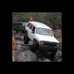
90' Jeep cherokee built for some offroad adventures. Dents add character right? I will spare you the boaring details about the beast. I did just get a new 9500 lb winch so that IF I do get stuck I can get out.
-
New to geocaching with a couple of finds. Now just waiting on new GPS unit, the 2 I have are hard to use for geocaching. I just wish the weather would warm up soon. Ohh and don't worry about the username I just came up with a long time ago when I lived on a submarine. I didn't think about it when I registered the name. I am just somewhat off center or at least according to my wife.
-
Thanks for everybodys help on this. I just want to make sure I am starting out on the right foot. I am starting to enjoy the hunt. And as with most interactive activites there is a right way and wrong way to do things. So thanks again from a newbie.
-
Ok, so I am new here and new to Geocaching. I have searched the forums and I found no answer and I am kind of afraid to ask. I find a cache in the woods; it was right out in the open. Container stuck out like a sore thumb. I sign the log and now the million dollar question. Now keep in mind this without moving 1 inch from where I found it. 1. Replace the cache just as I found it? 2. Replace the cache covered with leaves, rocks (carefully), sticks, or such so it does not stick out like a sore thumb? Then covering the tracks that lead to the cache? I am just wondering because I am starting to enjoy the game and so are my kids. I just want to do it with proper etiquette in mind. I know there may be no definitive answer, I would just like a guide to go by. Thank You Lunatic
-
A group, member, or just a visitor. I would be up for a couple of caches. Lunatic