+happycycler Posted June 21, 2003 Share Posted June 21, 2003 How does one open a Standard (IL or MO) River Survey Cap to look for the associated bolt. Yesterday I found JC0574. The cap appeared tight and I do not know how they are closed. Standard threads requiring a large pipe wrench? I don't feel like risking damage to the cap which is also a benchmark. Plus I did not even have a huge wrench with me. I also found the cap for bolt PID = KC0118. This cap is not in the GeoCaching database which is unusual -- they generally come as a pair. Quote Link to comment
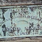
Z15 Posted June 21, 2003 Share Posted June 21, 2003 You do not remove that cap, thats the survey mark! I have no idea about a bolt you are looking for? Where does the idea of a bolt come from? JC0574_MARKER: P = PIPE CAP JC0574_SETTING: 17 = SET INTO TOP OF METAL PIPE DRIVEN INTO GROUND JC0574_STAMPING: ELEV 458.77 FT MEMPHIS DATUM 1903 JC0574_STABILITY: D = MARK OF QUESTIONABLE OR UNKNOWN STABILITY JC0574 JC0574 HISTORY - Date Condition Recov. By JC0574 HISTORY - 1903 MONUMENTED JC0574 HISTORY - 1961 GOOD NGS JC0574 HISTORY - 19990306 GOOD USPSQD JC0574 JC0574 STATION DESCRIPTION JC0574 JC0574''DESCRIBED BY NATIONAL GEODETIC SURVEY 1961 JC0574''5.7 MI W FROM GRAFTON. JC0574''ABOUT 5.7 MILES WEST ALONG STATE HIGHWAY 100 FROM THE GRAFTON JC0574''SCHOOL, INSIDE OF THE PERE MARQUETTE STATE PARK, AT THE SOUTHWEST JC0574''CORNER OF THE HARTFORD CEMETERY, 76 FEET EAST OF THE CENTER LINE JC0574''OF THE HIGHWAY, 118 FEET WEST OF THE NORTHWEST CORNER OF THE JC0574''HARTFORD CHURCH, 4 FEET NORTHEAST OF A FENCE CORNER, 3 1/2 FEET JC0574''EAST OF A NORTH-SOUTH FENCE LINE, 4 FEET NORTH OF AN EAST-WEST JC0574''FENCE LINE, AN IRON PIPE WHICH PROJECTS 12 INCHES ABOVE THE LEVEL JC0574''OF THE GROUND AND BEARING AN ILLINOIS RIVER SURVEY CAP STAMPED JC0574''AS STATED ABOVE AND ABOUT 25 FEET ABOVE THE LEVEL OF THE HIGHWAY. Quote Link to comment
+happycycler Posted June 21, 2003 Author Share Posted June 21, 2003 Thank you elcamino. I am reassured that there is not an easy way to open the cap and access the assosiated bolt. Sorry that my post is not as clear as it should be. Here in the St. Louis, MO area I see several pairs of benchmarks that consist of a pipe cap and a bolt that is underground and accessed thru the pipe cap. An example would be: JC0574 CAP & JC0577 BOLT I recently also found a cap at the:KC0118 BOLT location. quote:... A COPPER BOLT LEADED IN THE TOP OF A LIMESTONE SLAB 4 FEET UNDERGROUND ACCESS TO WHICH IS HAD THROUGH AN IRON PIPE BEARING AN ILLINOIS RIVER SURVEY CAP STAMPED AS STATED ABOVE. .... However our Geocaching database does not list a cap for this KC0118 BOLT. So I claimed a find for KC0118 even though I did not open the cap and view the bolt there either. There is obviously much that I should yet learn. I am thankful for these forums -- much very good information from you helpful folks. Thanks to all who offer help thru this media! Quote Link to comment
+TEAM 360 Posted June 21, 2003 Share Posted June 21, 2003 quote:Originally posted by happycycler:Thank you elcamino. I am reassured that there is not an easy way to open the cap and access the assosiated bolt. Sorry that my post is not as clear as it should be. Here in the St. Louis, MO area I see several pairs of benchmarks that consist of a pipe cap and a bolt that is underground and accessed thru the pipe cap. An example would be: http://www.geocaching.com/mark/details.asp?PID=JC0574 & http://www.geocaching.com/mark/details.asp?PID=JC0577 I recently also found a cap at the:http://www.geocaching.com/mark/details.asp?PID=KC0118 location. quote:... A COPPER BOLT LEADED IN THE TOP OF A LIMESTONE SLAB 4 FEET UNDERGROUND ACCESS TO WHICH IS HAD THROUGH AN IRON PIPE BEARING AN ILLINOIS RIVER SURVEY CAP STAMPED AS STATED ABOVE. .... However our Geocaching database does not list a cap for this KC0118 BOLT. So I claimed a find for KC0118 even though I did not open the cap and view the bolt there either. There is obviously much that I should yet learn. I am thankful for these forums -- much very good information from you helpful folks. Thanks to all who offer help thru this media! Go ahead and claim the find anyhow. I see some people claiming finds on the newer type of metal rod benchmarks with just a pic of the cover hole, not the rod itself. Quote Link to comment
+happycycler Posted June 22, 2003 Author Share Posted June 22, 2003 Thank you TEAM 360 for your reply. I looked in the NGS database for the cap associated with PID KC0118 and found a PID KC0544 listed with the same description and SCALED location. [quote - ----------------------------------------------------------------------------- - This listing contains control for which complete digital - - data sheets where not provided. The complete data sheets were - - not provided for the reason listed below. The reason below is - - associated with a horizontal control Nonpub code shown under - - the heading 'H' and/or a vertical control Nonpub code shown under - - the heading 'v' - - - - The format of the records are as follows: - - Pid = Station Permanent Identifier) - - Name = Station Designation - - Lat = Approx. Latitude (Degrees, Minutes, truncated Seconds) - - Lon = Approx. Longitude (Degrees, Minutes, truncated Seconds) - - O = Horizontal Order - - o = Vertical Order - - H = Horizontal Nonpub Code - - v = Vertical Nonpub Code - - - - H Nonpub HORIZONTAL CONTROL NONPUB REASON - - -------- -------------------------------- - - X Surface Mark Reported Destroyed - - Y Surface and underground mark reported destroyed - - A A-Order Horizontal mark not tied to an adjusted HARN - - C C-Nonoperational CORS Station - - W Weakly determined position. - - P Purpose of position is not for network control - - D No Descriptive Text available - - R Restricted position - - - - v Nonpub VERTICAL CONTROL NONPUB REASON - - -------- ------------------------------ - - X Surface Mark Reported Destroyed - - Y Surface and underground mark reported destroyed - - F Bench Mark not yet adjusted. - - D No Descriptive Text available - - Z Presumed destroyed - - R Restricted elevation - - - - - - NOTE - Stations found in this listing may still have a valid - - datasheet produced by use of other publishable values. - - For example, an ADJUSTED height may be non-publishable - - but a good GPS height might be found on the datasheet. - - This listing does not imply that values found on the datasheet - - are restricted. If it's on the datasheet, use it. - - - ----------------------------------------------------------------------------- Pid Name Lat Lon Elev O o Hv ------ ------------------------------ ---------- ----------- -------- - - -- >KC0554 3 CAP 39 02 47. /090 33 31. D Which explains why it is not showing up in the GeoCaching database. Quote Link to comment

Recommended Posts
Join the conversation
You can post now and register later. If you have an account, sign in now to post with your account.
Note: Your post will require moderator approval before it will be visible.