n0wae Posted August 8, 2004 Posted August 8, 2004 I'm just a casual BM hunter and stumbled on this one today on Argentine Pass CO. It's located at N39°37.502 W105° 46.950 and a search on Geocaching.com didn't find anything. Just wondering about it since I placed a cache nearby. Thought I'd ask the experts here. Quote
+1setter Posted August 8, 2004 Posted August 8, 2004 It looks like there is something 1/2 mile or .9 mile S of the Pass KK2038 . Without a picture, nobody here will be much help. Quote
+seventhings Posted August 8, 2004 Posted August 8, 2004 n0wae - Radial search in the NGS database centered on your coordinates yield the same result as indicated by 1setter. Most likely you found one of the several hundred thousand survey marks that are in neither the NGS nor the Geocaching databases. That is, one of the no-PID marks that may be important to local surveyors, municipalities or utiliies, but is not part of the National Spatial Reference System (NSRS) that comprises the database of benchmarks that we benchmark hunters hunt for. I have stumbled across many such marks. Interesting, but not loggable in Geocaching. Do you have a picture of the mark? What information was stamped on the mark? There are many Dept of the Interior, BLM, BIA, and USGS marks that do not have PIDs (that is, are not in the NSRS). will Quote
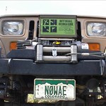
n0wae Posted August 9, 2004 Author Posted August 9, 2004 Do you have a picture of the mark? What information was stamped on the mark? Thanks for the replies. Lets see if I can get a picture on here... Quote
+Kewaneh & Shark Posted August 9, 2004 Posted August 9, 2004 It looks like a triangulation station set by the USGS in 1924. Many, but not all, of the USGS marks have been incorporated into the NGS database. I've found quite a few 'unincorporated' marks as well. Definately an interesting find though. I've never found one that color. Most of the brass marks I've found have a dark bluish/brown patina on them. - Kewaneh Quote
+seventhings Posted August 9, 2004 Posted August 9, 2004 n0wae - Nice find, but it's typical of no-PID (unincorporated) marks. Looks like the designation stamping mught be "D 23". A search of the NGS database for this designation/name in Colorado yields a destroyed USC&GS (now, NGS) benchmark in Larkspur/Palmer Lake, PID=KK0184. But that's definitely not your mark. You've got yourself a no-PID. If you hunt marks regularly, you'll stumble across lots of these. On average, I come upon a no-PID for every 20th mark in the database that I hunt for. will Quote
mloser Posted August 9, 2004 Posted August 9, 2004 I rarely come across no-PIDs. I have found a few PADH (PA Dept of Highways) markers that weren't stamped, but just one standard-sized benchmark. By Seventhing's calculations I should have found 15 by now. Guess I am only looking where I am supposed to and not wandering blindly around!?? Matt Quote
+seventhings Posted August 10, 2004 Posted August 10, 2004 I may, in fact, spend a lot of time wandering around blindly, but there's another explanation for why I have found so many no_PIDs. 1. For awhile, I actively hunted USGS marks that were on my toposheets, whether or not they were in the NGS/Geocaching database. Found a good number of these as they are rather plentiful in northern VA. 2. On several occasions, I have logged marks as 'NOT FOUND" because the disk differed materially from the designation and described stamping. See HV8691 for an example. These types of not-founds give rise to no_PID finds. Sometimes when I find these discrepancies, I submit my case to NGS and get them to change the official description to conform to what I found (assuming I have a air-tight case). See HV9683 for an example. 3. I hunt Mason-Dixon stones and other pre-1900 state boundary marker stones. Few of the stones along the PA-MD boundary have PIDs, and they often have state boundary markers nearby that don't have PIDs, either. will Quote
Z15 Posted August 10, 2004 Posted August 10, 2004 (edited) Most of the brass marks I've found have a dark bluish/brown patina on them Thats probably because many are not brass but bronze, an alloy of copper and tin and sometimes other elements. Also any copper-base alloy containing other elements in place of tin Edited August 10, 2004 by elcamino Quote
+jwahl Posted November 23, 2004 Posted November 23, 2004 USGS did a lot of mapping control that was third order or worse up until the 70's. When NGS created the NAD83 many of the third order stations were dropped. In those days you could go to USGS and get paper copies of USGS bench marks (level runs) and control points (triangulation stations), and you did the same with NGS which was then C&GS. No NGS only automated and put into the database stations that were incorporated into the NAD83 adjustment. So that means a whole lot of this lower accuracy control was just dropped as the data was never automated and not published in the new datum anyway. There are a lot of them out there and since USGS did them for mapping, they show on the quad maps. This cap looks like it is both a tri -station and was levelled to for elevation. I have heard that you can order the old control information from the USGS eros data center. Some of the USGS control was included in the NAD adjustment and so you will find some stations in the NGS database. - jerry wahl Quote
Z15 Posted November 24, 2004 Posted November 24, 2004 (edited) fyi 99% of the USGS control that is in the NGS db is there because NGS (C&GS) used those marks instead of setting their own control at that location. The mark was there and they used it. Also, I have noticed in my area that USGS was working at the same time as NGS was leveling so it would appear C&GS went out of their way to tie-in some of the USGS marks. In other words, C&GS (NGS) positioned the point and its not the USGS position. This statement was on control I received from USGS a few years back.. Transit Traverse are marks with TT on them, e.g. TT 13 or TTS 13 etc. Edited November 24, 2004 by elcamino Quote
evenfall Posted November 24, 2004 Posted November 24, 2004 n0wae, Heres a link to a to a thread I posted in while back that was written to address stations like the one you found. You can have a look at it Here. In addition to all the other great info on this thread, I hope it helps! Happy Thanksgiving, Rob Quote
DaveD Posted November 24, 2004 Posted November 24, 2004 nOwae - I don't know why I didn't respond to this before (senior moment). The mark you found is of course a USGS monument as your picture shows. It is only a bench mark, meaning USGS never determined it's horizontal position. Per USGS published data, this mark, designated COLO D 23 1924 has an NGVD 29, third-order elevation of 13206.490 ft. Along with so many other USGS marks this data was never provided to NGS for inclusion in the National Spatial Reference System. Quote

Recommended Posts
Join the conversation
You can post now and register later. If you have an account, sign in now to post with your account.
Note: Your post will require moderator approval before it will be visible.