sixthings Posted May 30, 2003 Share Posted May 30, 2003 sure, davinci drew one hundreds of years ago, and someone got one in the air for 3 seconds in 1907, but it wasn't until the mid-30's that the Germans got one to fly safely. will someone please explain RY0904 to me? thanks. Quote Link to comment
+Kewaneh & Shark Posted May 30, 2003 Share Posted May 30, 2003 Although there is only one entry in the 'Official History', it looks to me that the benchmark has been visited more recently than 1911 and the history entry was added to, rather than a new entry made. I have seen benchmarks described as drive stations (meaning you could drive to them) and as walk/hike stations (meaning they were inaccessable to vehicles, but could be walked to). I would assume that this one is fairly remote and a helicopter would be the easiest way to access it. On the other hand... maybe the USGS had a cutting edge 'flying machine' as a survey tool in 1911. Keep on Caching! - Kewaneh Quote Link to comment
+Web-ling Posted May 30, 2003 Share Posted May 30, 2003 Back to the Future with a helicopter instead of a DeLorean. Cool! Quote Link to comment
survey tech Posted May 30, 2003 Share Posted May 30, 2003 Note that the designation is 7016 B, but the stamping is 7016 B 1911 42. Thats the tip off, it was probably visited by helcopter in 1942. There are a large number of stations in the Rockies and Sierras that can only be reached by helicopter. Surveyors have occasionally been stranded for days at these locations when bad weather closed in on them, making it impossible to pick them up. Quote Link to comment
square nail Posted May 30, 2003 Share Posted May 30, 2003 ACCORDING TO THE MAP A PERSON COULD DRIVE TO WITHIN A THOUSAND FEET. SOUNDS LIKE IT WILL GO TOWARD THE TOP OF MY SEARCH LIST. Quote Link to comment
+happycycler Posted June 1, 2003 Share Posted June 1, 2003 Is that the Lolo pass trail that is on the Lewis & Clark route? Quote Link to comment
DaveD Posted June 2, 2003 Share Posted June 2, 2003 The description of this station was supplied to NGS by USGS. I have reviewed the USGS publication from which it was derived and it shows that this text was actually written by one of the field units in 1966. Quote Link to comment
sixthings Posted June 2, 2003 Author Share Posted June 2, 2003 happycycler~ yes, the Lewis and Clark route is right there, and part of the road used to access this mark is the old Lewis and Clark route itself. good history here. DaveD~thanks for your input. A surveyor recently told me who you were. thanks for taking the time to contribute to these forums, and for all of your good information. Quote Link to comment
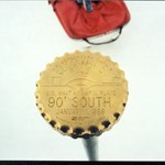
square nail Posted July 1, 2003 Share Posted July 1, 2003 I found this BM yesterday and noticed that it did not have the same numbers stamped on it that the data sheet said it should. There is no "1911 42". The data sheet doesn't list any RM's so I would assume this is the correct monument. The coordinants were perfect. I also found evidence of an old wood/wire monument about 50 feet north of of the BM on the actual peak and most visable point of the mountain top. It appears to me that the BM was mounted where it supposedly would not move even though the viewing station was in a different spot. The ground was not solid on the very peak. It seems sad to see that the mounment was mounted so close to a tree that it was disturbed when the tree fell over. Can a person get more information as to the reason for the number 42 on the BM? See pics http://geocaching.com/marm/details.asp?PID=RY0904 [This message was edited by SQUARE NAIL on July 01, 2003 at 08:06 PM.] Quote Link to comment

Recommended Posts
Join the conversation
You can post now and register later. If you have an account, sign in now to post with your account.
Note: Your post will require moderator approval before it will be visible.