

Basilisk
-
Posts
7 -
Joined
-
Last visited
Everything posted by Basilisk
-
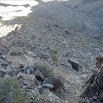
Looking to hear any stories about getting stuck (vechile wise) while out caching. Personally this past weekend I came very, very close to being stuck in the desert. I drive a 2WD tacoma prerunner truck which can has the clearance of a 4x4 but lacks the extra power in the front. (Locking rear diff helps, but most of the time on a steep hill I just get a running start!) So I made it out to the spot that I parked, hiked to the cache, and came back. You can see for miles here and I decided to continue forward rather than go back along the road I came in on. I knew on the way out what direction the town was, so there was no question of where I was. I'm crusing along and the dirt road I choose narrows into a wash. I figure that this will probably get me nowhere but continue on as it seems well travelled. Well, I wasn't paying enough attention and realized too late that the small rock grouping I was going down was waaaaay too high for my truck. Before I knew it my front bumper was almost in the sand and my rear tires were barely gripping the rock. My heart started racing as the tires couldn't get grip. Here I am in the desert (Only a few mile hike out though) and I'm going to get stuck. I wasn't worried about walking out, it was having to get a tow! Luckily I got traction and crawled out as my differential and other things I didn't want to think about at the moment scraped and banged the rocks. I thought I was out when 100 feet ahead was another drop. I couldn't believe it. There was no way to go back because I would never get back over the rocks behind me. I had to go forward. Well, the truck ended up with the rear tires in the air with the trailer hitch on the rock ledge holding the rear wheels up. Just another 2 inches of clearence and I would have made it. The front bumper was in the sand pretty good. I put it in neutral, got out, and proceeded to push and push until it came off the rock and the rear wheels touched the groud. After some more scraping I was free. 200 feet later the wash turned into a dirt road and 3 guys were standing around their truck just plinking. They looked at me and I gave a nod as I drove by. I had accidentlay honked my horn a few times as I was being bounced around... They probably wondered how the hell I made it through there in my stock tacoma and why I was honking the horn! Needless to say this weekend I will be taking a different route...
-
TEAM KFWB GPS ARRIVES IN CALIFORNIA AND NEVADA!!
Basilisk replied to canadazuuk's topic in West and Southwest
Glad to see this cache completed and I think its a great idea. I hope to see some future similar caches in the southwest area again. I live in Las Vegas and should have known about this cache, but I was not paying good enough attention! These types of long cache adventures are exactly what I am looking for. Break out the truck, camping and survival gear and head out for a long weekend! -
I am looking for software that will not only plot my routes on a topo map but also onto satellite imagery photos. Are these the only two that offer this option? Also, I see that TopoUSA says free download of a 10kmx10km satellite section... Does that mean that is all I can download, a one time piece 10kmx10km large? Or can I download pieces anywhere in my state? Thanks!
-
I recently did this cache in the snow: http://www.geocaching.com/seek/cache_details.aspx?ID=34231 Things are A LOT harder in the snow! The hint said under a tree but when everything is under a few feet of snow it can be almost impossible to find caches without a metal detector. But I got lucky I guess.
-
Geocaching... hazardous to your health?
Basilisk replied to Georat's topic in General geocaching topics
Just today, I was hiking down a wash full of loose rocks. I was thinking to myself "My friend should come on this hike, but he might get hurt..." Just as I finished the thought I lost my footing and almost ended up with a sprained (or worse) ankle for the hike back to the truck... Ah, the irony. Be careful! -
This probably gets asked a lot, but now that I am comfortable with my Vista I am looking to expand into the software area. I downloaded the trial ExpertGPS and love the feature that allows me to show my tracks on topo or aerial photo maps. I am debating whether to purchase MapSource or ExpertGPS. Does MapSource offer the same ability to plot my tracks on the computer? I assume that the aerial photo feature is unique to ExpertGPS... Thanks! Edit: Hmmm, wonder why my avatar and title are not showing up... Do moderators screen them first?
-
Anyone else have Vista "compass lock?"
Basilisk replied to LarsThorwald's topic in GPS technology and devices
I would be interested to find out what causes this also. Just today I was on a cache off-trail hike and I had the compass locking up problem. I haven't noticed it in the past but it happened several times today. Perhaps magnetic interference? The only way I could fix it was to turn off my Vista and then on again. Weird!