

DBC FOR LIFE
-
Posts
37 -
Joined
-
Last visited
Everything posted by DBC FOR LIFE
-
Garmin 60c Randomly Shuts Off...
DBC FOR LIFE replied to DBC FOR LIFE's topic in GPS technology and devices
I tried using the remedy you speak of just a couple of months ago. It worked flawlessly until about 2 weeks ago. Now what is happening is the added pressure (coupled with high RPM's from the motor - my bike is at 6,000 - 7,000 RPM at highway speeds) has worn off the golden-metallic conductors on the green circuit board. My next trip is to have a drop of solder added to each of the two contacts on the circuit board to create a better connection. This is very annoying and I hope GARMIN can come up with a HIGH RPM solution sometime soon, as I love riding with navigation. -
Favorite 60c/cs Geocache Settings
DBC FOR LIFE replied to geodinks's topic in GPS technology and devices
On the map page I like the track-log to be blue so that it stands out and I can see what streets I have driven on. Also, I prefer North Up because its easier for me. For ROUTING I have it set to prompt me for "guidance method" and "follow road method" - this way it will route me on the street and when I get close then I hit MENU -> RECALCULATE -> OFF ROAD and it will switch to the arrow. -
Are you able to input waypoints and/or coordinates into the car nav system...?
-
Try this for the $75.00 update to City Select 6.0 (which is the newest version). http://shop.garmin.com/cartography/mapsour...CD=011-00803-05
-
Aha, so I AM wrong! I didn't realize that C/L mon's were on this site - interesting. I wish it were that "easy" around here! (They are all [mostly] all in the hills here...)
-
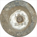
The last two poster have given a wealth of information. I'm not sure why you would want to see the centerline monument in the handhole anyways. These are not typically the "benchmarks" that are referred to on this website anyways (at least not in my area). I can tell you, for example, when we were surveying a church in Norwalk, CA I was bent over cleaning out the monument well (we had traffic control cones out, etc - and we were both wearing bright orange reflective vests in the middle of a clear day) when my partner in crime yanked me out about 10 feet quickly. I was taken by surprise but when I realized what was happening there was two police cars that were having a high-speed pursuit with an individual who wasn't cooperating, and drove right over where I WAS kneeling. I know from experience that I wouldn't open one wearing street clothes by myself unless you provided a pot of gold
-
NeoGeo, computer generated routes DO work on the 60c, but are not desirable. CampingCachers: I believe the upgrade is $75 for CitySelect v6, and worth every penny when you use the autorouting. I even use it on my motorcycle
-
Software To Get Coordinates With Street Address
DBC FOR LIFE replied to GeoMike11's topic in GPS technology and devices
The one you will enjoy the most is Keyhole 2. You can get it at www.keyhole.com which offers a 7 day trial and if you like it you pay $29.95. I highly reccommend this to everyone who geocaches because you can get all the streets, aerial photos that you can drag around, etc. Also it will serve your purpose because if you hover your pointer over any point you can get the coordinates of it. The only downside is that it gives you corrdinates in decimal degrees or d.m.s. but NOT degrees minutes.minutes which we are all used to. This is easy to combat, just multiply by 60 or divide by 60 depending on which way you are converting. Another very good program which does what you want specifically is Garmin MapSource, but now you're looking at spending ~$100. There are websites that will do if for you but I like to see a map. -
I agree the eTrex line is mediocre at best.
-
When you mix the two you compromise on both. A friend of mine just bought the Navman PiN with integrated GPS and Pocket PC. Its not very effective when it comes to GPS tasks. For example everytime he tries to use it in the car the womans voice says "SIGNAL TOO LOW". Also, when its time to look something up about the cache and then go back to searching there is about 30 seconds of frantic stylus taps to get from one place in the unit to another. Seems like such a pain in the a**. Although with minimal searching, this particular item (www.outpost.com ITEM# 3693495) might not be so bad because it has the quad-helix antenna instead of the patch antenna which offers (USUALLY!) superior reception.
-
Etrex Yellow And A Laptop - Questions..
DBC FOR LIFE replied to Steve02's topic in GPS technology and devices
I would love to have a kayak that flys over bridges, etc. -
I can tell you that I've always owned garmins, and friends have always owned magellans - and I get consistently closer to caches than they do. In fact with my 60c when there is any sort of tree cover around they are wandering around 50-60 feet away with their magellans while I'm screaming "GOT IT!!" Its all about that "quad-helix antenna".
-
Garmin 60c Randomly Shuts Off...
DBC FOR LIFE replied to DBC FOR LIFE's topic in GPS technology and devices
EAGLEEYE, try turning off WAAS and clear your tracklog and see if it still happens. I have a suspicion that the units get "confused" when they are computing too much data. Haven't verified it yet..... -
I'm not sure that an EDM baseline would offer any benefit, since those are only for calibrated distances, and this transit doesn't have an EDM...
-
Make sure you go with the signed copy of the Standard Plans....... LOL
-
Garmin 60c Randomly Shuts Off...
DBC FOR LIFE replied to DBC FOR LIFE's topic in GPS technology and devices
Royta is correct, I already have this option disabled, so then when geocaching and we stop the car, I can continue on foot without the unit ever shutting off. Unless it shuts itself off that is!!!!! -
130, 140, 150 feet isn't really critical. Just remember its not a mistake until its poured in concrete
-
If very cold or freezing temperatures are possible then think about the extra few dollars on Lithium batteries, which have a much lower minimum temperature. I know the GARMINS are rated to a lower operating temp than the Magellans.
-
Good point ElCamino... Section Corners are NOT benchmarks. As you have noticed they are also not always there. Around here the 1/4 corners are rarely there...
-
The more conductive the metal, and the bigger it is, the further away they detect it. Thus Aluminum, copper, and gold are very detectable. Iron is close. Lead is not very detectable because its conductvity is way down from those other metals.
-
Garmin 60c Randomly Shuts Off...
DBC FOR LIFE replied to DBC FOR LIFE's topic in GPS technology and devices
I'm reluctant to believe that the battery terminals have anything to do with the problem, because it also happens when plugged into the cigarette lighter (running on external power). -
Your standard metal detectors are not actually "metal detectors" at all.... They merely detect changes in density of materials (metal is very dense). A true metal detector, or magnetic locator as they are often called is very expensive, which is what is surveyors use. I think the one we have was ~$1,500.00 or there abouts. Heres an example: Magnetic Locator. These search for iron or other ferrous metals in a vertical position. I have successfully found 2" I.P.'s down 4 feet, which is handy when you are looking for a section corner. Hope that helps, Milan
-
Find two lightposts (or similar) about 150 feet apart. Set up halfway between the two and level up. Now sight post #1 and instruct someone to make a level line where your crosshair hits it. Turn ~180° and sight post #2 and do the same thing. Next, setup close to post #1 (about 10 feet away, or as close as you can reasonably focus). Level up and sight the same line. Have someone hold a pocket tape up so you can record the distance between what you are sighting and your line. Turn ~180° and sight post #2 and record the difference again. It should be the same but it probably isn't. Whatever the difference between the two pocket tape readings is the amount you are out of level in 140 feet (in this example). If you need more information on this, a better place to post would be: RPLS.COM Message Board, which is a message board for registered professional land surveyors. Enjoy, Milan
-
You definitely want to go with a RAM mount for your specific unit with the 1"ball and 4" suction. It attaches to your windshield and is very sturdy. I'm not sure which specific unit you have but here is an example for the Garmin 60c (they make cradles for most all units however...) RAM-B-148-GA12U enjoy! Milan
-
Greetings! I always get great information from these forums, so I'm back for another try... When I'm using the GPSr for navigating (either turn by turn directions, or on the trail) I will look up at the 60c and notice that the screen is blank. I press the power button to turn it on (again) and it will work fine for anywhere from a minute to several days and then it shuts off again. The unit has never been dropped or mistreated... I've tried using new batteries with the same results... It has the v3.50 firmware installed... When in the car I use the sturdy RAM mount with 4" suction so it is not getting "jarred" or anything like that. Its really annoying because it always happens when you need to know where to go next, and it can be REALLY annoying when I'm on my motorcycle and have to pull over to push buttons. I guess my question is simply this: DOES ANYONE ELSE'S TURN OFF ON THEM? (and WHY!?) Milan