

PDOP's
-
Posts
3766 -
Joined
-
Last visited
Posts posted by PDOP's
-
-
... This page draws them better.
Thanks I hadn't seen that page before.
-
Note that 135 is not shown at it's correct location. It's currently at -95.79 degrees longitude which is just to the right of 133 at -97.65 degrees.
-
Great
 Do you have a computer interface cable for downloading data? If you do check out how to Download Cache Information
Edit to add: Geocaching Software
-
Hello and welcome. First make sure your eTrex is set to WGS-84 and HDD(D)° MM.MMM Datum and Format (link)
-
It's a good unit for that price. Lots of good info at http://garminoregon.wikispaces.com/
-
... Wouldn't hurt my feelings if they could find another good place E of the Rockies to park it.
It was originally at 133 degrees west so I would guess that it might eventually be returned to that longitude.
-
PRN 135 / WAAS 48 may return.www.intelsat.com
Galaxy 15 Status UpdateOn 23 December, the power from the Galaxy 15 battery completely drained during its loss of earth lock and the Baseband Equipment (BBE) command unit reset, as it was designed to do. Shortly thereafter Galaxy 15 began accepting commands and Intelsat engineers began receiving telemetry in our Satellite Operations center. We have placed Galaxy 15 in safe mode, and at this time, we are pleased to report it no longer poses any threat of satellite interference to either neighboring satellites or customer services.
After completing initial diagnostic tests, we will load updated commanding software to the satellite. We expect to relocate the satellite to an Intelsat orbital location where engineers at our Satellite Operations Control Center will initiate extensive in-orbit testing to determine the functionality of every aspect of the spacecraft. We will provide an update through normal sales channels, and MyIntelsat, if and when the satellite recovery mission is successful.
-
As a premium member you can use Pocket Queries to have files of up to 500 caches each emailed to you or download files of up to 1000 caches from the 'Pocket Queries' webpage. See Creating Your First Pocket Query (link) and Pocket Queries: A Detailed Explanation(link) by Markwell.
To load a folder of files in GSAK see the help file entry for "Load File(s)/Folder Radio Buttons (File>Load GPX/LOC)" (link)
-
-
Thanks Allory
-
The maps - WOW - I am actually speechless. Speed of tiling is great; openstreetmaps are great; I love the way you layer the symbols; etc etc I cannot seem to find anything I don't like.
No topo maps - MyTopo is missing.
-
-
Or... you could have it pull all of the sats positions live from the web... http://www.nstb.tc.faa.gov/incoming/Waas_SV_Status.txtI should fix FizzyCalc to let you input the current location of the WAAS birds, shouldn't I?Hmm... I haven't had FizzyCalc use networking to keep it simple, but I think I'll put out a new tool to locate the WAAS satellites. It'll give me a chance to try Python package deployment...
Now that the WAAS satellite situation has settled down any chance for an update to FizzyCalc to handle the current location of the WAAS birds?

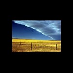
Image above represents the broadcast footprints of the geostationary satellites in December 2010.
-
PRN 135 is gone - WAAS Intelsat GEO Satellite Ceases Broadcast (link)
-
There is a Canada section of the forums (link) where you'll find lots of good info too.
-
Lots of things affect the accuracy of the GPSr ( and this is not an inclusive list):
...
Cloud cover
Snow
Rain
...
-
The best accuracy you can expect from recreational grade GPS receivers is +/- 3 metres (10 ft) under ideal conditions. Under tree cover or in difficult topography accuracy will be much worse.
-
The Oregon wiki is a good source of info. See question GC9 at http://garminoregon.wikispaces.com/Geocaching
-
Your question would be better asked in the FindStatGen macro thread (link) on the GSAK forums.
-
-
Thanks for posting this.
-
There's good info on using multiple maps at http://garminoregon.wikispaces.com/Maps
I know the link is for the Oregon wiki but the Dakota wiki notes that:
"Most information found on the Garmin Oregon Wiki applies to the Garmin Dakota as well, if you aren't finding an answer on this wiki please check the Oregon wiki."
-
... We're driving through town the other day and I notice that the Oregon is showing our path is about 15 metres parallel to the road.
Depending on the view of the sky at the time that's not an unreasonable error. For road navigation you might want to selcct "Lock on road" (setup=>routing=>Lock On Road=>Yes) but that can be confusing when finding caches off road.
-
I think you meant to post your question in an existing topic but instead started a new one.
The only way to remove geocaches is to connect the unit to your computer and delete the gpx files containing the geocache(s).
WAAS PRN 135 (e.g. 48) Back !
in GPS technology and devices
Posted · Edited by PDOP's
Thanks. I had found that one at
http://www.nstb.tc.faa.gov/index.htm which was linked to in another thread. The notice on that page is new today:
NOTICE: On December 23, 2010 Intelsat regained control of the Galaxy 15 spacecraft that hosts the L-band transponder that is used to transmit the WAAS GEO PRN 135 (CRW) signal. The FAA began transmitting from the re-activated payload at 16:30 UTC on 6 January 2011. The signal is in GEO Test mode per RTCA DO-229d. The FAA will be evaluating the performance of the signal prior to taking the signal out of GEO Test mode. The satellite is currently being maneuvered to orbital slot 93W where Intelsat will perform testing on the communications transponders. Once that testing is complete, the satellite is expected to be maneuvered back to an orbital slot that provides coverage to both Alaska and CONUS.
IIRC it's been that way since 135 started to drift east in April. It's the same on the WAAS Geo Footprint page too (link).