

Nick_Scots
-
Posts
26 -
Joined
-
Last visited
Everything posted by Nick_Scots
-
C:Geo - Just downloaded it and used it today, scoping out new cache sites and for mapping a forrest for then creating an Orienteering map. Excellent app. I have an HTC Wildfire only free apps installed. I used SUNDROID today, to check the exact sunset for my locale. Used CRITTER BROWSER to check what a Pipistrelle bat looks like, saw a few out at dusk. Also used it to check about Field Mouse. And used GOOGLE SKYMAP, but too foggy. Wanted to use SATELLITE AR to see the space station, too foggy. As I had a full Phone signal I was ok, although I like C:Geo and it's abiiity to cache mapping etc for offline use. Nick
-
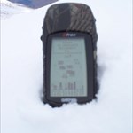
So why can't you WIFI update with the WIFI within the IPOD touch? I was looking at the IPOD touch today. I use an ACER N30PDA for caching but actually prefer the handheld Etrex Cammo as it doesn't suffer from 'cold kills battery' as much as the PDA. Nick
-
PDA GPS, handheld Garmin cammo, pencil, cache description on a notepad. That's it. I have only found a few, prefer to hide instead. Nick
-
How many people don't read the descriptions ?
Nick_Scots replied to Nick_Scots's topic in General geocaching topics
Well looks like I thought, that not al people read the descriptions, first. I own a cache that says to dig a few inches under a standing stone to find the cache,lots of users don't dig down. Ta for readinmg my post. Nick -
How many people don't read the descriptions ?
Nick_Scots posted a topic in General geocaching topics
Come on then, how many of you just download data and don't actually read the descriptions by the cache owners ? Nick -
Some caching photos take your breath away
Nick_Scots replied to Stuey's topic in United Kingdom and Ireland
Birkhill Clay Mine Cache -
Fairly Interesting Observation
Nick_Scots replied to The Lavender Hill Mob's topic in United Kingdom and Ireland
Two cachers found a cache of mine today, GE shows on the other side of a canal. MS Virtual earth is more accurate. Nick -
Fairly Interesting Observation
Nick_Scots replied to The Lavender Hill Mob's topic in United Kingdom and Ireland
I've found GE to be off, especially since my local hiding area is low res. MS Virtual Earth is much better res. I check my Beeline on my Acer PDA using my Garmin Etrex Cammo with WAAS enabled. The BEELINE never seems more accurate tham 17.5ft, the circle. I've tweaked the 'arrive' distance to less than 3m. I have seen other threads about turning off static navigation. Nick -
Beeline Geocaching Details
Nick_Scots replied to ForsdykeFinders's topic in United Kingdom and Ireland
Ta, okay I'll premium upgrade soon . Nick -
Beeline Geocaching Details
Nick_Scots replied to ForsdykeFinders's topic in United Kingdom and Ireland
I can't get Beeline to import a whole list of caches, just one at a time ? Nick -
Copying entire UK MemoryMap to Mio
Nick_Scots replied to Delta68's topic in United Kingdom and Ireland
Some Mem Maps you have to draw a track around an area, then Send that Overlay to the PDA limiting to 400mb. Nick -
That's what I thought, 3 or 4 small caches, one item, each with coords for the final Bonus Cache, so you need to find all 4 first to find the trad big cache. Nick
-
Good idea, it allows single cachers but also mulit cache seekers. Nick
-
Dry stone walls are a "no no" for geocaches - otherwise this look promising, good luck. I'm only sorry I won't be near Falkirk for a while as I have unfinished business with the multi based on the Wheel. Sorry, Ruined Wall is an Orienteering term. Plenty boulders small enough to tirn over but big enough to cache under. Nick
-
Ta for all the replies. Just been out night navigating another cache site ! Nick
-
Anyone spotted an online (preferably uk) supplier of a hard case with touch screen membrane for the acer n35 ? Nick
-
Just another thought. Would geocachers prefer a circular walk with no retracing of tracks as a - multicache or a series of seperate caches 1mile apart they could be done seperately if limited time was available. Also adding in some archealogical/historical interest ? Nick
-
Cheers Nick
-
3) Is not a good idea as Geocaching uses the dd mm.mmm format and WGS84 datum rather than OS Grid and OSGB. In any case you MUST include Additional Waypoints for all stages (including the Final location as a Hidden waypoint) and these can only be entered in the normal Geocaching dd mm.mmm format. You can of course use the OS grid in the descriptive text as well. 4) You don't have to have intermediate stages 0.1miles apart, just ensure that any physical stage of your cache is more than 0.1miles away from any other cache. I hope this helps and feel free to e-mail any of the reviewers to discuss your plans privately if you want to. Ta, I will set the cache in the Geocache format. I have set caches for kids before. I'm intrigued by the navigation aspect of Multi-caching. I want to set one up - 1) Coords given - when you arrive there you do a puzzle from that virtual cache, you then walk to a new coord you have worked out. 2) Then that cache has more coords etc etc I draw/survey orienteering maps so I'm out in the woods looking for boulders, ruined walls, large trees etc so I might as well put that work to another use ! I have access to online mapping down to 1;20k so it's easy ! Nick
-
Before I set one up, been out today to check distances and cache sites, is it gonna be accepted if - 1) The first cache has info to copy down and work out the next stages coords 2) There is three stages in total 3) The coords will be in OS grid 4) There is more than 0.1mile between stages. Nick
-
Are you sure ? http://www.nlb.org.uk/dgps/dgps.htm I have been getting DGPS for nearly three years in scotland. Sometimes as many as 5 of them. Schihallion summit was the best with my Garmin Etrex Cammo. Nick
-
I have one with FUGAWI and Mem Map for the alps, at 1;25k. Can you link or tell me where you got the battery extender from ? Ta Nick
-
The Acer has better accuracy than the etrex ? especially with the puck in your rucksac. It's problem is battery power and it's not waterproof. I bought it for £75 and £75 for the alps at 1;25k with memory map. It crashed after I got to the alps and would not take a charge. Etrex Cammo - waterproof but no maps.
-
The Acer has better accuracy than the etrex ? espceially with the puck in your rucksac. It's problem is battery power and it's not waterproof. I bought it for £75 and £75 for the alps at 1;25k with memory map. It crashed after I got to the alps and would not take a charge. Etrex Cammo - waterproof but no maps.
-
I have a Garmin Cammo Etrex, with WAAS enabled I get plenty of D sats, down to 4 or 5 m accuracy. Sciehallion summit I got 2m acuracy . I thought that was differential signals ? There is one in the forth estuary for shipping. Nick