


BiT
-
Posts
248 -
Joined
-
Last visited
Posts posted by BiT
-
-
I'm considering venturing out and doing a lot more solo hiking to go after those long hike caches this year and would like to have an added measure of security. I have seen two items that look interesting, the SPOT Satellite Messenger and the TracMe. There are a lot of differences, price, GPS based, subscriptions, etc.... Has anyone had any experience with either units?
-
It be honest, when I'm outside with the CO I don't have any issues with the screen. However when inside at my desk, the screen is a little dim but isn't that what the backlighting is for?
Go for the CO!
-
Ah ha, that looks like the key.
-
I was playing around with Garmin.com's Introduction to Geocaching and was surprised that some of my caches didn't show on their list.
I first thought that it may be filtered for a lower difficulty rating but one of my 4 star caches appeared. Then I thought it may be that some are yet to be found. That could be the case. Then I noticed some of my others didn't show as well. Puzzle cache didn't show but I didn't expect them to show. Some of my caches that didn't show were offset caches and other were traditional.
Anybody got any ideas on why some are showing and some are not. Try some of your hides in your area and see what results you get.
-
Okay, I didn't know that.
-
Ok, I have a question, is there a way to show the location of the cache (ie. Lat/Lon) on the geocache listing on the screen. If not can this be an added issue to the list if others agree with me. I have the location (Lat/Lon) on the map screen and would like to compare it to where I am in conjuction to the cache location. I have not used the arrow to find caches, I usually go with the cords to get me close and start searching.
What I thought you could do is while on the compass page go in and change one of the data fields to location (selected) and another to location (lat/lon). However, both those data fields then only displayed location (lat/lon). I tried a geocache, POI, and waypoint.
This may be another one for GO$Rs list - the location (selected) only displays the current location.
-
GO$Rs, add "reposition here" to your list!
-
-
Glenfg: Ram has a mount for the Colorado - I ordered one a week or so ago. Check out the Ram website. Rider
True, but wait until you get that email from a third party where Ram has farmed-out your order stating that it will not be available until March 26th. See this thread.
-
Is there a way to Map a POI or waypoint? I think the 60CSx had that feature but cannot seem to do it on the CO.
Say for example that I want use my CO to search and pan around the area surrounding Guadalupe Peak. I can use Where To?>All POI>Option> Spell... and then find Guadalupe Peak. I will come up with the POI information box at the top of the screen and the green Go at the bottom right. However with that you can only zoom in and out. I want to pan around that area.
Is there a way to do this rather than pan all the way from you current location to that location of interest?
Sorry for the cross post.
-
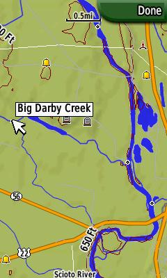
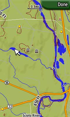
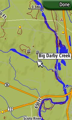
Yep, same here. The name of the lakes around here don't appear. Also the rivers only appear when they are a thin line. Anything bigger and no name is displayed.
-
Is there a way to Map a POI? I think the 60CSx had that feature but cannot seem to do it on the CO.
Say for example that I want use my CO to search and pan around the area surrounding Guadalupe Peak. I can use Where To?>All POI>Option> Spell... and then find Guadalupe Peak. I come up with the POI information box at the top of the screen and the green Go at the bottom right. However with that you can only zoom in and out. I want to pan around that area.
Is there a way to do this rather than pan all the way from you current location to that location of interest?
-
-
Is it in bad form or poor taste to duplicate another cacher's bookmark? That is to have the same bookmark, maybe just called something different, but with the same exact caches.
-
Like the rest said, it works great. Use to from TX to AZ, OH to NC, TX to AK, TX to OK, OH to WV, and etc...
The only negative is I wish the alerts were louder since I like to listen to the radio and music and have four kids talking and at time it can be hard to hear.
-
I think right now the only way to have a geocache in a planned route to go back to the COOS (CO Old School) and load the geocaches as POIs.
-
deleted post
-
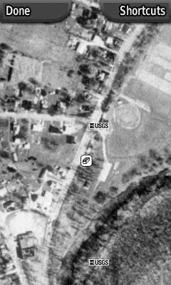
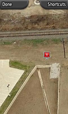
Say for example that you want to go after a cache that has a 5 mi. hike or that evil urban micro. Why not take a few other map sources with you? For example, on the 5 mi. hike you may want a portion of the USGS 7.5' Topographic Map or a portion of a Digital Orthophoto Quadrangle. For that evil urban micro, how about those Microsoft Map Point Bird's eye views or some aerials?
What you need to do is take screen shots (Ctrl/Alt/PrtSc) of all the available online map sources that you need and save them as .jpg files (open your Paint [start>Accessories>Paint], paste, and Save as). Then you push them to your CO's SD card.
Voila, you now are able to view those resources while in the field.
Sample screen shots from the CO.
-
I don't understand why you guys didn't see this. Surely you saw the list: Show Description, Show Logs, Show Hint (does not appear if no hints are available) when you pressed the options button and were going to Descriptions. The list is there. You had to select which one. You made the selection, but you didn't read the choices?
I can see how you might have had a momentary lapse of comfort when the logs weren't there, but wouldn't you normally have then thought "Okay. If I select Options>Show Hintm I'll see the hints ... okay. That's still there. Now I see the Show Logs button."
I really, really, really believe its stuff like this that got all those initial Colorado haters off on the wrong foot. It wasn't the unit. The unit performed. It was the user unfamiliar with the unit who wasn't performing.
A question: Were both of you guys/gals wearing sunglasses? Maybe you just weren't seeing what you were doing?
I'm not sure what the "Hintm" is.
Hintz, Hinta, ... , Hintxzy
Whereas my CO has a "Show Hint."
-
Is it where you can Select Category?
Where To?>Shopping/Food&Drink/Fuel Services/Lodging/Entertainment/Recreation/Attractions/Transportation/Auto Services/Community/Hospitals/Geographical Points/...Other>Options>Select Category
Or was that here before?
-
Well I got an email from Groundspeak but it didn't say if the issue would be fixed.
It would be nice to see an earthcache appear as a earthcache and not wonder if it is a mystry cache. Conversely, it would be nice to see a mystry cache and go to find it and discover it is an earthcache.
................................
Hi Brian,
Thanks for writing in and the heads-up.
Eric
Groundspeak, Inc.
Ticket Details
===================
Ticket ID: KFR-930871
Department: Geocaching
Priority: Medium
Status: Closed
-
Yep, I tried it and it didn't seem to go over the 2,000 threshold. Darn, thought we may have stumpled upon something.
-
I read a couple of posts that said that geocaches can be put on an sd card and read by the Colorado. I tried this with no luck. Am I missing something?
I think it works as long as you create a [sD drive]:\garmin\gpx folder on the SD card and put the gpx files in this folder.
GO$Rs
Interesting, has anyone tried this yet? Does that mean we could be 2,000 + on geocaches?
-
I got an email back from Groundspeak yesterday that basically said thanks for the heads-up. My question, are they going to fix it?
..............................................................
Hi Brian,
Thanks for writing in and the heads-up.
Eric
Groundspeak, Inc.
Ticket Details
===================
Ticket ID: KFR-930871
Department: Geocaching
Priority: Medium
Status: Closed
Cache descriptions truncated on CO,
in GPS technology and devices
Posted
I noticed that some of the longer cache descriptions are being truncated. This is especially harmful on earthcaches and virtual cache where you have to answer questions and they are often posted at the end of the cache description.
I noticed this happening in both loading situations-PQ and "Send to GPS". I opened the .gpx file on the CO in a text editor application and it is all there, so it looks like the CO is truncating the descriptions.
Example: With When the Glacier Kame the description is truncated just before the questions.