

GPS Guy
-
Posts
122 -
Joined
-
Last visited
Posts posted by GPS Guy
-
-
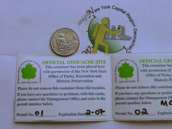
Here are the permit stickers for cache containers in NYS Parks. (OPRHP)
They are a quarter inch too tall for a film can.
-
Don't even try it..........

I don't think so........
You wouldn't dare......
No, but I would! Ha Ha!!!!

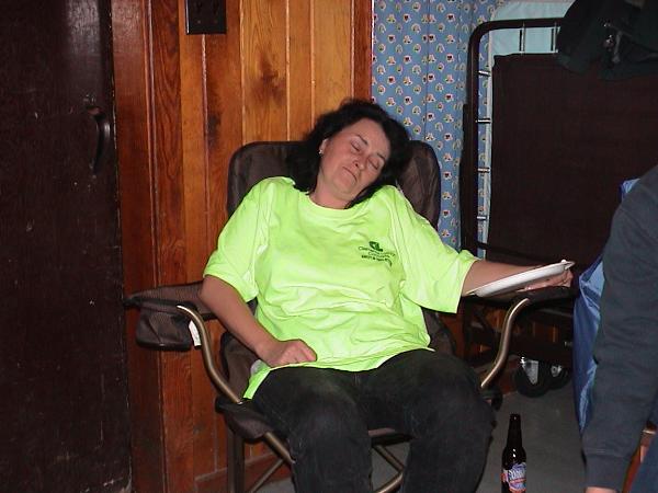
Congratulations Mrs Rusty!
Now, get some rest!
-
Rusty-
You should demo that at our next tech meeting.
-
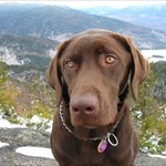
My pal GeoKobi likes to lead the way on any hike we do. He is a 4 legged mobile entertainment system, and keeps me grinning all day.
I just got the gc.com '05 calendar and lo and behold, he is one of the geodogs in the month of July!
-
Holy cow! What a difference a lot of rain makes!
Well, the first night and day of our event got drenched byIvan, but many campers and cachers still turned out for a soggy wet, cold day of good fun. I was impressed that so many came out to cache in the pouring rain. Our diehard campers had a blast partying, feasting and night caching. Always will we remember the comedy of CamillusGeo, who carried on for hours on end.
Despite the rain, we all had a blast and a successful event. Thanks to all who helped, as well as those who attended in sub-optimal conditions.
-
-
The Second Annual Capital Region Geocaching Picnic Will be held at John Boyd Thacher State Park September 18 and 19, 2004. We hope you can attend.
-
Hope you have time to test the bike out well before you leave your sister's. Ride on!
-
Voltaire-
You still out there? How's the trip been going?
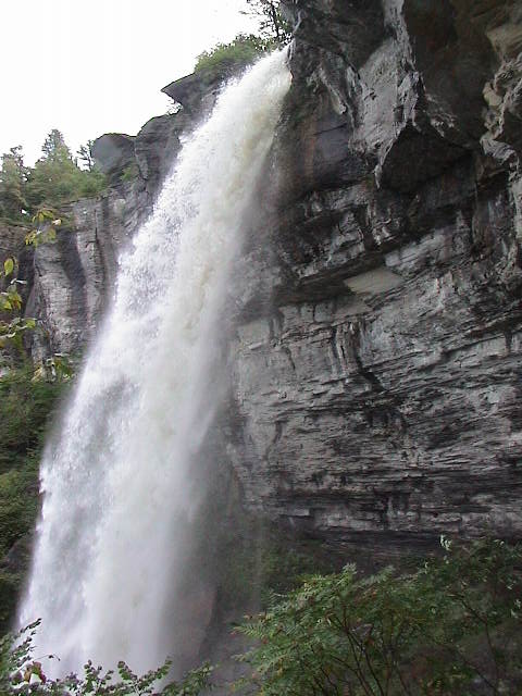
I was back up at Kaaterskill Falls and Pancho Villa's for mexican dinner again today.
-
Voltaire- I hope you enjoyed Zion. Have a great and safe trip!
-
She logged this event on the 19th. GCJNDQ
-
Voltaire-
I see what you mean, now. When I enter the coordinates for highway 128 in Utah into the first seach page, I get results from far flung places like the Bahamas and Saskatchewan. When I manually enter the coordinates on the second search page like THIS, I get the proper results of all the nearest caches to the coordinates. Strange, but I don't have an explanation.
BrianSnat- I had to climb a tree to get that shot! It resembles a historical photo I saw in a book that included the hotel and other structures atop the falls. I think the book was "Rip Van Winkle Railroads."
-
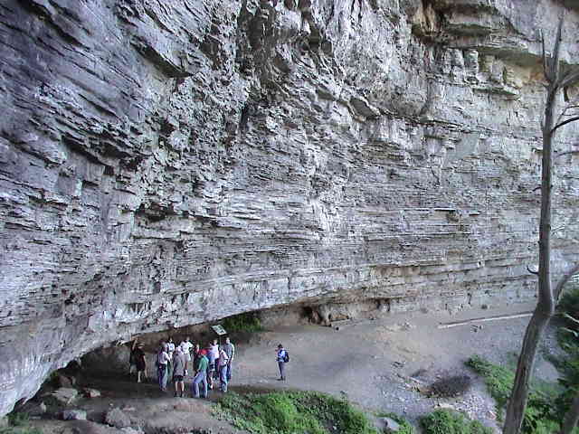
I was at Kaaterskill Falls on Saturday. (Girlfriend wanted to get mexican dinner at Pancho Villa's in Tannersville.) We hung out at the top of the falls (Laurel House Rd.). I found one carving from 1829 and another from 1810. I also found ash, metal and china shards just upstream from the old Laurel House Hotel.
-
Hey Voltaire,
Check out these locations.
NY Rt 23A west of Catskill, NY. Near Tannersville. See Kaaterskill Falls.
I have some Southwest locations for you that topographically blew my mind.
#1- Zion NP along Virgin River. N37d17.11', W112d56.90' Check the East entrance road, too. Major wind and water cut rock there. (See drainage below bridge at East end of tunnel.)
#2- Glen Canyon Nat'l Mon. Anywhere you can see it. I hear the water is down to 60% capacity. I remember National Geographic covered the canyon while the waters were rising for the first time in the '60s.
#3- Colorado River along Utah Highway 128. N38d48.23', W109d20.23' Red rock cliffs and water.
#4- Colorado Nat'l Mon. South of Fruita, CO. N39d6.40', W108d43.97' Sleeping out under the stars is mandatory.
Good luck with your trip!
-
Congrats to Rusty on this new milestone! Many more to go.
-
There was snow in North-South Lake Campground in the Catskills on the 25th. The temperature in my tent went down to 20 degrees.
-
There are two caches on/near Cornell. Catskill Critters was last found on the 11th, and I found Maltby Hollow on the 25th.
I had a great hike across Slide/Cornell/Wittenberg to the campground during the summer of '02. Met a bunch of yoga enthusiasts on top of Wittenberg.
-
Yes, I do. On foot or snowshoes. I don't travel as far as I might during other times of the year, but I go. When I hide my caches, I keep in mind the future snow cover, so they won't be too hard to find in the winter.
-
Sounds like fun... As long as no one is racing down the streets.
[This message was edited by Marc G. on April 10, 2003 at 08:20 AM.]
-
See the BBB report Here:
They did not refund my credit card until several months later when I threatened to take action. I'll never do business there again. I believe anyone who does is making a mistake.
-
When I started the nearest was over 100 miles away and there were fewer than 140 caches worldwide. So, I placed the first two in the region and waited a while before anyone found them. Finally someone else hid one not too far away and I could go seek. Lots of fun ever since.
-
NOAA has posted a story here: http://www.noaanews.noaa.gov/stories/s1055.htm
The FCC has approved a NOAA request to allow hikers and outdoor enthusiasts access to the same technology that pilots and ships use to signal for rescue. Available July1, 2003.
Comments, please.
-
Here is a site to fit the bill.
-
I use 2 gallon plastic paint pails with snap on lids. They do a good job of keeping out the water. I always use ziplock bags as a precaution. The pails are available at Home Depot.e


Nys Parks & Recreation Survey
in Northeast
Posted
I think that depends on the individual park manager. Mine got to stay. They will have to move two years from now. I am archiving one because it is too close to another cache, and it would put me over the 5 cache limit for that park.
Don't kill your caches until you talk to the manager of your park. You may be pleasantly surprised.