

GPS Guy
-
Posts
122 -
Joined
-
Last visited
Everything posted by GPS Guy
-
Hello. I just happened to peek in the forum today. Most of us are sadly on Faceplant these days. You can look for local groups there at New York Capital Region Geocachers, Glens Falls and Surrounding Areas Geocachers, Blue Line Geocachers. Or, try geocachingny.org, which is not very active, due to Faceplant. We have a monthly breakfast meeting on the second Sunday of the month at 8am. The location moves around the local area. We just had a group snowshoe hike to GCPYGD overlooking Lake George. There is an upcoming winter event in Lake Pleasant, NY in a couple of weeks. GC4YBEQ Hope to see fresh faces there. GPS Guy
-
I'll be there with my snowshoes, sleeping bag, and snowmobile!
-
Is the ADK park close enough? HERE
-
Just another day or so left to vote for Kobi on FB. VOTE Shameless.
-
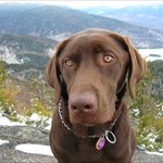
Kobi has been caching with me since he came into the family over 9 years ago. He's a regular at our geo events around upstate NY. Lucky him, and me. He gets to go with me almost everywhere. I just entered him in a photo contest. Please follow the link and "like" his photo, in order to vote. Thanks! Vote For Kobi HERE, Please.
-
Thanks Geolobo and Bluegirl for the weekend events and caches. HEREis Geolobo's slideshow from the camp out.
-
The campout page has been updated. Survival Campout
-
love the little disclaimer at the bottom...I bet the Bear's name is Yogi - he's smarter than the average bear The bear's name is Yellow Yellow. Here is a story: NYTimes NY DEC Bears
-
Oh, c'mon! Those were ice beds, and this is snow. It is so much warmer, especially if you dig all the way to the ground. I have stayed at the Shamrock Motel, and the Adirondack Hotel. Both were fine for me, except they both had four walls.
-
The New York Capital Region Geocachers are having their annual picnic on Saturday, September 18, 20010, returning to beautiful North-South Lake State Campground in Haines Falls, NY. Located on the Catskill Mountains escarpment, there are plenty of great views and hiking opportunities, not to mention the event. EVENT PAGE CAMPGROUND PAGE 2006 EVENT THERE We hope to see you there.
-
It appears that the maps were updated to better show the boundaries of public and private lands within the forest preserves, not to mention state wide. Green is stae land, and white is private. HERE at NYS DEC, you will see similar boundaries on DEC's map. HERE is a closeup of the Catskills.
-
Yes. I used to throw my Garmin 76S down the trail so Geo Kobi could run after it and retrieve it. He would grip it by the edges for the most part, but I would take it back if he put a tooth on the screen. It still works great. I still use it when I set up a new cache, as it will average a waypoint, unlike the Colorado I upgraded to. On those occasions, I will still give it a toss for Kobi. He manages to sniff out the occasional cache, even without a GPSr.
-
New York Capital Region Geocachers 6th Annual Event
GPS Guy replied to geosliders's topic in Northeast
I'm on way out the door with the geo dogs for the campground right now! See you soon. -
I will post your question in our local NYCRG forum and ask that answers be posted here. Most parks are closed at dusk, or 9 or 10 pm.
-
Winter caching is great! Just go after winter friendly caches, and enjoy being out there. We just attended a winter event in Long Lake, NY. The hosts put out about 29 new caches. Everyone was out there on foot, snowshoes, skis, and snowmobiles caching away. A great time all weekend. One of the cachers lost his 60csx on the trail. The rangers saw his note in the trail register, and went in with a metal detector and found it in 2 feet of snow. Oh yeah. Tonight, Long Lake will go to 27 degrees below zero. Brrr.
-
A few friends and I have discussed caching with our sleds, but it is hard to know which caches are both winter and snowmobile friendly. While searching the Forum for this, I only found one TOPIC in Canada. So, I thought I'd open it up to everyone. (Everyone who gets snow, that is.) If you own a sled/winter friendly cache, that is on or near a sled trail, can you please set the attributes to show the snowmobile/snow icons? And any other attributes that apply, for that matter. This will help us get a usable pocket query. Thanks!
-
Congrats! It's been a good journal read, and map study. Well done!
-
Much of IP's holdings in NY have had conservation and recreation easements sold to NYS DEC. LINK There should be public access allowed to portions of the land, but be careful. There are still leases held by hunt clubs, etc. that would restrict access. NYS DEC Link You'll need to do some digging. I would first try the contact info on the trail, as Trucker Lee said. Good luck.
-
17 miles to go. Looks like he'll finish on Wednesday. It'd be nice to greet Quoddy at Trails End, but perhaps it would be wiser to wait until after he's had a good long shower.
-
Best of luck! I'll follow along on the RSS feed and my Long Trail map.
-
HaaHaa!! Well, now that I've picked myself up from under my desk, and finished clearing out the cellar, I wanted to congratulate you all on your fine hike together. I'm glad you saw what a nice patch of woods that is. Thanks for all the pictures. Well done!
-
I see what you mean. This interactive DEC map shows the area we speak of. Wouldn't it be nice if they put in a cable bridge across the creek there.
-
I don't know if things have changed, but parking at the north end of the LP on 23A has been problematic for many years. There are no parking signs along the local road where the long path comes out of the woods and no parking allowed on 23A in that area. I have seen a DEC Trailhead parking area near either 42 10.584, 74 01.822, or perhaps 42 10.543, 74 01.652. It is on the north side of 23A heading out of Palenville. I've assumed that this area serves the trails up South Mountain.
-
I'd like to suggest a bushwhack on the way in to save some distance and avoid the north and east section of snowmobile trail, which I have found to be quite muddy. Try this: When you climb to the saddle at 2970 feet SE of the peak, turn left and bushwhack to Aircrash 1. That should save your socks from getting wet for a while. Also, between Aircrash 1 and the south trail to the summit, you will find large quantities of nettles on the trail. Long pants may be useful in that area. Have a great time!
-
I gather that DEC wants to reduce the pressure on the High Peaks Region by discouraging use of all types, and encouraging use in less visited areas. Isn't it ironic that nature loving 46rs could be considered part of the problem by virtue of their participating in a "numbers run". Aren't there some serial 46rs who have done it repeatedly, by season, nighttime, barefoot, etc?