

Miragee
-
Posts
11294 -
Joined
-
Last visited
Everything posted by Miragee
-
As a Premium Member, you can set up your Pocket Queries to only return caches with a Terrain rating of 2.5 and above. That would pretty much rule out caches in small parks and parking lots, although it might include a cache requiring you to climb a tree or tower . . . When I was traveling, I did the reverse with my PQs. I set them to return caches with both a Difficulty and Terrain rating of '2' and under since I knew I didn't have time for cleverly-cammoed difficult hides, nor time for a hike.
-
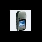
Sorry . . . I'm not familiar with that GPS unit. I have a Garmin Vista HCx. Some GPS units don't have any way to enter coordinates. If there is a screen that shows you the coordinates, you could try to match those up to those of the cache after getting close by, like to the park where the cache is hidden. That is tedious, but I've used that technique a few times in tricky locations when the "Go To" arrow on my GPS unit was less than helpful.
-
I set up my Pocket Queries for this "cache-rich" area by "Date Placed." That way I get a wider search circle. I open these PQs in GSAK and filter them accordingly for a "caching adventure." You can use the "smart name" codes in an infinite number of ways, but this is how I set mine up: %smart=9 %con1%typ1%dif1%ter1 The information included is part of the Name, the Size of the container, the Type of cache (Traditional, Multi, Virtual, Puzzle), the Difficulty and Terrain (based on a 10-point scale). To get part of the hint, I use this code in the Waypoint Description blank of the "Send To GPS" dialogue box: %Name=8 %hint For the .gpx Export for "Custom POIs," I use the same Waypoint code, but for the Cache Description, I use this code: %By %Hint %Code That gives me the cache owner's name, the hint, and if there are enough characters left, the GC code.
-
Welcome to the Forums! From the Search page, you can check the boxes for the caches you want to look for to download a .loc file container all of those caches, or you can download the .loc file from each cache page, or, after intalling the Garmin Communicator, you can download directly from each cache page. If you download the .loc files, you'll need a program like EasyGPS or GSAK (Geocaching Swiss Army Knife) to send the waypoint to your GPSr. Your Garmin Mapsource program will also work, although I don't have experience with it. I use GSAK. "Paperless" caching refers to using a PDA, like an inexpensive Palm m500 or m515 to put the cache descriptions into a program like Cachemate. For "paperless" caching to work, you need to become a Premium Member so you have access to the .gpx files and Pocket Queries. The .gpx files have much more information in them compared to the .loc files.
-
Welcome to the Forums! You have to purchase the maps for your 60CSx. The older Topo maps can be found inexpensively on eBay, but to get the most of that GPS unit, you'll want the City Navigator maps for auto-routing, unless you already have another GPS unit in your car. There are some free maps that are discussed in the GPS and Technology Forum, but I don't know if they are available for your area.
-
Welcome to the Forums! Since you are a Premium Member, you can request Pocket Queries that only contain caches you have not found yet. If you use a program like GSAK (Geocaching Swiss Army Knife) to keep track of the data, you can have a separate database for the caches you have Found along with the Default database of caches you have not Found yet.
-
Welcome to the Forums! bsayusd gives you lots of good information. I'll just add that I have a Vista HCx with the City Navigator maps and Topo maps installed. I use it for auto-routing, and then switch to the Topo maps when I am hiking. The Legend HCx, which sells for around $190, is a good choice if you are budget-minded but want a GPSr you can grow with. I purchased the Topo maps on eBay to save a bit of money. I got the City Navigator maps in a "combo" package with the beanbag auro-mount and cigarette-lighter adapter.
-
Welcome to the Forums! If the GPS unit you have is the Nuvi, this thread will be helpful for you. However, you have to become a Premium Member to get access to the more-detailed .gpx files and Pocket Queries.
-
Welcome to the Forums! The 60CSx can be held either horizontally or vertically. My friends who have that GPSr usually keep it in the clip on a pack strap or on their belt. After you have done a "Go To," the arrow is pointing to the cache. You can change the Data Fields on that screen to give you different information that the default Data Fields. Usually a Park n' Grab is just that, but I have DNFd those kind of caches before. It took me three trips, and help from a cacher who had found it before, to finally find one Park 'n Grab behind a shopping center. That might have been the final straw . . . the one that makes me leave my GPSr off when I go to town to run my errands.
-
Welcome to the Forums! EasyGPS is a good program to start with. Many people use GSAK (Geocaching Swiss Army Knife) once they become a Premium Member to get access to the more-detailed .gpx files and Pocket Queries.
-
Welcome to the Forums! GSAK is an incredible program that can be daunting at first, but it is so incredibly useful, it is worth the time to figure it out. The people in the gsak.net Forums are ready to help if you get stuck. In the meantime, here is a rudimentary tutorial that might help you get started. Using the "smart name" codes, you can get a useful waypoint name, and the hint on your GPSr.
-
If cost is a factor, I would get the Vista HCx and purchase the older Garmin Mapsource Topo maps on eBay to install to it. The Topo maps on the GPSr are very helpful. I like my Vista HCx very much and prefer the button placement and click-stick action when compared to the buttons on the 60CSx. I've never liked the flat, TV-remote-control-shape of the 76 series. The very best thing to do is go to a store that carries each GPSr so you can hold each of them and see which one you prefer.
-
Opinions on best GPS for Geocaching
Miragee replied to redsuspenders's topic in GPS technology and devices
The Garmin Colorado is the only other option I know of that includes the cache descriptions. I love my Vista HCx for Geocaching, but I have to carry my Palm m515 with me to have the cache descriptions and Past Logs in Cachemate. -
For questions about GSAK, the gsak.net Forums are the best place to ask questions. The people over there are very knowledgeable and Clyde is there all the time to answer questions about his program. There is a Macro for GSAK that will import the Cachemate logs, but I haven't used it myself, so I can't help you . . .
-
I think my fairly new GPS might be broke!
Miragee replied to biscuits&gravy's topic in GPS technology and devices
You might also try the new "Hybrid" batteries which are charged when you buy them. Rayovac "Hybrid" batteries, purchased at Target, work great in my Vista HCx. -
First Annual CacheAddicts Best Of Awards
Miragee replied to Cache Liberation Front's topic in West and Southwest
The link works for me. I use the Opera browser . . . but on a PC. -
That doesn't seem right . . . Even without WAAS, a GPSr should be more accurate than that. Do you have it set to the correct Datum? It should be set for WGS84. If it is set to NAD27 or some other datum, the location may be tens to a couple of hundred feet off, depending upon where you are.
-
Welcome to the Forums! You have made a good choice for a first GPS unit. You might want to get an "Invisible Shield" for it. I have one of those on my Vista HCx and I also got the Garmin neoprene case to further protect the GPSr. I have both Topo maps and City Navigator (auto-routing) maps on my GPS unit and find both to be helpful. Whether you need one, or the other type of maps, depends on the kind of caching you like to do.
-
I don't know why people keep saying the Vista is not as durable as the 60. I accidentally dropped my Vista C from a more-than-100' "cliff." When we found the GPSr at the bottom, it was still working. If you did that to a 60, I think there is a good chance the antenna could break off as it bounced on its way down . . .
-
There has been a problem using the Home Coordinates and limiting to a single State. It is better to input the coordinates manually, or use a nearby cache GC number. Here is how I fill out one section of the form: I create several "Date Placed" PQs and use a centerpoint away from my Home in order to get a 90-mile search circle.
-
I have the Vista HCx and prefer its smaller size to the 60CSx. It does everything the larger 60 does, including auto-routing, however it seems to have less "cool factor." The best thing to do is go to a store where you can handle both and see which one you like best.
-
Using the "lightbox" to make your cachelisting more enjyable
Miragee replied to Special K.'s topic in Website
I guess I just prefer watching the log page open, with all the image links in one place, instead of watching the lightbox go around and around and around and around before the image finally appears. The computer is fast . . . it is the 28.8 connection that slows down the image loading . . . -
Welcome to the Forums! You can purchase the older Topo maps on eBay to save some money on those. They don't have "unlock codes." The best street mapping software is City Navigator which has an "unlock code" and can only be used on one GPS unit. Some people buy MetroGuide and then use a "hack" to get the auto-routing feature from those maps. I think one of those programs is called MetroGold.
-
Looking to buy cheap/entry level GPSr
Miragee replied to PastorJon's topic in GPS technology and devices
Thanks... Trying to figure out how serious you are... What makes a Magellan less desirable? Is it durability? accuracy? ease of use? Magellans have dreadful customer service. A friend's Explorist stopped connecting to his computer and he could not get help for more than a year. Finally they sent him a Triton 400, which lasted for three hours before locking up. He sent that back and got another Triton 400. It is still working, but was very non-intuitive to use. He is still using my trusty Garmin Vista C as a back-up unit. -
Welcome to the Forums! Check out the Garmin Quest. That can be used for Driving and for Geocaching. The least expensive Garmin 'H' model that has the High Sensitivity receiver and can auto-route is the Legend HCx. It costs less than $200, but the City Navigator maps cost another $100.