

Miragee
-
Posts
11294 -
Joined
-
Last visited
Everything posted by Miragee
-
You can put 1000 waypoints in a Legend HCx. You only see 50 in the "Find by Nearest" list. If you want to see all of them, you can use "Find by Name."
-
Garmin has Mapsource Trip and Waypoint Manager for loading the caches, however I have not used that program. I use GSAK (Geocaching Swiss Army Knife) to handle all the data from Pocket Queries, which you can get as a Premium Member. I filter for the distance around a cache that is my centerpoint for the day and send 900 caches to my Vista HCx in a few seconds. After that, I Export a .pdb file for Cachemate on my Palm for caching "paperless." From GSAK I can also Export .gpx or .gdb files to use in Google Earth or in Mapsource Topo or City Navigator maps. From GSAK I also Export .gpx files for Garmin's POI Loader for sending Custom POIs to the card on the GPSr.
-
I have the Vista HCx and like it very much. I have both City Navigator and Mapsource Topo maps installed on it. I also use Garmin's POI Loader to put almost 9,000 Custom POIs on the GPSr. These include Benchmarks as well as the Unfound caches, my Owned caches, and all the caches I have Found, divided up by those that are Archived, and those that are still Active.
-
If you are using GSAK, you can Export a .gpx file of the entire database. I send more than 1700 caches in my Default database at one time. I put an Unfound.gpx and Unfound.bmp file in the Update folder I point the POI load to. The .bmp is a "Treasure Chest" icon. Check out this thread for some ideas. You don't need to rename the files. Just put all the .gpx and .bmp file in one folder for the POI loader to update.
-
Once you setup GSAK for that GPSr, you can send all 500 caches to it at one time using GPS/Send Waypoints. You can also send individual waypoints from the right click menu. Another thing you can do is Export a .gpx file and use Garmin's POI Loader to send the caches as Points of Interest. Those have more characters in the names and description, so using GSAK's "smart name" codes, you can get more information, including the hint.
-
It is easier to load caches into a Garmin than into a Magellan. You can load up to 1000 at one time, and if you get the HCx, you can load thousands more waypoints as Points of Interest using Garmin's POI Loader.
-
I send both Waypoints and POIs to my Vista HCx using GSAK. For the POIs, I use the Garmin POI loader. It is a free download. Then, from GSAK, I Export .gpx files for each category of POI. For the name of the cache, I use these "smart name" codes: %smart=9 %con1%typ1%dif1%ter1 %By For the description, I use these codes: %Hint %Code You can mix and match these anyway you want, but I like the name first for the Waypoint in case I need to look the cache up by Name instead of by Nearest. This thread in the Forums will be helpful. Since when you load POIs it wipes out the previous ones, I have all the different types of POIs in one Update folder and point the POI loader to it. It picks up these files and puts them in the Custom POI list. Unfound.gpx Unfound.bmp -- Closed Treasure Chest FoundArchived.gpx FoundArchived.bmp -- Tombstone Found.gpx Found.bmp -- Box with checkmark Benchmarks.gpx Benchmarks.bmp -- Blue dot
-
If you want it the "old" way, you could use this page.
-
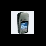
I picked the model I have, the Garmin Vista HCx, because it had the newer "High Sensitivity" receiver that outperforms the Vista C I used prior to that. I also chose Garmin because of their reputation for excellent Customer Service. I also picked the Vista HCx because I could use it for auto-routing, with the excellent Garmin City Navigator maps installed on it. It is also a nice small size for hiking. I'm sure others will give their reasons for choosing the models they have.
-
In your case, you can get two different 500-cache PQs and load them into either one, or two databases in GSAK. Your Vista HCx will hold 1000 waypoints, but you can load thousands more as POIs and the POIs can have more characters in the name and description which is very handy. GSAK's "Smart Name" codes are useful for getting the information you want, like the cache owner's name and the hint and whether the cache has a TB or not. Because caches get Archived and Disabled all the time, you might want to set up Notifications for those two eventualities, as well as for brand new caches.
-
Because I live outside a very cache-rich area I set up my PQs by "Date Placed." I picked a centerpoint for those that would get me about a 45-mile radius. At the present time, it takes seven PQs to cover that wide an area. I load all of those caches into three separate databases in GSAK depending on whether the caches are 35 miles N and NW of my home, or out in the Desert. In the Default database I have about 1700 caches to choose from when choosing a centerpoint for my search. In my previous post I forgot the other, most important Filter to use before loading your GPSr: "Last .gpx Update." I don't Delete the caches from my database when I load new data. That way the Past Logs build up beyond just the last five. However, if I don't filter for "Last .gpx Update" I won't know which caches have been Disabled or Archived since the last refresh of the database. Those need to be deleted so you aren't looking for a cache that doesn't exist anymore.
-
I don't know what I would do without my camera. It's the only way I can remember where I've been and what I've done. The external hardrive is getting waaay too full, though. Interesting, and somehow gratifying to know others depend on their cameras as I have to. I even mentioned that in a recent blog entry, which still needs to be "fleshed out" . . . if I can remember the details . . .
-
Since you are a Premium Member, you can do what I do (if you use GSAK to handle the data from Pocket Queries.) Before heading in any direction, I get fresh Pocket Queries which I open in GSAK. I do a few filters before loading any caches into my GPSr. First, I filter for "Last 2 DNFs" and Delete those caches from my database, unless by reading the cache page I think I can find the cache. Then, I Delete all the caches by one particular hider . . . Then I pick a Centerpoint in the database and filter for distance around that location. I load about 900 caches into my GPSr . . . just in case our route varies slightly. I have an 'x" GPSr, so the last thing I do is send POIs for all the caches in my database, as well as all the caches I have Found (separated by Archived and Still Active) to the GPSr.
-
I made a trip to Dollar Tree and a few Thrift Stores before my recent cache-hiding adventure. At Dollar Tree I found a plastic skull I used to hide an Airborne container that held the log and a pencil. At the Thrift Store I found swag for the two ammo cans I hid, but I also found a small metal "bird house." I painted it with the colors of the Manzanita bush I was going to hang it in and attached a bison tube to it. I'm not very creative on my own, but sometimes "found objects" spark a bit of creativity.
-
Recently, I had a cacher put a "Needs Maintenance" log on a cache of mine when they found it on the ground, instead of "eye level" as stated in the hint . . . Doh!!! : To get rid of the Attribute, my "Owner Maintenance" was to edit the hint . . . With the new policy about "Absentee Owners," I sure hope cachers are much more judicious in using the "Needs Maintenance" attribute . . .
-
Without being a Premium Member and using a program like GSAK to center the area you are going to when you send caches to your GPSr, what you are asking is difficult . . . Although, someone else might have a different suggestion, beyond finding every single cache in the area and keeping the waypoint in your GPSr when you go out on your "cache hiding" spree. Like you, I enjoy hiding caches. Before I go out, I get a fresh Pocket Query of the area I am going to. Then I use a nearby cache as the Centerpoint in GSAK and load my GPSr with all the caches, including the ones I have found. If there is a Puzzle or a Multi in the area, I either have to find the cache and all the waypoints and have those in my GPSr to check Proximity, or check with my Reviewer to see if the "empty space" I see on the map is really empty. I highly recommend becoming a Premium Member. It really makes caching much, much easier.
-
Yup . . . after logging yet another DNF today, I'm up to 304 DNFs, some of which I have gone back to find later. Some of which aren't worth returning to now that I saw the location. It happens. Don't give up. Just look for easier, larger containers.
-
Welcome to the Forums! When you are on the Map Page, hit Menu and from there, when you are on the selection that names the maps, hit Menu again. Now you can choose to "Show" or "Hide" different maps.
-
Like Wild Thing 73, I would recommend getting a good handheld GPSr you can grow with. I have the Vista HCx and like it. I have both the Garmin Mapsource Topo maps (bought cheap on eBay) and City Navigator maps (for auto-routing) installed on it. Becoming a Premium Member is a good idea so you can get the data more easily and use that data to cache "paperless." GSAK is an invaluable program on your PC.
-
Radius . . . what radius? Fortunately, I've never been a "radius slave."
-
Nat'l Geographic Backwoods Explorer...will it work?
Miragee replied to VA Caver's topic in How do I...?
If by "compatible" you mean, can you install the maps to the GPS unit, no, the maps are not compatible. However, you can probably display tracks from the GPS unit on the maps and should be able to Export .gpx or .loc files from software like GSAK in the correct format to view cache locations on the maps. -
Here are the errors in the code on that page, some of which might be causing the mis-alignment.
-
What is the best GPS for geocaching and for autos?
Miragee replied to 1phoenix's topic in How do I...?
Welcome to the Forums! The Legend HCx, Vista HCx, GPS Map60 Cx/CSx, and 76 Cx/CSx will all give auto-routing directions with the City Navigator maps installed. Some people prefer the 76 or 60 for driving, other people prefer the smaller size of the Legend HCx or Vista HCx for biking or hiking. The best thing to do would be to go to a store, like R.E.I., that carries all the models so you can handle them and see which one you prefer. The Legend HCx is the least expensive, selling for around $185.00. -
I have both a Palm m500 and an m515. Both work well for Geocaching with Cachemate installed. If you want one that has a few more features, the Zire 72 Silver Edition is pretty cool. All of these units are easy to see in bright sunlight. Some of the other models, including the TX are hard to see outside. You should be able to get a Palm m500 that connects to your computer with USB for less than $30.00. For "paperless" caching, you will want to become a Premium Member. Then you can get Pocket Queries. I use GSAK (Geocaching Swiss Army Knife) on my PC to handle all the PQ data.
-
I use the compass screen on my GPSr, a Vista HCx ($220), to find the cache. You can configure the "Data Fields" on the Map screen to give you the arrow and distance to next, so you can use it. Very rarely, I use the Satellite screen to "match up the numbers." You will put both City Navigator and Topo on the card from Mapsource at the same time and can switch from one to the other easily from the Menu when you are on the map screen. You need to purchase Mapsource maps, although there are some free maps, and some people even create their own. National Geographic TOPO! makes beautiful paper maps and can display the tracks from the GPSr.