

Miragee
-
Posts
11294 -
Joined
-
Last visited
Everything posted by Miragee
-
I Export a filtered .gpx or .gdb file in GSAK to be viewed in Mapsource. Using a graphics-editing program, like Corel PhotoPaint, I get some nice-looking maps. However, there is another tool available at Keen People. I made some maps using their .gpx Maptool that I put in my Profile.
-
You can Mark your current location and then edit those coordinates to those of the cache. Then you use the "Go To" feature to get an arrow and distance to the cache. The only time I use the satellite screen to match up the coordinates is if I have gotten very close to the cache in a tricky location where the arrow is less than helpful. Welcome to the additction!
-
Welcome to the Forums! Here is the story about "Signal the Frog."
-
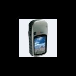
I would definitely look at the other Garmin models that have 'H' in the model name. Those have the High Sensitivity receivers like the 60Cx. Check out Garmin's site and the "Comparison Page." I have the Vista HCx and actually prefer that model to the 60Cx model. It gets excellent reception.
-
After I get back from a Geocaching Adventure, I download the Waypoints and Tracks to my computer. I save the file with both the date and location. It is fun to bring up the past tracks and overlay them if I revisit a favorite place. I also write up my adventures in my blog, as well as in the GC.com logs.
-
I have both a Palm m500, which I have had for more than six years, and a Palm m515. Both of those would be good choices for Geocaching and they should be inexpensive on eBay. They connect with USB, which I recommend, as opposed to the PDAs that connect with the Serial Port. I use Cachemate on the Palms, Exporting the data from GSAK.
-
I have the Vista HCx and really like it. The Legend HCx is a bit less expensive and is also an excellent choice.
-
Garmin Customer Support is excellent. Magellan's is terrible, or it has been for several of my friends who had/have Magellan GPS units. I have a Vista HCx and like it for its small compact size. It gets excellent reception and never loses the signals. I got the older Topo maps on eBay to save a little money.
-
Welcome to the Forums! What kind of GPSr do you have? Have you installed the USB drivers?
-
City Select and Vista Compatability
Miragee replied to WearyTraveler's topic in GPS technology and devices
Did you download and install the patch for Mapsource Topo? It is for an error with those old Topos. -
can u help me figure out if its good
Miragee replied to mana22345's topic in GPS technology and devices
Welcome to the Forums! Check out the comparison page at the Garmin website. The newest units, other than the Colorado, have 'H' in the model name. That stands for "High Sensitivity." Those GPS units will get better reception than other models, or the basic yellow eTrex or the blue Legend. For ease of use, you want to get a GPS unit that connects to your computer with USB. The least expensive, most feature-rich model of the newer 'H' units is the Legend HCx which sells for around $180. -
If you have trouble, you might need to download the helpful utility called RegAid. It is available on the Smittyware site.
-
Well . . . you can specify criteria for the PQs, or you can get a PQ based on a Bookmark list. When I am setting up a regular PQ, this is how I fill out one section of the form: Then, I bring all the caches into GSAK and do any filtering necessary in that program, like for easier caches, or caches with a higher Terrain rating, or caches along a specific route through the nearby metropolitan area. Here is a great tutorial about Pocket Queries that might be helpful.
-
Need an Acceptable Unit for an 11-year old
Miragee replied to Nitro_Boost's topic in GPS technology and devices
Welcome to the Forums! Check out Garmin's comparison page for the newer units that have 'H' in the model name. Those have the High Sensitivity receivers. For true ease of use, you will want to get a unit that connects to a computer with USB, instead of the Serial Port. -
Vista hcx - Use both city nav & topo - how?
Miragee replied to martonic's topic in GPS technology and devices
Welcome to the Forums! Once you get City Navigator maps installed, switching from one to the other is very easy from the screen you describe. All you have to do is hit Menu again, and from there you can choose to "Show" or "Hide" whichever map set is applicable. All you have to remember is to "Show" City Navigator maps again, after using the Topo maps, before using the "Follow Road" option . . . -
A little gift for Harmon . . . I'm not tellin' who the guilty party is . . .
-
For cache pages, you just use HTML. For cache logs, there are a limited number of codes you can use and I'm not sure you can change the size of the font. You can use Bold, Italic, and Color codes, similar to those used on these Forums.
-
Here is a rudimentary GSAK tutorial that, although it was created a while ago should be helpful.
-
To install those maps to your computer, the best thing to do is copy each of the three CDs to the hard drive first. Then, do the install from there. That way, you won't have to put the CDs into the drive when you want to use the maps. After you install the maps, download the Mapsource update, and the Patch, from the Garmin site and install those. Within Mapsource, you use the Maptool on the toolbar to select the maptiles you want to install.
-
I have both the City Navigator street maps and Topo maps on my GPSr and computer. If I am headed to a specific area, I pick a cache as a "centerpoint" and do a distance filter in GSAK to only show the caches within a specific distance of that cache. From GSAK, I Export to Mapsource and print that map. A friend who has National Geographic TOPO prints out beautiful maps with the targeted caches on those. If you know the area, you could also print Google Earth images with the caches showing. Those are very helpful for finding trailheads and trails.
-
The other day on Long Valley Peak, I saw this insect critter. Then, yesterday, "lostguy", Auld Pro, and I saw this beautiful snake on Goat Peak.
-
Why should I become a premium member?
Miragee replied to Hellolost's topic in General geocaching topics
On the right hand side of your My Account page, there is a link for Set Up Notifications. You have to set them up for each type of cache, or action. I have them set up for New Traditional, Multi, and Puzzle caches. I also have them set up for Archived, Disabled, and Re-Enabled caches. This is the Off Topic Forum if you aren't wasting enough time in the regular Forums, or if they have too much angst for you. You can change your Forum Title to say something other than "Premium Member." -
download geocaches from GSAK to Garmin 60CSx
Miragee replied to Happy Travelers's topic in How do I...?
First, you have to install the USB drivers for the 60CSx. Then, in GSAK, go to GPS/Setup and choose Garmin as the type of GPS, and check the box that it is USB. When you send the caches to your GPS unit, you can use the "smart name" codes to get a more useful Waypoint name and get the Hint in the Waypoint description. -
When you download the file, it is "zipped." After you Unzip it, you will see the separate files inside the folder. The one you need to install to your Palm is Cachemate.prc. You might also have to install the MathLib.prc.
-
Why should I become a premium member?
Miragee replied to Hellolost's topic in General geocaching topics
Markwell has a great tutorial about Pocket Queries, which are files of up to 500 caches that are emailed to you. If you live in a cache-rich area, or if you are traveling, they are essential.