

Colorado Papa
-
Posts
506 -
Joined
-
Last visited
Everything posted by Colorado Papa
-
LOST, FOUND and DEAD. Oops, sorry, Spoo. Haven't recovered these, yet.
-
Yeah! I'm trying to find that *%$ JK1231 among rattlesnakes.
-
Airway Beacon PIDs from the above mentioned string.
-
Let me restate my question. What kind of horizontal accuracy does this mean? The reference you gave me, Rob, applied ORDER FIRST, SECOND and THIRD to vertical. Horizontal refered to A and B Could it be this mark has a typo error and the vertical was to be a third order so the horizontal, therefore, would be scaled? After doing much searching, New Zealand uses a horizontal ORDER THREE for a 0.25M accuracy. Edit to add: I find it hard to believe this station could have any horizontal accuracy since it was placed in 1947 and never seen since. Ted
-
And NGS classified this as GOOD??? Sheez... Rob, what were you saying about being able to read it??? ...center over the triangle...
-
Tennessee, Sounds like you had better get hold of Jeremy and let him know the benchmark pages are having problems. How else can we get hold of him? You're our best bet. Ted
-
Can someone please explain first, second and third order marks? I have been trying to locate a third order adjusted mark, JK1231, for over a year whose coordinates do not fit the description. The location that fits the decription has been flooded several times and I suspect the mark is well buried. Previous seeker did post a fantastic view of the area that would be a great entry in the other string.
-
Now that's an idea! Perhaps GC should start selling our own benchmarks that refer back to this database. We can place the markers along side the NGS marks we find so others know where to look for data that they might need for other marks. Hmmmm, Jeremy!!!!
-
May I also add that in Cameron County, Texas last year, I ran into a study using all available marks, and some new ones, for irrigation control and distribution.
-
I can appreciate your interest in adding the benchmark to the cache. Take a look at GCG6QP I set up last year. This is only a BLM marker also not in the database.
-
I'll second the motion. All in favor, say "Aye".
-
We need more information, as to coordinates or information from the disk. Otherwise, we don't understand your question.
-
By golly, I think we've got it! Does this 1922 bridge look familiar? How 'bout this 1908 bridge across the Arkansas River? Ted
-
PFF< I'm not picking on you, but I sure wish posters to this section would use the http:// from above to enter reference pages such as EZ2882 so that it wouold be easier to see what people are refering to. This is just a general statement with nothing to do with your post, other than Why didn't you do that?
-
Good show, John. Keep up the good work, even if it doesn't show as pluses here on GC. Ted
-
I take if from the descriptions and this particular reset that underground marks are not the actual PID? Note how SCALED and ADJUSTED are reversed for each one. I presume the RESET was accurately measured for location but not for elevation like the original was? DF5628'THE AZIMUTH MARK, AND THE UNDERGROUND MARK WERE RECOVERED IN GOOD DF5628'CONDITION. THE SURFACE STATION MARK, AND THE REFERENCE MARKS HAD DF5628'BEEN DESTROYED. A NEW STATION MARK WAS PLUMBED PRECISELY OVER THE DF5628'UNDERGROUND MARK, AND NEW REFERENCE MARKS WERE ESTABLISHED. DF5628 DESIGNATION - HILLSBORO RESET DF5628* NAD 83(1991)- 45 31 56.69243(N) 122 56 49.02472(W) ADJUSTED DF5628* NAVD 88 - 61. (meters) 200. (feet) SCALED RD0386 DESIGNATION - HILLSBORO RD0386* NAD 83(1986)- 45 31 57. (N) 122 56 49. (W) SCALED RD0386* NAVD 88 - 61.237 (meters) 200.91 (feet) ADJUSTED
-
Rob, You hit the nail real square! Thanks for the post. Ted
-
Good job, John. However, scaled coordinates should be within 1/3 mile but I did locate one that was off by nine miles. Also have found marks listed in the wrong county. We can't emphasize enough to go by the description and not by the GPSr. I don't use scaled or adjusted coordinates to locate a mark unless roads, terrain, etc. have changed drastically. I follow the description as to how to get to the point and revise it as necessary. When I find the mark, then I'll set the GPSr on or near the mark for five minutes during which time I take pictures, then take an average reading for another minute.
-
I take it from your post that you would agree with me about JK1205 observed in 1879.
-
John, I'll give you a "Gotcha!" Better update my stats: "Well, if we are giving statistics, of 302 log entries, 192 FOUND 78 NOT FOUND 21 DESTROYED 11 NOTES" Don't know why NOT FOUND figure went down. Maybe something GC did with the figures? Did you read my edited post? And this one was edited to revise stats. Ted
-
You better believe it! I haven't been keeping count but I'm sure about half of my recoveries have been along old rail routes including those that were abandoned more than fifty years ago. What really makes it interesting is reading about the old railroads, like the Short Line, for example. I used to think it was only a square on the Monopoly board until I found out it was a real railroad right here where I live!
-
So what? Who's counting? Take the 100/100 back to the geocaching side of the forum. Edit to add the following: Just looked at your stats and randomly checked some of your logs and compared them with NGS. Interesting that I didn't find a single picture nor a report to NGS. You've done a terrific job of finding marks and have posted new coordinates that I'm sure NGS would like to know about. Instead of being concerned about numbers, add pictures to your logs and inform NGS of your finds. Deb Brown will even accept your pictures if in the proper format. BTW, welcome to the world of forums and make yourself at home here. We are always happy to have more benchers aboard. Ted
-
It sure is. Elevation was very important to the route railroads followed so it was the obvious place to place benchmarks about every mile. Take a look at all the benchmarks along the old Denver and Rio Grand from JL0006 to JL0034 as an example. Also notice how the GPS coordinates are different from the posted coordinates. I suggest you keep your distance from active tracks. It isn't that important to find a BM while losing a life.
-
Go look for FE2343 to get an idea as to what you are looking for but don't believe what you see is the mark as in this case. This is a reference mark pointing to the actual station. As for your problem, use the coordinates to see if you can locate the mark in question or post them here and someone will suggest a nearby PID that you can compare the description. As for railroads, if the tracks have been removed and only the bed remains, yes, it probably is private property although in some cases, the counties take over the right-of-way and develope the old bed into a hiking trail. In my own case, just spent the weekend finding many marks along the abandoned Denver-Rio Grande Railroad without much concern about whether or not it was legal or who owned the property. A local said the line has not been used in eight years but he expects coal trains to start start coming through in the next two years.
-
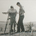
This sure has been a terrific weekend. The social secretary says she never knew so much about the Arkansas Valley north of Salida, Colorado before. We even found this old bridge over the Arkansas River while going for JL0007. With this plaque: