

Colorado Papa
-
Posts
506 -
Joined
-
Last visited
Everything posted by Colorado Papa
-
Leave it to monkeykat to wake up the dead. This topic is over three years old with my previous entry over two years ago. This reply is only to let you know I'm still alive but have been very inactive. Maybe one of these days I'll get going again.
-
As you can tell, I've been quite inactive. This is the first time I've logged on here in months. Too many personal things going on this past year. Hopefully, by January, will have things settle down so I can get back to being a serious BMer and forum participant. I hate this being confined to one location, and the motorhome sits idle in the driveway. Thanks for thinking of me, Spoo.
-
Just finished reading a book about the history of the Chili Line. Makes me more interested in wanting to seek out the benchmarks along the old R-O-W. I only wish I was interested in these things back in 1953 when we drove from Santa Fe to Antonito on our honeymoon. The rails and bridges would have been gone only 12 years and much easier to find things. Probably could have found people living along the line who remembered it. I didn't realize when I found the marker at the CO-NM state line that it had been such a historical place in 1904! For you other people, I suggest that you seek historical information about old benchmarks and why they were placed there. Makes for very interesting reading.
-
Looks like I'll have to back out as well. Spouse is having surgery 6/9 and too many appointments before hand. Dang, and I was really looking forward to this!! Maybe later???
-
I was thinking of doing it as we were heading down to New Mexico for the Chili Line get-together sometime around Memorial Day. However, I probably can make it earlier if you want. It's about 85 miles south of me and with getting only 7 MPG, would like to combine trip with other activities.
-
I'll be in the DC area the weekend of Oct 1. I suppose that's too late for this get-together. Will be RVing from Colorado sometime after Labor Day. From DC, will head north for fall colors and back west to and through Buffalo and Minnesota. Anyone want to plan on something along the way in that time-frame?
-
Well, I sure have been out of contact for the past couple months. Been enjoying the winter too much in south Texas. But it got too hot (90 degrees) so came back home to, of all things, SNOW!!! Sorry to hear campgrounds booked up... I didn't do any reservations either. So we'll meet where possible, before or after to be determined. Now who was it that was willing to climb up the butte with me to find that benchmark near Walsenburg, CO?
-
Maybe I'll join you. I'm inclined to prefer Memorial weekend. Other things going on in June.
-
I agree that it is not uncommon to find the mark inside. USPSQN didn't bother looking inside for this mark after the station had been sold to a private individual who expanded it as a restaurant.
-
Being retired, I'm flexible. Let's see what others have to say???
-
Read an article today where farming is using GPS to control the tractors for all farm duties via remote control to within one inch! Why do we need benchmarks?
-
sf,The Butte is right along side I-25, maybe less than a mile on a dirt road. However, since I'm spending the time in south Texas, will not be able to meet you until April. Coloradojeep, Want to try it as I pass by enroute home late March or early April? Otherwise, will have to wait until Memorial Day weekend when we have the New Mexico get-together.
-
Hey, Bucky, as a resident of New Mexco, you maybe interested in this string regarding a get-together in the spring.
-
Yes!Take a look at this PID map that was generated by fellow benchmark finders. However, there are some exceptions. Prefix AA, AB, and others can be found in locations everywhere. Most of them were installed after 1981.
-
Yep, shoulda used this designation last year for AB1180. Came back this year with a metal detector and found it under the grass. New description submitted to NGS should make it easier to locate in the future without special equipment.
-
I have one, but not on my property. In fact, I may never see it!
-
It maybe a typo error and was supposted to be a track guard which I presume to be a derailer on a side track. Edit: Speking of typos.
-
I suggested using Cimarron Canyon State Park. It has three campgrounds (map). The west one is Tolby Creek Campground which is near PID GM0243. The east ones are Maverick and Ponderosa campgrounds near PID GM0235. Plenty of BMs going east and west from either location. Any other suggestions?
-
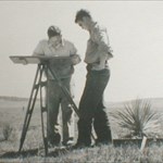
After reading more about the Chili Line, it makes me more interested in following the line and getting all the benchmarks along the old ROW. However, if done during warm weather, gotta beware of unexpected crawling things. Edit: Those things bring back memories of when I was on the front end of chain hiking through the badlands of South Dakota in 1950. I recall one time being in the middle of a den before I knew it. My boss was a big Greek who always wore low cut shoes and would just stomp on them. I'd try to impale them with a stake, or else the end of the stadia rod.
-
My gosh! People are willing to pay over $50 for one of these with no designation? Probably doesn't have a designation since you can't trust its elevation or coordinates.
-
I've found them in a book store. Ask Barnes & Noble.
-
Edit: ?
-
Wow, Rob, you lead me into a great discussion group about the Chili Line. One of the best items is a list of all the satellite photos of the DRG&W Antonito-Santa Fe "Chili Line" (Abandoned) from Antonito to Santa Fe. With these photos, and my experience that the BMs are exactly at the scaled coordinates, it should be fairly easy to walk right up to each BM along the route.
-
Am curious where you found this info. I'd like to locate a map of the route.Perhaps this would help to determine where we should meet. I could follow the route along US 285 south from Alamosa CO as far as Tres Piedras NM. From there it may have angled SE, possibly to Taos and I don't know where else???? EDIT: With a little more researching, located BMs (and caches) along US 64 (and abandoned RR) in the Cimarron Canyon State Park area, between Raton and Taos. Most of these marks were placed in 1934 and have not been FOUND since.
-
Am curious where you found this info. I'd like to locate a map of the route.