LandRover
-
Posts
930 -
Joined
-
Last visited
Posts posted by LandRover
-
-
I am officially declaring "I'm In".
Will pick up my gear on Saturday. Looks like nothing but more snow!!
So how many do we have now?
Upgrading my particpation status from a definite maybe to a definite definite.
Ironman114 if you want to stop in Federal Way on your way north we could carpool.
-
But then again, these are your priorities and not theirs. Until you walk in somebody else's shoes, you are only guessing.
Caching may have taken a backseat to life for JenandJim, but not enough to stop them from caching completly. They have found at least 40 caches since picking up the coin in question back in march, certainly it would have fit into one of those cache containers.
I'lll crawl back under my rock now.
-
If anybody has suggestions for easy to moderate snowshoeing, I'm open. I was looking for the Peninsula area but if that is too damaged to look at right now, then other areas will be considered.
How about Hollow Tree? I did that one last winter, and it's a nice, easy snowshoe. We took some first-time showshoers and they didn't have a problem, even with the creek crossing and small hills.
The snowshoe caches I know about (including Hollow Tree) are on my Snowshoe Cache bookmark list. I am sure there are more, so I welcome suggestions for additional listings from anyone; this is a public list.
Hollow Tree it is! With the recent snow storms and more on the way, it's looking pretty good to go. I'm changing the date I'll be going to Sunday morning, the 30th, so my wife can join. She's not a big hiker and we'll probably lag behind but we will have fun all the same.
Well I'm a definite maybe on this one.
-
Tiger and Squak Mtns are usually a safe bet and there's lots of caches on them. Tiger alone could keep you busy for most of the winter, but know that a few trails on the east side of the mountain are currently closed for the season. The Iverson Railroad Trail, Northwest Timber Trail, and the Preston Railroad Grade Trail are all closed from Oct 15 - April 15.
Tiger, Squak, and Rattlesnake are the ones that I currently know to be ok. There's also McDonald I guess as a cache was just published there. I appreciate the note about trails being closed as I was unaware and was actually planning to do more of Tiger before the end of the year.
There are still lots and lots of trails on Tiger so don't let a couple of closed trails stop you from exploring the mountain.
FYI a Green Trails map is a really hand thing to have if you want to do some Tiger Mountain exploring.
-
Would there be a good resource, like a bookmark list or webpage, that lists mountain caches that are generally accessible during this stretch of months? I'm just getting into hitting the mountains and *loving* it, but honestly am not familiar enough with the area to know what might be accessible or not.
Currently, I'm trying to read recent logs on potential caches to visit or scanning caches recently visited by area cachers who seem find themselves up on a mountain every weekend. Either that or I hit the mountains that I know to be ok.
If there's anything out there that sounds like it might be useful, it'd be greatly appreciated!
Hydnsek had a Snowshoe bookmark list if that is something you're interested in.
And if you would like to participate in a group outing TotemLake has his Hike of the Month thread too.
-
I'd have to agree. What I do with coins that appear to have been stolen, is change the name of it to "THIS COIN HAS BEEN STOLEN!!" I doubt it does anything useful, but it makes me feel a little bit better.
I haven't renamed any of my "missing" coins but I have added "If you are logging this from someones collection it was STOLEN" to the page of some of them.
-
Congratulations to Berta, Nick and cute little Zoey for finding #600 today at Gastropod!
Way to go Cuz, it's about time.

-
If I'm not mistaken, and I very well could be, the receiver that you are using to aquire the Sats needs to be licensed to the mapping software you want to display. Your 60CSx is licensed to use your CN but your Venture is not so nRoute it will only display the Base Map.
-
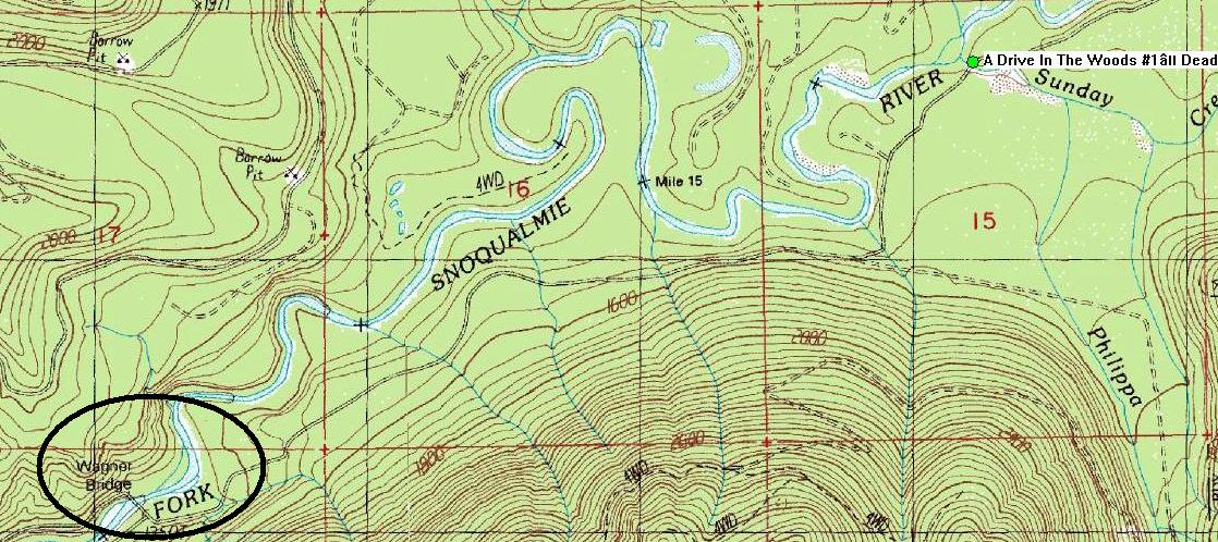
Wrong bridge, the Wagner Bridge is about a mile from the Forgotten Bridge and only 650' NE of Potty Mouth. A Drive In The Woods #1– Dead End is another 2.5 miles past the Wagner Bridge.
my bad

They looked the same and were constructed the same.
I put the dang thing there and it sure looked like the bridge to me. First I'd heard about a road closure further back. But it does remind me that I have some cache page updates to make.
Here's a USGS map with both the Wagner Bridge and The Drive in the Woods cache.
FYI if you really want to get up there permits to use Hancock Forest Management Group's private road network to get into the public recreation areas beyond the bridge are $200 and are good from Jan. 1 to Dec. 31 so if you buy a permit now it's only good until 12-31-07.

-
So, does anybody know the scoop with the closure of the North Fork Road (outside North Bend) just past Deep Creek? What for, how long, etc.
There's a sign posted warning of the closure as you start on the road, and the closure is just past the Forgotten Bridge at Deep Creek cache. So Potty Mouth and all caches beyond that are unreachable at present.
I don't know if this is the same closure or not but:
Wagners Bridge, which carries North Fork Road Southeast over the North Fork of the Snoqualmie River about 10 miles northeast of North Bend, will be closed for construction from Monday, July 9 through November. The road is a popular access point to the Alpine Lakes Wilderness for hikers and recreationalists.
The one-lane bridge was built 30 years ago with untreated timber, and is now deteriorating. It has a restricted load capacity and is vulnerable to damage by floods and earthquakes. The King County Road Services Division will build a concrete girder bridge on the same location and alignment as the existing bridge. The new bridge will be built to current safety standards, will support legal highway loads, and will span the 100-year flood plain.
While the bridge is closed, motorists can purchase a vehicle access permit to the Hancock Forest Management Group's private road network to get into the public recreation areas beyond the bridge. For information about the vehicle permit call Julie Stangell at (360) 879-5823. Vehicle permits are also available for sale at the Ace Hardware in North Bend. There is also access to the Alpine Lakes area on Forest Service roads from the north and east.
http://www.metrokc.gov/kcdot/roads/cip/Pro...px?CIPID=200604
I hope there wasn't a cache under that bridge!
photo snip
There was a cache under that bridge
A Drive In The Woods #1– Dead End, but it looks like it went missing a while ago.
Wrong bridge, the Wagner Bridge is about a mile from the Forgotten Bridge and only 650' NE of Potty Mouth. A Drive In The Woods #1– Dead End is another 2.5 miles past the Wagner Bridge.
my bad

They looked the same and were constructed the same.
I had originally thought it was the bridge of whch you spoke but then looking at the USGS maps Wagner Bridge is labeled as such.
No idea why they have the road closed so far from the bridge.
-
So, does anybody know the scoop with the closure of the North Fork Road (outside North Bend) just past Deep Creek? What for, how long, etc.
There's a sign posted warning of the closure as you start on the road, and the closure is just past the Forgotten Bridge at Deep Creek cache. So Potty Mouth and all caches beyond that are unreachable at present.
I don't know if this is the same closure or not but:
Wagners Bridge, which carries North Fork Road Southeast over the North Fork of the Snoqualmie River about 10 miles northeast of North Bend, will be closed for construction from Monday, July 9 through November. The road is a popular access point to the Alpine Lakes Wilderness for hikers and recreationalists.
The one-lane bridge was built 30 years ago with untreated timber, and is now deteriorating. It has a restricted load capacity and is vulnerable to damage by floods and earthquakes. The King County Road Services Division will build a concrete girder bridge on the same location and alignment as the existing bridge. The new bridge will be built to current safety standards, will support legal highway loads, and will span the 100-year flood plain.
While the bridge is closed, motorists can purchase a vehicle access permit to the Hancock Forest Management Group's private road network to get into the public recreation areas beyond the bridge. For information about the vehicle permit call Julie Stangell at (360) 879-5823. Vehicle permits are also available for sale at the Ace Hardware in North Bend. There is also access to the Alpine Lakes area on Forest Service roads from the north and east.
http://www.metrokc.gov/kcdot/roads/cip/Pro...px?CIPID=200604
I hope there wasn't a cache under that bridge!
photo snip
There was a cache under that bridge
A Drive In The Woods #1– Dead End, but it looks like it went missing a while ago.
Wrong bridge, the Wagner Bridge is about a mile from the Forgotten Bridge and only 650' NE of Potty Mouth. A Drive In The Woods #1– Dead End is another 2.5 miles past the Wagner Bridge.
-
I never would have thought this could happen to me until just recently when I had my own experience with being lost in the woods. I had marked the location of the car (didn't think of marking the trailheads but I will from now on) but had bushwhacked so far that I was reluctent to take the same route I used to get there. It was a scary situation, but I learned some valueable lessons that day.
(So did my husband...he didn't go out on the trail with me that day and after a few hours decided he didn't want to wait for me so he drove home! Needless to say when I found my way out and walked the two miles back to the parking lot to my cell phone, he got quite an earfull!)
So let me get this straight, YOU screwed up so your husband was in trouble.
Logically this makes no sence; but as a husband I get it.
If your husband drove home, I assume he drove home in a car, what was your cell phone doing in the parking lot?
-
Hello from Czech Republic. I was fortunate to be able to go to an old fire watch lookout tower near Krnov (northeast Czech near the border of Poland). See my log with photos:Fire Lookout. One of the locals told me this tower is about 150 years old. Unfortunately the stairs to the top is open in the summer months and the geocache is at the very top. But it was nice to see it anyway and enjoy the view.
Looks like they build their lookout towers to last over there.
-
For those of us interested in the future of the Carbon River Road on the NW side of Mt Rainier NP - it's not looking too good:
Fate of Mount Rainier's flood-damaged Carbon River Road uncertain


-

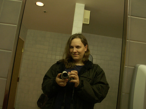
Am I the only one that finds it odd that she is in what appears to be a public restroom with her camera??

-
I'm not finished posting the pics and tonight is going to make it impossible with how slow the server is.
However, the story is in my DNF (3 of 5 found).
It was a good hike and my geopuppy, Penny, and I, learned how to work with each other and I am truly imprssed at how good a trail hound she has turned into.
All in all, getting to Twin Falls Lake is going to take a good summer day when the boardwalks are nice and dry. I plan on trying this one again next year.
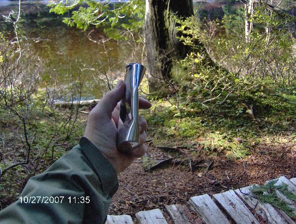
Here's something to wet your whistle though...

Are you sure it wasn't an empty flask that contributed to the fall??

-
There is a small group hoping to make the trip up to Mission 9: Tunnel of Light on October 7th. But the plan is to ride the trail all the way to Rattlesnake Lake, a 21 mile long bike ride.
-
Scheduled for 9/29
Time TBD
Estimated 6 miles roundtrip
TH and parking at N47° 30.016', W122° 1.333'
Wow, I might almost make this. What are the cache goals, and do you know the name of that TH area?
Looks like the TH for Poo Poo Point.
Closest Cache is Paraglider's Secret #2 Micro Style
-
Bump
Anyone else wanting to do the Iron Horse from Hyak to Rattlesnake on 9/30 at 8AM?
Not a good weekend for me. I've been gone quite a bit the last few weekends. The following weekend works better because the Wife is going back to Tennessee to see our Son before he ship out to Iraq.
-
-
Depending on timing I might just be up for this. I have already done the Ape Cache but not the ride to Rattlesnake Lake.
-
Cool, I explored a lot of these caves when I was a kid. I have tried to find coordinates for them on the internet but they appear to be one of those things that those that know where they are want to keep them as hush hush as they can.
-
Weird! Mine shows 4.4 up to the flats, but only 3.5 down.
And 2.2 for the summit round trip.
It's all the stopping we did on the way up. If you look at your track on the way up there is probably a lot of track wandering at the rest stops. If you edit those out of your track it will probably come in a lot closer to the down hill distance.
-
I sat outside in the garden with my husband last night for an hour or so. The sky was dark, and the milky way seemed to go on forever. We enjoyed watching some of the meteors. I wish that we could participate in the event, it's totally something we would normally do if life were just a bit gentler on us right now. But we're planning on heading up above our house a little ways tomorrow night where it's darker, and watching the display from there. We'll be with you guys in spirit.

Hopefully tou were a lot dryer

So, tell us how it went! Did it really rain on you? Bummer!
K7-wave and I are headed east this evening to Table Mountain in hopes of clear skies and lots of pretty streamers.
Yes it rained, not real hard but enough to get lots of stuff wet and number of people showed up not prepared for the rain. The owrst part of the rain were the clouds that prevented any meteor viewing.


Trekking poles or hiking stick
in General geocaching topics
Posted
I started out with a stick I found on the beach. I used that for about 6 months then switched to a pair of trekking poles that I bought at WallyWorld for about $20. After going through at least 3 pair of the cheap WallyWorld poles, either breaking them or just having lots of trouble with the locking mechanisms, I finally decided enough was enough and moved up to REI poles,the pair weigh just over 11 oz, they weren't cheep but well worth the money. And for about $8 I was able to get a set of snow baskets for them to use when snowshoeing. Of course I still didn't get out of REI until I had spent over $200, kind of like going to COSTCO, you just keep seeing stuff you could really use.