

jefro
-
Posts
44 -
Joined
-
Last visited
Everything posted by jefro
-
My Oregon 300 with 3.10 update has the same problem. When out geocaching, even under light tree cover, the compass and distance to cache jump all over the place. Hope Garmin can fix this problem soon or I'm going to sell the Oregon and get a Lowrance Endura. I'm having the same problem as well. When approaching a geocache, I'm steered in various different directions before it finally settles down after a few mins, if at all. Also, my pointer also remains motionless at times during this process. It will not show me moving at all. 3.10
-
There are actually two of the listed in some endnotes in a book about Texas history. The book has a copywrite of 2000. It reads ," The Global Positioning System (GPS) coordinates are as follows: 41TL57 41TL58 I just have no clue as what format this is or how to convert it to degrees, minutes and seconds. Barbara That's UTM I believe. Universal Transverse Mercator.
-
If non geocachers are muggles, what are we?
jefro replied to hawkfan5's topic in General geocaching topics
Does anyone know where the term muggles derived from? Harry Potter? I've always known muggles to be a Louis Armstrong song - in reference to cannabis. -
Oregon 2.99+ generic map .img file names
jefro replied to Eagle93's topic in GPS technology and devices
Try creating a new profile and calling it "Topo" or something like that, and again - disable all the other maps. I had the same problem with TopoCanada v4 and it did the trick. Then once that new profile fixed the problem, it was corrected somehow in my "recreational" profile. Ah wow, I was a few hours behind on that one. I shouldn't read forums and eat dinner at the same time. -
Oregon 2.99+ generic map .img file names
jefro replied to Eagle93's topic in GPS technology and devices
Try creating a new profile and calling it "Topo" or something like that, and again - disable all the other maps. I had the same problem with TopoCanada v4 and it did the trick. Then once that new profile fixed the problem, it was corrected somehow in my "recreational" profile. -
Can you give me an example of a file name you used. I've managed to get my topo on my Oregon's internal memory, and my Bluechart Americas on my sd card...but for some reason it's not giving me full detail - like it's not unlocked. Yet when I had the bluecharts on my internal memory, it showed it all, lol. Confusing Ok, I figured it out now Here's what I did on the Oregon to make it work. Copied the gmapsup.img made from my topo canada v4, and overwrote it into my Oregon's internal memory. So now I just simply use my "Marine" profile when I want to use the bluechart americas 2008, and my default "recreational" when I want the topo canada v4. Thanks for the info!!
-
Can you give me an example of a file name you used. I've managed to get my topo on my Oregon's internal memory, and my Bluechart Americas on my sd card...but for some reason it's not giving me full detail - like it's not unlocked. Yet when I had the bluecharts on my internal memory, it showed it all, lol. Confusing
-
Greetings, Is there any way to get 2 different garmin map products on a micro sd card? I've managed to get my topo canada onto a micro sd card, but when I want to combine my selected region with my bluechart 2008, it overwrites my topo on the sd card Is this simply a matter of renaming the .img file, or creating a separate folder? There's plenty of room on the card, it's 4gb in size. Or, is there any way that my Oregon can display both the TopoCanada v4 and the bluechart americas 2008? I've read something about transparent maps elsewhere in these forums, but can't find it again.
-
Ok, I've made screenshots of the process. I've posted them here... (hopefully they are readable...) Feel free to check out my photography as well www.flickr.com/jeffrogerson The first 5 pictures are the screen captures for the pocket queries. Ok, I created a brand new query from scratch - exactly the same as the first - and this time it worked. ...strange. Thanks for all the help folks It appears to be working. Just got an email with a zip. Thanks again.
-
Ok, I've made screenshots of the process. I've posted them here... (hopefully they are readable...) Feel free to check out my photography as well www.flickr.com/jeffrogerson The first 5 pictures are the screen captures for the pocket queries.
-
I checked the preview...it appears to be working. It shows all 500 returns within my 75 km selected radius. I've tried both my hotmail and gmail email accounts, and no emails with either. I will take a screen shot and post it to show what's all selected. Essentially it's as per the instructions outlined here... http://support.Groundspeak.com/Support/ind...384&nav=0,5
-
some things that i have found that help is to make sure that i have clicked the right day check mark several times cause those boxes are pretty close toogether furthermore, i never seem to get my email until i navigate away from the pocket query page and then refresh my email page ... other than that just click another day box Just reviewed my pocket query...doesn't seem to be anything out of the steps outlined. I specified an alternate email address as well, and nothing.
-
Does anyone know how long the pocket query email takes? I'm going on 12 hours and no email. I followed the step by step instructions.
-
Waypoint prob solved, phew.
-
Nope, nada. At the top of my screen it still shows "South to Dundas st W"....grr. I can tolerate the pink guidance line telling me where to go - as that is enough of a reference for my travel. The text is cluttering.
-
If you pay for a premium membership, its very easy with pocket queries There is a place in the setup menu of your Oregon where you can go into mass storage mode whenever its connected to a computer. Cool I caved and got a premium membership. Just getting acquainted with pocket queries...as clicking on each single geocache will take me FOREVER! You will love pocket queries. Just download the file in zip format, then unzip, then send the gpx file to the Oregon. It's that simple. The first couple times will be a little challenging to some, but after you get the hang of it you will bless the geocaching gawds for allowing you to get the premium membership so cheap. Ok, cool I've "ran a query"... All I got in my email was a link... the link just shows the query I created and says "running query"... How long does it take for the gpx zip to come through?
-
If you pay for a premium membership, its very easy with pocket queries There is a place in the setup menu of your Oregon where you can go into mass storage mode whenever its connected to a computer. Cool I caved and got a premium membership. Just getting acquainted with pocket queries...as clicking on each single geocache will take me FOREVER!
-
Ok, I seem to have gotten the "send to gps" button to work. Not sure if I overlooked this somewhere, but my GPS has to have mass storage mode enabled for the file to be sent. Is there any way to send an entire page's worth of geocaching.com search results for my area to my device - instead of clicking each one by one?
-
Yes, 3.10 When navigating to "menu - setup - map - data fields, I get 4 options.... 0, 2, 4, custom. When I select custom I get 2 more options.... when navigating (which is 0), and when not navigating (which again is 0).
-
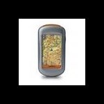
Greetings folks, I recently purchased an Oregon 300, and plugged in a 4gb card with Topo Canada v4. The main reason for this purchase was to geocache...however I've run into quite a bit of difficulty in doing so. After searching via the geocaching.com website, I located several caches in my area. Either from the search results menu, or by clicking exclusively on the geocache - when I select "Send to GPS", I get a pop up window error stating the following... ------------------------------------------------------------- The following items cannot be transferred: 1. Waypoints Either the GPS does not support the items or Garmin Communicator Plug-In needs to be upgraded. -------------------------------------------------------------- It then prompts me to select OK, or cancel. After I select OK, it shows this text in the pop up window... "Geocache GC1CR0Y.gpx (or whichever geocache I selected) saved successfully". I have no idea where it was saved it. It's nowhere on my pc. In fact, I don't think it even saved. I've tried using both firefox and ie, but I get the same error with both. I only have a basic membership, so the gps eXchange option is not available to me. I've been itching to get outside and do some geocaching with this thing, but I can't even get a geocache onto my Oregon Can anyone offer any assistance? Edit....yes, I do have the latest version of Garmin Communicator as well.
-
Hmm, that didn't seem to do the trick. When I went into that menu option, both custom fields were set to 0.
-
Downloading my first geocache on Oregon....or attempting to....
jefro replied to jefro's topic in How do I...?
I think that option is greyed out to me as I'm not a premium member. -
Downloading my first geocache on Oregon....or attempting to....
jefro posted a topic in How do I...?
Heya, Just purchased a new Oregon 300 today, and I'm having a little trouble downloading geocaches to my device. When I click the checkbox (also tried without doing so), and selecting "send to gps", I get the following error..... The following items cannot be transferred: 1. Waypoints Either the GPS does not support the items or Garmin Communicator Plug-In needs to be upgraded. Then once I click "ok" it shows me this in the pop-up window. Geocache GC1CR0Y.gpx saved successfully. I have the most current usb drivers and Garmin Communicator. Is there something I'm overlooking? -
Ok...I'm at it again.... Is there any way to turn off the "navigation text" when you're on the map page. With the Map60CSX you can turn off "guidance text" I think it's called. Essentially, while on the map screen - I don't wish it to tell me at the top of the screen which turn I have to take. It takes up 3/4 " of my screen, arghh! Not to mention - I don't need to see that info
-
Phhewww, glad I didn't run into that problem! One more thing... Where the heck did the satellite acquisition screen make it to on the Orgeon? Found it.