

geofred
-
Posts
124 -
Joined
-
Last visited
Everything posted by geofred
-
I have Garmin Mapsource maps. I have the serial connector for my eMap which worked well when connected to the serial of my old laptop. So I upgraded for a better laptop. Better appears to mean USB connections only. Is there a workaround so my serialless toshiba can be used with my eMap?
-
I bought a cable to attach my i-net ready cell phone to my Handspring Prism. I can call up geocaching.com with phone and peruse the site for local caches. I use a freeware Eudora as the browser and it stores what I look at for a later reading. It has saved the aggavation of going to a recently destroyed cache -- while I was already on the road to it trying for marathon day of caching. When you cannot think ahead, consider calling ahead--to stay ahead.
-
I had no use for PDA's until I ran into "Just a Short Walk" on a Carmel, CA beach cache hunt. He showed me his Handspring Deluxe in which he had stored a long list of CA caches. And, it was only $50.00 on Ebay. That was about a year ago and the Deluxe's still sell for about $50-$60 have plenty of storage and of, course, the 8mg memory is expandable with memory cards. Give up paper. Go Deluxe.
-
How long looking for unfound cache before leave
geofred replied to GPSCache's topic in General geocaching topics
Out here, in Colorado, where it may be necessary to drive to the middle of nowhere, which takes at least 90mins minimum, and then another half hour hike to the "vicinity" I have been known to spend two hours looking. And luvin every minute. -
You can download a new Garmin Mapsource update as of 12/02.
-
I sent an email to NGS and got the following response. I recently became aware of this aspect of the Geocaching program. This can be a significant public service to the Nation -- to record the condition of benchmarks so that the information in the National Geodetic Survey database is more up-to-date. Such confidence in the continued availability of these benchmarks can save time for those surveyors and others who are planning on using benchmarks in their area for surveying and mapping projects. This can also be an excellent opportunity to acquaint more of our citizens about the importance of accurate and consistent coordinates. It is a information partnership, built on fun, that can potentially provide significant public value. Thank you for reminding me of the Geocaching program. I will take this opportunity to share your message with other NOAA managers so that they too can appreciate the enthusiasm and value of this program. Charlie Challstrom Director, National Geodetic Survey NOAA's Ocean Service
-
I got a decent $50 Vivatar compact digital at Walmart. I use it instead of the family JVC digital still/video camera. I got nervouse carrying the $2300 camera around on scrambles. Quality is good for benchmarking. And I have no fear giving it a 10year old to keep them interested in the hike.
-
I noticed that several of my logs of found Virtual caches set by one particular cacher have been deleted and therefore no longer appear on my cache page as found. I am certain I annoyed this cacher in an extended exchange about setting caches on county parks land. This appears to be his retaliation. Clearly it is not in the spirit of geocaching, at least as I understand it, but is there anything that can be done?
-
Does "BM" on a USGS topo map mean there is a Bench Mark there?
geofred replied to Bugsyboat's topic in Benchmarking
I asked USGS and got the following reply: Subj: Re: Benchmarks Date: 8/28/2002 6:01:10 AM Mountain Daylight Time From: ask@usgs.gov To: FEBERT@AOL.COM Sent from the Internet (Details) August 28, 2002 From USGS: The USGS is one of about 30 State and Federal agencies which might place Benchmarks and other cadastral survey markers that may appear on the map. Usually, there exists some sort of field monumentation according to the practices of the agency which left the marker. If the agency was the USGS or the National Geodetic Survey (formerly called USC&GS), then the measured position would usually have been marked by a brass or aluminum circular tablet about 4 inches in diameter and set in a concrete base. This might have been deliberately buried or later covered by leaves, brush, etc. Some of the markers have been destroyed by vandalizism or inadvertently covered or plowed up by construction or other earth-movement activities. USGS keeps paper records of the markers that its surveyors placed, and the records may be obtained by specifying the current USGS quad map that covers the area required. To the extent possible, USGS also records information about destroyed or missing markers if the public informs us. Depending on the amount of copying that is needed to fill a request, USGS may have to charge for the copies. The National Geodetic Survey has its geodetic control records online, and you can reach them at - link to "data sheets". In response, please use the e-mail address "Ask@USGS.gov". Thank you, Diane Brittle USGS -
While searching for a survey disk near an abandoned missile site, I came across two concrete monuments with US indented/carved in the concrete. There was a plain metal disk in the top. They were about 8inches high and there was one on the right and one on the left of the entry road. (If there is a way to insert a photo here please let me know.)
-
I found this web page to "translate" the data sheets for PIDs. It is an annotated version for review of contents. http://mapfinder.nos.noaa.gov/mapfinderHTML3/surround/geodetic/geodetic.html
-
I found this web page to "translate" the data sheets for PIDs. It is an annotated version for review of contents. http://mapfinder.nos.noaa.gov/mapfinderHTML3/surround/geodetic/geodetic.html
-
I have a forest service map, really I do, and it shows BM as bench marks. Usually there is a 4 digit number. I am looking for BM5212, bm5180, bm 5091 which are all with the National Grasslands of Eastern Colorado. I cannot find them in the database. I entered BMXXXX and LLXXXX to no avail. When I entered approx. co-ords I go locations for things my map calls Horizontal Control Stations indicated by small equilateral triangles with a dot in center. How to go from map to land with a BM #?
-
quote:Originally posted by SC-Yankee:Here's a pic of one type. There are many and there is a thread somewhere here where someone posts a lot of different ones.http://img.Groundspeak.com/benchmark/lg/3839_100.jpg Assuming I find the one in the picture just by stumbling around in the woods. And I forgot to bring by gps,r. What do I use on the disk to find the bm and what index do I go to for more info on the bm?
-
I have found a few local brass monuments based on the directions to the benchmark. But I have not figured out how to read them. If I were to stumble on one in the great out of doors, say on a cache trip, how would I be able to find out what BM it is? What data is contained on BM? What is a witness post? What are they made of?
-
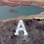
I would like to be contacted by a cacher in this area. Please create a cache using the following: http://perinspeek.frontier.net/high_eye.html I need a good reason to drive to that corner of the state! Let me know by email.
-
I would like to be contacted by a cacher in this area. Please create a cache using the following: http://perinspeek.frontier.net/high_eye.html I need a good reason to drive to that corner of the state! Let me know by email.
-
I have read about Avantgo and Plucker being used for searching the web, esp. Geocaching.com, and downloading and then organizing geocaches in the PDA. Are people doing this? And how does one do that?
-
You should receive an email with a subscription number to enter on your profile.
-
You should receive an email with a subscription number to enter on your profile.
-
I have used my eMap in the city, in the woods, and in the desert. A change of memory stick and I can go from topo detail to hotels/restaurants. I use the yellow jacket and it has cushioned many a drop. The waterproof bag works well in rain and desert/beach sand. Absolutely the best choice.