


intolerable
-
Posts
1556 -
Joined
-
Last visited
Posts posted by intolerable
-
-
i don't know how make a circle on the picture.
if using windows, you can use the program 'paint'... good luck!
-
In the same boat as StarBrand... I've logged a cache that I've since adopted.
To be honest, I have a few caches that I've placed that I wouldn't mind logging upon going back... doubt I would, but for the effort of getting there and lack of others logging, why not?
-
For what it's worth, I'm using the 64-bit Win7 beta with my Vista HCx/Mapsource and haven't had any problems, although seem to recall getting the 64-bit driver installed took a few tries. But since then, no issues.
-
The fourth cache we picked was also in Seattle, but down by the waterfront. One of the cool things about the Seattle area (IMO) is that we have mountains, the Puget Sound/Pacific, rainforest and desert all within a reasonable driving distance. Wanted to try and show off a bit of that so we headed down to Olympic Sculpture Park Walk, a great puzzle cache that was impossible for us to finish in one visit with mightyzinn along!
Sadly, all my pictures of the Olympic Sculpture Park artwork turned out horrible... It's a super groovy sculpture garden/park, too bad my camera didn't agree with the lack of sunshine/murky sky!
After this we walked back up to Seattle Center and hit one of our fav local used bookstores, where I almost had the ET get a free tarot card reading. Good times

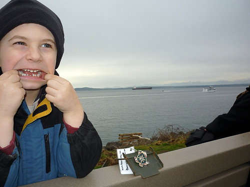
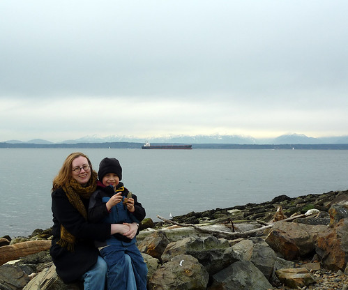
mightyzinn, ET & cache!
It makes my head spin thinking about all the evil koodies and ick on those hands,
but he was so very proud of the clever pose...
mightyzinn & ET with Port of Seattle in background
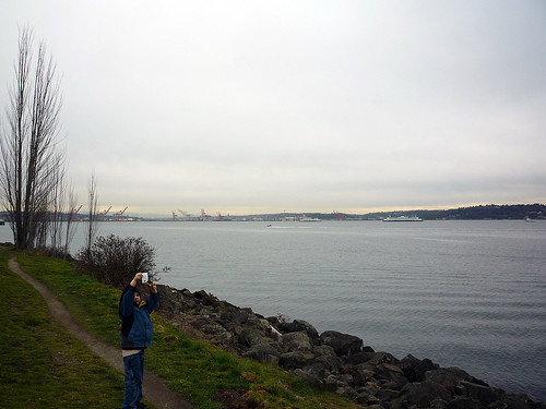
More mightyzinn, ET and Puget Sound
Olympics in the background
You can sorta see the Olympics behind redegg and mightyzinn
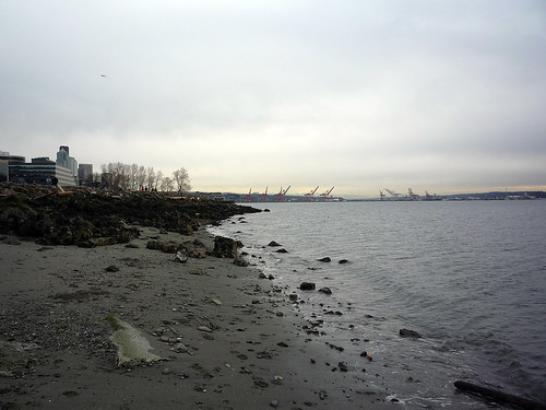
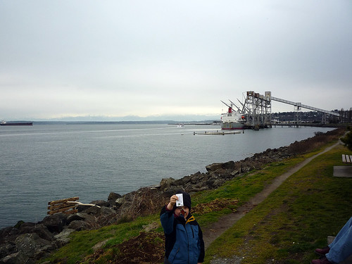
Looking down the shore towards Seattle
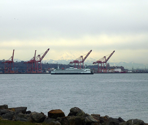
Ferry, with Rainier melting into the clouds in the background
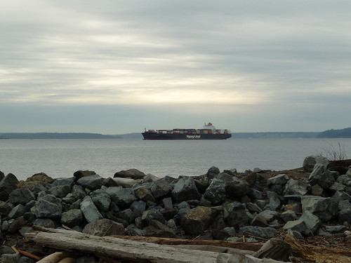
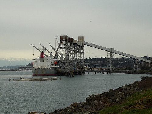
Lots of big ships come into the Port of Seattle...
You can usually get amazing views of the Olympics across the Sound, but by the time we finished
lunch and crossed the street and started taking the pics, had no luck.
-
Another place I hope to visit in the near future
It's great fun and there's so much to do between Seattle Center and downtown!
Will post pics from the fourth find later today and have the ET back off to tsun within a day or two for more adventures!!!
-
Yesterday we headed into Seattle. Previously I had hoped to show off the city a bit, Seattle Center in particular, but I didn't manage to come up with a find. I was pretty bent on that, so for the third cache we found a puzzle cache even I was able to correctly solve, Key West Storm.
Seattle Center is home to Key Arena, the Pacific Science Center, The EMP and Science Fiction Museum, the Space Needle and more. Some of the below pictures were taken from our DNF visit as they turned out *so* much better than the one's yesterday as we had no blue skies and all my pics were washed out
After spending some time at Seattle Center to pick up some waymarks/have fun, we made our way down to the Seattle waterfront to pick up the fourth cache.
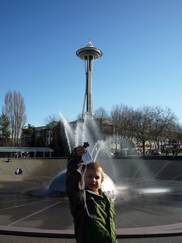
mightyzinn with ET at International Fountain, Center House/Space Needle in background
ET with my fav sculpture @ waymark WM47D2
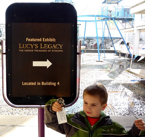
mightyzinn & ET on the way in to see the Lucy's Legacy exhibit at the Pacific Science Center
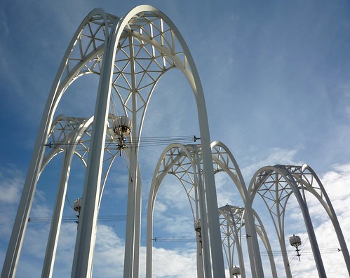
The arches above the Pacific Science Center
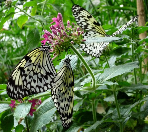
Butterfly House @ Pacific Science Center
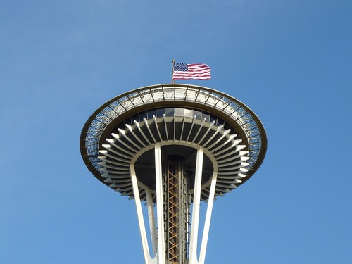
Our DNF visit was on President's Day and the Space Needle was sporting a flag
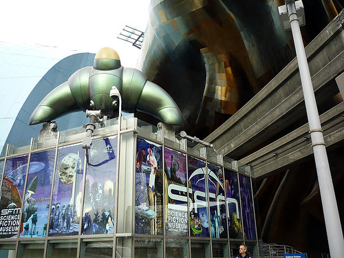
Science Fiction Museum, EMP and monorail track.
I tried to take a pic of the ET inside, but security was not amused
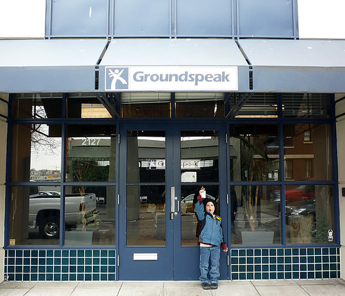
We took a detour on our way down to the waterfront so we could swing by this place...
I'm lame-o for not setting up an appointment to get the ET inside
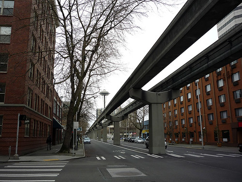
You can ride the monorail from Seattle Center to downtown,
but then you miss the caches, waymarks, benchmarks and a nice walk
-
It's possible that they don't realize that it doesn't affect the status of the TB/geocoin and is simply removing the note. I can see why someone might be upset about that if they thought you were in some way changing the travels of a traveler.
-
Very cool!
Question... the links between the two, are they pretty strong? Wondering if this would travel well?
Can't wait to order :-)
Chris,
I don't have these in hand yet, so I can't test strength but they look pretty thick and I imagine they'll hold up pretty good. I'd worry about a stolen coin over the jump rings, lol. I know they won't hold up to a bolt cutter
That's cool
 Several times I've wanted to release a ET into the wild, but I can never seem to bring myself to in the end... and from the looks of these I'm pretty sure that wouldn't change
 Another awesome job!
-
Very cool!
Question... the links between the two, are they pretty strong? Wondering if this would travel well?
Can't wait to order :-)
-
Love them mountians! Loved the Mt. Rainier pic
 Nice, nice job... looked like a great day for caching.
tsun
It was a *great day out*, one of the best in quite a while. I was a bit disappointed that I completely forgot about a local geocoin event that was yesterday though, as I'd hoped to have the coin bump into coreynjoey and some other forum folks.
-
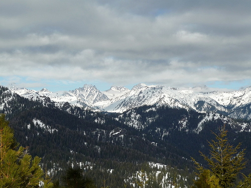
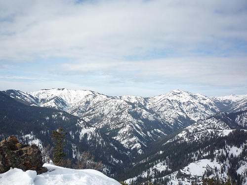
After failing to find the two caches I tried for at Seattle Center last weekend, I headed back to the hills where I'm more in my element
When the Earth Turtle Challenge first started, I was actually living in North Bend, WA, which is pretty much where we were hiking. Our plan was to hit the cache Absolute Last Promontory (GCP2GJ) and then bushwhack up to the top of Green Mountain. 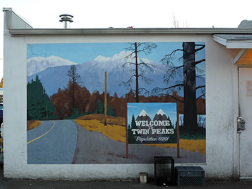
First stop, Twede's. Do people really cache without coffee?
Fans of Twin Peaks might better know this joint as Norma's Double R Diner.
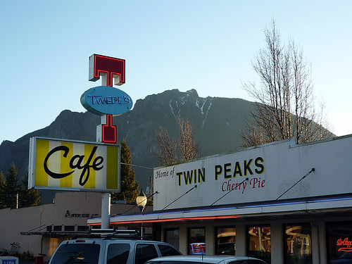
The mountain in the background is Mt. Si...
If heading to visit the APE cache from Seattle, you can't can't miss it...
It usually looks much more dramatic than in this picture
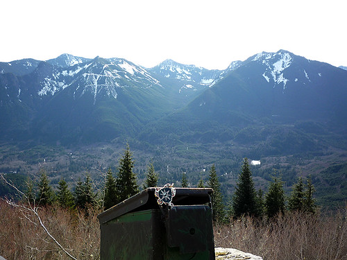
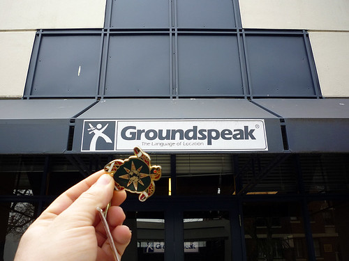
It's a geocache and an Earth Turtle!
Sadly, most of the pictures were washed out.
Mt Rainier was peeking out over some of the mountains, but I didn't manage to capture.
That was ok though, as the Rainier views just got better and better as we made our way up

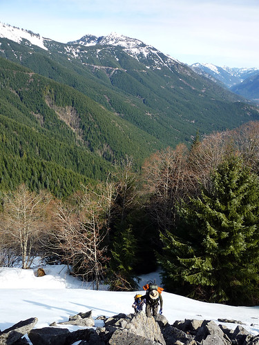
It was all up, up and more up starting here! A bit more than 4000 ft gain total.
Just another day along the I-90 corridor

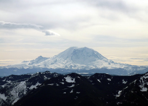
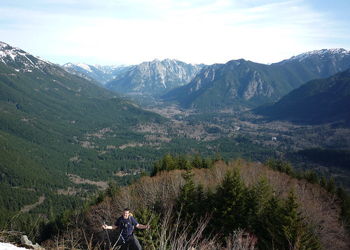
Mt. Rainier from the cache I've not yet gotten around to listing.
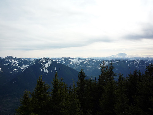
Rainier towering over everything else.

Green Mountain (GC1MZ00) almost went right there...
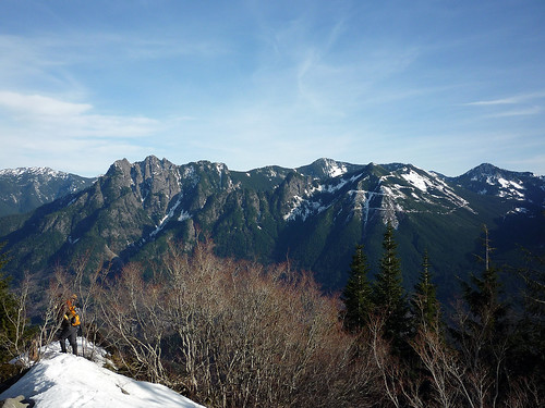
Can you tell I like the mountains?
-
Most excellent! Gotta love the mountains
Can't wait to see more.You'll probably see more mountains from me, as that's where I mostly cache
Thanks everyone for the compliments on the pictures

And you managed not to throw this one over a cliff.....good job!
I'm always ultra aware of where the ammo can is headed now
Now the concern is more not sending *myself* over the edge... -
I received the Earth Turtle bound for WA on Friday, just in time for a hike on Sunday
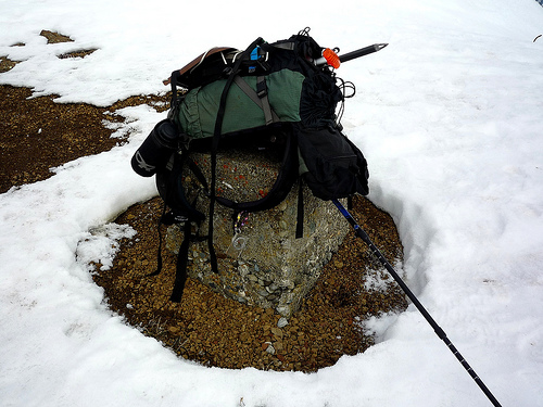
 rockitbiker and I headed out to the Wenatchee National Forest to find The Butte (GCGEFH), a cache placed in '03 with one logged find in '04 (although there was a unlogged find in the cache logbook from '05). I was fearing that the cache might actually be gone and I wouldn't be able to log the ET this trip as this was the only cache to be found on the hike, but we managed to dig it out of its hiding spot.
Did a double summit on the hike, so the ET got to see Teanaway Butte's neighbor 'Tarzan' Butte also.
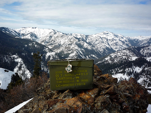
It's an ammo can and an Earth Turtle!
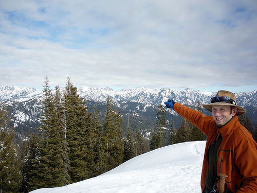
rockitbiker kindly poses with the ET
Dragontail Peak, Stuart Range, Enchantments
The remains of the fire lookout that was once found at the top of Teanaway Butte (and rb's gear!)
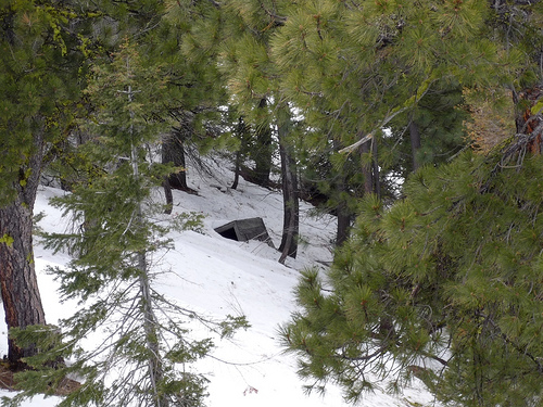
Was pretty sure this was the remains of the fire lookout potty
Just really hard to capture it in a picture
-
I didn't see it mentioned so thought I would point out that you can also hotsync using bluetooth. I'm using 64-bit Windows 7 beta and it works fine. You can get a usb bluetooth adapters pretty cheap if you don't already have bluetooth or an adapter.
-
Is one of these the tunnel to the APE cache?
Yes, I believe so.
The article mentions the Snoqualmie Tunnel as one of those at risk. Hopefully money can be found for repairs, but seems trails all over WA are in need of money badly
That's for posting!
-
I gave it look over on Saturday. Here is a few things I noticed.
1. Highway 101 is in the water on the west coast by N47 42.772 W124 25.011
2. The strait to the Puget Sound is missing the bodies of water. The Columbia river disappears at Interstate 90. It comes up Tan like the land color.
3. There is funny looking contour errors out in the sea on west coast. I saw the same thing when I was processing Dem files too. It looks like needs crop to the State borders.
4. The Interstate Flags are missing.
5. The USGS GNIS POI data is missing.
Overall, the contours look good. The streams look good until it runs into a body of water, since the body of water and streams are two different colors, the streams show though on the lake as well, but I noticed that on the Idaho and Nevada topo as well. I haven't tried it on the gps yet, just looking at it with Mapsource.
John
There are also some contours on summits were the contours lines cross over each other. Saw this on a few different peaks.
Although I didn't notice any when I looked, the garbage contours found on the coast showed up on my maps also, in addition to the Puget Sound. So these may also be present there. The only solution I found aside from editing each quad was to simply delete all 0 ft contours.
-
A quick look at this new map and it doesn't look like it has any peaks along the I-90 corridor (so I will make the wild assumption that just the GNIS state file was used so probably *no* peaks in the Cascades are featured). And that's just the peaks, not considering any other sort of POI
 It seems to me, the real benefit of 40 ft contours are when used in the mountains.
There are/were three people actively working on WA Topos at GPSFileDepot who use the topo_process utility there, which grabs the GNIS state file. If additional data isn't added, any WA map using this will be missing *lots* of data. The same utility grabs the latest TIGER data for transportation. The topo_process utility is great, but that is the data it uses. I have no doubt that you probably have far more data
Also, the POIs cannot be searched... I'm not sure what version of cGPSmapper you are using and if that matters.
I can understand why you might consider not continuing and likely more WA maps will follow. But if you are still planning on pursuing making the maps regardless, for yourself, I know that I would be very interested in the opportunity to check them out/use them. And I certainly think many would benefit greatly from your maps if you decided to share.
And, no offense to whoever worked really hard on the maps
-
I'm not sure why one would want topo without trails.
So that you could use the topo sort of like a basemap and use an alternate source for trails which could be updated much more frequently. Sounds like that's the plan here.
Which brings up a semi-related question: I was viewing various maps in MapSource and was not able to figure out how view more than one at a time. I really wanted to overlay the topo or trails over the street map, but I wasn't smart enough to do it.
Can it even be done?
I don't think this can be done. If it can, I sure wish I knew how!
-
The Priest Lake Topo is using all of the GNIS POIs, plus my own POIs as well as POIs from BTS. I don't know what you mean by "more" POIs, but yes, I plan to use all that are available to me.
I found, with WA at least, there was a drastic difference between the number of POIs when downloading using the search tool as opposed to downloading the state ZIP file and was just wondering if it included all. Didn't mean to imply I thought there was a lack of POIs, as it certainly doesn't
No, I don't plan on doing routing, at least not right away. That takes a ton of work tweaking the roads, and that is the biggest issue I have right now - lots of roads of various levels of accuracy from a variety of sources. I need to sort out that mess first.
Honestly, I cannot wait to see what you come up with for roads, routing or not. That's pretty exciting that you are drawing on a number of source.
I still plan on playing with zoom levels for various elements, so any feedback people have on that is appreciated.
Zoom levels in regards to major contours and more major landmarks (cities, peaks, etc) might make orienting ones self easier when zoomed out. But these look great!
Thanks so much for the chance to check them out and hopefully eventually put them to use!
-
In fact, it would be great if people did and commented on what they like and don't like so I can make changes for the initial release of Northwest Topos.
So far they look excellent

Couple of questions...
Are you planning on adding more POIs? I used all the WA GNIS data available (a lot, sometimes to the point of clutter for my use). If so, will one be able to search them?
Will the transportation have routing?
Any chance you will have major contours above .5 mile?
The pre-pre alpha looks great, much smoother, especially around water, than my efforts. Is everything done in GlobalMapper? While I'm having great fun learn how to do all this stuff and plan to continue, I very much look forward to using your maps
-
I can't recommend enough checking out gpsfiledepot.com. Lots of info/utilities/more there to help you. They're nothing short of awesome over there (and here!)
-
Excellent pictures! Wow, easy to understand why your sig reads 'I am in love with Montana...'
-
If you hold down the joystick button on the front of the unit, you can create a new waypoint and modify the coords there. Responding here as the other thread was empty
-
Arg! I decided not to get a PN-40 because of how POIs are handled... but that aerial imagery is so why I wanted one.
 Nice, nice job... looked like a great day for caching.


CHALLENGE: The Earth Turtle Challenge
in Trackables
Posted
What up??? Please tell me you got the ET back (like, quite some time ago!!!!)
Hope this continues, this was an awesome idea... I want to do this with a couple of my hiking groups MMM coins, but send them off to groovy peaks around the world :-)