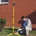
+PFF Posted February 13, 2006 Share Posted February 13, 2006 NORTH CAROLINA GEODETIC SURVEY SEEKS HELP FINDING "STATE TREASURES" You remember the movie "National Treasure"? Well, the creative staff at NCGS has launched a program to recover the old Meridan Markers across the state. To assist us, they have built a very clever website based upon the movie. Meridian Stations are a pair of stone monuments weighing about 400 lbs each, aligned exactly North-South. They were set in the late 1800's. Surveyors had to visit the station once a year to check their compasses. They then recorded the results with the Register of Deeds for the county, paying a ten-cent recording fee. Visit the website by going to http://www.ncgs.state.nc.us and scrolling down to the "state treasures" link. The stones from about 12 counties have been found. Updating the website is slow, so before you head out on a search, check with me to see what counties already have been reported. NC-SC STATE LINE BOUNDARY MONUMENTS FROM 1905 A survey of the state line from western Robeson County (NC) to the Pee Dee River was commissioned by North and South Carolina in 1905. Thirty-seven granite markers were placed at intervals averaging one mile apart. In 2005, the NC Geodetic Survey invited GEOCACHING volunteers to join the search for the 100-year-old monuments. Click HERE to see photos of a typical marker which was recovered recently by NCGS. This is what we are looking for! Many have been lost to road widening, farming, etc. Others have been found but appear to have been tampered with. However, we think some have survived. At EB1368, I've included a picture of another monument, plus the source document and a description of the tools and techniques Neweyess and I are using. If this interests you, contact me for more information. MOUNT MITCHELL TOWER TO BE REPLACED I was chatting today with Lewis Ledford, Director of State Parks for North Carolina. He told me that the stone observation tower is going to be replaced in the near future, due to deterioration of the cement. The current tower was built about 1959. The “wings” were added much later. Ledford is the former Ranger for Mount Mitchell, and it was he that took the panoramic photographs on display atop the tower—the ones with identification labels of nearby peaks. (You also will see his name on the data sheet shipped with the Mt. Mitchell benchmark reproduction from Bernsten International.) The challenge in replacing the tower is that the new structure must comply with the Americans With Disabilities Act, and it will be difficult to construct a ramp (like the one at Clingman’s Dome) without adversely affecting the surrounding area and the 360-degree view. The details are still being worked out, and no date has been given for destruction of the current tower. I see Mr. Ledford regularly, and I’ll post an update when I have it. -Paul- Mount Mitchell Observation Tower Photo by ZDV (2002) Link to comment

Recommended Posts