Search the Community
Showing results for 'defying gravity 노래방,김천밤의민족화려한밤【KaKaoTalk:Za32】카카오 톡 상담 깜짝'.
-
Good elevation bench marks are still important to professionals for at least several more years. NGS plans to complete their GRAV-D project and release a new vertical datum that will be based on GPS measurements with adjustments from the gravity data. Until then, GPS can't give accurate elevation data of the kind (orthometric heights) established on the passive bench marks. And if you understand just a little bit about what the marks represent , the difference between SCALED and ADJUSTED, use common sense and caution, and follow the examples of prior recovery reports, you can still make worthwhile contributions by reporting finds.
-
Check the logs on this cache. Previous people to find it claim it is rather death defying. Very popular amongst highly experienced cachers (8000 finds and up) http://www.geocaching.com/seek/cache_detai...17-1459fd2e51cb
-
Accuracy is how close you are to a known place on earth. What is shown on your GPSr screen is "Estimated Position Error", which is what it sounds like, and called "Accuracy" on Garmins. I recommend the Adjusted Benchmarks because you can see how accurate your GPSr is, and compare it to what it says on the screen. Here is a listing for one, the type of mark is after the word,"Marker: The coords are in minutes and seconds. National Geodetic Survey, Retrieval Date = AUGUST 24, 2004 DY1768 *********************************************************************** DY1768 DESIGNATION - Z 50 RESET DY1768 PID - DY1768 DY1768 STATE/COUNTY- CA/LOS ANGELES DY1768 USGS QUAD - TORRANCE (1981) DY1768 DY1768 *CURRENT SURVEY CONTROL DY1768 ___________________________________________________________________ DY1768* NAD 83(1994)- 33 46 52.89299(N) 118 17 47.04124(W) ADJUSTED DY1768* NAVD 88 - 21.030 (meters) 69.00 (feet) ADJUSTED DY1768 ___________________________________________________________________ DY1768 EPOCH DATE - 1995.00 DY1768 X - -2,515,583.035 (meters) COMP DY1768 Y - -4,672,647.944 (meters) COMP DY1768 Z - 3,526,306.861 (meters) COMP DY1768 LAPLACE CORR- 1.62 (seconds) DEFLEC99 DY1768 ELLIP HEIGHT- -14.89 (meters) (11/30/95) GPS OBS DY1768 GEOID HEIGHT- -35.90 (meters) GEOID03 DY1768 DYNAMIC HT - 21.008 (meters) 68.92 (feet) COMP DY1768 MODELED GRAV- 979,605.8 (mgal) NAVD 88 DY1768 DY1768 HORZ ORDER - FIRST DY1768 VERT ORDER - FIRST CLASS II DY1768 ELLP ORDER - FOURTH CLASS II DY1768 DY1768.The horizontal coordinates were established by GPS observations DY1768.and adjusted by the National Geodetic Survey in November 1995. DY1768.This is a SPECIAL STATUS position. See SPECIAL STATUS under the DY1768.DATUM ITEM on the data sheet items page. DY1768.The horizontal coordinates are valid at the epoch date displayed above. DY1768.The epoch date for horizontal control is a decimal equivalence DY1768.of Year/Month/Day. DY1768 DY1768.The orthometric height was determined by differential leveling DY1768.and adjusted by the National Geodetic Survey in June 1995. DY1768.WARNING-Repeat measurements at this control monument indicate possible DY1768.vertical movement. DY1768 DY1768.The X, Y, and Z were computed from the position and the ellipsoidal ht. DY1768 DY1768.The Laplace correction was computed from DEFLEC99 derived deflections. DY1768 DY1768.The ellipsoidal height was determined by GPS observations DY1768.and is referenced to NAD 83. DY1768 DY1768.The geoid height was determined by GEOID03. DY1768 DY1768.The dynamic height is computed by dividing the NAVD 88 DY1768.geopotential number by the normal gravity value computed on the DY1768.Geodetic Reference System of 1980 (GRS 80) ellipsoid at 45 DY1768.degrees latitude (g = 980.6199 gals.). DY1768 DY1768.The modeled gravity was interpolated from observed gravity values. DY1768 DY1768; North East Units Scale Factor Converg. DY1768;SPC CA 5 - 531,251.096 1,972,545.440 MT 1.00006414 -0 10 08.2 DY1768;SPC CA 5 - 1,742,946.30 6,471,592.83 sFT 1.00006414 -0 10 08.2 DY1768;UTM 11 - 3,738,669.062 379,970.442 MT 0.99977761 -0 43 15.3 DY1768 DY1768! - Elev Factor x Scale Factor = Combined Factor DY1768!SPC CA 5 - 1.00000234 x 1.00006414 = 1.00006648 DY1768!UTM 11 - 1.00000234 x 0.99977761 = 0.99977995 DY1768 DY1768 SUPERSEDED SURVEY CONTROL DY1768 DY1768 NAVD 88 (06/15/91) 21.044 (m) 69.04 (f) UNKNOWN 1 2 DY1768 NGVD 29 (??/??/92) 20.305 (m) 66.62 (f) ADJ UNCH 1 2 DY1768 DY1768.Superseded values are not recommended for survey control. DY1768.NGS no longer adjusts projects to the NAD 27 or NGVD 29 datums. DY1768.See file dsdata.txt to determine how the superseded data were derived. DY1768 DY1768_U.S. NATIONAL GRID SPATIAL ADDRESS: 11SLT7997038669(NAD 83) DY1768_MARKER: DB = BENCH MARK DISK DY1768_SETTING: 31 = CURB DY1768_STAMPING: Z 50 1926 RESET 1945 DY1768_MARK LOGO: CGS DY1768_MAGNETIC: N = NO MAGNETIC MATERIAL DY1768_STABILITY: D = MARK OF QUESTIONABLE OR UNKNOWN STABILITY DY1768_SATELLITE: THE SITE LOCATION WAS REPORTED AS SUITABLE FOR DY1768+SATELLITE: SATELLITE OBSERVATIONS - April 28, 1999 DY1768 DY1768 HISTORY - Date Condition Report By DY1768 HISTORY - 1945 MONUMENTED CGS DY1768 HISTORY - 1946 GOOD NGS DY1768 HISTORY - 1968 GOOD CA-037 DY1768 HISTORY - 1978 GOOD NGS DY1768 HISTORY - 19890601 GOOD NGS DY1768 HISTORY - 19940722 GOOD NGS DY1768 HISTORY - 19941116 GOOD MWDSC DY1768 HISTORY - 19950406 GOOD MWDSC DY1768 HISTORY - 19990428 GOOD NGS DY1768 DY1768 STATION DESCRIPTION DY1768 DY1768'DESCRIBED BY NATIONAL GEODETIC SURVEY 1946 DY1768'AT WILMINGTON. DY1768'AT WILMINGTON, NEAR THE INTERSECTION OF GAFFEY STREET AND DY1768'ANAHEIM STREET, IN LARGE CONCRETE BRIDGE OVER STREET CAR TRACKS, DY1768'AT THE SOUTH-WEST CORNER OF THE BRIDGE, 0.5 FOOT SOUTHWEST DY1768'OF THE SOUTHWEST CURB OF BRIDGE, ON TOP OF THE SIDEWALK. DY1768'A STANDARD DISK, STAMPED Z 50 1926 RESET 1945. DY1768 DY1768 STATION RECOVERY (1968) DY1768 DY1768'RECOVERY NOTE BY LOS ANGELES COUNTY CALIFORNIA 1968 DY1768'RECOVERED IN GOOD CONDITION. DY1768 DY1768 STATION RECOVERY (1978) DY1768 DY1768'RECOVERY NOTE BY NATIONAL GEODETIC SURVEY 1978 DY1768'RECOVERED IN GOOD CONDITION. DY1768 DY1768 STATION RECOVERY (1989) DY1768 DY1768'RECOVERY NOTE BY NATIONAL GEODETIC SURVEY 1989 DY1768'RECOVERED IN GOOD CONDITION. DY1768 DY1768 STATION RECOVERY (1994) DY1768 DY1768'RECOVERY NOTE BY NATIONAL GEODETIC SURVEY 1994 (SDD) DY1768'IN LOS ANGELES (HARBOR CITY AREA) , AT THE INTERSECTION OF GAFFEY AND DY1768'ANAHEIM STREETS, IN TOP OF AND 0.3 M (1.0 FT) SOUTHEAST OF THE DY1768'NORTHWEST END OF THE SOUTHWEST CONCRETE CURB OF THE ANAHEIM STREET DY1768'BRIDGE SPANNING A CREEK, 49.5 M (162.4 FT) NORTHEAST OF THE CENTERLINE DY1768'OF THE NORTHBOUND LANES OF GAFFEY STREET, 7.3 M (24.0 FT) SOUTHWEST OF DY1768'THE CENTERLINE OF ANAHEIM STREET, 0.6 M (2.0 FT) NORTHEAST OF THE DY1768'NORTHWEST END OF THE BRIDGE GUARDRAIL, AND 0.2 M (0.7 FT) ABOVE THE DY1768'LEVEL OF ANAHEIM STREET. DY1768 DY1768 STATION RECOVERY (1994) DY1768 DY1768'RECOVERY NOTE BY METRO WATER DISTR SO. CALIFORNIA 1994 (DEL) DY1768'LOMITA, NEAR THE INTERSECTION OF ANAHEIM ST, PALOS VERDES DRIVE NORTH, DY1768'GAFFEY ST AND VERMONT AVE. ON ANAHEIM ST 350 FEET (106.7 M) EASTERLY DY1768'OF VERMONT AVE, 27 FEET (8.2 M) SOUTHERLY OF ANAHEIM ST, 0.7 FEET DY1768'(21.3 CM) EASTERLY OF THE WEST END OF THE BRIDGE WALKWAY THAT LIES ON DY1768'THE SOUTHERLY SIDE OF ANAHEIM ST, A 3-1/2 INCH BRASS DISK STAMPED DY1768'RESET Z-50 1926 SET FLUSH IN CONCRETE CURB OF BRIDGE SPANNING CREEK. DY1768'REF MWD FB 2519 02 024, TB 794 A6. DY1768 DY1768 STATION RECOVERY (1995) DY1768 DY1768'RECOVERY NOTE BY METRO WATER DISTR SO. CALIFORNIA 1995 (DEL) DY1768'RECOVERED AS DESCRIBED. DY1768 DY1768 STATION RECOVERY (1999) DY1768 DY1768'RECOVERY NOTE BY NATIONAL GEODETIC SURVEY 1999 (GAS) DY1768'IN HARBOR CITY, AT THE INTERSECTION OF GAFFEY AND ANAHEIM STREETS, IN DY1768'TOP OF AND 0.3 M (1.0 FT) SOUTHEAST OF THE NORTHWEST END OF THE DY1768'SOUTHWEST CONCRETE CURB OF THE ANAHEIM STREET BRIDGE SPANNING A CREEK, DY1768'49.5 M (162.4 FT) NORTHEAST OF THE CENTERLINE OF THE NORTHBOUND LANES DY1768'OF GAFFEY, 7.3 M (24.0 FT) SOUTHWEST OF THE CENTERLINE OF ANAHEIM, 0.1 DY1768'M (0.3 FT) NORTHEAST OF THE NORTHWEST END OF THE BRIDGE RAIL, AND 0.2 DY1768'M (0.7 FT) ABOVE THE LEVEL OF THE STREET. NOTE--THE MARK IS ON STREET DY1768'RIGHT-OF-WAY.
-
I was just on a cache hunt last weekend, starting my second attempt at finding Wild Arboretum, my enthusiatic six-year-old assistant leading me by 20 yards ... A deep, dark cloud suddenly appeared over the tree line and quickly moved into position over us. In Portland, this usually means nothing more than you are about to look like you just went over Niagra Falls in a leaky barrel. Beckoning my son to turn back, I was interrupted by one blinding fl -- what the -- make that THREE flashes of --- WOW THAT THUNDER IS LOUD! Less than a second between the flashes and the eardrum-splitting explosions, I think to myself as I notice my son no longer seems to be ignoring my weather admonitions, seeing as how he has already had the good sense to run past me on the way back to the car, leaving me for dead where I stood. Okay, about 5 seconds per mile, that makes those thunderbolts precisely, oh, about death ray range of both of us at any instant, I think inside while I try to reassure and comfort my son with my calm, trembling exterior. 1000 strikes a year in the U. S., I recollect, but only about a third of them are fatal, right? Hurrying back toward the car, another flash brings a good two-second pause before hurtling a somewhat more subdued thunder crack at our ears, which I realize are still ringing from our first death-defying (deaf-defying?) encounter. Amazingly, we both arrived at and entered our comfortingly rubber-insulated-from-the-ground car before a drop of rain fell, which was good because we didn't have to wait two minutes before an amazing cloudburst absolutely rendered my windshied wipers useless on their most hysterical setting. We never witnessed another flash, but we heard another thunderclap or two. It was all gone in ten minutes as suddenly as it came, but we didn't resume the hunt that morning since we assumed the trails were muddy enough to get us in serious trouble with my wife. In conclusion, I don't know how or if the lightning affected the reception or accuracy of my receiver. Frankly, I don't even know how my receiver made it back to the car that day, as I have no recollection of carrying it back. I do know, however, that lightning can have a direct and dramatic effect on the geocacher.
-
Agreed. Iv'e used both agent and Microplanet Gravity (Gravity's predicessor) and Gravity won hands down. Agent is nothing to sneeze at though and either will serve you well.
-
"Gravity-Defying Geckos Teach Scientists a Lesson" Perhaps we'll have to adjust cache difficulty ratings to incorporate a "handicap" factor to compensate for any natural advantages certain teams may have ... -GD
-
Latest OpenStreeMap UK Garmin Mapsets...
needaxeo replied to talkytoaster's topic in United Kingdom and Ireland
I was very impressed that these maps navigated turn-by-turn around Milton Keynes Redway. I wasn't expecting it (and I'd been googling around for some kind of "sustrans in garmin format" without much success) Most of the caches we've done have either been local or on country footpaths, and I've overlayed an OS custom map at 1:50k of most of the area the PQ "500 nearest" covers, and I'd just been looking for the footpath using the 'as the crow flies' line between me and the cache to get the direction. On Sunday, I decided to go and find a few caches I could cycle to. I was sat on my bike at Caldecotte lake and I hit 'recalculate on road' just for laughs, to see what death defying route via MK's roundabouts and dual carriageways it would give me. Instead I got 'go E on trail to redway...' and a complete off road route (bar a couple of very quiet side streets / cul-de-sacs) I had to use a bit of intelligence to navigate back across MK towards home (It wanted to send me down the road to LB) but once I'd navigated back to Caldecotte Lake it sent me down the canal towpath. -
On Monday, the European Space Agency will launch GOCE (Gravity Field and Steady-State Ocean Circulation Explorer--and no, I don't know why it isn't called "GFSSOCE" ), which will map Earth's gravity field and help scientists construct a more accurate geoid to measure elevations anywhere on the planet. Here's a quote from the mission manager about how sensitive the gradiometer on the spacecraft is: ""Imagine a snowflake, which has a fraction of a gram, slowly falling down on to the deck of a supertanker. The acceleration that the supertanker experiences from that snowflake is comparable to the sensitivity of our instrument." Yikes! There's an excellent BBC article about GOCE here: http://news.bbc.co.uk/2/hi/science/nature/7935621.stm And the official GOCE website is here: http://www.esa.int/SPECIALS/GOCE/ Patty
-
Contest: Photos of old USC&GS Survey Disks
NGS Surveyor replied to NGS Surveyor's topic in Benchmarking
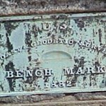
Thanks all for the photos. CallawayMT – Your GRAVITY STATION disk is very unusual, I’ve only ever seen three (I have an unused one on my desk). They were used from about 1936 to about 1970. Difficult Run – Your GRAVITY STATION reference mark disk (with the arrow) is very, very unusual, I’ve never seen any! I do have a photo of one. They were used from about 1936 to about 1961. 2oldfarts – I don’t think your disk is flat. Notice how the sunlight only lights up the top portion of the disk. The “flat” disks were completely flat, for a photo of two from a 1921 pub. see: http://www.flickr.com/photos/12262796@N06/3343702001/. In about 1921, five convex (curved top) disks were introduced, see: http://www.flickr.com/photos/12262796@N06/...in/photostream/ also from a 1921 pub. Your 1921 disk is from this 1921 transition period when the disks were changed from flat-topped to convex. I think yours is the disk in the upper right. GeorgeL NGS -
I use my sed script in a batch file that invokes it in DOS. It is for changing a file from the NGS into a shorter file. Here is an example: For a one-PID file example, this: The NGS Data Sheet See file dsdata.txt <http://www.ngs.noaa.gov/cgi-bin/ds_lookup.prl?Item=DSDATA.TXT> for more information about the datasheet. DATABASE = Sybase ,PROGRAM = datasheet, VERSION = 7.03 1 National Geodetic Survey, Retrieval Date = JUNE 5, 2004 HV2008 *********************************************************************** HV2008 DESIGNATION - SPEED RM 1 HV2008 PID - HV2008 HV2008 STATE/COUNTY- DC/DISTRICT OF COLUMBIA HV2008 USGS QUAD - WASHINGTON WEST (1983) HV2008 HV2008 *CURRENT SURVEY CONTROL HV2008 ___________________________________________________________________ HV2008* NAD 83(1986)- 38 53 04. (N) 077 02 52. (W) SCALED HV2008* NAVD 88 - 1.017 (meters) 3.34 (feet) ADJUSTED HV2008 ___________________________________________________________________ HV2008 GEOID HEIGHT- -32.05 (meters) GEOID03 HV2008 DYNAMIC HT - 1.016 (meters) 3.33 (feet) COMP HV2008 MODELED GRAV- 980,096.0 (mgal) NAVD 88 HV2008 HV2008 VERT ORDER - FIRST CLASS II HV2008 HV2008.The horizontal coordinates were scaled from a topographic map and have HV2008.an estimated accuracy of +/- 6 seconds. HV2008 HV2008.The orthometric height was determined by differential leveling HV2008.and adjusted by the National Geodetic Survey in June 1991. HV2008 HV2008.The geoid height was determined by GEOID03. HV2008 HV2008.The dynamic height is computed by dividing the NAVD 88 HV2008.geopotential number by the normal gravity value computed on the HV2008.Geodetic Reference System of 1980 (GRS 80) ellipsoid at 45 HV2008.degrees latitude (g = 980.6199 gals.). HV2008 HV2008.The modeled gravity was interpolated from observed gravity values. HV2008 HV2008 SUPERSEDED SURVEY CONTROL HV2008 HV2008 NGVD 29 (??/??/??) 1.253 (m) 4.11 (f) ADJUSTED 1 2 HV2008 HV2008.Superseded values are not recommended for survey control. HV2008.NGS no longer adjusts projects to the NAD 27 or NGVD 29 datums. HV2008.See file dsdata.txt <http://www.ngs.noaa.gov/cgi-bin/ds_lookup.prl?Item=HOW_SUP_DET>to determine how the superseded data were derived. HV2008 HV2008_U.S. NATIONAL GRID SPATIAL ADDRESS: 18STV836836(NAD 83) HV2008_MARKER: DR = REFERENCE MARK DISK HV2008_SETTING: 30 = WALL HV2008_STAMPING: NO 1 1935 HV2008_STABILITY: D = MARK OF QUESTIONABLE OR UNKNOWN STABILITY HV2008 HV2008 HISTORY - Date Condition Report By HV2008 HISTORY - 1935 MONUMENTED CGS HV2008 HV2008 STATION DESCRIPTION HV2008 HV2008'DESCRIBED BY COAST AND GEODETIC SURVEY 1935 HV2008'AT WASHINGTON. HV2008'AT STANDARD BRONZE REFERENCE DISK STAMPED NO. 1 1935 SET IN THE HV2008'CONCRETE TOP OF THE GRANITE SEA WALL ALONG WEST POTOMAC PARK HV2008'1/2 MILE NW OF THE INLET GATE BRIDGE OF THE TIDAL BASIN, AND S HV2008'OF THE COMFORT STATION AT THE GOLF PRACTICE COURSE IN WEST HV2008'POTOMAC PARK. MARK IS 1.2 FEET IN FROM THE WATER FACE OF THE SEA HV2008'WALL, AND 65 FEET SW OF SPEED. *** retrieval complete. Elapsed Time = 00:00:01 becomes this: HV2008 *********************************************************************** HV2008 DESIGNATION - SPEED RM 1 HV2008 PID - HV2008 HV2008 STATE/COUNTY- DC/DISTRICT OF COLUMBIA HV2008 *CURRENT SURVEY CONTROL HV2008 NAD 83(1986)- 38 53 04. (N) 077 02 52. (W) SCALED HV2008 NAVD 88 - 1.017 (meters) 3.34 (feet) ADJUSTED HV2008 MARKER: DR = REFERENCE MARK DISK HV2008 SETTING: 30 = WALL HV2008 STAMPING: NO 1 1935 HV2008 MONUMENTATION: 1935 by CGS HV2008 STATION DESCRIPTION HV2008 DESCRIBED BY COAST AND GEODETIC SURVEY 1935 HV2008 AT WASHINGTON. HV2008 AT STANDARD BRONZE REFERENCE DISK STAMPED NO. 1 1935 SET IN THE HV2008 CONCRETE TOP OF THE GRANITE SEA WALL ALONG WEST POTOMAC PARK HV2008 1/2 MILE NW OF THE INLET GATE BRIDGE OF THE TIDAL BASIN, AND S HV2008 OF THE COMFORT STATION AT THE GOLF PRACTICE COURSE IN WEST HV2008 POTOMAC PARK. MARK IS 1.2 FEET IN FROM THE WATER FACE OF THE SEA HV2008 WALL, AND 65 FEET SW OF SPEED. (Note: this forum software removes some spaces.) If you want my sed script, email me. If you want to get a sed.exe, put "sed" in an internet search engine and you can find a freeware sed for DOS.
-
Recovered a cool Gravity Reference Mark in North Florida, BE0315. The last one I tried to find had been recently taken from its monument.
-
Cal baselines are ONLY for distance, and have no better lat-lon than is needed to find them. http://geodesy.noaa.gov/CBLINES/calibration.html The best available for absolute lat-lon are HARN or CBN stations with GPS coordinates. First order stations may be as good relative to other nearby ones, but not relative to the world. If he's interested in that level of accuracy, he must develop a very good understanding of datums, the flavors thereof, and what those imply. If this is somehow astronomically related, he needs to know that astronomical latitude and longitude will probably differ by up to hundreds of feet from GPS lat-lon due to variations in gravity, which pull the local vertical away from the normal to the ellipsoid, so it will in general not point to the axis of the earth.
-
This is a first for me, never seen anything like this one in my 30 yrs. I think I am going to see if I can find the tree, unless its been logged out. The NGS Data SheetSee file dsdata.txt for more information about the datasheet.DATABASE = Sybase ,PROGRAM = datasheet, VERSION = 7.00 1 National Geodetic Survey, Retrieval Date = MAY 6, 2004 RL1335 *********************************************************************** RL1335 DESIGNATION - U 135 RL1335 PID - RL1335 RL1335 STATE/COUNTY- MI/ONTONAGON RL1335 USGS QUAD - ALDRIDGE CREEK (1981) RL1335 RL1335 *CURRENT SURVEY CONTROL RL1335 ___________________________________________________________________ RL1335* NAD 83(1986)- 46 44 59. (N) 089 41 59. (W) SCALED RL1335* NAVD 88 - 359.375 (meters) 1179.05 (feet) ADJUSTED RL1335 ___________________________________________________________________ RL1335 GEOID HEIGHT- -30.71 (meters) GEOID03 RL1335 DYNAMIC HT - 359.415 (meters) 1179.18 (feet) COMP RL1335 MODELED GRAV- 980,711.4 (mgal) NAVD 88 RL1335 RL1335 VERT ORDER - SECOND CLASS 0 RL1335 RL1335.The horizontal coordinates were scaled from a topographic map and have RL1335.an estimated accuracy of +/- 6 seconds. RL1335 RL1335.The orthometric height was determined by differential leveling RL1335.and adjusted by the National Geodetic Survey in June 1991. RL1335 RL1335.The geoid height was determined by GEOID03. RL1335 RL1335.The dynamic height is computed by dividing the NAVD 88 RL1335.geopotential number by the normal gravity value computed on the RL1335.Geodetic Reference System of 1980 (GRS 80) ellipsoid at 45 RL1335.degrees latitude (g = 980.6199 gals.). RL1335 RL1335.The modeled gravity was interpolated from observed gravity values. RL1335 RL1335; North East Units Estimated Accuracy RL1335;SPC MI N - 222,070. 7,793,770. MT (+/- 180 meters Scaled) RL1335 RL1335 SUPERSEDED SURVEY CONTROL RL1335 RL1335 NGVD 29 (??/??/92) 359.394 (m) 1179.11 (f) ADJ UNCH 2 0 RL1335 RL1335.Superseded values are not recommended for survey control. RL1335.NGS no longer adjusts projects to the NAD 27 or NGVD 29 datums. RL1335.See file dsdata.txt to determine how the superseded data were derived. RL1335 RL1335_U.S. NATIONAL GRID SPATIAL ADDRESS: 16TBS938808(NAD 83) RL1335_MARKER: DB = BENCH MARK DISK RL1335_SETTING: 30 = WHITE PINE TREE RL1335_STAMPING: U 135 1948 RL1335_STABILITY: D = MARK OF QUESTIONABLE OR UNKNOWN STABILITY RL1335 RL1335 HISTORY - Date Condition Report By RL1335 HISTORY - 1948 MONUMENTED CGS RL1335 HISTORY - 1955 MARK NOT FOUND USGS RL1335 RL1335 STATION DESCRIPTION RL1335 RL1335'DESCRIBED BY COAST AND GEODETIC SURVEY 1948 RL1335'12.2 MI SW FROM SILVER CITY. RL1335'ABOUT 2.6 MILES WEST ALONG STATE HIGHWAY 107 FROM ITS INTERSECTION RL1335'WITH STATE HIGHWAY 64 IN SILVER CITY, THENCE 4.5 MILES SOUTH ALONG RL1335'THE NONESUCH MINE ROAD, THENCE 3.2 MILES WEST ALONG AN OLD ROAD RL1335'TO A STREAM CROSSING AND THE END OF TRUCK TRAVEL, THENCE CONTINUING RL1335'WEST ALONG A TRACTOR TRAIL LEADING TO THE WHITE PINE EXTENSION RL1335'MINE 0.4 MILE TO THE JUNCTION OF THE TRACTOR TRAIL AND THE OLD RL1335'NONESUCH MINE - WHITE PINE EXTENSION MINE ROAD, THENCE WEST ALONG RL1335'THE TRACTOR TRAIL AND THE ROAD 1.45 MILES TO THE SITE OF THE MARK. RL1335'THE MARK IS 0.6 MILE WEST OF LITTLE IRON RIVER AND 0.95 MILE EAST RL1335'OF THE DUMP AT WHITE PINE EXTENSION MINE, 53 YARDS WEST OF A VERY RL1335'SMALL STREAM CROSSING, 12 FEET SOUTH OF THE CENTER LINE OF THE RL1335'ROAD, 32.32 FEET EAST OF A SPIKE IN A TRIANGULAR BLAZE ON THE RL1335'NORTH SIDE OF A 6-INCH ASH TREE, 43.36 FEET SOUTHWEST AND ACROSS RL1335'THE ROAD FROM THE HEAD OF A SPIKE IN A TRIANGLE ON THE SOUTH SIDE RL1335'OF A 12-INCH MAPLE TREE, ABOUT 4 FEET ABOVE THE GROUND, AND SET RL1335'VERTICALLY IN A BLAZED AREA ON THE NORTH-NORTHWEST SIDE OF A RL1335'33-INCH WHITE PINE TREE. NOTE-- A SMALL HOLE IN TREE AND IMPRESSION RL1335'OF OUTSIDE RIM OF TABLET ARE EVIDENT, BUT TABLET IS MISSING. RL1335 RL1335 STATION RECOVERY (1955) RL1335 RL1335'RECOVERY NOTE BY US GEOLOGICAL SURVEY 1955 RL1335'MARK NOT FOUND.
-
Is this the PID (NR0050) you are looking for? Trouble is the the elevation does not agree with what you quoted. If not in Wyoming, go to http://www.ngs.noaa.gov/ and do a search for the data sheet by name (MR 23) in whatever state this is located. NR0050 DESIGNATION - MR 23 NR0050 PID - NR0050 NR0050 STATE/COUNTY- WY/NATRONA NR0050 USGS QUAD - SHEEP CREEK (1960) NR0050 NR0050 *CURRENT SURVEY CONTROL NR0050 ___________________________________________________________________ NR0050* NAD 83(1986)- 42 36 22. (N) 106 21 04. (W) SCALED NR0050* NAVD 88 - 1875.443 (meters) 6153.02 (feet) ADJUSTED NR0050 ___________________________________________________________________ NR0050 GEOID HEIGHT- -12.17 (meters) GEOID03 NR0050 DYNAMIC HT - 1874.157 (meters) 6148.80 (feet) COMP NR0050 MODELED GRAV- 979,868.3 (mgal) NAVD 88 NR0050 NR0050 VERT ORDER - SECOND CLASS 0 NR0050 NR0050.The horizontal coordinates were scaled from a topographic map and have NR0050.an estimated accuracy of +/- 6 seconds. NR0050 NR0050.The orthometric height was determined by differential leveling NR0050.and adjusted by the National Geodetic Survey in June 1991. NR0050 NR0050.The geoid height was determined by GEOID03. NR0050 NR0050.The dynamic height is computed by dividing the NAVD 88 NR0050.geopotential number by the normal gravity value computed on the NR0050.Geodetic Reference System of 1980 (GRS 80) ellipsoid at 45 NR0050.degrees latitude (g = 980.6199 gals.). NR0050 NR0050.The modeled gravity was interpolated from observed gravity values. NR0050 NR0050; North East Units Estimated Accuracy NR0050;SPC WYEC - 334,370. 480,600. MT (+/- 180 meters Scaled) NR0050 NR0050 SUPERSEDED SURVEY CONTROL NR0050 NR0050 NGVD 29 (??/??/92) 1874.491 (m) 6149.89 (f) ADJ UNCH 2 0 NR0050 NR0050.Superseded values are not recommended for survey control. NR0050.NGS no longer adjusts projects to the NAD 27 or NGVD 29 datums. NR0050.See file dsdata.txt to determine how the superseded data were derived. NR0050 NR0050_U.S. NATIONAL GRID SPATIAL ADDRESS: 13TCH891179(NAD 83) NR0050_MARKER: DD = SURVEY DISK NR0050_SETTING: 80 = SET IN A BOULDER NR0050_STAMPING: MR 23 1947 NR0050_STABILITY: C = MAY HOLD, BUT OF TYPE COMMONLY SUBJECT TO NR0050+STABILITY: SURFACE MOTION NR0050 NR0050 HISTORY - Date Condition Report By NR0050 HISTORY - 1947 MONUMENTED USGS NR0050 HISTORY - 1959 GOOD NGS NR0050 NR0050 STATION DESCRIPTION NR0050 NR0050'DESCRIBED BY NATIONAL GEODETIC SURVEY 1959 NR0050'29.35 MI S FROM CASPER. NR0050'ABOUT 14.8 MILES SOUTHWEST ALONG STATE HIGHWAY 220 FROM THE WEST SIDE NR0050'POSTOFFICE AT CASPER, THENCE ABOUT 8.9 MILES SOUTHEAST ALONG A DIRT NR0050'ROAD WHICH IS THE MEDICINE BOW ROAD, THENCE ABOUT 0.7 MILE SOUTHEAST NR0050'ALONG TWO BAR ROAD, THENCE ABOUT 0.4 MILE SOUTHEAST ALONG A PAVED NR0050'ROAD, THENCE ABOUT 4.55 MILES SOUTHEAST ALONG A DIRT ROAD, 19 FEET NR0050'NORTHEAST OF THE CENTER LINE OF THE ROAD, IN SECTION 31, R 79 W, T 31 NR0050'N, IN THE TOP OF A LARGE BOULDER, ABOUT 0.5 MILE SOUTHEAST OF A BRIDGE NR0050'OVER CORRAL CREEK, ABOUT 100 FEET NORTHWEST OF A CURVE IN THE ROAD, 16 NR0050'1/2 FEET WEST OF A POWER POLE, AND ABOUT 1 1/2 FEET ABOVE THE LEVEL OF NR0050'THE ROAD.
-
I have been trying to guess what the other half might be. A lucky guess would put me 3/4 of the way there. I'll go with General Relativity. If this is right, because wavector wrote more words than I did, it's his win, plus I don't have a question Yes, it is General Relativity. The more mass/gravity there is, the slower time runs. This effect can be measured between the top and bottom of a tower, but the clock has to be very accurate (an understatement). The GPS satellite is high up from the surface of the earth, which causes time to run faster (General Relativty). But it is moving rapidly compared to a spot on earth, which causes time to run slower (Special Relativity). SR has a much greater effect than GR (in this case), so overall, time runs slower on the satellite, and has to be accounted for. Even though GR is a theory of the universe at large (a theory of Gravity), it is Special Relativity that is the most mind-blowing. For example, if you are rocketing toward a distant planet at 90% of the speed of light, time will be passing way slower for you than the people you left on earth. But since everything seems normal to you, how can that be? Simple: space shrinks for you, and the star is closer than you measured from earth. Egads! Take it away wavector!
-
I suspect that you have found an Arizona Hwy. Dept. disk instead of the Coast & Geodetic Survey (CGS) disk. Maybe the bridge was replaced since 1934? In which case the Hwy. Dept. may have placed their own benchmark on the newer bridge. Not all state highway dept. (& other agency) disks are in the NGS database. GeoCaching database is derived from the NGS database. from the NGS data base: ---------------------------- ER0206 ********************************************************** ER0206 DESIGNATION - X 66 ER0206 PID - ER0206 ER0206 STATE/COUNTY- AZ/APACHE ER0206 USGS QUAD - SPRINGERVILLE (1969) ER0206 ER0206 *CURRENT SURVEY CONTROL ER0206 ___________________________________________________________________ ER0206* NAD 83(1986)- 34 07 58. (N) 109 16 18. (W) SCALED ER0206* NAVD 88 - 2125.701 (meters) 6974.07 (feet) ADJUSTED ER0206 ___________________________________________________________________ ER0206 GEOID HEIGHT- -22.52 (meters) GEOID03 ER0206 DYNAMIC HT - 2122.407 (meters) 6963.26 (feet) COMP ER0206 MODELED GRAV- 979,010.0 (mgal) NAVD 88 ER0206 ER0206 VERT ORDER - SECOND CLASS 0 ER0206 ER0206.The horizontal coordinates were scaled from a topographic map and have ER0206.an estimated accuracy of +/- 6 seconds. ER0206 ER0206.The orthometric height was determined by differential leveling ER0206.and adjusted by the National Geodetic Survey in June 1991. ER0206 ER0206.The geoid height was determined by GEOID03. ER0206 ER0206.The dynamic height is computed by dividing the NAVD 88 ER0206.geopotential number by the normal gravity value computed on the ER0206.Geodetic Reference System of 1980 (GRS 80) ellipsoid at 45 ER0206.degrees latitude (g = 980.6199 gals.). ER0206 ER0206.The modeled gravity was interpolated from observed gravity values. ER0206 ER0206; North East Units Estimated Accuracy ER0206;SPC AZ E - 347,740. 295,910. MT (+/- 180 meters Scaled) ER0206 ER0206 SUPERSEDED SURVEY CONTROL ER0206 ER0206 NGVD 29 (??/??/92) 2124.753 (m) 6970.96 (f) ADJ UNCH 2 0 ER0206 ER0206.Superseded values are not recommended for survey control. ER0206.NGS no longer adjusts projects to the NAD 27 or NGVD 29 datums. ER0206.See file dsdata.txt to determine how the superseded data were derived. ER0206 ER0206_U.S. NATIONAL GRID SPATIAL ADDRESS: 12SXC593782(NAD 83) ER0206_MARKER: DB = BENCH MARK DISK ER0206_SETTING: 36 = BRIDGE ER0206_STAMPING: X-66 1934 ER0206_STABILITY: B = PROBABLY HOLD POSITION/ELEVATION WELL ER0206 ER0206 HISTORY - Date Condition Report By ER0206 HISTORY - 1934 MONUMENTED CGS ER0206 HISTORY - 1969 MARK NOT FOUND USGS ER0206 ER0206 STATION DESCRIPTION ER0206 ER0206'DESCRIBED BY COAST AND GEODETIC SURVEY 1934 ER0206'0.8 MI E FROM SPRINGERVILLE. ER0206'AT THE JUNCTION OF HWYS. NO. 60 AND NO. 71. ABOUT 400 FEET EAST OF THE ER0206'INTERSECTION. SET ON THE SOUTH HEADWALL OF A CONCRETE BRIDGE. ER0206 ER0206 STATION RECOVERY (1969) ER0206 ER0206'RECOVERY NOTE BY US GEOLOGICAL SURVEY 1969 ER0206'MARK NOT FOUND.
-
The question "What have you learned since you started geocaching" came up in our local DixieCachers.com forum and I thought the answers might make an interesting article for The Online Geocacher. Select answers posted here may be used to compile that article. Here are some of the answers from our local thread. Stephanie2427 I believe it was at this cache,Gulf State Park #5 - Beach Time!, that I learned about sea oats. I had never heard of sea oats before this. Now I'm reading a book where the author has a serious fascination with sea oats and mentions them on every other page. Thanks to geocaching I'm not confused on what she's talking about. So what have you learned while geocaching? TazDevil091102 I have learned not to believe someone when they say " This hike in the woods won't be to bad" Frodo_13 The fact that there is no cash in a cache really blew me away. I thought folks would roll up twenty dollar bills and tuck them inside a match container for the fun of having me extract it. Real drag that no cash thing. Joefrog I learned that Rambler's idea of a quick cache run is similar to Skipper's idea of a "3 hour tour!" GoodolBoy I learned what reverse azimuth is. I plan on using it in a new cache some time. ParrGolf When I first began geocaching I used to read a forum called Alacache...something. The people on there were always planning events and I was worried that I would have to handle snakes, bite the heads off of chickens, or dance around a fire naked if I attended one. Turns out that doesn't happen....most of the time. WheresDIB I have learned that lamp posts in parking lots have skirts around them, almost universally in any state. 4Ps In-A-Pod We have learned a lot in a little over a year. That Steph hates hiking, Taz can bring cookies at some of the most inopportune times, Blue is not as nimble as he would have you to think, if you want an FTF in Montgomery you better sleep with your eyes open and glued to the computer, Caver's "strolls" are....well they just are, Frog is a heck of a graphic designer and has this thing for burning pumpkins, Bamagirl and the Muggle always seem to get the RV backed in somehow, I really can turn a 3-4 into a drive up (with the right vehicle); and last but not least; there are still a lot of good people around – you folks! Gryphonkin Things I have learned while geocaching: The laws of gravity still apply to you, even if you never studied law. Gravity is not a fat man's friend... The term "wagon trail" has a lot more room for interpretation than I realized. Puzzle caches are pretty darn hard to find if you've only loaded in the parking coordinates. At the end of almost every long bramble filled hike is a nice big paved road that you could have driven right to the cache on... Like certain other activities, it is possible to cache alone but it's a heck of a lot more fun if you have a few friends to help out. There are mountains in Alabama. You don't have enough water for that hike. Seriously. No matter how much you have, you don't have enough... When a group of "friends" all gathers just to "see you off" on your Green Mtn. hike, they aren't wishing you well, they're taking note of the clothes you are wearing so the police can ID your corpse. There is no mistake that can't be rectified through a strategically placed semi-circular course correction. So, what have YOU learned?
-
Useless trivia time.... Just for fun, I created a list of all possible marker types, as specified in the _MARKER field of the datasheets. I couldn't find this list anywhere on the NGS site, and since some similarly demented person might find it useful, I present it here: 01 = LONE TREE 02 = CONSPICUOUS ROCK 03 = MOUNTAIN PEAK 04 = ROCK PINNACLE 05 = ROCK AWASH 11 = PILING 12 = DOLPHIN 13 = LIGHTHOUSE 14 = NAVIGATION LIGHT 15 = RANGE MARKER 16 = DAYBEACON 17 = FLAG TOWER 18 = SIGNAL MAST 21 = AIRPORT BEACON 22 = AIRWAY BEACON 25 = RADAR ANTENNA 26 = SPHERICAL RADOME 27 = RADIO RANGE MAST 28 = LORAN MAST 41 = ANTENNA MAST 42 = RADIO/TV MAST 43 = RADIO/TV TOWER 44 = MICROWAVE MAST 45 = MICROWAVE TOWER 51 = TANK 52 = STANDPIPE TANK 53 = ELEVATED TANK 54 = WATER TOWER 55 = TOWER 56 = SKELETON TOWER 57 = LOOKOUT TOWER 58 = CONTROL TOWER 61 = POLE 62 = FLAGPOLE 63 = STACK 64 = SILO 65 = GRAIN ELEVATOR 66 = WINDMILL 67 = OIL DERRICK 68 = COMMERCIAL SIGN 69 = REGULATORY SIGN 70 = MONUMENT 71 = BOUNDARY MONUMENT 72 = CAIRN 73 = LOOKOUT HOUSE 74 = LARGE CROSS 75 = BELFRY 81 = GABLE 82 = FINIAL 83 = FLAGSTAFF 84 = LIGHTNING ROD 85 = CHIMNEY 86 = CUPOLA 87 = DOME 88 = OBSERVATORY DOME 89 = SPIRE 90 = CHURCH SPIRE 91 = CHURCH CROSS 92 = ANTENNA ON ROOF 93 = MICROWAVE ANTENNA ON BUILDING 94 = ROOFTOP VENTILATOR 95 = ROOFTOP BLOCKHOUSE A = ALUMINUM MARKER B = BOLT C = CAP OF CAP-AND-BOLT PAIR DA = ASTRO MARKER (USUALLY A DISK) DB = BENCH MARK DISK DD = SURVEY DISK DE = TRAVERSE STATION DISK DG = GRAVITY STATION DISK DH = HORIZONTAL CONTROL DISK DJ = TIDAL STATION DISK DK = GRAVITY REFERENCE MARK DISK DM = MAGNETIC STATION DISK DO = NOT SPECIFIED OR SEE DESCRIPTION DP = BASE LINE PIER DQ = CALIBRATION BASE LINE DISK DR = REFERENCE MARK DISK DS = TRIANGULATION STATION DISK DT = TOPOGRAPHIC STATION DISK DU = BOUNDARY MARKER DV = VERTICAL CONTROL DISK DW = NOS HYDROGRAPHIC SURVEY DISK DZ = AZIMUTH MARK DISK E = EARTHENWARE POT F = FLANGE-ENCASED ROD G = GLASS BOTTLE H = DRILL HOLE I = METAL ROD J = EARTHENWARE JUG K = CLAY TILE PIPE L = ABSOLUTE GRAVITY STATION PLUG M = AMMO SHELL CASING N = NAIL O = CHISELED CIRCLE P = PIPE CAP Q = CHISELED SQUARE R = RIVET S = SPIKE STATION IS THE ANTENNA REFERENCE POINT OF THE GPS ANTENNA STATION IS THE L1 PHASE CENTER OF THE GPS ANTENNA T = CHISELED TRIANGLE U = CONCRETE POST V = STONE MONUMENT W = UNMONUMENTED X = CHISELED CROSS Y = DRILL HOLE IN BRICK Z = SEE DESCRIPTION
-
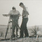
I'm no professional surveyor, but I think they are pretty important. While I was in school, I spent a summer helping a geology professor with a Gravity survey he was doing. He was trying to find buried faults, in odrder to help deliniate aquafers, or groundwater for wells. In order to properly process the gravity data, we had to know the precise locations & elevations of the gravity stations. This was during the days of SA (1997), and the geology department did not have any differential gps gear, so we had to use tradtional transit surveying. All of our surveying was tied into benchmarks. We couldn;t have completed the study without it. From what I understand, in order to do real surveying with a gps, you still have to tie it into a benchmark. BTW, there were several times when we spent most of a day just trying to find a benchmark, just using a datasheet. It was lots of fun. I just wish that I could remember where they all were, so I could log them. When I finally found geocaching and benchmark hunting, I knew it was for me!!!
-
That's the same thing that Nira mentioned in post #9 and explains a lot of what I've noticed. The only other way that basalt can interfere with a compass is from a gravity induced impact.
-
NGS quote: If you did not find the actual marker, then you should enter notes concerning evidence of its possible destruction as text records and select "Not recovered, not found" as the condition of mark See example below.. SG0053 *********************************************************************** SG0053 DESIGNATION - 612 SG0053 PID - SG0053 SG0053 STATE/COUNTY- MI/HOUGHTON SG0053 USGS QUAD - CHASSELL (1975) SG0053 SG0053 *CURRENT SURVEY CONTROL SG0053 ___________________________________________________________________ SG0053* NAD 83(1986)- 47 07 20. (N) 088 34 00. (W) SCALED SG0053* NAVD 88 - 186.155 (meters) 610.74 (feet) ADJUSTED SG0053 ___________________________________________________________________ SG0053 GEOID HEIGHT- -33.80 (meters) GEOID99 SG0053 DYNAMIC HT - 186.184 (meters) 610.84 (feet) COMP SG0053 MODELED GRAV- 980,763.7 (mgal) NAVD 88 SG0053 SG0053 VERT ORDER - FIRST CLASS II SG0053 SG0053.The horizontal coordinates were scaled from a topographic map and have SG0053.an estimated accuracy of +/- 6 seconds. SG0053 SG0053.The orthometric height was determined by differential leveling SG0053.and adjusted by the National Geodetic Survey in June 1991. SG0053.WARNING-Repeat measurements at this control monument indicate possible SG0053.vertical movement. SG0053 SG0053.The geoid height was determined by GEOID99. SG0053 SG0053.The dynamic height is computed by dividing the NAVD 88 SG0053.geopotential number by the normal gravity value computed on the SG0053.Geodetic Reference System of 1980 (GRS 80) ellipsoid at 45 SG0053.degrees latitude (g = 980.6199 gals.). SG0053 SG0053.The modeled gravity was interpolated from observed gravity values. SG0053 SG0053; North East Units Estimated Accuracy SG0053;SPC MI N - 261,140. 7,881,120. MT (+/- 180 meters Scaled) SG0053 SG0053 SUPERSEDED SURVEY CONTROL SG0053 SG0053 NGVD 29 - 186.167 (m) 610.78 (f) ADJ UNCH 1 2 SG0053 SG0053.Superseded values are not recommended for survey control. SG0053.NGS no longer adjusts projects to the NAD 27 or NGVD 29 datums. SG0053.See file dsdata.txt to determine how the superseded data were derived. SG0053 SG0053_MARKER: DD = SURVEY DISK SG0053_SETTING: 36 = BUILDING SG0053_STAMPING: 612 SG0053_STABILITY: B = PROBABLY HOLD POSITION/ELEVATION WELL SG0053 SG0053 HISTORY - Date Condition Recov. By SG0053 HISTORY - UNK MONUMENTED USGS SG0053 HISTORY - 1948 GOOD NGS SG0053 HISTORY - 19960717 MARK NOT FOUND NGS SG0053 SG0053 STATION DESCRIPTION SG0053 SG0053''DESCRIBED BY NATIONAL GEODETIC SURVEY 1948 SG0053''AT HOUGHTON. SG0053''AT HOUGHTON, 68 FEET WEST AND ACROSS A NORTH-SOUTH STREET FROM THE SG0053''NORTHWEST CORNER OF THE DULUTH, SOUTH SHORE AND ATLANTIC RAILWAY SG0053''STATION, 27 FEET SOUTH OF THE SOUTH RAIL OF THE TRACK, AND SET SG0053''VERTICALLY IN THE NORTH FACE AT THE NORTHEAST CORNER OF A BRICK SG0053''BUILDING ACROSS STREET FROM RAILWAY STATION, 1/2 FEET WEST OF THE SG0053''NORTHEAST CORNER AND ABOUT 3 FEET SIDE WALK. SG0053 SG0053 STATION RECOVERY (1996) SG0053 SG0053''RECOVERY NOTE BY NATIONAL GEODETIC SURVEY 1996 (GAS) SG0053''THE BUILDING HAS BEEN RAZED. ASSUMED DESTROYED.
-
"these days"? - the first time I had an ammo can taken and replaced with a cheap container was in late 2004. Cacher clearly came prepared to make the swap, and somehow rationalized doing it. Brought a camo painted large pretzel jar, took my can, left the contents in their piece o' garbage container.... Re geotrail, yep, that's inevitable. You can't really blame cachers for the effects of gravity on earth and plants. You can get out during or near the end of whatever is your high season for caching, and move the can - so the geotrail leads to nada (at least you can do this until someone surrounds your ammo can with micro powertrail every 530ft so that you've got no room to shift...)(then you pull your can and find a new place)
-
Cachers find keys to new mini cooper
TotemLake replied to The finch farmers's topic in General geocaching topics
I own a Mini. I had heard about Mini's long before the new BMW ones. They used to race them on the ice tracks during Minnesota winters. The center of gravity is so low they do not roll over... ever. Your big high center of gravity, "safe" SUVs can be rolled very very easily. Only if you try to drive it like a little car. I've taken SUVs for a ride and they don't tip over nearly as easily as all the urban myths purport. Even the Suzuki that Consumer's Guide purported to be easily rolled a few years back was forced into the roll by wreckless driving that no sane person would do. What I do know is an SUV can turn a little BMW into a VW. -
Cachers find keys to new mini cooper
John E Cache replied to The finch farmers's topic in General geocaching topics
I own a Mini. I had heard about Mini's long before the new BMW ones. They used to race them on the ice tracks during Minnesota winters. The center of gravity is so low they do not roll over... ever. Your big high center of gravity, "safe" SUVs can be rolled very very easily. -
Again, no it is not. Answering questions that can only be done by actually visiting the site of a well-crafted EC is the cacher's virtual signature. A picture requiring a face shot is an ALR, at least according to the new rules. Openly defying the guidelines...this is gonna end well.