Search the Community
Showing results for 'defying gravity 노래방,김천밤의민족화려한밤【KaKaoTalk:Za32】카카오 톡 상담 깜짝'.
-
The All New All New Groundspeak UK Pub Quiz
Pajaholic replied to Simply Paul's topic in United Kingdom and Ireland
Hopefully, the easy bit: A dwarf planet is a body that isn't a satellite of another planet, large enough that its own gravity has made it spherical, yet not large enough to gravitationally pull in everything in its surrounding area. As to how many: I guess the answer depends on how far out you consider the Solar System to extend. Pluto was recently demoted to dwarf planet. ISTR this had something to do with another dwarf planet being found in the same orbit. Ceres is in the Asteroid Belt. So if you consider the Solar System to stop at about the orbit of Pluto, the answer is 8 planets plus three dwarf planets, making 11 in all. However, there are at least two dwarf planets further out than Pluto. So that gives 8 planets plus at least 5 dwarf planets, giving a minimum of 13. That said, I suspect that the answer to this will change in a year or two because 'they' seem to discover new objects in space with monotonous regularity and ISTR conjecture that there could be over a hundred dwarf planets yet to be discovered. This makes sense as it's hard to believe that Ceres is the only body in the Asteroid Belt large enough to be 'gravitationally spherical' and the Solar System beyond Pluto hasn't been fully surveyed AFAICT. -
Thanks. A 'complete' datasheet for the second example is: The NGS Data Sheet See file dsdata.txt for more information about the datasheet. DATABASE = ,PROGRAM = datasheet, VERSION = 8.00 1 National Geodetic Survey, Retrieval Date = January 1, 2012 UA0024 *********************************************************************** UA0024 FBN - This is a Federal Base Network Control Station. UA0024 DESIGNATION - JEFFERSON PIER UA0024 PID - UA0024 UA0024 STATE/COUNTY- DC/DISTRICT OF COLUMBIA UA0024 COUNTRY - USA UA0024 USGS QUAD - WASHINGTON WEST (1983) UA0024 UA0024 *CURRENT SURVEY CONTROL UA0024 UA0024* NAD 83(2007) POSITION- 38 53 23.29463(N) 077 02 11.56258(W) ADJUSTED UA0024* NAD 83(2007) ELLIP HT- -25.045 (meters) (02/10/07) ADJUSTED UA0024* NAD 83(2007) EPOCH - 2002.00 (01/01/02) UA0024* NAVD 88 ORTHO HEIGHT - 7.020 (meters) 23.03 (feet) ADJUSTED UA0024* NAVD 88 EPOCH - 2006.81 UA0024 UA0024 NOTE: NAVD 88 ortho height was determined from prior model GEOID03. UA0024 NAD 83(2007) X - 1,115,141.472 (meters) COMP UA0024 NAD 83(2007) Y - -4,844,303.306 (meters) COMP UA0024 NAD 83(2007) Z - 3,982,786.811 (meters) COMP UA0024 LAPLACE CORR - -2.52 (seconds) DEFLEC09 UA0024 CURRENT GEOID HT- -32.06 (meters) GEOID09 UA0024 DYNAMIC HEIGHT - 7.016 (meters) 23.02 (feet) COMP UA0024 MODELED GRAVITY - 980,097.6 (mgal) NAVD 88 UA0024 UA0024 VERT ORDER - FIRST CLASS II UA0024 UA0024 FGDC Geospatial Positioning Accuracy Standards (95% confidence, cm) UA0024 Type Horiz Ellip Dist(km) UA0024 ----------------------------------------------------------------------- UA0024 NETWORK ACCURACY 0.31 0.25 UA0024 MEDIAN LOCAL ACCURACY AND DIST ( 44 points) 0.62 1.20 29.84 UA0024 ----------------------------------------------------------------------- UA0024 NOTE: Individual local accuracy values and other accuracy information UA0024 are available here. UA0024 UA0024.The horizontal coordinates were established by GPS observations UA0024.and adjusted by the National Geodetic Survey in February 2007. UA0024 UA0024.The datum tag of NAD 83(2007) is equivalent to NAD 83(NSRS2007). UA0024.See National Readjustment for more information. UA0024.The horizontal coordinates are valid at the epoch date displayed above. UA0024.The epoch date for horizontal control is a decimal equivalence UA0024.of Year/Month/Day. UA0024 UA0024.The orthometric height was determined by differential leveling and UA0024.adjusted in April 2010. UA0024 UA0024.Photographs are available for this station. UA0024 UA0024.The X, Y, and Z were computed from the position and the ellipsoidal ht. UA0024 UA0024.The Laplace correction was computed from DEFLEC09 derived deflections. UA0024 UA0024.The ellipsoidal height was determined by GPS observations UA0024.and is referenced to NAD 83. UA0024 UA0024.The current geoid height was determined by GEOID09. (remove sentence) UA0024 UA0024.The modeled gravity was interpolated from observed gravity values. UA0024 UA0024.The dynamic height is computed by dividing the NAVD 88 UA0024.geopotential number by the normal gravity value computed on the UA0024.Geodetic Reference System of 1980 (GRS 80) ellipsoid at 45 UA0024.degrees latitude (g = 980.6199 gals.). UA0024 UA0024.The modeled gravity was interpolated from observed gravity values. UA0024 UA0024.The following values were computed from [current datum/realization, e.g. NAD 83(2007)]. UA0024 UA0024; North East Units Scale Factor Converg. UA0024;SPC MD - 135,774.106 396,829.478 MT 0.99994988 -0 01 22.6 UA0024;SPC MD - 445,452.21 1,301,931.38 sFT 0.99994988 -0 01 22.6 UA0024;SPC VA N - 2,136,780.288 3,626,959.736 MT 0.99995965 +0 54 48.1 UA0024;SPC VA N - 7,010,419.99 11,899,450.40 sFT 0.99995965 +0 54 48.1 UA0024;UTM 18 - 4,306,519.398 323,370.814 MT 0.99998418 -1 16 44.1 UA0024 UA0024! - Elev Factor x Scale Factor = Combined Factor UA0024!SPC MD - 1.00000393 x 0.99994988 = 0.99995381 UA0024!SPC VA N - 1.00000393 x 0.99995965 = 0.99996358 UA0024!UTM 18 - 1.00000393 x 0.99998418 = 0.99998811 UA0024 UA0024|---------------------------------------------------------------------| UA0024| PID Reference Object Distance Geod. Az | UA0024| dddmmss.s | UA0024| HV4442 WASHINGTON MONUMENT 1913 119.205 METERS 10816 | UA0024|---------------------------------------------------------------------| UA0024 UA0024 SUPERSEDED SURVEY CONTROL UA0024 UA0024 ELLIP H (02/12/02) -25.021 (m) GP( ) 4 1 UA0024 NAD 83(1993)- 38 53 23.29439(N) 077 02 11.56216(W) AD( ) B UA0024 ELLIP H (06/29/94) -25.094 (m) GP( ) 4 1 UA0024 NAD 83(1993)- 38 53 23.29440(N) 077 02 11.56215(W) AD( ) B UA0024 ELLIP H (04/04/94) -25.094 (m) GP( ) 4 1 UA0024 NAD 27 - 38 53 22.89700(N) 077 02 12.64600(W) AD( ) 3 UA0024 USSD - 38 53 23.23000(N) 077 02 12.48000(W) AD( ) 3 UA0024 NAVD 88 (08/03/00) 7.02 (m) 23.0 (f) LEVELING 3 UA0024 NAVD 88 (05/07/99) 7.021 (m) 23.03 (f) UNKNOWN 1 2 UA0024 UA0024.Superseded values are not recommended for survey control. UA0024.NGS no longer adjusts projects to the NAD 27 or NGVD 29 datums. UA0024.See file dsdata.txt to determine how the superseded data were derived. UA0024 UA0024_U.S. NATIONAL GRID SPATIAL ADDRESS: 18SUJ2337006519(NAD 83) UA0024_MARKER: Z = SEE DESCRIPTION UA0024_SETTING: 7 = SET IN TOP OF CONCRETE MONUMENT UA0024_MARK LOGO: CGS UA0024_PROJECTION: PROJECTING 91 CENTIMETERS UA0024_MAGNETIC: N = NO MAGNETIC MATERIAL UA0024_STABILITY: C = MAY HOLD, BUT OF TYPE COMMONLY SUBJECT TO UA0024+STABILITY: SURFACE MOTION UA0024_SATELLITE: THE SITE LOCATION WAS REPORTED AS SUITABLE FOR UA0024+SATELLITE: SATELLITE OBSERVATIONS - May 21, 2010 UA0024 UA0024 HISTORY - Date Condition Report By UA0024 HISTORY - 1907 MONUMENTED CGS UA0024 HISTORY - 1907 GOOD CGS UA0024 HISTORY - 1940 GOOD CGS UA0024 HISTORY - 19930909 GOOD NGS UA0024 HISTORY - 19960718 GOOD DMW UA0024 HISTORY - 19980928 GOOD NGS UA0024 HISTORY - 19991122 GOOD NGS UA0024 HISTORY - 20000224 GOOD NGS UA0024 HISTORY - 20000330 GOOD NGS UA0024 HISTORY - 20000510 GOOD NGS UA0024 HISTORY - 20030515 GOOD DMW UA0024 HISTORY - 20051216 GOOD GEOCAC UA0024 HISTORY - 20061111 GOOD USPSQD UA0024 HISTORY - 20081222 GOOD NGS UA0024 HISTORY - 20090319 GOOD GEOCAC UA0024 HISTORY - 20100521 GOOD GEOCAC UA0024 UA0024 STATION DESCRIPTION UA0024 UA0024'DESCRIBED BY COAST AND GEODETIC SURVEY 1907 (OBF) UA0024'JEFFERSON PIER IS A CONCRETE POST ABOUT NW OF THE WASHINGTON UA0024'MONUMENT, VERY NEARLY IN THE LATITUDE OF THE CAPITOL DOME AND THE UA0024'LONGTITUDE OF THE WHITE HOUSE. UA0024 UA0024 STATION RECOVERY (1907) UA0024 UA0024'RECOVERY NOTE BY COAST AND GEODETIC SURVEY 1907 UA0024'RECOVERED IN GOOD CONDITION. UA0024 UA0024 STATION RECOVERY (1940) UA0024 UA0024'RECOVERY NOTE BY COAST AND GEODETIC SURVEY 1940 (TMP) UA0024'THIS STATION WAS RECOVERED. THIS STATION IS LOCATED ON THE W UA0024'SLOPE OF THE MOUND OF THE WASHINGTON MONUMENT, AND IS IN LINE UA0024'WITH 16TH STREET EXTENDED, AND IN APPROXIMATE RANGE WITH THE UA0024'N SIDE OF THE LINCOLN MEMORIAL. IT IS IN A DEPRESSION ABOUT 8 UA0024'INCHES BELOW THE LINCOLN MEMORIAL. IT IS IN A DEPRESSION ABOUT UA0024'8 INCHES BELOW THE GENERAL GROUND SURFACE AND ABOUT 15 FEET IN UA0024'DIAMETER. THE MARK IS ABOUT 2 FEET SQUARE AT BASE AND ABOUT 6 UA0024'INCHES SQUARE AT TOP AND EXTENDS ABOUT 2 FEET ABOVE GROUND. UA0024' UA0024'THIS MARK IS SAID TO HAVE BEEN RAISED FROM TIME TO TIME AS WORK UA0024'WAS DONE ON THE MONUMENT GROUNDS, BUT THE POSITION OF THE UA0024'STATION IS SUPPOSED TO HAVE BEEN HELD EACH TIME. UA0024 UA0024 STATION RECOVERY (1993) UA0024 UA0024'RECOVERY NOTE BY NATIONAL GEODETIC SURVEY 1993 UA0024'THE STATION IS LOCATED IN WASHINGTON, D.C., ON THE WASHINGTON MONUMENT UA0024'GROUNDS AT THE JEFFERSON PIER STONE WHICH LIES ON A LINE EXTENDING UA0024'BETWEEN THE WHITE HOUSE AND THE JEFFERSON MEMORIAL. OWNERSHIP--UNITED UA0024'STATES DEPARTMENT OF THE INTERIOR, NATIONAL PARK SERVICE. CONTACT UA0024'THE NATIONAL PARK SERVICE, TELEPHONE NUMBER (202) 485-9880. UA0024'THE STATION IS A BRASS PLUG WITH A PUNCH MARK, SET IN THE CENTER OF A UA0024'RECESSED CROSS IN THE TOP OF A 2 BY 2-FOOT GRANITE MONUMENT WHICH IS UA0024'INSCRIBED POSITION OF JEFFERSON PIER ERECTED DECEMBER 18, 1804, UA0024'RECOVERED AND RE-ERECTED DECEMBER 2, 1889, DISTRICT OF COLUMBIA AND UA0024'PROJECTS 26 INCHES ABOVE THE GROUND. UA0024'LOCATED 110 M (360.9 FT) WEST-NORTHWEST OF THE WASHINGTON MONUMENT AND UA0024'13.0 M (42.7 FT) SOUTH OF THE SOUTH EDGE OF A 15-FOOT WIDE CONCRETE UA0024'WALKWAY. UA0024'NOTE--PERMISSION MUST BE OBTAINED FROM THE NATIONAL PARK SERVICE TO UA0024'OCCUPY THIS STATION. UA0024 UA0024 STATION RECOVERY (1996) UA0024 UA0024'RECOVERY NOTE BY DAFT MCCUNE WALKER INCORPORATED 1996 (JMS) UA0024'RECOVERED AS DESCRIBED. UA0024 UA0024 STATION RECOVERY (1998) UA0024 UA0024'RECOVERY NOTE BY NATIONAL GEODETIC SURVEY 1998 (RLA) UA0024'RECOVERED AS DESCRIBED. UA0024 UA0024 STATION RECOVERY (1999) UA0024 UA0024'RECOVERY NOTE BY NATIONAL GEODETIC SURVEY 1999 (RWA) UA0024'RECOVERED AS DESCRIBED. UA0024 UA0024 STATION RECOVERY (2000) UA0024 UA0024'RECOVERY NOTE BY NATIONAL GEODETIC SURVEY 2000 (MLM) UA0024'RECOVERED BY NATIONAL GEODETIC SURVEY, RECOVERED AS PREVIOUSLY UA0024'DESCRIBED. UA0024 UA0024 STATION RECOVERY (2000) UA0024 UA0024'RECOVERY NOTE BY NATIONAL GEODETIC SURVEY 2000 (RWA) UA0024'RECOVERED AS DESCRIBED. UA0024 UA0024 STATION RECOVERY (2000) UA0024 UA0024'RECOVERY NOTE BY NATIONAL GEODETIC SURVEY 2000 (RWA) UA0024'RECOVERED AS DESCRIBED. UA0024 UA0024 STATION RECOVERY (2003) UA0024 UA0024'RECOVERY NOTE BY DAFT MCCUNE WALKER INCORPORATED 2003 (JMS) UA0024'RECOVERED IN GOOD CONDITION. UA0024 UA0024 STATION RECOVERY (2005) UA0024 UA0024'RECOVERY NOTE BY GEOCACHING 2005 (WD) UA0024'THE PIER NOW LIES INSIDE A NEW PAVED PATH AND RETAINING WALL THAT UA0024'CIRCLES THE WASHINGTON MONUMENT, ABOUT 60 FEET SOUTHEAST OF THE UA0024'INTERSECTION OF THREE PAVED ACCESS PATHS AND THE CIRCULAR PATH, AND UA0024'ABOUT THREE FEET HIGHER THAN THE CIRCULAR PATH. UA0024 UA0024 STATION RECOVERY (2006) UA0024 UA0024'RECOVERY NOTE BY US POWER SQUADRON 2006 (DEB) UA0024'RECOVERED IN GOOD CONDITION. UA0024 UA0024 STATION RECOVERY (2008) UA0024 UA0024'RECOVERY NOTE BY NATIONAL GEODETIC SURVEY 2008 (DBC) UA0024'RECOVERED AS DESCRIBED. UA0024 UA0024 STATION RECOVERY (2009) UA0024 UA0024'RECOVERY NOTE BY GEOCACHING 2009 (SMC) UA0024'RECOVERED IN GOOD CONDITION. UA0024 UA0024 STATION RECOVERY (2010) UA0024 UA0024'RECOVERY NOTE BY GEOCACHING 2010 (MTT) UA0024'RECOVERED IN GOOD CONDITION. Again, I haven't test this on my program yet, as my code for it is at home. I believe that v2.0 didn't use RegEx for some of the strings, instead using absolute positioning. I think that will mess up the code that grabs the coordinates from the sheet. (And, obviously, it will ignore the 'Country' designation.)
-
Alien Search Party - The 2nd Invasion!
DragonsWest replied to joranda's topic in General geocaching topics
This looks like insanity at its finest. The pull of gravity is strong in that direction... -
800g Black Cat Peanut Butter (Smooth, unsweetend)
The-Eaves replied to The-Eaves's topic in South Africa
Not sure what this has to do with geocaching, but the specific gravity of lead is 11.34, and the S.G. of peanut butter is 1.15. (Peanut butter does indeed sink in water.) The volume of a film canister is 39 cubic cm, so the weight of a canister filled with lead should be 442g, and a canister full of peanut butter will weigh about 45g. (Using the above S.G. of peanut butter, the volume of your jar must be 696ml, if it was filled to the top.) I am so glad that my sleep will now be undisturbed by ruminations surrounding my favorite spread... -
800g Black Cat Peanut Butter (Smooth, unsweetend)
Danie Viljoen replied to The-Eaves's topic in South Africa
Not sure what this has to do with geocaching, but the specific gravity of lead is 11.34, and the S.G. of peanut butter is 1.15. (Peanut butter does indeed sink in water.) The volume of a film canister is 39 cubic cm, so the weight of a canister filled with lead should be 442g, and a canister full of peanut butter will weigh about 45g. (Using the above S.G. of peanut butter, the volume of your jar must be 696ml, if it was filled to the top.) -
Scrabble contest
2oldfarts (the rockhounders) replied to 2oldfarts (the rockhounders)'s topic in Benchmarking
Here is the monumentation code list. Monumentation Code Definition A Aluminum marker other than a disk included elsewhere in table B Bolt C Cap of cap-and-bolt pair DA Astro pier disk DB Bench mark disk DD Survey disk (other agency) DE Traverse station disk DG Gravity station disk DH Horizontal control disk DJ Tidal station disk DK Gravity reference mark disk DM Magnetic station disk DO Disk not specified (see description) DP Base line pier disk DQ Calibration base line disk DR Reference mark disk DS Triangulation station disk DT Topographic station disk DU Boundary marker DV Vertical control disk DW NOS hydrographic survey disk DZ Azimuth mark disk E Earthenware pot F Flange-encased rod G Glass bottle H Drill hole I Metal rod J Earthenware jug K Clay tile pipe L Gravity plug M Ammo shell casing N Nail O Chiseled circle P Pipe cap Q Chiseled square R Rivet S Spike T Chiseled triangle U Concrete post (without other marks) V Stone monument W Unmonumented X Chiseled cross Y Drill hole in brick Z See description You need to look at the datasheet to see the marker code. You could substitute the code letter for the designation letter to score more points. John -
Pictures - Cool Cache Containers (CCC's)
karkess replied to AmishHacker's topic in General geocaching topics
Here's my first attempt at a locking style geocache conatiner. It's obviously pvc and opens like a drive thru banking tube. The end caps slide in and out to lock the door. The bottom just slides out, but the top has a gravity lock and the the cache has to be rotated so the proper letter is facing up before it will slide out unlocking the door. You probably don't need to guess what the eye loop is for on top, it's going high in a tree, yet will be able to be lowered from the ground at a different tree. -
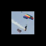
The Geocoinfucius geocoin has been whispering a few words of wisdom for me: The sky is NOT the limit... the ground is. If at first you don't succeed, skydiving may not be for you. He who hesitates shall inherit the earth. Gravity: It's not just a good idea... It's the law! On another jump I filmed Geocoinfucius and other geocoins and travel bugs right after landing. The footage of the geocoins is near the end in the video. On this jump I was filming (but not participating in) a four-way formation skydive. The dive started off bad with a tumbling exit from the plane. Three of the four jumpers linked up, but since the fourth jumper never made it into the formation I flew in at the end and made it a four-way round formation. We passed through some cloud layers during the dive and ended up deploying our parachutes inside a large cloud. We couldn't see a thing until we popped out of the bottom of the cloud around 1,500 feet. Fortunately, the pilot did a great job of putting us out of the plane at the right spot and we were very close to the landing area. We had no problem landing right on target at the drop zone. Here's the video link: And if you liked watching those videos, here are the rest of the jumps (minus the one jump where my video camera malfunctioned): Now this geocoin has tasted the thrill and beauty of flight and knows why the birds sing. Blue skies! Model Citizen - Zero Discipline
-
Part A: 1) Monarch Butterfly 2) Coho Salmon 3) Grey Whale 4) Canada Goose 5) Green sea turtle 6) Arctic Tern 7) North american Caribou Part B LADYBUGS!!! (I love that insect!!!) Ladybugs (also called lady birds or lady beetles) are small, oval-shaped winged insects. These shiny insects are usually red with black spots or black with red spots on the wing covers. The number of spots identifies the type of ladybug. Most ladybugs are less than 1/4 inch (4-8 mm) long. As ladybugs age, the spots fade. There are about 5,000 different species of ladybugs throughout the world. A common species is the two-spotted ladybug (pictured above); it is orange-red with two black spots. The ladybug, like all beetles, undergoes a complete metamorphosis during its life. The life stages of the ladybug are: egg --> larva --> pupa --> adult. These tiny predators (Family Coccinellidae) are helpful in gardens because they eat many garden pests (including mealy bugs and aphids). Birds are the major predator of the ladybug. I heard that there are "farms" now with ladybugs... where you can buy ladybugs to "clean" your infected plants (from the animals that ladybug eats), instead of using chemicals that are bad! I do not know if that is true... but it is surelly a good thinking.... When not flying, the wings are covered by a pair of modified wings (called elytra). When flying, the elytra open up. Like all insects, ladybugs have: 6 jointed legs (black), two antennae (black), and an exoskeleton made of chitin (a material similar to our hair and fingernails). Their three-part body consists of a head (with the mouthparts, eyes, and antennae), thorax (where the legs and wings attach), and the abdomen (containing the reproductive and most of the digestive organs). Ladybugs migrate too! They are mostly in groups and when there is a lack of food and some start to die or a change in the temperature (can not live in low temperatures), their leader takes them in other places! In america ladybugs are migrating to North America in the Summer and in south America in the winter! Four ladybugs were sent into space in 1999 on NASA's space shuttle led by Eileen Collins. Ladybugs and their main food, aphids, were sent to a zero-gravity environment to study how to aphids could get away from the ladybugs without being able to jump using gravity. the greek name of the ladybug is Πασχαλίτσα (paschalitsa). Pascha is Easter!!! Probably that is because of their colour.... red and black... and because they appear when we have Easter... (spring)! It is consider as a good luck if a ladybug lands on you!!! But it is also a bad lack if you throw her away, force her to leave...!!!!
-
Have a question for those of you that like to hang out in Arizona - Apparently, a friend an I will be doing another ghost town/mine photography tour in early September. He wants to stop at the Grand Canyon since he's never been there. Can anyone recommend places along it to go - that are *NOT* overrun by tourists? During the trip, as well as photographing structures that are succumbing to gravity, I will be benchmark hunting, so.. there, see, on-topic.
-
That makes sense. If you take some of these roads at top speed in a lighter vehicle, you may defy gravity.
-
Gravity in effect (Trucks only). As an aside: Why do feel the need to take the mickey out of Ontario all the time.
-
Took back the Sweetwater today and got the Katadyn Hiker Pro. Will report back soon on how well it works for me. Also I am very interested in the new Sawyer inline gravity filter. It has a 1 MILLION (Dr Evil laugh and pinky to corner of the mouth mauahahah) gallon guarantee for the filter.
-
I know this defies the law of gravity, but I never studied law! - Bugs Bunny
-
Oh Gravity, thou art a heartless bitch ~Dr Sheldon Cooper
-
My first thought is... IS that the intended attachment point for the bag? Doesn't sound practical to me. Anyway... could you give the product IDentification... be handy to look it up online to see. I found several but non that had a dome. I'd bet the actual attachment is on the steel somewhere. As to redesigning it... again helps to know what it is... One thing you might consider is some sort of pump and hose (manual or electric) to avoid the lifting and suspending part at all. There are 12 volt water pumps that are for use in travel trailer water systems that might work for you... you don't need a lot to replace a gravity feed flow rate. An advantage to using a pump system is that you might be able to have more water available... i.e. large or multiple reservoirs... how to warm it is up to you though... solar or electric or even fired. If I was going to bother with it, I'd say that some method of recycling used water would be helpful... some you want to let pass, but some you can let run for a bit to lather up... but you want clean to rinse off, right? That could be a simple valving system. Does your 'shower' have storage for drain water or does it escape to the ground... some places don't like direct discharge and need to store grey water for disposal... another factor. Waiting and thinking Doug 7rxc
-
I was looking at the MSDS. Is it just a coincidence that the specific gravity is 1.00?
-
I've noticed that occasionally a cache owner is a little less than diligent in providing correct coordinates for the final - sometimes a puzzle or multistage final has to change location, for example, and the final did not get updated. Or the cache might get relocated by gravity / wind / goats / aliens. Too many possibilities, esp. after Keystone checked That Which Is Not Visible To Us Mere Mortals. Checking the sigs in the paper log is your best bet if you're really curious.
-
In California, where the incident occurred and I practice, the woman's statement would not be a criminal threat (PC 422) -- something that is unequivocal. immediate, specific, with a gravity of purpose, causing sustained fear. It would not be brandishing a weapon (PC 417) since she did not draw or exhibit the gun. Courts distinguish between "true threats" and hyperbole or emotional outbursts (which the laws against threats were not designed to punish). So yes, under some circumstances, a statement about a gun could constitute a threat -- particularly if the person does something in conjunction with it. But in this situation? I don't see it rising anywhere near that level -- although I recognize that we know little about what actually happened.
-
The official website desperately needs an overhaul
nittanycopa replied to Viscus's topic in General geocaching topics
I agree the message system - contacting and adding other users as friends - is very clunky. The messages are pretty vital, IMO, regardless of whether this is perceived as a social activity or no. Messages help us to keep in contact with cache owners, report problems, etc. The Facebook thing...best way to go about this is to add it as an optional dimension in the profile. It shouldn't be integrated with geocaching.com in any manner. Users should be able to add social "contact" options, though, as they can on any other similar profile. And I'm sure that'll still rile up the 'ole anti-Facebook crowd here. You don't use Facebook? Good for you, would you like a cookie for defying the social norm? -
NGS is still utilizing and maintaining data on passive marks for now and is still very interested in the quality of the data in the NGS IDB. The latest version of DSWorld is an attempt to improve on the existing recovery web page, 'http://www.ngs.noaa.gov/ngs-cgi-bin/recvy_entry_www.prl'. The recovery page has no provision for entering hand-held GPS positions, mark LOGOs, State and County corrections, no built-in spelling checker for text, etc. While GPS is an excellent tool for determining horizontal position to the sub-centimeter level, precise orthometric height (elevation) determination with GPS is still in the 2-5 cm range. To improve on this, precise gravity surveys are required (see NGS's GRAV-D program).
-
Here's a link to a diy filter you can make yourself. http://gear-report.com/how-to-make-a-diy-gravity-water-filter-for-backpacking-camping-survival-emergency-myog/ The sawyer filter is supposed to be very good for the price.
-
The National Geodetic Survey and our predecessor agency the U.S. Coast & Geodetic Survey has observed several million individual observations including: triangulation and traverse direction (angle) measurements, high accuracy distances from rods, tapes and electronic (microwave, laser and infrared) measurement system, height differences from leveling, gravity observations and global positioning system vectors. When an data element such as the horizontal position or the orthometric height are designated as "ADJUSTED" that means that the value was determined through a very rigorous analysis of the observations, application of appropriate standard errors and adjustment of these data as part of either a national, regional or local least squares adjustment of the observations. All such observations are maintained by NGS in our database as part of the National Spatial Reference System and are available to the public on demand (we seldom get such requests). The term "ADJUSTED" along with the corresponding order of accuracy provides the user with a level of confidence in the quality of the data element to meet the needs of their surveying/cartographic/GIS applications. We constantly tell users to challenge these data. Many control points are in places effected by a high degree of plate tectonic motion while many, if not most, of the geodetic positions and heights are the result of observtions taken more than 40 years ago and have not been validated by contemporary measurements. Unless a mark has been phyically moved a considerable distance it's not likely that you will detect a significant difference with the resource/recreation grade GPS receivers. The modernization of GPS and development of other constellations such as the Russian GLONASS, European Union GALILEO and Chinese COMPASS will greatly enchance the capability of hand-held devices. Some believe that future receivers may easily achive 10 cm with no augementation (e.g. WAAS, NDGPS).
-
There is one definition of NAD83, but many "realizatons" of it, as shown by the designation in parenthesis. When they do a new realization, they use the best and latest data available for some stations (nowadays CORS station history and VLBI data) and combine it with the original old theodolite observations from the 1930's for other network stations using least squares to get a best fit to make the adjustment. This gets us NAD83(1986), NAD83(1992), NAD83(1996), NAD83(NSRS2007) etc. My tentative understanding of a realization is like a rubber sheet map that wants to be the perfect NAD83, but, since it has to be pinned down to the real world, there is a small amount of stretching where there was observational error. Each later realization has less stretching because it uses better data and is the best estimate available, but still isn't perfect. Vertically we have National Geodetic Vertical Datum of 1929, NGVD29 and North American Vertical Datum of 1988, NAVD88. They are based on leveling runs across the country taken over the last century. They are truly different vertical datums because the definition changed. Basically NGVD29 was a best fit with the data they had for the US in the early 1930's, and NAVD88 was a best fit using additional data in the US and Canada (and maybe Mexico) and fitted to all of North America. NGS is working toward a new vertical system based on GPS measurements instead of the optical leveling runs, but will have to gather a lot more gravity data (search GRAV-D) in order to be able to convert from height above the ellipsoid to orthometric height, which is what we ordinarily use as a measure of elevation. Speaking of which, it would be nice if someone more knowledgeable than me checked and clarified my wikipedia edits of orthometric height and dynamic height.
-
Should reviewers be responsible for 'safety'?
schroeder123 replied to sbell111's topic in General geocaching topics
How would it be a simple matter to limit an electrified cache to individuals that demonstrate proficiency with such hazards? "Here is my cache. Your not allowed to get it unless you show me your electrician certificate." I am new here and I suppose that could be a joke. Also climbing a cliff is indeed an obvious danger. The fact that people fall does not mean they did not understand that gravity exists. They were aware of, and accepted that level of danger, but fell. Most people seem to be saying that they want to be allowed to be free to decide what is too dangerous for them. I understand that point and agree in the vast majority of instances.