Search the Community
Showing results for 'defying gravity 노래방,김천밤의민족화려한밤【KaKaoTalk:Za32】카카오 톡 상담 깜짝'.
-
Gravity. Seriously though, like Tequila says, give them a call. I dropped my 60 in the driveway and broke the battery cover. They sent me a new cover no charge, and the unit was around 3 years old. They didn't even ask how long I had it.
-
Article in 'Government Computer News' about the NGS and benchmarks...
Bill93 replied to mikeb226's topic in Benchmarking
Horizontal (e.g. triangulation station) marks are still sometimes useful but not as necessary as they once were before GPS. True (elevation) benchmarks are still required for many purposes because GPS (ellipsoid) height is not the same kind of (orthometric) elevation needed for real-world work. It will be another 8-10 years according to the GRAV-D plan before they have enough gravity data to let GPS data be converted to orthometric at the accuracy required for many purposes. -
Had a great day caching yesterday. I logged a few more finds, discovered some really cool places in my town that I never knew about (there's a Gravity Hill--where your car will coast UPHILL from a stop when in neutral), and found my first Travel Bug! Then my daughter came home from a week at Grammy's and came with me on a quest for the first time. Even the dog is benefiting from my new pastime--I'M wiping her out. Now, every time I head toward the door, she jumps up and gives we that eager, excited look. I just know she's thinking "Are we going caching?" Today's forecast calls for rain, which took the wind out of my sails for a bit, until I concluded, "so what--Going out caching anyway." We don't really have appropriate raingear, but it's more like a light, steady rain versus a downpour. We won't melt.
-
I reckon about 50,000 years. I've been out of the astronomy scene for a while - last time I heard the highest speed a spacecraft has reached is about 18km/s. At that speed, and ignoring slowing down effects of the sun's gravity, it'll take around 70,000 years. I presume the Helios is somewhat faster, and a gravity assist by Jupiter will do wonders for it.
-
Has anybody seen a discussion of how they converted GPS height above the ellipsoid into orthometric height above the geoid? How well can they trust the geoid (gravity) model on top of a mountain that probably hasn't had a direct gravity measurement? And is it NGVD29 or NAVD88?
-
Check the logs on this cache. Previous people to find it claim it is rather death defying. Very popular amongst highly experienced cachers (8000 finds and up) http://www.geocaching.com/seek/cache_detai...17-1459fd2e51cb
-
The Jeep is high to manage the potholes and ruts commonly seen on our forest service roads. To try to treat it and turn it like a sports car (certain turns) is ridiculous. Its the same old argument that went into how unsafe the Samurai was by proving it couldn't handle sports car like turns just to prove a point. It wasnt unsafe until it was handled like a low ground clearance sports car instead of a mini SUV. Simply, you must drive the conditions you're faced with, but you must also drive the vehicle the way it was designed. Depending on where you intend to drive, plan your purchase accordingly. I agree with everything you said, especially the last paragraph. I was trying to point out that she picked the two extremes of center of gravity. The "certain turn" is the "S" turn seen on the 60 Minutes show on Jeeps, not a sports car turn. You do a wide turn one way followed by a sharper turn the other way. Every Jeep owner should know about the show or at least about the S turn. I have logged a lot of Jeep time in the north woods of Minnesota.
-
I own a Mini so I am biased. The old Mini was modified by John Cooper to make the Mini Cooper rally car. To say the Mini Cooper is bad on back roads when it has won several rallies is kind of absurd. The Jeep is the opposite of of a Mini when it comes to center of gravity. The Jeep is so high that you can roll it over by making a certain kind of turn. You can't roll a Mini. That said, I have bottomed out on speed bumps and parking lot and driveway ramps. I own a Mini because I like to drive. I kind of grind my teeth when people say it's cute(sorry). I would like to have Jeep too, though. A real dilemma. Good luck.
-
The Katadyn Vario and MSR Sweetwater, among others, are decent choices. Definitely make a trip to REI or an outdoor store that will let you try out the different models available. While the principle is the same, they all work a little differently. Some you pump, some you crank, others are gravity fed. No these aren't always light weight, but you have to consider the amount fuel you would just for boiling water.
-
Have to agree with Shiraz-Mataz, the Vario may be a good bet at group hikes, as it dispenses (up to) two quarts of water per minute. May even get by with a Gravity bag/filter like Katadyn's Base Camp model. A slower unit, but holds two-and-a-half gallons of water. Hey, you're takin' a break anyway... We use a Katadyne Hiker. Only the two of us normally, so (up to) a quart per minute is break time. If the water looks iffy, we always drop in a Katadyn Micropur tablet - just in case.
-
Latest OpenStreeMap UK Garmin Mapsets...
needaxeo replied to talkytoaster's topic in United Kingdom and Ireland
I was very impressed that these maps navigated turn-by-turn around Milton Keynes Redway. I wasn't expecting it (and I'd been googling around for some kind of "sustrans in garmin format" without much success) Most of the caches we've done have either been local or on country footpaths, and I've overlayed an OS custom map at 1:50k of most of the area the PQ "500 nearest" covers, and I'd just been looking for the footpath using the 'as the crow flies' line between me and the cache to get the direction. On Sunday, I decided to go and find a few caches I could cycle to. I was sat on my bike at Caldecotte lake and I hit 'recalculate on road' just for laughs, to see what death defying route via MK's roundabouts and dual carriageways it would give me. Instead I got 'go E on trail to redway...' and a complete off road route (bar a couple of very quiet side streets / cul-de-sacs) I had to use a bit of intelligence to navigate back across MK towards home (It wanted to send me down the road to LB) but once I'd navigated back to Caldecotte Lake it sent me down the canal towpath. -
Earthquake Moved California City 31 Inches
Juicepig replied to FunnyNose's topic in General geocaching topics
The earths diameter and gravity distribution also shifted (as they do every earthquake) The GPS system normally needs to be adjusted after every major earthquake -
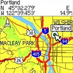
The Coast & Geodetic Survey began long ago finding elevations of bench marks and latitude/longitude of other points (loosely called benchmarks here but not by professionals). In the 1930's a major push was made to connect the whole country into one elevation network and one lat/lon network so everybody was working off the same system. Elevation measurements require setting up an instrument about every 200 yards, reading the height on a rod behind, and the height of a rod ahead (oversimplified). Then the level instrument is moved up and the process repeated. This means it was easiest to follow a reasonably level path without excessive vegetation, and railroads and roads were the obvious paths to use. For horizontal lat/lon, most of the measurement was done by theodolites taking angles to various positions in all combinations, with typical sight lines of a few to 20 miles. The obvious places were hilltops, with additional sights to "intersection stations" like towers and water tanks. The primary network maps look like a fish net stretched across the country. Your highway happened to fall close to where they wanted a path in the mesh. After the field measurements were done, it took years of manual computation to tie all the data together into the best estimate of all the elevations and positions. Somewhere on the ngs web site under About NGS/history you can find stories and pictures of the history of these operations and maps of the progress. Today the elevation bench marks remain very important reference points for all types of construction, drainage, and flood control work. GPS cannot yet adequately replace them because GPS knows almost nothing about variations in gravity from place to place and elevation is based on gravity (it is preferred if water runs downhill). Horizontal marks are less important than they used to be, but are sometimes still useful and certain selected ones are very important references for the whole network.
-
Thanks Russell. The mountains in that whole region are very distinctive. They are great for hiking but can be treacherous climbing because the rock is very crumbly. Here is an easy one but for me was very poignant considering the gravity of the circumstances surrounding it.
-
I just realized that while my new Nokia Nuron (5230) does not support the Geocache Navigator app my husbands Samsung Gravity 2 does...do you think that would be a good option to try as far as GPS or will that just confuse me even more? TIA
-
Sitting in a pub a few years ago I was watching one of these shows on what was formerly known as Outdoor Life Network (it's called something else now, hype, extreme, wossname) There was a home video of a big ol' hopped up Suburban with a ratted out motor trying to go up what looked like a 25% grade - it made it about half way and the rear axle snapped. There was a slight pause then it started rolling back down hill, then tumbled and shed windows, doors, wheels, etc. until at the bottom of the climb about all that came to rest was what looked like the carcass of a stripped vehicle. I can see a 4x4 for going over rough terrain, but I could never understand taking a vehicle with a high center of gravity up a steep grade. Heck, I had to remove the 32 sprocket from my mountain bike cassette because whenever I accidently shifted into it on steep climbs I would flip!
-
Just to add my two pence to the mix: I recently found a cache that nobody had looked for in a year. It was lying upside down in the open on the side of a steep hill. Clearly it was supposed to be tucked among the tree roots beneath the overhang about 5 feet above where it was. That's where I put it anyways, rather than back in the open where it would surely continue its gravity-assisted migration down the hill. One of my hides was placed at the bottom of a small tree. Last time I checked on it, it was at the top of the small tree. I put it back at the bottom. No big deal. So, there may be cachers who deliberately replace caches in the wrong spot, but I think most cache movement is due to a slow incremental migration, or muggle and Mother Nature activity. Cache migration is a fascinating phenomona. I may have to apply for a huge government grant and devote my time to some serious field research.
-
Is there cheating in geocaching ?
4wheelin_fool replied to TeamSeekAndWeShallFind's topic in General geocaching topics
Off the rails we go... You may joke, but there is an entire field of social scientists who look at society in this way. The idea is that society has a "genome" which involves "memes" instead of "genes", and the societal genome evolves over time. Actually the internet has been a fascinating laboratory in which to study memetics. The instant connectivity has lead to very rapidly spreading memes that have actually taken over popular culture at times. What is really interesting is to look back at our history and see these memes play out through oral and written communication over tens or hundreds of years instead of the days and months it takes now. I wasnt joking. I only added the smile to give the post less gravity. Memes are pretty facinating, as well as watching trends come and go. People tend to pass along many memes without realizing it. Some people will do things based on unconscious interpretations of other memes. Take littering for example, there was a study that I read about how existing litter will rapidly trigger an increase in an area where there is alot of litter already. Areas which are pristine, rarely trigger someone to toss garbage. Although there are people who will always litter, and others who will never litter, the majority of litterers are varied based on how much garbage is out there. They are more likely to toss something out the window if the area is dirty already. They base their decisions on percieved notions of other people. When they do that, there is a fair amount of non-thinking involved, as if they are not really aware of their own actions, but rather having a meme eliciting some control over them. Another study showed that graffiti in an area will eventually trigger a rise in crimes. A bicycle left unattended in a spot where the researcher added graffitti is more likely to be stolen, than in the same spot without any graffiti. Percieved respect has something to do with it, but there is memes at work also. Violent crime rates will often rise in spots where there is little control over small crimes. There are negative and positive memes which trigger actions, but at the same time imply that often people really do not have much independent thought and follow impulses sent out by others. Trends work the same way. The more people you see following a trend is more likely to influence you to follow it. Sometimes it's in word usage. Some words and grammar specifically are used in certain fields, but when introduced into another area, eventually will become a part of the vocabulary. Every action triggers a reaction somewhere. Many people do not realize that what they do is based on someone else's influence, and may in turn, be influencing others.. -
What's the breakdown now? I think - at least every Province now has an Earthcache - E Cape still a little shy. Lets see these stats and this will probably show why the WC and KZN guys are lagging. Definitely seems to be a NW/GP and MP centre of gravity now - although hennieventer shot the stats up in the north.
-
Manchester Airport Geocache Exclusion Zone
badger replied to Deceangi's topic in United Kingdom and Ireland
Being of the genous 'blunt speaker' - may I respectfully suggest it's not the words "lack of communication" that are in question - but your total inability to comprehend the gravity of your rather immature actions; or in reallity, your non actions. Just put your hands up (pun intended) and admit - your response was totally unjustified and does put geocaching members of the public , in a very embarrassing , if not DANGEROUS situation. Beside that - the more you protest - the bigger twit you are seen to be ..... Move on - Nice one Rutson .. Badger needs all the friends he can get at the moment As we are speaking bluntly, you are a typical Forum Troll, why don't you go back under your bridge where all good Trolls should be... I understand the need and the reasoning for the exclusion zone, that is not the issue, it is the fact Groundspeak or their representatives did not successfully communicate with the cache owner bere jumping in feet first and leaving incorrect accusations on the cache page. The cache and original placement of the cache were well within the guidelines, and still are. Had I received the contacts regarding the imminent exclusion zone I would have removed and archived the cache, that is not in question. I now realise once again why I stopped using the forums so much, it was because of the keyboard warriors such as yourself! And I don't need to add a silly rolling eyes emoticon to disguise a sarcastic comment. -
Manchester Airport Geocache Exclusion Zone
The Syllogiser replied to Deceangi's topic in United Kingdom and Ireland
Being of the genous 'blunt speaker' - may I respectfully suggest it's not the words "lack of communication" that are in question - but your total inability to comprehend the gravity of your rather immature actions; or in reallity, your non actions. Just put your hands up (pun intended) and admit - your response was totally unjustified and does put geocaching members of the public , in a very embarrassing , if not DANGEROUS situation. Beside that - the more you protest - the bigger twit you are seen to be ..... Move on - Nice one Rutson .. Badger needs all the friends he can get at the moment -
doesn't that only relate to points between two stellar objects (such as sun/earth or earth/moon), and not to points relative to only one stellar object (such as a certain longitudes of the earth)? That's what I understand a Lagrangian point is too. The wikipedia explanation of "Libration" doesn't seem to apply either.http://en.wikipedia.org/wiki/Libration As a guess it might be that variations in the earths gravity (due to mass concentrations) might cause satellites to be attracted to certain points in the orbit.
-
Without gravity observations there would be no way that NGS (USC&GS) could provide accurate heights (bench marks) for the country. These observations are vital to the proper reduction of leveling observations. They are also an important part of the horizontal component of the reference frame as they help in the determination of what's call the Deflection of the Vertical. This allows for the accurate determination of the relations between the Earth's gravity field and the determination of coordinates on a mathematical reference surface -- the ellipsoid. NGS is currently involved in a historical undertaking to observe gravity from space platforms (GRACE, GOCE), airborne, absolute, marine and relative measurements to form the foundation for a new national vertical datum based purely on gravity data- bench marks from NGS will become a thing of the past. This effort is describe in detail on the NGS web site (http://www.ngs.noaa.gov) and search for GRAV-D (Gravity for the Redefinition of the American Vertical Datum)
-
Two years ago I found a benchmark in Great Falls Montana that had a Marker Type listed as "gravity station disk" The disk read "International Gravity Station University of Wisconsin" as was stamped "Great Falls B". So what is an International Gravity Station? Didn't notice any changes in gravity in the area []
-
Well, as a score, yes it's meaningless...but as a history of what I've found, it's great. Exactly!! The found count has been rendered meaningless for years, when comparing finds to another cacher. I can't compare my finds to the "NGA placement team" no more than I could to someone who "attended" a single event 125 times Higher numbers unconsciously imply more power, despite whether they have meaning or not. They also have a subconscious gravitational effect. Even if they individually have no apparent gravity, together they have mass. A numbers cacher is like a planet attracting satellite cachers. Don't be blinded, it's completely scientific.