Search the Community
Showing results for 'Garmin Communicator windows 10'.
-
If you would like to take some time to test, here is an instruction on how you can do it: You can also take advantage of geocache photos on your Garmin handheld, JPEG only, need to be placed on the handheld’s mass storage in the following manner: Photos \Garmin\GeocachePhotos\Last Character\Second To Last Character\Full Code\ Spoiler Photos <Photos Path>\Spoilers\ For example, photos for a geocache with code OXZTXGC would be placed under the path \Garmin\GeocachePhotos\C\G\OXZTXGC\ And spoilers would be placed under \Garmin\GeocachePhotos\C\G\OXZTXGC\Spoilers If the geocache has only three characters total, a 0 (zero) is used for the second to last character. For example, photos for a geocache with code OXR would be placed under the path \Garmin\GeocachePhotos\R\0\OXR\
-
As I mentioned above, I use my phone if I want to see images for a cache and have never tried to figure out a way to port them to my 66. There is no \Garmin\GeocachePhotos\ folder in the GGZ files I generate using GSAK, and I'm not aware of a way to create one using that method. I'm sure you could manually add such a folder, but I'm not sure how you would properly access any images you put in it on the device.
-
Were you able to import the photos of caches to the 66? Can you check if you have a \Garmin\GeocachePhotos\ folder and if you can display photos as a description for geocaches?
-
I don’t own a 67. However, I own a 66 that most definitely supports GGZ, and its manual also omits any reference to GGZ: https://www8.garmin.com/manuals/webhelp/gpsmap66i/EN-US/GUID-7A0A0748-A379-4FE5-9D3A-277C4B406A1E.html
-
Did you upload GGZ files to GPSMAP67? the documentation says that GGZ is no longer supported https://www8.garmin.com/manuals/webhelp/GUID-5724F4C0-7557-4C51-BF07-54A567FA4600/EN-US/GUID-7A0A0748-A379-4FE5-9D3A-277C4B406A1E.html BTW GGZ may contain a \Garmin\GeocachePhotos\ folder structure with photos
-
I got a new GPSr: Garmin Etrex 32X. My old GPSr: Garmin Etrex 30X. On the Etrex 30X, when I uploaded my POIs, they would show on the map. With the Etrex 32X, they do not show on the map. How do i get them to show on the map?
-
I have created and named a list that I can see in both the Geocache App and on Geocaching.com, I can also see the list exists on my Garmin 67i but when I press enter on the list the list is highlighted as not synced, when I enter the list it gives me the option to sync, when I press enter it seemingly starts to sync then on page stating Basic geocache details downloaded with continue highlighted at the bottom of the screen, when I then press enter it takes me back to the original list which states not synced and I have to start all over again and this then becomes a continuous loop, can anyone help me get out of this madhouse please ? If it helps I can download photos of each of the screens !
-
To answer the question: any model which supports Garmin Live can do that. Some of the models are: eTrex SE, Oregon 7xx, Montana 7xx
-
I looked at a couple of your logs. If you would limit you comments to finding the cache you wouldn't need such a Garmin.
-
Jusr for you: Hi. Is there a Garmin device that supports adding longer text than "Found it"? Where I can enter a long text, log, that I always use to log the geocache. Well thank you.
-
No, nothing moved. The only reason I considered changing anything is because when the second correct coordinates are determined they show when plotted on the Direction to cache map they show at a wrong spot. And apparently for some also on the tool they use to find the coordinates -- iPhone , Garmin etc. BUT some have found it and said coordinates are okay. I recently found a puzzle cache description with a puzzle which gave me ideas. Maybe leave as a multi and tweak the description
-
Retrieve waypoints to create a cache from the Montana 700i.
HHL replied to RonGerth's topic in How do I...?
Actually this averaging should be done on the Garmin unit itself whilst creating the waypoint. Re: Pulling the waypoints: Set your unit's USB connection to "Mass Storage Mode". Re: GSAK support: just use another supported Montana unit in GSAK's settings. Hans -
Retrieve waypoints to create a cache from the Montana 700i.
HHL replied to RonGerth's topic in How do I...?
That's definitely wrong. You may open any GPX waypoint files from GSAK's gui. There are macros to fetch waypoints from Garmin units as well. Happy Learning Hans -
Retrieve waypoints to create a cache from the Montana 700i.
StefandD replied to RonGerth's topic in How do I...?
GSAK is a geocache database, not a waypoint database. It does support Montana (I use one myself) but only for geocaches. To retreive waypoints, you need a program like Garmin BaseCamp, EasyGPS, or any other program which supports gpx files. There are even online solutions, like Garmin Explore. You can find the waypoints you created in the folder \Garmin\GPX\ on your Montana. The file name contains the date you created the waypoints. -
I'm not sure if that's a declarative or interrogative statement, but perhaps is would be more appropriate in a group where the native language is closer to your native one. (Sorry. That's not judgmental; it's just statistics based on our readership/participation..) This group is dominated by English speakers. Your best chance of getting help - or getting appreciation if you're giving help - is to communicate in English, even if that means using something like translate.google.com. I think you're asking if any Garmin can record a default 'found it' long with additional text. If that's the case, it really is up to whatever software (GSAK, etc.) sits between your GPS and the upload API to search and replace that text on the way.
-
Hi. Existing a garmin device that support add a longer text than "Found it"? Presets log which I always use to logging a geocache. And I can set this log in Garmin too. Thanks
-
You have been hunting caches, and the coordinates are showing up on the cache page. Where have those caches been in relation to the coordinates? Do they always seem too far off, for example? You will almost never end up at "0", but are you guided reasonably close, so that the description and hint help you find it? Keep hunting caches, and get a feel for where the cache is, compared to the coordinates. Hunt caches where you've entered coordinates yourself (such as solutions to puzzle caches). You'll get a better idea about what the coordinates mean, and how to present them on your own cache page. I mark many waypoints of my selected cache spot using my Garmin GPS, and select the consistently closest waypoint. There are Apps and formulas to "average" waypoints, but I've never had trouble using the closest one. You may notice that the coordinates wander around, and tend to settle on a pretty reliable spot. Try some ideas and see how they work for you. One thing I do to test my coords is, I go back several times and try to "find" my spot again, from several directions. To see if I'm consistently close. If I end up in basically the same place every time, I'm confident that my coordinates are OK. If you see cache logs that say your cache is "a little off", believe them. Don't be the Cache Owner where everyone says, "yeah, the coordinates are always wrong". And a great hint can help a lot.
-
No "NM", when not finding a cache?
barefootjeff replied to baer2006's topic in General geocaching topics
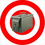
Maybe from the logs of the most recent finders? This ammo can part way down the cliff face isn't missing or broken, even though its owner appears to have left the area in 2010 and isn't even in the country now. Yet it's had two earlier DNFs, both of which explained that they hadn't actually descended the cliff. We should be reading the logs, not just counting them. There's always a possibility a cache could be missing or broken, even if the CO checked it yesterday. I'd much rather have a cache to go out and attempt to find, even if there's a chance it might be gone, than just be sitting at home looking at all the empty space on the map. For the sort of caches I enjoy the most, which usually mean being out in the wilds for most of the day, it's largely immaterial to my enjoyment whether that day ends with a smiley or a DNF, because most of the fun is getting to GZ and the find is just the icing on the cake.
-
Hi, I am an active and premium paying geocacher since 2010... sometimes I do much more caches than I am able to log, at least well detailed logs or concerning fotos... so I upload one foto when I am on site (most likely a selfie as a proof of visit) and later - sometimes weeks or month later - due to work or health issues, and as I finished to sort all my travel-fotos and then I edit my log for are more detailed log or upload some more fotos. Until today it was no problem at all: as for instance there is my found-log from this year june 21. and I select some fotos to upload today in november, all these newly uploaded fotos were finely sorted in, into my gallery with the corresponding date, which is e.g. the 23.06.21. - such my gallery keeps consistent, concerning the dates of chronology of my fotos. But now, with the recent change, these newly uploaded fotos are inserted in the gallery with the TODAY date! And I do not see any way to edit this "image detail" - namely the DATE ... Now you can maybe switch fotos horizontally or vertically or some editing features while uploading (very nice for the ones, who are not able to do these things themself befor uploading the fotos), but you can NOT set the CORRECT DATE - a feature which was available before the change all the time for many years. And such - just btw. - because it was not necessary to choose, because when I added a foto now, e.g. in novemeber, for an existing log from june, the fotos where finely insertet to the approporiate date - the possibillity to change the date of the image detail is NOT there anymore... I am frustrated... changes, to makes things BETTER are fine, thank you for taking care! But changes, taking away well working features simply suck, sorry to say so!
- 273 replies
-
- 16
-
.png)
-

-

-
No "NM", when not finding a cache?
barefootjeff replied to baer2006's topic in General geocaching topics
That cache has already had two DNFs, one in 2010 from someone who got to the top of the cliff but hadn't looked at the description and didn't realise they needed abseiling gear, and the other in 2016 from someone who had the right gear but was thwarted by strong wind. I get lots of DNFs on my caches for all manner of reasons, but out of about 60 only two turned out to be a missing cache. Most of the time, particularly on the more physically challenging caches where there are a lot of ways to not complete the find, DNFs don't mean there's a problem with the cache, they're just a report of an unsuccessful attempt at it. -
No "NM", when not finding a cache?
barefootjeff replied to baer2006's topic in General geocaching topics
I'm not concerned about my caches, although most get few finds these days so if mandatory annual (or even six-monthly) owner visits were introduced I'd likely just archive the more remote ones and retrieve them during the cooler months. No, my concern is more for the old-fashioned high-terrain caches like the 5/5 abseiling one I visited with my friends a couple of weeks ago. It was placed in 2006, with an OM log a year later saying they'd upgraded it from a plastic pot to an ammo can, but no owner logs since and the CO's more recent finds suggest they left the area in around 2010 and, with their most recent (and only find since 2020) in Italy, they might not even still be in the country. That cache is inside a crack 15 metres down a vertical cliff and, not surprisingly, was still in pristine condition when my friends made their find, which they said is one of the best caches they've ever done. It, like most of the other remote ammo cans (or similar) around here with or without active owners, doesn't need constant maintenance to keep it in good condition, and will likely remain in good condition of its own accord for decades to come. Had the owner done the "right" thing and archived it when they presumably left the area in 2010, none of those who've found it since would have had that memorable experience, instead it just would have become more empty space on the map. I'm sure my friends are glad they didn't. I find it frustrating when I look at the map and see just empty space, or a trail of roadside micros, where there used to be a good smattering of scenic and challenging caches like these. A month or so back I did a bunch of kayaking caches with my friends along a stretch of river in southern Sydney. A few of the caches were missing and some had wet logs but, hey, it didn't matter, it was still a great day out. The CO might no longer be active or responsive but it's still better than sitting at home staring at a blank map.
-
Garmin 750i or 67i (or eTrex 32x)
TOW Vehicle replied to TheDexterTeam's topic in GPS technology and devices
Recently purchased the Garmin 700i w/o the camera and am happy with it's functionality and accuracy in Geocaching. In our case, THERE IS A LOT TO LEARN coming from an old Magellan Explorist 710 is through. Main reason for the purchase is; the size of the screen for these ole eyes and the iN Reach capability during many off road events/travels should something happen to us. My saved off road tracks (in GPX format) do load right up also the the 700i. Routes that I hand made on Vantage Point (from Magellan) may not load up w/o conversion to some other source though. Don't know yet really. Base Camp wants to be a PIA to load too. We still use the phone to load FOUND remarks as a faster way to move on. Again, that learning curve comes into play but the 700i will work when there is no cell service I believe. Best wishes either-way, you decide! -
oregon 550 compatible with garmin express
Mockingbird559 replied to dahollander's topic in General geocaching topics
I just updated my Oregon 550 a couple of weeks ago. No problems using Garmin Express. That software is pretty much mature so updates would be minimal. I have been generally pleased with my 550. Also had a 450 which was ok but I found I wanted a camera more than I thought I would so I gave it away and use either the 550 or my 750T. On the 450 and the 550 fur sure, the rubber on off button can wear severely to the point of possibly leaking or cracking and wearing away completely. I accidentally found a makeshift replacement part on ebay. Kinda pricey, over $25 but it does work with the right glue. I think the one I bought came out of Russia so it can take a while to arrive. I think it is from a 3D printer but that doesn't seem to be a problem. Also thanks for the reference link to Oregon gps. I have not seen that one. cache happy -
oregon 550 compatible with garmin express
kunarion replied to dahollander's topic in General geocaching topics
Yes, placing files directly is an option. Plug it into USB, and it becomes a USB drive. Navigate to [Drive:]/Garmin/GPX, and remove any obsolete files, copy new GPX files. Bunch of info on using Garmin Oregon GPSs is here: https://www.gpsrchive.com/Oregon x00/index.htm -
oregon 550 compatible with garmin express
kunarion replied to dahollander's topic in General geocaching topics
Yes, you should be able to set it up for Garmin Express, to use the web site's "Send To Garmin" feature, and to get software updates (if any). It's convenient, but I almost always manually delete and add GPX files instead. Just look at all the posts around here for "Send To Garmin doesn't work", and you'll understand why a more direct process is better. The 550 has nice readability in full sun. If it's cloudy and dark, I often left the backlight on, to make the screen easier to see. The 550 is a little slower and has fewer features than the more modern models. But I've kept mine even after upgrading. It's perfectly good for Geocaching. You can customize and personalize it just the way you like. Will you be able to test it before purchase? The USB connector is secured mainly by solder to the circuit board, and can fail. It's good to ensure it can connect to a PC.


.png)


.png)