
Search the Community
Showing results for '밤의시대defying gravity 노래방[TALK:Za32]'.
-
I'm going to guess that the link is not secure (http://) and thus Chrome blocks the download attempt. Obviously the solution is for the engineers at HQ to update the e-mail template to use a secure link, because Geocaching.com can definitely talk https://. For now the easiest way to get your results is going to be to download through the Pocket Queries page. Namely: Open https://www.geocaching.com/pocket/default.aspx. Click "Pocket Queries Ready for Download" Download the appropriate query. Alternatively, you can: Right-click "Download now" in the e-mail. Click on "Copy Link URL" Open a new tab, and paste the URL. Before you hit enter, make sure that the URL that you pasted begins "https://" (note the "s").
-
Hi i want to activate one of those geocoin. Can, someaone please, tell me where should i go to get the activation code. PL
-
I can't seem to get my new (Christmas gift) Garmin 76CS Plus gps to (Interface) send lat. or long. to my new Raymarine DS 500 X fish finder. On their own, they both work perfect, but I am at my witts end and I need some help. I have read both owner's manuals from cover to cover and it seems to be so easy to make the gps send text to the fishfinder. I have hooked everything up the right way ( I Think), I set the gps to send NMEA text and the fishfinder to receive NMEA in. The Garmin gps only has four wires out of the power/data cable ........... {Red=Power} {Black=Ground} {Brown= Serial Data Out} {White=Serial Data In}.......... The Raymarine fishfinder has alot more wires, Seven to be exact..........{Red=Power} {Black=Ground} {White=NMEA Input+} {Green=NEMA Input -} {Yellow=NEMA Output+} {Brown= NEMA Output -} {Grey=CGND}. I used the {Brown, Serial Data Out} wire on the gps and hooked it to the {White, NMEA Input+} on the fishfinder and nothing happend. Do anyone of you know what I'm talking about? I need some interfacing help here. I will try to talk to Raymarine after the holidays if I still need to, but they are vacation till Jan. 2nd.
-
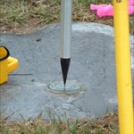
Could be this one except that the stamping is supposed to be 'ASTRONOMICAL STATION' - it is destroyed, however.. TT1521 *********************************************************************** TT1521 DESIGNATION - ASTRONOMICAL STATION TT1521 PID - TT1521 TT1521 STATE/COUNTY- AK/VALDEZ-CORDOVA CENSUS TT1521 COUNTRY - US TT1521 USGS QUAD - VALDEZ D-4 TT1521 TT1521 *CURRENT SURVEY CONTROL TT1521 ______________________________________________________________________ TT1521* NAD 83(1986) POSITION- 61 57 16.08712(N) 145 18 13.67771(W) ADJUSTED TT1521* NAVD 88 ORTHO HEIGHT - 314.413 (meters) 1031.54 (feet) ADJUSTED TT1521 ______________________________________________________________________ TT1521 LAPLACE CORR - -0.49 (seconds) DEFLEC12A TT1521 GEOID HEIGHT - 13.95 (meters) GEOID12A TT1521 DYNAMIC HEIGHT - 314.837 (meters) 1032.93 (feet) COMP TT1521 MODELED GRAVITY - 981,929.2 (mgal) NAVD 88 TT1521 TT1521 HORZ ORDER - SECOND TT1521 VERT ORDER - FIRST CLASS II TT1521 TT1521.The horizontal coordinates were established by classical geodetic methods TT1521.and adjusted by the National Geodetic Survey in July 1986. TT1521. TT1521.The orthometric height was determined by differential leveling and TT1521.adjusted by the NATIONAL GEODETIC SURVEY TT1521.in June 1991. TT1521 TT1521.The Laplace correction was computed from DEFLEC12A derived deflections. TT1521 TT1521.The dynamic height is computed by dividing the NAVD 88 TT1521.geopotential number by the normal gravity value computed on the TT1521.Geodetic Reference System of 1980 (GRS 80) ellipsoid at 45 TT1521.degrees latitude (g = 980.6199 gals.). TT1521 TT1521.The modeled gravity was interpolated from observed gravity values. TT1521 TT1521. The following values were computed from the NAD 83(1986) position. TT1521 TT1521; North East Units Scale Factor Converg. TT1521;SPC AK 3 - 886,047.927 536,529.966 MT 0.99991634 +0 36 52.0 TT1521;UTM 06 - 6,870,270.322 588,967.693 MT 0.99969696 +1 29 49.6 TT1521 TT1521! - Elev Factor x Scale Factor = Combined Factor TT1521!SPC AK 3 - 0.99994862 x 0.99991634 = 0.99986496 TT1521!UTM 06 - 0.99994862 x 0.99969696 = 0.99964559 TT1521 TT1521: Primary Azimuth Mark Grid Az TT1521:SPC AK 3 - KLUTINA 182 08 47.5 TT1521:UTM 06 - KLUTINA 181 15 49.9 TT1521 TT1521|---------------------------------------------------------------------| TT1521| PID Reference Object Distance Geod. Az | TT1521| dddmmss.s | TT1521| TT1523 KLUTINA APPROX. 0.7 KM 1824539.5 | TT1521|---------------------------------------------------------------------| TT1521 TT1521 SUPERSEDED SURVEY CONTROL TT1521 TT1521 NAD 27 - 61 57 17.80100(N) 145 18 05.97600(W) AD( ) 2 TT1521 NGVD 29 (??/??/92) 312.40 (m) 1024.9 (f) COMPUTED 1 2 TT1521 TT1521.Superseded values are not recommended for survey control. TT1521 TT1521.NGS no longer adjusts projects to the NAD 27 or NGVD 29 datums. TT1521.See file dsdata.txt to determine how the superseded data were derived. TT1521 TT1521_U.S. NATIONAL GRID SPATIAL ADDRESS: 6VWP8896770270(NAD 83) TT1521 TT1521_MARKER: DS = TRIANGULATION STATION DISK TT1521_SETTING: 36 = SET IN A MASSIVE STRUCTURE TT1521_SP_SET: PIER TT1521_STAMPING: ASTRONOMICAL STATION TT1521_STABILITY: B = PROBABLY HOLD POSITION/ELEVATION WELL TT1521 TT1521 HISTORY - Date Condition Report By TT1521 HISTORY - 1911 MONUMENTED CGS TT1521 HISTORY - 1941 GOOD CGS TT1521 HISTORY - 1949 GOOD USGS TT1521 HISTORY - 1949 GOOD USAF TT1521 HISTORY - 1952 GOOD CGS TT1521 HISTORY - 1964 GOOD CGS TT1521 HISTORY - 1964 GOOD CGS TT1521 HISTORY - 1966 DESTROYED CGS TT1521 TT1521 STATION DESCRIPTION TT1521 TT1521'DESCRIBED BY COAST AND GEODETIC SURVEY 1911 (ES) TT1521'THE STATION IS ABOUT 18 METERS W OF THE TRAIL GOING N AND ABOUT 100 TT1521'METERS N OF THE KLUTINA RIVER. TT1521' TT1521'STATION IS MARKED WITH A CONCRETE PIER 14 BY 26 INCHES ON TOP AND TT1521'PROJECTING 34 INCHES ABOVE GROUND. THE BASE IS 2 FEET IN THE GROUND TT1521'AND SOMEWHAT LARGER THAN THAT PART OF THE PIER THAT PROJECTS ABOVE TT1521'THE GROUND. A COPPER DISK TRIANGULATION STATION MARK WITH THE WORDS TT1521'ASTRONOMICAL STATION STAMPED ABOUT THE TRIANGLE IS SET IN THE TT1521'TOP OF THE PIER. TT1521 TT1521 STATION RECOVERY (1941) TT1521 TT1521'RECOVERY NOTE BY COAST AND GEODETIC SURVEY 1941 (ANS) TT1521'STATION RECOVERED, MARK FOUND TO BE IN GOOD CONDITION. THE ORIGINAL TT1521'DESCRIPTION IS NOT ADEQUATE AT PRESENT, THE FOLLOWING IS TO BE USED. TT1521'THE STATION IS IN THE THIRD JUDICIAL DISTRICT, ABOUT 1/4 MILE W OF TT1521'THE COPPER CENTER ROAD HOUSE, 65 FEET W OF THE CENTER LINE OF THE TT1521'RICHARDSON HIGHWAY, ABOUT 75 YARDS N OF A TIN WAREHOUSE OF THE TT1521'ALASKA ROAD COMMISSION, AND ABOUT 130 YARDS N OF THE KLUTINA RIVER. TT1521'(THE KLUTINA RIVER HAS CHANGED ITS COURSE SINCE THE ORIGINAL TT1521'DESCRIPTION WAS WRITTEN.) THE MARK IS AN OLD TYPE TRIANGULATION TT1521'DISK, INSCRIBED ASTRONOMICAL STATION, SET IN THE TOP OF A CONCRETE TT1521'POST 14 INCHES WIDE, 26 INCHES LONG AND 34 INCHES HIGH. TT1521' TT1521'TO REACH THE STATION FROM THE COPPER CENTER ROAD HOUSE GO W ON GRADED TT1521'ROAD FOR 1/4 MILE TO THE TIN WAREHOUSE OF THE ALASKA ROAD COMMISSION TT1521'AND THE STATION. TT1521' TT1521'THE ELEVATION OF THE STATION IS ABOUT 1026 FEET. TT1521' TT1521'NO OTHER MARKS WERE ESTABLISHED. TT1521' TT1521'THIS STATION WAS TIED TO THE TRIANGULATION ARC IN 1941. TT1521 TT1521 STATION RECOVERY (1949) TT1521 TT1521'RECOVERY NOTE BY US GEOLOGICAL SURVEY 1949 (RB) TT1521'STATION FOUND AS DESCRIBED. TT1521' TT1521'STATION MARK--A STANDARD NGS DISK SET IN A CONCRETE PIER PROJECTING TT1521'3.0 FT. TT1521 TT1521 STATION RECOVERY (1949) TT1521 TT1521'RECOVERY NOTE BY US AIR FORCE 1949 TT1521'STATION AND REFERENCE MARKS WERE RECOVERED AS DESCRIBED AND IN GOOD TT1521'CONDITION. TT1521 TT1521 STATION RECOVERY (1952) TT1521 TT1521'RECOVERY NOTE BY COAST AND GEODETIC SURVEY 1952 (TCC) TT1521'THE STATION WAS RECOVERED IN GOOD CONDITION. IT IS LOCATED AT COPPER TT1521'CENTER, ALONG THE RICHARDSON HIGHWAY, 0.6 MI. S OF STEWARTS STORE, TT1521'1/4 MI. W OF COPPER CENTER ROAD HOUSE, 0.15 MI. NE OF A STEEL GIRDER TT1521'BRIDGE OVER KLUTINA RIVER, 271 FT. E OF THE E CORNER OF A TIN TT1521'WAREHOUSE OF THE ALASKA ROAD COMMISSION, 137.5 FT. N OF AND TT1521'ACROSS THE HIGHWAY FROM THE N CORNER OF THE HYKE TRANSFER SERVICE TT1521'GARAGE, 63 FT. NW OF THE CENTERLINE OF THE HIGHWAY, AND ABOUT 2 FT. TT1521'HIGHER THAN THE HIGHWAY. IT IS MARKED BY A TRIANGULATION-STATION TT1521'DISK, STAMPED ASTRONOMICAL STATION AND SET IN THE TOP OF A 14- TT1521'BY 26-IN. CONCRETE PIER PROJECTING 3.0 FT. ABOVE THE GROUND. TT1521 TT1521 STATION RECOVERY (1964) TT1521 TT1521'RECOVERY NOTE BY COAST AND GEODETIC SURVEY 1964 (GCR) TT1521'THE STATION WAS RECOVERED AS DESCRIBED AND FOUND TO BE IN GOOD TT1521'CONDTION. IT IS 59.0 FEET WEST OF THE CENTER LINE OF THE RICHARDSON TT1521'HIGHWAY. 55.0 FEET EAST OF THE NORTHEAST CORNER OF THE STANDARD OIL TT1521'COMPANY BUILDINGS. TT1521 TT1521 STATION RECOVERY (1964) TT1521 TT1521'RECOVERY NOTE BY COAST AND GEODETIC SURVEY 1964 TT1521'0.6 MI S FROM COPPER CENTER. TT1521'0.6 MILE SOUTH ALONG STATE HIGHWAY 4 FROM THE POST OFFICE AT COPPER TT1521'CENTER, ABOUT 0.15 MILE NORTHEAST OF A STEEL AND CONCRETE BRIDGE OVER TT1521'THE KLUTINA RIVER, 157 FEET NORTHEAST OF THE SOUTHEAST CORNER OF THE TT1521'STANDARD OIL COMPANY WAREHOUSE, 137 1/2 FEET NORTH AND ACROSS THE TT1521'HIGHWAY FROM THE COPPER CENTER GARAGE, 60 FEET NORTHWEST OF THE TT1521'CENTERLINE OF THE HIGHWAY, AND ABOUT 2 1/2 FEET HIGHER THAN THE TT1521'HIGHWAY. A DISK SET IN THE TOP OF A 14 BY 26-INCH CONCRETE PIER TT1521'PROJECTING 2.5 FEET. TT1521 TT1521 STATION RECOVERY (1966) TT1521 TT1521'RECOVERY NOTE BY COAST AND GEODETIC SURVEY 1966 (EWR) TT1521'THIS MARK WAS FOUND BROKEN OFF, AND LYING ON THE GROUND. THE DISK TT1521'WAS RECLAIMED FROM THE BLOCK OF CEMENT. THERE WAS NO SUBSURFACE, OR TT1521'REFERENCE MARKS SET FOR THIS STATION. PRESENT CONDITION TT1521'DESTROYED
-
Can anyone compleatly decode the geo-talk abreviations found in log books, I figured out tnln, and ftf, and dnf, but that was it? What is some of the other abreviations used?
-
We are fairly new to the geocaching world and have become VERY addicted to say the least. We enjoy hiding as much as we enjoy finding. We are wanting to put out a multi cache. Ive been doing research on different caches to see how everyone else does theirs. I haven't found all that much about how to list them and how they need to be done to get approved. Say if I want a 4 stage cache, how would I go about inserting all the coords. We are going to do a trivia one and the answers to the questions will be the key to the next one's place. Do we just put in one cache's coordinates? Im really a green pea here that needs some help. Thanks in advance!
-
I have a real problem with muggles. Not the ones that catch you cacheing as I have only found one cache so far. No, I have problems with them at work; I am afraid they are going to catch me printing out the caches that I am going to look for this weekend! I have to hit the print button and run down the hall to get the printout off the printer before someone sees it. Oh, I could explain what I am doing, but half would think I am crazy and who knows what the other half will think.
-
If you sent in the correct answers, the CO made a mistake. You don't say how he reacted when you asked him about it, so I can't say whether you should talk to him more or just ask for an appeal which I assume would be quickly granted. I've run into cases where the question required specific information from the sign -- e.g., available information says the elevation is 600' but the sign says 601' 3" -- but even in a case like that, the CO should allow the "close enough" answer when the sign is missing.
-
FYI, It would seem that the OGA talk list RSS feed has been locked out. A shame that the general public can no longer see what is going on unless they become an official member.
-
Signal's Labyrinth (Memory Lane)
Max and 99 replied to Max and 99's topic in General geocaching topics
Yes, the leaderboard has been available since the very beginning, on the website and your points on the app. The mystery items are random. It doesn't matter if you log the same cache as someone else they are randomly given. Please see my post on March 30th that includes a response from HQ. Signal items are completely random! You can see more recent posts too that talk about the same thing. App: if you are not viewing the experimental profile then try swiping left at the top where it shows the promotions.
-
Sad when there are creeps around like this.
MNTA replied to Goldenwattle's topic in General geocaching topics
Now you have something to talk about during your event -
The moderator may move or delete this, I don't know, but our magnetic compasses (if we carry one) are as much a part of our gear as our GPSr. I am curious as to what make and model magnetic compass people are using. I have a Suunto M3G with the global needle (I am in Ecuador). Turns out the little Silva starter compass I carry every day in my backpack worked just fine. But I like the larger dial and needle and the luminous dial on the more expensive model. Looking through the catalogs, you sure can spend a lot for a compass! I Remember years ago Silva was the only game in town.
-
Look for clues on the page. For example, if there's a mention of "the key". Some ciphers use a key word. But the puzzle may be unique, where the challenge is to figure out "where to start". Look at the Difficulty rating. If it's 3.5 or higher, prepare to attack this one with your game face on. You may first try easier puzzle caches, especially puzzles by the same Cache Owner. Some ciphers are more common for Geocache puzzles. Look for nearby "Puzzle Cache" Events or even "Geocaching 101" or meet & greet Events. If you can talk to the CO or others at an Event about where you're stuck, they may help. Good luck!
-
It seems to, which is likely historic. (But that's great .) There's been more caches published since my visit, so you should be able to outdo my finds. Including ALs about 23 more since I was there. So for a small place, a lot of caches. Tempted to return to find the new ones. There's a challenge cache there to log, if you find all the caches on the island. I logged it, as at the time, I found all the caches. There's a couple of ALs too, which is interesting on an island without proper mobile coverage. I didn't have those to do then. I think you find the answers and go somewhere that has wifi to log them. Endeavour3 is a local cacher, and very helpful. He tends to put on meet and greets when he knows cachers are visiting. He had a CITO for my visit, and we walked along Kingston foreshore picking up rubbish, and me logging any caches I passed. There was an Earth cache (his) and after we visited it and he gave me a talk on it, he said now you can log. There's a wide variety of caches there. Even a small power-trail. The island is 34.6 km². We have bigger farms than that in Australia.

-
Hm. Reviewers being reviewers. Not all reviewers are the same. Not the CHS. How many times have we been through this whole "CHS" thing? Why are "experienced cachers" "required" to respond to the email? That's new. We know that caches that have been pinged by the algorithm are flagged for reviewers (or rather, if they're below the score threshold, to be specific, as far as I know, on top of numerous other factors available to reviewers' judgmental scans). That's it. The reviewer is the one that acts after that. That's it. That's all. If your reviewers are strict on caches with low score - talk to them.
-
One of my least enjoyable days was the day I decided to find 100 caches in a day on a power trail. 80ish of the finds on the trail plus a few others in the area and I did it solo. Talk about miserable, I was so exhausted getting in and out of the car. Yes I parked next to the cache but after 100 times it adds up. Even putting on the seat belt was a an effort. No plans of ever doing that again.
-
Then you should be here----> http://forum.geocaching.com.au/ Mix
-
Release Notes (Website: Enhanced Search Results)
smashcfr replied to Geocaching HQ's topic in Geocaching HQ communications
Hi, A fact is that some useful features were working and have just disapeared. I may have missed it, but I did not read any answer about the filter of the Personal Notes... For example with this link I was able to search all mysteries having "not modified" coordinates and that does not have a PN : https://www.geocaching.com/play/results?sw=1&ct=8&hf=1&ho=1&cc=0&nfb=smashcfr This has just been deactivated... Why, as it worked ? And why this does not have been repaired, as this should be very easy if you use GIT... As I already said, it's great to try to produce new things, this can be very positive... But not when each time useful functionnalities disapear (I wrote here about PN, but I'd be able to talk about many more...). So please, any news about those PN ? This should be very easy to put it back... -
I have a Pioneer XM Radio Inno, with car kit, home kit, remote, and portable speakers. I am looking for a Magellan Roadmate 2000 or 3000. May be out of the ball park here, but I firgure it never hurts to put it out there. Thanks for looking, The Miller Family
-
1) I had read about geocaching way back when it started. I have always loved maps and compass, and I knew about GPS. Years later, my wife worked food service as a kitchen manager. One day, she brought home a catalog from a local food service company, and told me I have 100,000+ points that I could spend on anything I wanted. They had a Garmin eTrex, the original eTrex for 98,000 points, so I ordered it. Loaded the coords for a local cache, and went and found it. Then, it sat for over a year, before I found another cache. 2) I did it for a number of reasons. First and foremost in my mind, it was a cool use of the technology. A bit of adventure, getting out and about. Something I could do with the kids, then the grandkids. 3) I haven't gone geocaching in a couple of years. Basically, all the remaining local caches are (IMO) lame. I don't have as much time to do this, and I do other GPS based activities. I will get back into it when I retire. (I'm right on the brink of starting to count down the months, instead of the years. Got 33 months left.) Other have mentioned that Geocaching is a hobby, not a game. To me, it is a bit of both. Games need to have rules, so I make up my own rules. Challenges actually. I did a Jasmer challenge. I want to find a cache in each degree (0-359) using my home as a base. I want to find cache in each 5 mile band away from my house out to 350 miles. I will do GeoTours. These are the games/challenges I set for myself. You talk about the Gamification of the Outdoors. I'm assuming that this is about games played in real world locations, and how technology is allowing a more diverse set of location based games. Pre-GPS, this would include things like Orienteering and Letterboxing. With GPS, we got Geocaching. With Smartphones, our options expanded to include 'games' such as Pokemon GO, Ingress, Pikmin Bloom, and others. If you change the title to Gamification of Location, you could include some console based games, games that required multiple people to be in the same location (indoors or outdoors) in order to do certain things. (Anyone remember the cables required to link handheld consoles together, before wireless.)
-
Thank you for the reply. I have asked that question to the head office and got no reply yet. I wanted to install the app on my phone but didn't know if there was a cost to do so. All the feed back talk is about how it cost so much to use your phone with the app. I'm not real Tec'y ,so I need help with it all. Thank You Again
-
The one I placed had a horizontal post hole. If I were to drill my own, it might have a slight angle down, so gravity assists it staying in place. But I won't make anything for Geocaching that leaves a trace when I later remove the cache (makes some cache ideas tougher, sure), and I definitely won't ask to drill a hole, and I won't drill a hole in other people's property, for a host of reasons. I'll leave the hole drilling to the experts.
-
How Adventure Labs could become geocaches
GeoElmo6000 replied to GeoElmo6000's topic in Playing Adventures
It would be nice if someone from geocaching HQ would read this post and say something. Even, "no thank you, we're happy with the way this is" though I'd prefer "thanks for the feedback, that's an interesting idea and we'll talk about it". I think it's a great idea as a software engineer, and helpful to integrate labs into the mainline game. Anyone from HQ listening? Hello? -
Nothing personal of course but as from tomorrow I shall be on holiday and out of contact for a couple of weeks. If you have any questions, comments etc. please contact either Eckington or Deceangi in my absence. I'm hoping to have limited internet access from 22nd March and I'll be back as normal from 30th (or more likely 31st allowing for jet lag). If anyone has a TB or Geocoin that wants to go to Grenada in the West Indies be sure to put it in Gatwick Bug Hotel MK 2 (West Sussex) by tomorrow morning as I'm hoping to bag a few caches on my way to the airport tomorrow afternoon. Be good while I'm away Byeeee
-
For anyone interested, here is the episode of Challenge Talk where we discuss the idea of fully theming challenge caches. Seems like there is a general consensus that theming the challenge final cache itself in some way is much more enjoyable than just a run of the mill cache that signing is more like a smiley technicality.


.png)
.png)


.png)
