Search the Community
Showing results for '밤의시대defying gravity 노래방[TALK:Za32]'.
-
Suggestion: CO statistic on people searching for your caches
CAVinoGal replied to rassilon256's topic in Website
Perhaps it's because the cache is a gift from the CO to the community, and the way we have of repaying that gift is to share our experiences through our logs whether that experience results in a precious smiley or not. Besides, if we didn't log our epic DNFs, what would there be to talk about at events? Points well taken - the only way we have to see activity on our hides is by the logs, and perhaps by communications at events or via the message center. Seeing unlogged activity (as defined by the OP) is problematic on many levels and is not likely to ever happen: How do you know they are searching for the cache? I use the app, at times, to check to see if I am too close when I am looking at a potential hiding spot by choosing a cache nearby and hitting Navigate. I also hit the Navigate to check distances to several that may be in the area - to help plan our spontaneous walk in the park, what's nearby? cache outings. That will not mean anything to the CO. And giving folks access to the detailed distance and time factors, I agree with Max and 99, that borders on creepy! More accurate logs are what will give the CO the best idea of activity on his/her hide whether that is a Found It, Write Note, or DNF. Detailed logs are even better!! And those logs you get from folks who use the official app, other apps, and plain old GPS units to search for and find caches - a much more accurate picture of what's happening with your cache. -
Suggestion: CO statistic on people searching for your caches
barefootjeff replied to rassilon256's topic in Website
Perhaps it's because the cache is a gift from the CO to the community, and the way we have of repaying that gift is to share our experiences through our logs whether that experience results in a precious smiley or not. Besides, if we didn't log our epic DNFs, what would there be to talk about at events? -
I started Geocaching about 5 years ago. I only found a few easy caches, then didn't pick it up again until recently. It seems like my GPS unit is only accurate to within 10-15 feet. Is this normal? I guess that''s why people talk about "Ground Zero", right?
-
View Larger Map on an archived cache hangs the web page
CCFwasG replied to rragan's topic in General geocaching topics
Not allowed to talk about it but I use an app that lets me see archived caches easily. I'm not surprised about the error though - having trouble today getting the mapping function to work AT ALL for lists. (Off to find where to post about that...) -
When I try to upload or download waypoints from GSAK to my GPSMAP 76CSx from GSAK, a "sending waypoints" or "receiving waypoints" dialog box comes up with a gas gauge that goes from empty to full over and over and over and over and over, ad infinitem. It seems like it isn't communicating with the GPSr at all. USB connection. I can upload and download fine with Mapsource. The only way to get GSAK to do anything is to end task in task manager. Help!
-
It's because the Wherigo Foundation site is an alternate listing service. It was supposed to demonstrate to Groundspeak what we were intending to do with Wherigo so we could run Wherigo for Groundspeak, free of charge for everyone involved. The other Wherigo player apps and builders are on Groundspeak's ban list because of the same reason: they're an alternate to something else--their PocketPC app and their builder, respectively. Though I worked to get community work officially recognized, those at the top of Groundspeak never communicated any of their verbal support to those enforcing Groundspeak's guidelines. Throughout Wherigo's lifetime, regardless of individual intentions at the company, Groundspeak's apparent attitude has always felt one of apathy and passive hostility towards anyone attempting to make their product more accessible to the community. I coined the term "the Wherigo Foundation is Fight Club". They've always told their reviewers not to allow any mention of the Wherigo Foundation or other non-Groundspeak Wherigo applications in cache listings. It's just that the reviewers aren't consistent with each other that caches in some areas were published and others not. Part of the partnership agreement I was reviewing did state that, if the Wherigo Foundation site were to be discontinued, all cartridge files would be provided to Groundspeak for dispersal to community members. I was planning to do that, anyway, so that was fine. There was one other clause I haven't before talked openly about. Suffice it to say, the way I interpreted it, if I ever walked away from Wherigo and did not transition its running to others, the entire game would come to an end. I did not like that Wherigo would then seem to rely on one person's continued health, existence, and interest. The partnership agreement never panned out because Groundspeak took too long in replying, which further showed their apathy (I'd say nine months, several times, classifies as too long, regardless of how patient you are--while waiting for one such reply, I had a house built and moved into it). An odd quirk to all this is this Wherigo forum. Why can we openly talk about these applications? The answer is a combination of me and Groundspeak's apathy. Back when matejcik and charlenni first presented their applications, the forum rule was that moderators needed to clear through Groundspeak talk of new applications. So, as the moderator, I hid the threads and sought approval. Groundspeak did not reply for a month, so I unhid the thread. When that second application was announced, I hid the thread again and asked Groundspeak. I again didn't hear a reply and unhid the thread. Later, I did get a reply, saying it was fine and that there wasn't anyone at Groundspeak who could speak for authorizing these, so that's why it took so long. I asked, then, for something no other moderator has: the authority to make these decisions on my own. It was granted. Ever since then, so long as something wasn't commercial, I allowed it. Now, mind you, Groundspeak's employees have definitely changed since then, so no one there remembers that this responsibility was delegated, so would likely take it away. Another odd footnote is Wherigo\\kit. I am able to use Groundspeak's API for authentication, which does require approval and a review. More recently, when I had to submit an updated overview of this application, I was asked by someone at Groundspeak if I wanted Kit to appear in the list of official Groundspeak partners. I guffawed, pointing out that Groundspeak's reviewers do not allow caches to be published if they mention Kit, the Wherigo Foundation, or any other application, so listing Kit as an official Groundspeak partner would thoroughly confuse the situation, so Groundspeak should really consider its stance on the matter. This was about two years ago. Finally, something that irritates me. Groundspeak allows cachers to mention GSAK and Project GC in their cache listings. Both are commercial applications--GSAK was up until recently and Project GC pushes a subscription model. Groundspeak also allows mention of other commercial applications in cache listings. But, yet, when it comes to everything the community has done to help Groundspeak with Wherigo--and everything we have has always been free, with the individual developer shouldering 100% of the continued cost--Groundspeak has this as their official position. And, believe me, there are ongoing costs. I average about $200/month for hosting, storage, SSL/TLS license, and domain registrations between Kit, the Wherigo Foundation site, DevOps/TFS, and the staging areas I use when publishing. I could decrease the cost by doing a shared hosting plan, I suppose. I suppose I could have still continued to create things. But there comes a time when one needs a solid support group to provide feedback and motivation. I don't have that. And you'd figure people in my own area would be really supportive of my endeavors, be it Wherigo or having found almost 95K caches. They're not. There's a distinct anti-Wherigo feeling in my area. There have been some that would like it if I quit geocaching altogether. So, no support there. One can continue only so long against the flow and apathy before exhausting oneself. So, later, my job became the beneficiary of some of my free time. I worked uncompensated overtime 300 hours last year and 400 hours this year (and no time off). You'd think they'd be grateful, but instead I get managers telling me they're not asking me to work extra hours and they're apathetic about all the things I'm doing to fix their aging application single-handedly. No encouragement, no support, no appreciation from there. Sigh. So, anyway, that's my view on the matter. There are always other sides to it, though I've tried to be neutral.
- 114 replies
-
- 10
-

-
.png)
-
.png)
-
My approach would be to try to use leading zeros. If it's doing an alphabetic sort instead of a numeric one (not unreasonable, though you'refree to ask which of these steps is sorting them at all) "02 ... 09 10 11 12 ... 19 20 " will do what I think you're asking for. An alphabetic sort of that same sequence without tthe leading zeros would put 10 11 12 before 2. You may have too much software involved. Can you just copy the GPX file straight to the device and land it in whatever device directory it expects to find such things? I can't recall if 2597 mounts like a disk drive and reads GPX or if it was of the generation that wanted to be a camera and only talk through a protocol that didn't respect folders/directories. Goopd luck.
-
OK, who has an opinion on handheld compass's to share. I'm looking for a good mapping compass primarily to use with 1:24K topos and aerial photos. So far I've been looking at the Brunton 8096 Eclipse GPS compass Brunton and the Suunto GPS-Plotter G compass. Suunto. What do you think about the quality of these manufacturers, features these offer, other options, or ??? I haven't seen a Silva with similar scaling features for my purposes, am I missing something? Thanks for your comments
-
That's crazy talk!
-
I notice the card option on the forums. Could we get a google talk line in there?
-
The short answer is "no", and I don't want you to get your hopes up. But to some degree, it works as you hoped. *If* you get the AL loaded *and keep it loaded*, you can visit each stage and the AL with remember that you were there even though it can't get on-line to confirm your answer. You can even tell if your answer is right because if it isn't right, it says so, but if it is right, it puts up a spinny wheel so you know it's accepted your answer and is trying to register that fact with the wide world. The problem I've had is that even if I load the AL in advance, the app tends to time out if I don't actively talk to it. Then when I wake it back up, it has to reload the AL, so if I'm out of touch, I'm screwed. In addition, sometimes when it tries to register my answer on-line but fails, it will hang altogether so I have to shutdown the app myself, leaving me the reload problem again. If you won't have any connectivity, then forget it 'cuz you'll never get started. But if you can go into the nearest cafe to get on a wifi from time to time, you might be able to pull it off.
-
I've been geocaching for a little over a year now...not too religiously, but enough that when I travel, I take a quick look at what caches are in the zipcode I'm going to. It looks like the hot setup is to download all the specific cache info to a PDA and use the PDA in conjunction with your GPS. There's a lot of good and bad to every PDA I've researched. Anyone have a "most bang for the buck" story related to their PDA. BTW, I just "upgraded" from a Garmin 76CS to a 60CSx and LOVE IT, now I want to get the most out of it by throwing some cash into a reliable and functional PDA. Comments? Fire away!
-
I wouldn't consider travelling anywhere at present, unless it was for an important reason, such as medical. Europe is having a surge in Covid. Fine to talk about future trips in years to come, but to talk about a trip this year appears to be living in an alternative universe, where there is no Covid. As for myself, I don't know when I will be able to travel overseas next (our borders are closed); maybe not even next year, unless the few remaining Covid caches in Australia (I think about 15 new cases today) can be eradicated and we can make a bubble with NZ and perhaps some Pacific Islands. Even some state borders are closed to cross border visits. My last new country was PNG in February.
-
tell me about them
-
My ladyfriend and I went caching today at a spot just off the Blue Ridge Parkway in North Carolina. After we had located the cache and hiked back to the parking lot, I unlocked the car and laid my brand new GPSr (A Lowrance Expedition C) on top of my old Taurus wagon because I needed to put my backpack in the back seat. As soon as I had done that, we hopped in the car and headed home. After eating dinner, I went in the den and reached over to pick up my GPS carrying case and thought to myself, "this thing feels awfully light." Then I felt a sick feeling beginning to well up inside because I didn't remember getting my GPSr back off the roof of my car. Thinking that I may have just laid it in the back seat, I raced outside and there sitting on the top of my Taurus wagon was the Lowrance, just where I left it. I picked it up and stared at it in disbelief. I had just driven about 30-35 miles on an extremely curvy road at speeds of up to 50 mph and the thing hadn't moved. The only thing I can figure out was that the Expedition has some tiny rubber feet on the back of it that must have kept it from sliding around. Man, what a lucky break!!!
-
Just a place to talk about cache problems and other random cache stuff please feel free to post anything cache related!! Such as Problems you have had in the past with your caches and the odd stuff you have found in them and make it so this is a non judgmental place to talk no bashing other players about what they think speak your mind!!! and have fun!!
-
Yesterday evening about 7 pm we found a cache near a local business. We had to walk about 10 feet through knee high grass to find the cache. No problem, signed log, traded TB's and were on our way. Had a good evening and went to bed about 11. At midnight I was woken up by something crawling near my leg. I tried to shake it off and go back to sleep. I felt it again, and jumped out of bed and turned on the light, expecting to find a spider. When I threw back the (luckily yellow) sheets, my husband saw a tick walking around. IN MY BED!!! So, I let it crawl on a piece a paper and fed it to the Venus Flytrap in the kitchen and then TRIED to go back to sleep. I laid there for an hour and a half waiting... I knew if there was one, there may be others. And where in the heck was that thing hiding for the last five hours? No bites on anyone, but ugghh! I finally fell asleep and dreamed about ticks all night. Today the sheets get a wash in hot water. Here is my question. Are the ticks worse this year? Or is it that we are new to geocaching? We've walked through the woods with the girl scouts, boy scouts and just the family before, and never had a problem. Now we walk 10 feet through grass by a business and gets ticks in the bed. This is our fourth tick encounter this spring, even using DEET sometimes. Are there superticks in Sacramento? Do I have to put off geocaching until it's cold? Help! Signed, Sleepless in Sacramento
-
Are they travel bugs or collectibles or both? How can a coin from finland start here (calif). Can anyone purchase foriegn geo coins. They are interesting and i picked one up BUt I do not quite get it...Thanks a newbie who is getting rolling
-
I'm watching as thread after thread is closed and wondering, what can we talk about that is not going to get deleted, edited or closed? And if you can get past all of that, chances are you're going to get scolded for not saying what you want to say in the most innoculous manner possible -- heaven help you if you get the slightest bit passionate about what's on your mind -- you'll be slapped with a warning (the online equivalent of standing in the corner). What can we talk about? If we're told that the answer is caching (which I suspect it will be), then let us talk about and discuss the things that are related to it. So come on -- deleting, editing, closing, and scolding is not doing anything but getting everyone frustrated and afraid to speak about caching, much less anything else. This is a social activity -- do you really think that stiffling everyone is doing anything positive to further this activity? I think it all comes down to the social aspect of caching -- and this has been brought up several times in the past -- what are these forums really about if not a social venue to discuss whatever the topic of the day is amongst those who share a similar attraction to this activity? This should be especially true in the non-specific 'General' Forum. *****
-
I cant seem to get my explorist 500 to talk to my laptop using the mapsend software. There is no software update or patch for this model. im stumped and frustrated.
-
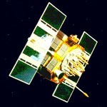
Events leading to SA being disabled - video
GeoElmo6000 posted a topic in GPS technology and devices
Hi all, A couple of geocaching video creators from New Zealand recently shared an interesting talk about the events leading up to Selective Availability being disabled. I thought it was really interesting and wanted to share it here. From the video description: "This Cache Walk is a talk by Jason Kim from the National Coordination Office for Space-Based Positioning, Navigation and Timing, Washington, D.C. He talks about turning off the Selected Availability (SA) feature in 2000 which increased the GPS accuracy to the public allowing the game of geocaching to begin." I hope you enjoy this. -
There has to be an easier way/Mystery & Multi
niraD replied to Cali9-1-1's topic in General geocaching topics
Why would they need to hide geocaches to battleship the finals? They could just use the saturation checker without actually submitting any caches for review. This is not the first time this topic has come up. Here is one of Keystone's replies to one of the earlier threads: So, suppose I tell you that your proposed location is 110m northwest of the final coordinates for "Cacher Conundrum," a five-star puzzle cache that only four people have ever solved and logged in the past three years. Armed with that intelligence, you track down the container and sign the log at the same time when you move your cache to a spot that's 162m away. What do I get for being helpful? A flaming email from the CO of "Cacher Conundrum," who also posts to three Facebook groups, and files a complaint with Geocaching HQ that I gave away secret information and ruined the puzzle cache. Having had that happen to us enough times, reviewers nowadays are constrained to be less forthcoming with details. Depending on your reviewer, you may get a hint, like "you are less than 161m from "Cacher Conundrum," GCABCDE, or you may get a hint that you should strongly consider moving to the southeast, or you may not get any guidance at all. So, that's how come. In a world where people hack lab caches and share the final coordinates of puzzle caches in Facebook groups, the inevitable outcome of such a feature would be to spoil every puzzle cache, multicache and Wherigo cache, plus a fair percentage of letterbox hybrid caches. There are people who like placing and finding these cache types. Geocaching.com has chosen not to alienate them by ruining the ability to keep the actual locations a secret. "But all I need is a distance and direction," you might say. So, the cheater simply enters enough coordinates into the planner tool to permit them to hone in on the actual location through triangulation. Think that can't happen? Talk to the travel bug stalkers who watch for drops of trackables in unpublished caches so they can figure out the locations and log a pre-publication "FTF." Talk to the group of cachers who hid traditionals in every conceivable spot within two miles of a 5-star puzzle, knowing they'd eventually "battleship" their way to a hit, and then they could do a scorched earth hunt within that area. I foiled them by publishing their cache even though it was 200 feet away from the puzzle final. Reviewers are smart humans*, you see, and that is better than an automated system. *Many reviewers are dogs. -
Thanks for the link. I'd never see such a list and had wondered. Dolphin? interesting. There are many dolphin statues on Florida's west coast and likely on other parts of the U.S. coast. I assume that's the reference? I found a "gravity plug" marker type (now destroyed). Wondered about the marker name at the time. It was an antenna, now decommissioned and removed. What about it was "gravity plug" I dunno. There are find X number of marker challenges. I own one in FL, there's at least one in Colorado https://coord.info/GC4V2V1 (If you ever get a chance to visit Washington D.C., be sure to check out the benchmark listings. Some interesting marker types within the range of normal tourist walking.)
-
Ok, I'm obviously a newbie and having difficulty with my software. I've looked through old posts and can't find the answers that I'm looking for. I've also looked at Smittys(something or other) and various other step by step web sites but none of them seem to explain exactly what to do - like "ok....my screen doesn't have that "magic button" you're talking about". So....as complex as it is - can anyone either help me fully or in part with the following questions? If you'd rather, anyone willing to talk to me like I'm 4 can email and we can do it that way. I just appreciate help. By the way - my GSAK and Cachmate are paid for. So here goes: POCKET QUERIES: I see where people have them generated a couple times a week. When I generate mine I say 'send me 50 that I haven't found'. But it keeps sending the same 50, because obviously I haven't changed the information. So, I deleted all my queries and will just mark the ones I've found in the meantime. Why would I keep downloading the same 50 and having to import them every couple days and rework them? Am I missing the point of Pocket Queries? I'm certainly not finding 50 every couple days but I like a good variety in case I travel 10-15 miles down the road. GSAK: Love the program but have a problem converting the files to get them into my PDA. I have to open Cachemate, go through about 15 steps, go back into GSAK and then export them. Does everyone have to go through that every single time? Also, do you list your Pocket Queries by date as different data bases? I have several files, all differnt names, with the same info in them. Does that make sense? Aren't I just wasting computer space? CACHEMATE: I love this program! Great for my PDA. But....does it really do my any good to mark that I've found a cache, put in the time, date and comments, turn around and do the same thing on GSAK and turn around and do the same thing on Geocaching.com? I understand having to do it in one program and then again on the web, but it makes no sense to be doing it three times - I'd rather be spending all that time outside. Isn't there someway my Cachemate can sync with GSAK, other than just importing the queries into my PDA? Well, there you have it. My ignorance exposed (along with a few spelling errors, I'm sure). Again, any insight, help, or laughing would be appreciated.
-
I'm not sure I follow, you might have to spoon feed it to me. I think your answer and quote doesn't apply to my question 1) and 4), just to my 2) and 3). I think you're saying it could have been a different marker and updated with Horiz later, so it might not have a triangle? That wouldn't be mentioned in the records? If I understand correctly about the symbol: since the records don't mention magnetism, or gravity, it's definitely not marking the tide, it's not a reference mark, and not a state mark, that eliminates a bunch of possibilities. On page 12, figure 28, that leaves: triangulation, and maybe these 4: azimuth, traverse, geodetic, topographic. So a triangle with a dot or maybe: crossed arrow, larger triangle with a dot, crossed line, or empty circle. (I'm not sure all of those disks existed in 1930 though.) A crossed line does closer match the questionable description of "cross hairs." Thanks for that tip, as I noticed PB&PP marks with a triangle on them say "$250 fine for disturbing" whereas those with a circle say "$250 fine for disturbing benchmark." That could be important. Is there any way to reverse engineer what the original symbol was? Regarding Azimuth, reference marks, long RM marks: would those all be documented and in the NGS database and come up in a search? Or could there be some undocumented azimuth/rm disks kicking around in the same area and I'm barking up the wrong tree with HV4826? If they are 1/4 mile away from triangulation stations, maybe the mystery marker is a reference marker for BOWEN, or maybe CIA TANK. Though BOWEN's paperwork listed 2 RMs about 75 feet away, not 1/4 mile. Thanks!


.png)
.png)


.png)