


brian b
-
Posts
367 -
Joined
-
Last visited
Posts posted by brian b
-
-
I had originally posted on WNC's cache pages how preposterous and presumptuous I found the "needs archived" log entry that the land manager had posted. I was then contacted, through the Groundspeak website, from this land manager in her official capacity (which I found incredibly ironic):
-------------
Dear brian b,
Despite my "needs archived" justification for the three "Xmas" caches, your statements are sadly inaccurate. As the land manager of Kittatinny Valley State Park, I'd be happy to find time in my schedule to discuss with you face-to-face our vision of creating quality geocaching experiences for our park visitors.
Regards,
[name withdrawn]
Resource Interpretive Specialist
Kittatinny Valley State Park
--------------
My point here is that I feel that NNJC and KVSP are not showing their whole hand. While they most definitely want to create a "quality geocaching experience" for the park visitors, they want to submit "the new KVSP Geotrail geocaches by next week and ask that [WNC] please archive [his] cache by next Monday 11/25/13 to allow the proper reviewer process" which would be just in time for the CTTS event.
I read this as a geocacher who is also a Land Manager forcing another fellow geocacher into archiving quality caches for their interpretation of quality caches -- WITH NNJC APPROVAL.
All in all, this smells a lot like bull feces.
-
Although now that I look at it, ASP seems to be a bit further from Montreal than I originally thought.

-
Check out Alleghany State Park: ASP, as it is a fantastic place to camp AND cache. Lots of trails, lots of history, some excellent earthcaches. And even an event or two, depending upon when you are heading that way.
-
Your first event and it was GW9? Very impressive.
I was there, too, as was my 11 year old daughter/cacher. We also had a great time. We worked our way over to the dam, and up to the overlook for a little walk in the woods (all the road side micros were rather tiresome, although I did contribute my name to quite a few of them). Overall, 5K people converging on the fairgrounds, a rather smooth experience.
-
New report of rescue. This by nypd helicopter rescuing west point cadets lost on training hike. Cadets were reported near death from hypothermia.
Conflicting reports out on this one. One report has them freelancing.
Either way rescuers put at risk. Be careful.
There plight had nothing to do with mountain conditions, but everything to do with stupidity.
-
I am getting this quite frequently as well. I have to click "english" to get it back, but when I simply move from one page to another, sometimes I am surprised with the foreign language.
I am glad to know other(s) are having the same issue. Started with the last update.
-
Cornfarrell, Waylesswood, and I snowshoed 6 miles on Schunemunk this Sunday. It took us 7 hours, and two of us dadgum near killed ourselves because of the ice.
And we hid about 10 new caches for those of you who are brave enough to trudge out in this stuff.
-
My experiences with Sterling Forest:
The Haunted Boy Scout Camp -- many people had issues with Park Police confrontations regarding hiking off trail/bushwacking. This is also mentioned in other, now archived, caches. I am hopeful that this has been remedied.
My experiences with Schunemunk:
(Please note that Schunemunk is, by far, one of my favorite places to hike. It resides less than one mile from my residence, and I am frequently on this mountain as part of my duties to the CFD -- fires and rescues. I mention this only because Schunemunk has been an issue in the past.)
Long Path meets Jessup Trail -- I was given less than three weeks to make this trip for retrieval. I, unfortunately, didn't get up there due to vacations and other issues. When I did, the cache was gone. Ironically, my other one, Schunemunk's High Knob was not (as it was a much furthe walk, I am sure).
To hear that Sterling Forest is, in fact, allowing caching is surprising. Schunemunk has quite a few caches (both with permission of NY State as well as on private property).
-
On a day not so long ago, in the middle of December (prior to the dumping of snow that we've currently received), Waylesswood and I knocked out about 30+ caches in the Hereford MUA (also known as the 909).
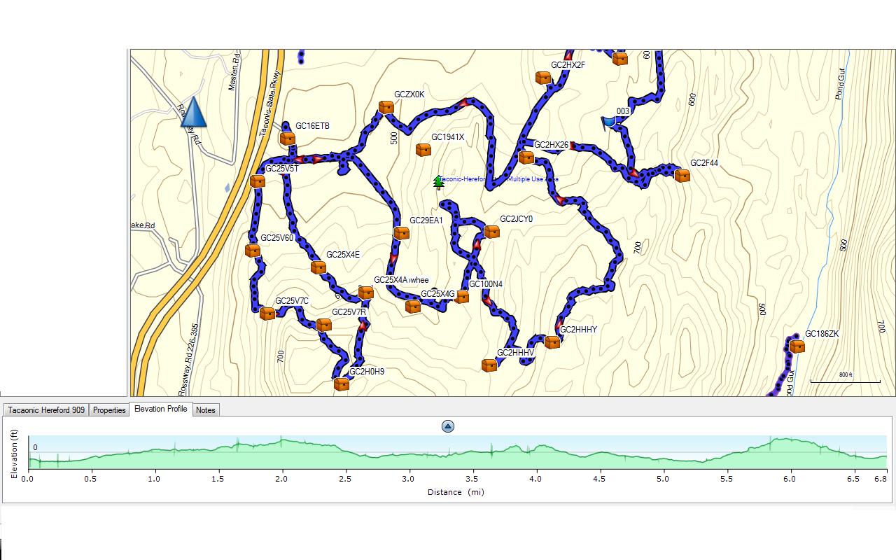
There are some good trails (many woods roads, mountain bike trails, and even a hiking trail or two), but we opted to bushwack from cache to cache. The undergrowth wasn't that bad, and the terrain was moderate to light. We utilized three different parking areas to minimize the amount of backtracking, but overall, we still put in about 12 miles (the pic only shows one section of the hike). Obviously, one would not need to take the whole park by storm, but could do parts and pieces of it as time (and legs) permit.
We only had one DNF, and the two multis are pretty nicely done (double check the updated coords on Fort Tyrell Multi, as the coords for stage one have been updated within the logs, but not by the owner.
-
-
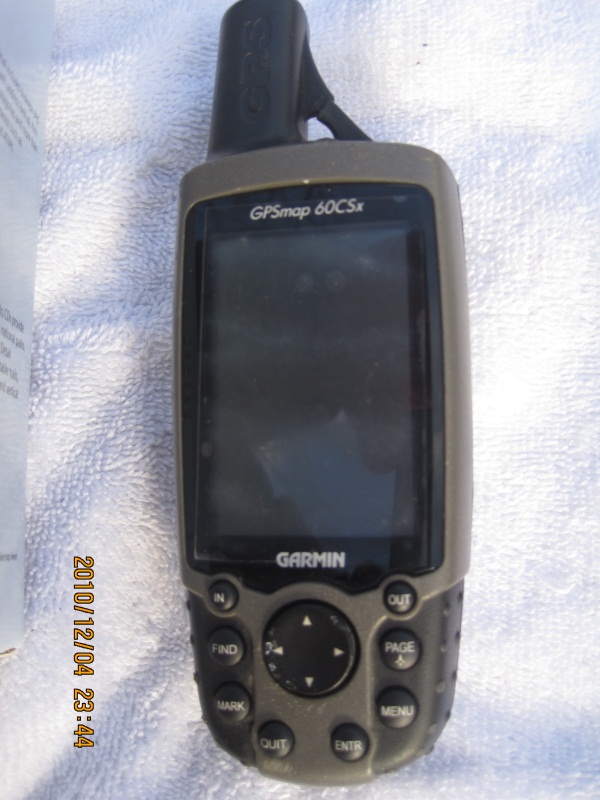
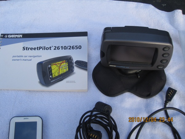
Garmin GPSmap 60csx -- complete with suction car mount, bike mount, poly holder
(the unit has a Micro SD card (2 gig) with most of Northeast topo downloaded as well as the original box that the unit came in)
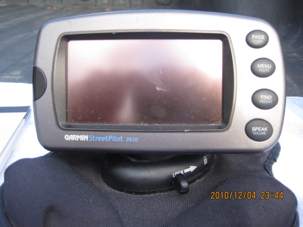
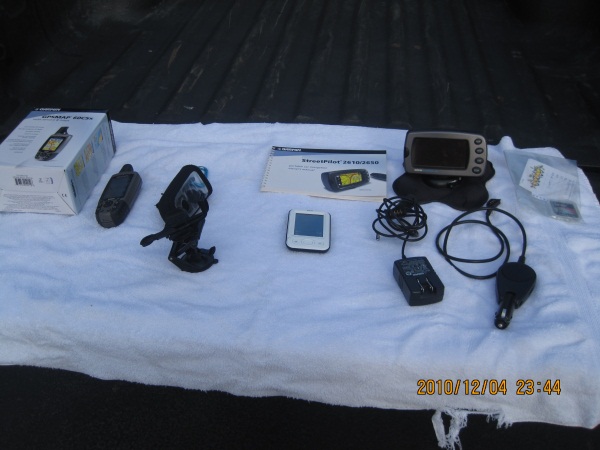
And if that weren't enough, I'm also going to throw in my Garmin StreetPilot 2610 with two memory cards, loaded with City Navigator for most of the Northeast, complete with both the AC and the DC jacks and the original user guide.
And if that STILL weren't enough, I'm also going to toss in my Palm pilot that makes for some easy paperless caching.
All this can be yours for $175 (and I'll even pay the shipping).
Photos of the great bag of goodies:
-
I use the NUVI 550 -- a garmin product that is specifically made for driving and caching. And it is pretty idiot-proof, too (as proven by the simple fact that I can use it). When you run a PQ, you can send it straight to the 550, and all the geocaching info will be there for you to peruse.
However, my buddy has figured out how to run macros, create his own macros, integrate other macros through GSAK and can now do about the same thing I can with my 550. When he talks to me about the newest things he's done, all I hear is "Wah, wah, wah, wah."
-
Orange County, NY
3.6 miles
6 caches (+ a few extras nearby, easy)
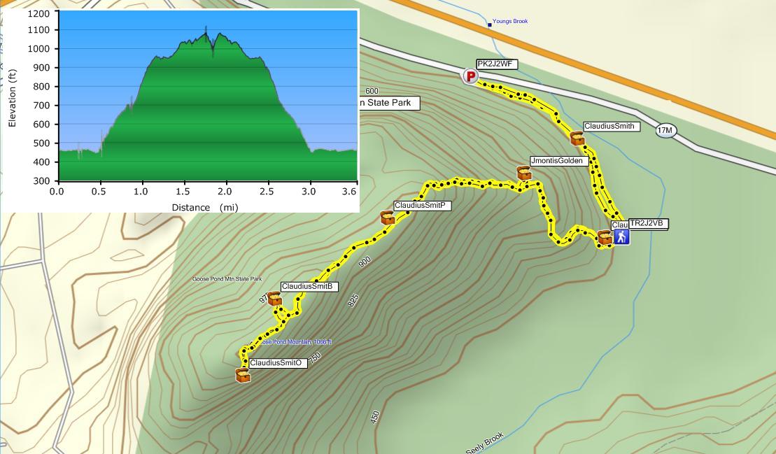
You'll begin with Cowboy Wetlands and make your way around up and to the final, Bandit's Arsenal, a LARGE cache (there are NO micros in this hike).
-
I've done a few "power trails" that were found in the woods (as opposed to those drive-ups). I found that by the time you get your feet moving at a good pace, you have to stop to find a cache. Then when you start walking again, by the time you get your feet moving, you have to stop and find a cache again. Over and over and over again.
If you add to this that you might be hiking with some friends, you really can't get a conversation going because as soon as you start talking, you have to stop the conversation and find a cache. It gets (as stated above) tiresome, boring, and rather dull.
Don't get me wrong. I like the number-game as much as anyone, but I would rather find a solid viewpoint, a good BS (BrianSnat) cache, a good ole jonboy cache than a bunch on a power trail.
The suggestion to check out the NYNJ Loop Trails is a wise place to start, especially if you are unfamiliar with the parks/trail system that this area has to offer.
But if you really must, here is the one that I referenced in the first paragraph: A Powertrail in the Woods (CT)
-
Nothing grueling? Then I guess The Tongue is out of the question (although it might be one of the best hikes, best views you'll find in this area).
-
Yeah, but what's the recipe for the Grape Crush?
-
Nice site, John. Thanks.
-
I have to concur with BS. Terrain ratings and Difficulty ratings should reflect their respective qualities. If that cache is in the middle of a median at a crowded intersection, the terrain rating should most likely be low, but the difficulty be high (but I would also question the validity of such cache, and most likely place it on my ignore list).
I think fats277 summed it up perfectly when it was stated that "The streetlights and security cameras are there to protect you, making it safe to walk but hard to find a cache."; hence, the difficulty (not the terrain) ought to be raised.
-
Small Oaks --
That is exactly how I transfer my PQ to the gps. What I am looking for is to have the names of the caches appear on the map screen. This happens when I export them (as you described), but then they show up in My Favorites, which then causes havoc when needed to delete them.
Is there a way to get the names (or even GC numbers) of the caches to show up above the cache other than through the export?
-
So I've purchased (and received) the 550; I updated the software and maps. I am having problems, however, in getting caches (in the form of a PQ) sent to the geocaching icon.
Using GSAK, I am sending to the GPS, and the .gpx file is finding its way into the Garmin/GPS folder on the Nuvi. The real issue is that they are showing up under My Favorites AND under Geocaches. I do not want them to show up under favorites, since I have to delete them one-by-one (if I don't want to lose all my favorites).
However, when I send them as an export .gpx file, I do not get the name of the cache on the screen.
When i send them as a "send to gps" file, I get them in both the Favorites and in the geocache, but the name is on the favorites.
Does anyone have any suggestions? I really do not want to have to send this thing back and resort to my old 2610.
-
As stated above, Premium Membership is key. Get a PQ run (follow the above links), and then i would recommend GSAK, a handy little tool that will allow you to pick and chose from the PQ what you want to send.
The cost is minimal (one time fee of $25, or if you don't mind an annoying wait, it is free).
I use the 60CSx, and this is how I get ready for all my caching.
-
Perfect. I think you helped me make my decision! Thank you for the pics (and your time).
Absolutely perfect!
Now, I must decide on the 500 or the 550. I think I'll go for the one with the Canandian maps . . . . especially since I have a hand held for hiking.
-
MustangJim
I would love to see some screen shots.
(And Ohio State looked quite good in the Rose Bowl. I grew up in Ohio, but ended up in KY before NY.)
-
Thank you all for you advice. I currently use a 60csx for my handheld, on the trail geocaching. But I want a car gps that will function as both an aid to caching as well as an aid to getting to a location. (MY 60 has all topo maps; otherwise, I would use that as a driving companion.)
Most of my questions were answered here. Now I just need to know if the wife will explode if I shell out the money for ANOTHER gps!!!

Geocache Archive Requests
in General geocaching topics
Posted
And that, Brian, is part of the problem. When Rangr Lynn (and Rangr Dave) addressed both WNC and myself, she identified herself as such, giving them impression that she was the end all in the discussion. Everyone is quick to jump on NNJC, and while the justification might be real, the blame extends elsewhere as well.