


stevesisti
-
Posts
176 -
Joined
-
Last visited
Posts posted by stevesisti
-
-
I have been spending the "spare" time at work today trying to sort out a sample map from all the suggestions. Thanks to all.
I have gotten it to a point that I have a topo map of the Western Cape in South Africa. I have it as a .img file using cGPSmapper programme created on 7/8/05. I think this is release 6.42 or something. can't remmeber when I downloaded it, but it is the newest version.
I want to load it up in Mapsource before throwing it into my unit. I am a bit nervous about just loading it in before seeing it on a Garmin product outside a small unit. I might be paranoid but just don't want to screw up my geocaching budget on this this activity here.
Anyone have some suggestions to get it in Mapsource? I am not much of a programmer, and that is really my main problem here with all this stuff.....

Thanks again, I hope others are finding this useful as well.
P.S. - Redwoods, your book looks very interesting, but I am leaving the country in 4 days and don't ahve the time to order it from Amazon right now. Perhaps later.
There are several ways and sources of material to get your data into gpsmapper and then into your gps..I can only tell you the path I went down, which might not necessarily be the best way.
Opened a USGS 1:24K topo quad with Ozi explorer (free trial program program), saving that file in the ozi program gives you an Ozi .map file. Open the .map file in map edit and the map becomes the "background or "template " on which you can "draw your map. Save the file in Mapedit as an .Mp "polish" file, then convert to an image (.img) file in Mapedit.
The fun starts once you have this .img file....if you just want to load that single .img file, without it being available to load thru mapsource, use this program "mapupload", again it's free....http://www.mapwel.biz/products.htm. Be advised though, like all uploads to your unit, all previously loaded maps are erased and the only map you will have is the one you just uploaded
If you want to load the map through Mapsource, things get interesting, especially if your not familiar with working from "command Line". You must use gpsmapper again and create a several files that Mapsource requires for the map to load....www.geopainting.com has a tutorial that explains how....good luck
-
If you're doing this as a way to be "cost productive", you're way off the mark. Yes, you can make maps, and much more detailed and personal maps than say Garmin has to offer...but it requires a lot of work. My only reason for doing so was to map an island that Garmin offered no coverage on, and to map 2 or 3 of my favorite areas in the adirondacks to a higher level than the garmin topo.
The level of Garmins topo has a "practical" side to it in that if all their maps were as detailed as the ones I created, 54 megs of unit memory would only hold a small fraction of New York state. Obviously the file sizes create a limit to the amount of detail you can create or would have a practical purpose for.
That being said...Mapedit and gps mapper would get you going. They are 2 seperate programs that work with each other, and the trial versions allow you to make a "small" map to get a feel for what is required. There is also an all inclusive program out there but the name slips my memory right now.
I found it very interesting, somewhat fun, but geeez... it really is a lot of work and requires at least a basic knowledge of different map products, datum and projections. These were by the way, non-routable maps.
On the plus side, Mapsource freely accepts the maps integrated into the Mapsource program as a selectable "loadable" map, along with the Garmin mapsets...and the 60CS works fine with the "homemade brew"...not even a single lockup.
-
I received the following in an email. Since I don't consider myself an expert in this area, I thought I would post this on the forums and give the whole GPSr community a chance to respond.
"The following P.S. is from a guy I've been talking
to. He is a map maker and makes maps similar to Tom Harrisons maps.I
told him I would ask around the Geocaching circle and your the only one I
have confidence in for an educated response. Any thing come to
mind?.... P.S. I am in the market for a GPS that offers mapping
capabilities. I am considering doing another map of
this area and would like to incorporate GPS into the
mapping process. I'm looking for a unit that can
track distance and trail configuration and then allows
me to download back into my MAC at home to show the
exact trail scope. I'd be going on trips of up to 10
days so memory and battery strength are important
factors as well. Any suggestions?"
My only comment would be to make sure you have a provision for an external antenna, especially if your going to incorporate the data into a map. All units see improved accuracy with an external antenna, specifically under trail conditions where he will most likely be.
My 60cs shows variations from track to track of well over 60 ft under tree cover, an external antenna improves this dramatically.
-
The five normally cited differences are:
1. 76cs is larger
2. 76cs floats (the 60cs floats only with lithium batteries)
3. 76cs has a larger basemap (13MB instead of 8MB)
4. 76cs has its key above the screen
5. 76cs has more memory (128MB chip less 13MB basemap=115MB vs. 64MB chip less 8MB basemap=56MB).
More in this thread.
Links to basemap comparisons in question 6 of the Maps Section of the FAQ.
Edit: firmware is identicle. Recent threads re lock-ups mention the 60CS, but I would assume that the 76CS would behave the same.
Hmmmm. You might want to check on that. I thought the base map had nothing to do with the available memory....In fact my 60 CS has 54 Meg available and I have loaded 53.3 into the unit with no problem....so.....
Ok, I see what you are saying....you are correct.
-
The five normally cited differences are:
1. 76cs is larger
2. 76cs floats (the 60cs floats only with lithium batteries)
3. 76cs has a larger basemap (13MB instead of 8MB)
4. 76cs has its key above the screen
5. 76cs has more memory (128MB chip less 13MB basemap=115MB vs. 64MB chip less 8MB basemap=56MB).
More in this thread.
Links to basemap comparisons in question 6 of the Maps Section of the FAQ.
Edit: firmware is identicle. Recent threads re lock-ups mention the 60CS, but I would assume that the 76CS would behave the same.
Hmmmm. You might want to check on that. I thought the base map had nothing to do with the available memory....In fact my 60 CS has 54 Meg available and I have loaded 53.3 into the unit with no problem....so.....
-
I don't see why anyone would use "trackback", having to perform the "find beginning" baloney at the start....
Easy to do while hiking, but what about traveling down the road at 60MPH?

I don't know about you, but I kind of like to watch the road while I'm driving - NOT my GPSr!
If you read the original post correctly, you would see that we were referring to "hiking" and not "driving" while following a track. Regardless, when driving a return trip, it is still easier to do a new "go to" to your return destination, rather than panning around the map page that is required when you do a Tracback....it's a no brainer...for most of us anyway :0).
-
I just finished reading the posts on the 60CS lock-up problem. This happened to me twice with my 60CS (v3.50) while I was out hiking solo earlier this week. I was in no real danger of getting lost, but I might have been if I had been out father from home.
Trackback freezing had occurred before, but I had assumed that it was just a quirk or a satellite reception problem. I did not realize that it was a widely reported bug.
I upgraded to v4.00 but now I am worried, as users are reporting the same behavior occurs with this software release.
The main reason that I have a GPS is to help me trackback when out on solo hikes. This is a very serious (and somewhat dangerous) problem with a unit that was quite expensive.
I have written to Garmin's technical support to ask them for advice and about my options under warranty.
You have a right to have the product perform as advertised.....having said that, I don't see why anyone would use "trackback", having to perform the "find beginning" baloney at the start....just turn around and follow the track you just made. You also seem to be a little concerned about getting lost...maybe a good idea to mark a waypoint at your starting point (car/trailhead etc.)
-
I recently did a paddling trip of 15 mi, with my 60CS set to record a track point at a distance interval of .01 miles (52 ft.). When I download the active track, the spacing between the majority of points is 150 ft, with very few of them being in the 50 ft range. I've always had the unit set to that distance, and it's set to that distance now. Does anyone know why it would save points at an interval different then what I have the unit set to ?
-
Who knows what your particular problem is....I have had several "funky" things happen while using the 60cs...from lock-ups to routings that went one way... and then all of a sudden reversed direction and went the other.....finally a reset fiexed all....at least for the last few months now the operation is flawless.
Simple approach....do a master reset.....start from square one and if the problem re-occurs, send it back to Garmin for a replacement....and don't be shy about talking to Garmin...they have excellent customer service...you paid good bucks for the unit...and should get good service in return.....and remember...it's not your job to figure out what the problem is....make a reasonable effort to get it functioning...after that....let Garmin take a crack at it or else replace the unit.
-
-
I don't see what all the fuss is about.....The definition of the unit is "handheld" and as such you're still looking at a screen and resolution size that would not take advantage of all the info on a std. USGS 1:24K topo map. The next question is...since there is no way to get any vector, or routing data from a raster map, this is probably going to be some sort of "hybrid" map either converted in the unit or beforehand with proprietary software, but either way, someone will have to supply the vector/navigation data and you can bet it's going to cost you.
Another intersting note...each USGS topo quad averages about 5megs of image data (someone correct me if I'm wrong) so the storage consideration would be enormous. I would also assume the processing demands would be equally large.
I would wait till more details come out, but you can be sure your not just going to be throwing the freely available usgs quads into one of these things and it's " off you go".
-
I figured the unit would actually stay dryer if I could keep it under the spray skirt in the cockpit and just run the antenna cord up to my shoulder shere a strap retaining loop would seem to be the perfect mounting spot. Where I live there isn't much fast water so I'm generally on inland lakes. Although I guess if I had the external antenna attached the attachment port would be open and could pose a threat. So maybe keeping the unit in a dry bag and somehow running the cord out and sealing that hole would be the best solution.
Don't know why you would need an external antenna in a Kayak...I use the 60 cs in a "dry-loc" plastic bag ($8.50) sitting on the deck of my Kayak and the reception through the bag is the same as without. It's been in the water several times and never let in a single drop...I have used these bags for several years with cell phones and they still perform fine. I can operate all the buttons with ease. Being out on the open water I always get superb reception....usually 7-10ft...and never lose a sat lock. Probably the best reception you will ever get is on an open body of water.
-
is there any plans to make a 60 series with the new chip? as i have a gps 60 and i am thinking of upgrading to a 60c. but i will wait if there is going to be somthing better soon.
i want to stick with the 60 series, as all my accessories will work with the new unit, such as car mount and pda cable.
cheers
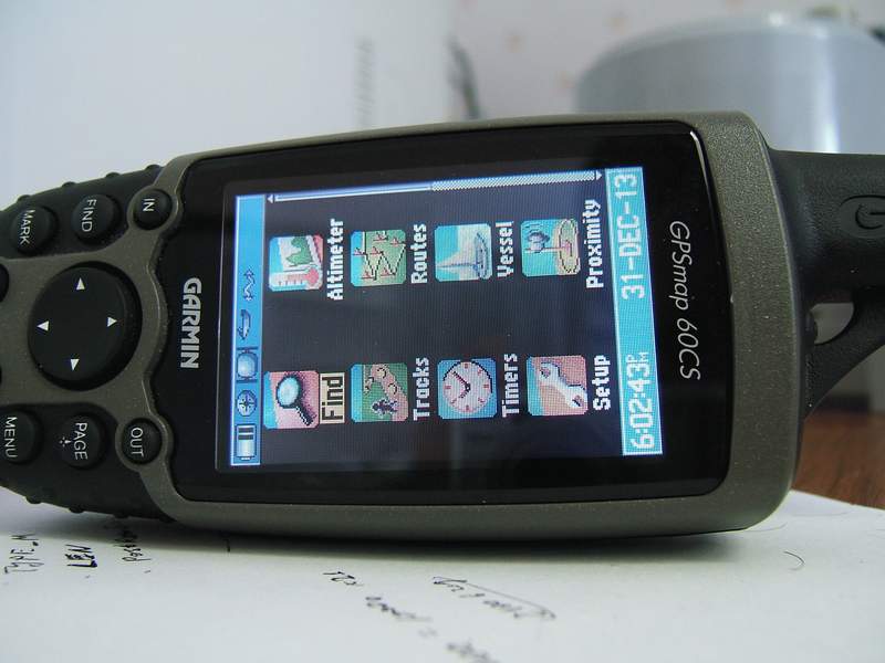
I have a 60cs and love it.......I get very good reception under tree cover and only occassionally lose lock when heavy tree cover is combined with a mountain/canyon. So I'm not complaining and will be happy with the 60cs for years to come. But I still have my curiosity about just how good the reception is on the new chip and if Garmin will use them "across the board" in their products
Steve
-
Garmin seems to be pushing the new Sirf III chip as in their new Bike gps units (edge)
I have never seen them advertise the reception on any of their handheld units as they decribe the edge...
# High-sensitivity GPS receiver—knows your position even in tree cover and canyons, making it extremely reliable for navigation
Are we looking at the next release of handhelds all incorporating the Sirf technology, making my 60cs somewhat of a "paper weight". If we are, I have to hand it to Garmin marketing, because if they perform as I'm starting to hear, I can see a new "wave" of purchases to get units with the higher sensitivity chip.
I heard there were problems with the original Sirf chip, But recent reviews and Garmins commitment to purchasing and incorporating the sirf chip in their new products makes me wonder just how good the chip is.
Steve
-
Hey did you guys see this?
http://www.marketwatch.com/news/yhoo/story...oo&dist=myyahoo
The SIRF chips are much better than Garmin chips. I actually used my cousin's BT GPS module with SIRF chips and it was awsome. There have been reports that some people were even able to lock onto signals while they're in the house! Don't ask me how but they were. These are some super sensitive chips! I guess that's why even Garmin has decided to just buy instead of develop.
Some decent reviews out the including one person at a trade show who said the only demo unit that had a fix indoors was a serf 111 chipset.
Well I think you can read between the lines...If Garmin has ordered the chips from
Sirf Tech to incorporate into their product...that says a lot.
Here we go again...trade in dem 60cs's for the latest, and greatest reception in handheld GPS :0)
-
The newer Magellan eXplorist series of GPSs are boasting 14 parallel channels instead of the 12 channels found on most units. My question is: does it matter?
I understand the concept of more-is-better; but would I notice a difference with only 15% more channels? The unit specifications still only claim a three-meter accuracy, the same as 12 channel models. Will it get a 15% faster lock? Drain the battery 15% faster? Or, am I missing the point of the two extra channels all-together?

Just wondering
Sounds like a sales gimmick to me.....if there were more sats available in orbit, well then maybe, but as it is, under tree cover, I usually average 5 or 6 sats...adding the ability to scan for two more sats that aren't going to be there is a waste of processor time. For the most part, under tree cover, I'm pretty much only picking out the sats that are at the 45 or above, which are the 4 or 5 sats I'm getting now. So right now I have an extra 5 slots that receive nothing....having an extra seven slots to look for nothing is the same situation as having 5 look for nothing.
Out in the open, I get lock on 6-10 sats with very good accuracy readings... having the ability to lock on 2 more isn't going to effect already good reception and accuracy.
-
He probably used the 76CS to 60CS software conversion kit, allowing the buttons to be used on top of the unit.
-
Regardless of what any manufacturer says regarding the water resistant rating, you really should have had the explorist in a waterproof bag. I keep my 60cs in a "Dry-Pak" bag when I have it on my Kayak. Reception is great and the buttons are easily pressed through the clear membrane. It's been dunked on numerous occasions and has never let in a drop...cheap insurance for $9.00.
I also have a water proof VHF marine radio from icom thats "supposed" to be waterproof, I also have that in a "dry-pak" bag. Same story, dunked along with the 60CS, not a drop inside.
It's really a shame these Mfgr's are allowed to call anything waterproof..at best they should be able to say "water-resistant".
I would definitely send it to the factory as soon as possible....and if I were you I would press them hard on a free repair owing to a "minor" exposure to water. I have had several electronic units return to service after a water dunk, only to have it fail again shortly thereafter.
-
It is difficult to wade through the smls viewer for the first time...or for your first several times for that matter....try this link for a listing of areas which have the high resolution images available...note that of the available ones...some are available for "viewing" only and not download.....you will get a feel for how limited the availabilty really is.
http://seamless.usgs.gov/website/seamless/...listofortho.asp
-
Have a look here, there is a brief explanation of how to see what areas are available. One of the problems you will encounter is that the new higher resolution (1/3 meter) are really only available in a very limited amount of areas and these area are all urban (city) areas, or popular areas of historic interest( Washington dc etc.). While the 3 meter DOQ have somewhat of a "national" program to cover the whole country, even they are not 100% coverage.
There are several states that have embarked on a program to re-map their boundaries in the Higher resolution imagery...this is not a "national" program...you will just have to look at the USGS SMLS site to see if what you want is available.
-
If you see a colored line that has white "dots", you're probably looking at a track. You can go to the main menu and then tracks, and look at the saved tracks...if you have any saved tracks, you can select them and see if they are "turned on" or viewable on the GPS. If it is not one of the "saved" tracks then it is your "current" track which you can either "clear " by the abiove method, of by selecting the "trip computer" page and pressing "menu" and then selecting"reset", then hit "enter" you will be given choices on what you want to delete...track log is one of the choices....be careful you don't hit select "all", unless of course you want to delete everything.
A "route" is a solid purple line and only appears when you are navigating a route....if that is what you are seeing, on the map page, press menu button and you will see an option to "stop navigating"....if that choice is not there, then you are not navigating and that is not what the purple line is.
-
I have used USA Photo Maps to view the local area and it will download 1 meter/pixel maps. The higher resolution .25 m/p "Urban" photos are not available for my area. The standard photos are also very old.
Does anyone know of a source of photo map data with higher resolution than 1 m/p?
Probably not....unless you are willing to pay for them and you are fortunate enough that the area you want has been photographed "recently" by a private concern.
Most organizations have a "mish-mosh" of government supplied (mostly outdated) and self generated (Mostly large urban areas) aerial photos. I have not found one place that "has it all".
From a practical point of view I don't really see why you would want that kind of accuracy. The file sizes become huge, and from a mapping point of view, you are just adding info which has no practical use. Also, having a small meters/pixel ratio means absolutely nothing if the source detail wasn't there in the first place...I can take a 72 dpi map and scan it at 4000 dpi....I now have a lot higher meters/pixel...but no more information than I had at 72 DPI.
-
You can buy radios that are frs only, gmrs only, or a combo of FRS and GMRS. Whether you need a license or not isn't necessarily determined by the radio, but rather if you are going to use the GMRS (higher wattage) frequecies. You could buy a dual radio, FRS/GMRS and not use the GMRS side of the radio and you don't need a license. You can buy a GMRS radio wihtout getting the license, but using it would be in violation of the FFC rules and regulations.
FRS is restricted to 1/2 watt, GMRS to 5 watts. From a practical point of view in real use situations, 10 times the wattage will not give you 10 times the transmission distance The most important factor in determining your transmission distance is your antenna,antenna height, and having free line of site to your receiving radio. I highly doubt you will be able to contact someone 6 mi away using a handheld...any buildings, hills,trees or mountains will knock the signal down for sure. Unless you live in Kansas, the standard distances quoted by radio MFGr's are way, way off from real-time use.
The gmrs license is $80 for 5 years, you can apply here
-
I've searched this forum and the Net.
There are a few free map editing programs that look like they should work but nothing that I have found seems to be able to simply edit and save .img maps. I just want to add/change a few roads to an existing map image, replace the old .img file with the edited one and have it work with Garmin software and have my added/changed roads to be recognizable for routing purposes.
Can this be easily done? If not, I'll quit obsessing over it
Also... there are over 1000 .img files in the City Select map folder. How can you identify which maps they are?
Thanks!
I beleive the original version of gpsmapper (0085 ver. ?) could convert a garmin .img file into a MP (Polish Format) file. Using "MapEdit" you could edit the .MP file, add roads etc., and then convert back to a Garmin .img file. The newer version of gpsmapper will not do this conversion, I assume owing to copyright liabilities.
I have used gpsmapper to make my own maps, the only reason for doing so is to create maps with much, much more detail than Garmins. The process is time consuming, and was originally developed for gps enthusiasts in foreign countries where Garmin didn't offer map coverage. The down-side of having more detailed maps is that the files are obviously larger than a typical Garmin file. The up-side is that it is very satisfying to be on your favorite lake following a shoreline and having the gps track follow the shoreline to a T. With Garmin topo, I would frequently find myself tracking "way up" on dry land.
My first map was of Lows Lake in the Adirondacks....Garmin topo is horrible compared to what you can do tracing a standard 1:24K USGS Quad map. Garmin topo eliminated many of the smaller islands, had irregular and "odd" shapes for many of the larger islands, and just plain left out several Kayak/canoe passages altogether.
I would suggest making your own maps for one or several of your favorite areas, but as an alternative to the Garmin maps, it's just simply too much work compared to the ease of buying the available Garmin product. I would also add that although I'm not thrilled with the detail of the Garmin topo, it would be impractical to have all my maps in higher detail. If I did, I would probably only be able to fit a few ny counties in the unit at a time.
Almost forgot the original question.....no, it cannot be easily done, at least not the first time you do it. Once you have gone thru the process , the next map is much mcuh easier.
How To Make Own Maps
in GPS technology and devices
Posted
well actually you need three files if I remember right. Your full size image file, the actual map, your PV file which is a smaller reduced image used by mapsource (created by the cgpsmapper pv command, and the TDB file, created by the same cgpsmapper pv command at the same time the preview is created. It also creates registry mods if you are going to use them
I hate the command line stuff because I'm not familiar with it, but more than likely your problem is the following.
The pv text file you are converting has to be in the same folder as the cgpsmapper.exe file...if it's not, cgpsmapper can't find it and you will get the above error. When you run cgpsmapper, you must run it from the command line...get the DOS prompt, navigate to the folder where both gpsmapper and your pv.txt file are, then type "cgpsmappper(space) pv (space) (your file name ending in .txt format). This is the pain in the arse part of the whole project....good news is having done it once...it's very easy the second time around.