


CTYankee9
-
Posts
307 -
Joined
-
Last visited
Posts posted by CTYankee9
-
-
I just ordered my GEO COIN and it will be coming in in matter of days. Im from PA and would like to see if i could get this coin started in California with a reliable cacher, and i will write the paper up and mail it to them all i ask is for it to be put in a cache ( i will return the favor if need be). and on the paper have the main objective get it back to PA where i can retreive, but along the way i am thinking of puttin a tablet in it for people to sign and write a lil something in it. so i just need someone willing to set this up for me, and like i said id be glad to do the same here in PA. so if someone would get back to me itd be appreciated.
If you wish, I will drop it off somewhere her in CA. Just Email me and I will send you an address to mail it to, more than likely I will drop it in the cache called "None More Southwesterly".
-
I won't have a phone for a couple of weeks, and consequently don't have Internet access without driving down to the RSD library, where I am now.
Is anyone from East County going to the Event tomorrow night?
If so, could I hitch a ride from RSD or El Cajon or . . . ?
I'll be going, but not staying too long, I have to work that evening. Give me a call at home if you are near a phone tonight.
-
This just in ....
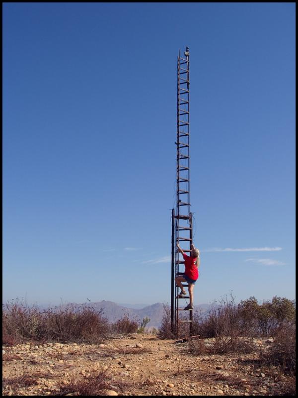
Honk if you know where this is.
HONK!
Not the stairway to heaven, GC13KE7, By Miragee.
-
After thinking about it some what I may do for these days is drive up Sunday Night and camp somewhere near the south-west end of the Bradshaw Trail, drive north-east Monday morning to the end near the 10, drive over to Box Canyon Road and take that back south-west for the first day. Camp-out again somewhere near the south-west end of Box Canyon Road and then Tuesday Morning do those caches with the Irish theme to the Northwest of 66th Ave and the 111. But it is written, so shall it be done! I will be up there somwhere on those days with my caching partner Piglit9.
Can't use Google Earth at the moment to get the cache names {hit the refresh throttle looking at all the caches and possibilities}. I will try and get some others to go along starting from that end of the Bradshaw trail and if others start at the northwest end, we can meet in the middle for lunch! I guess if it is a 4 hour drive, just driving it, then add a few hours for cache finding that would make it an 8 hour day for that portion. Then whatever it takes to do Box Canyon Road tacked on to it.
-
Upgrading to Google Earth Plus won't make any difference, since it's GC.com that imposes the limit.
To help with this limitation, you need to change when Google Earth refreshes the information it gets from GC.com. Normally, the KML fetches new data from GC.com whenever you zoom in or out or pan around the screen. Every change in screen view counts as a refresh, and you can run out of refreshes pretty quickly if you change the view a lot. To change this behavior to something more manageable:
- Open Google Earth.
- Right-click on the "Geocaching Network KML" entry and select "Properties".
- Go to the "Refresh" tab.
- In the "View-based refresh" section, set "When" to "On Request".
- Close this dialog box.
Using this setup, whenever you want fresh data from GC.com, just right-click on the "Geocaching Network KML" entry and select "Refresh". I use this approach, and I never exceed the limit any more (not counting the occasional glitch at GC.com).
Hope this helps!
--Larry
Edit to add: I have Google Earth Plus and I'm referring to what I see in this version of the software; it might look slightly different in the free version, but I think they're the same in this respect.
Yes the free version has the same option tabs and I have changed mine over. Thanks, I will see if this works better tomorrow when I can use it again, never ran into this wall before, just thought it was odd.
Sorry for hijacking the OP's thread for a few posts, but maybe this will help others?
Back to your originally scheduled KML solutions

- Open Google Earth.
-
-
The refresh throttling is from Geocaching.com - that limit does not come from Earth.
So upgrading to the Plus version of Google Earth won't allow me more refreshes in a day then for viewing the cache place-marks? I just never seen this before and was curious, I do a lot of Google use when planing a days caching and never hit this "limit" before and just to make sure I am correct; this comes from GC.com and it is each time I pan the map and reload the caches that count towards this limit?
And thanks for the prior info.
-
I have just started receiving the message that I have exceeded the allowable views for the day, please try again tomorrow? Never seen this before, is this something built into the Google Earth program or is it with GC.com?
-
WOW, I was just looking at doing that trail {Bradshaw} this morning sometime next month, I wouldn't be able to make the Pushwalla part due to my work schedule, but my days off are Monday/Tuesday. So depending on how early of a start you were planing on Monday I might be in. I would be coming from the San Diego area so a 3-3 1/2 hour drive would be required, but I don't mind getting up early to go or staying out all day to complete.
If you have any more details on times or starting location that would be great.
-
And this is the one that made the Campout happen
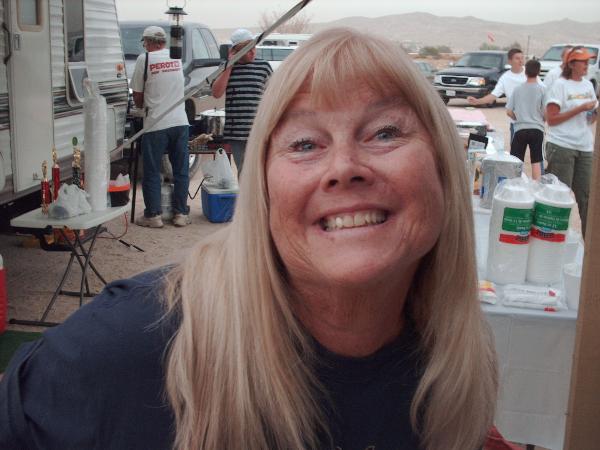
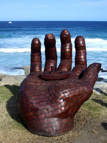
 Let's give her a big hand.
Thanks!!!!!!!!
-
SPECIAL FIRE UPDATE
ROAD CLOSURES
10/26/2007
4:44 a.m.
For non-storm Public Works information, please visit the
DPW web site
--------------------------------------------------------------------------------
Current Road Closures in San Diego County
Community Road/Intersection Incident
Julian area/Santa Ysabel
ALL WAYS IN AND OUT OF JULIAN ARE CLOSED TO THE PUBLIC Closed
SR 78 -- SR 79 to Bear Valley Pkwy Closed
SR 79 -- SR 78 to SR 76 Closed
SR 78 E/B -- Santa Ysabel to Haverrwood Closed
Valley Center, Pauma
Lilac Rd -- Valley Center Rd Closed
Couser Canyon -- SR 76 to Lilac Closed
SR 76 -- Pauma Reservation Road to SR 79 Closed
SR 76 -- Cole Grade to SR 79 Closed
SR 76 -- Mission to Old Hwy 395 Closed
Cole Grade -- Valley Center to SR 76 Closed
Pine Valley, Alpine
Harbison Japatul Road at Dehesa/Tavern Closed
S/B Japatul at I-8 Closed
Tavern at S. Grade Residents only
Harbison Canyon at Dehesa Closed
Poway
Poway Road at Espola Closed
Jamul, Rancho San Diego
Lawson Valley -- entire length Closed
SR 94 -- Steele Canyon to Forrest Gate Closed
Skyline Truck Trail -- entire length Closed
HoneySprings -- SR 94 to Lyons Valley
Otay Otay Lakes -- Wueste to SR 94 Closed
Potrero area THE TECATE BORDER CROSSING AND POTRERO AREA ROADS Closed
This is as of about 5AM. So for best planning purposes of which way we are going to get out there, I would use the 8 East in some manner and then turn north at the S2 at Octillo or go a little farther along the 8 to El Centro area and turn north to get on the 86/78. Yes, a bit farther than most of us were planning on, but hey, what ya gonna do.
-
Current Road Closures in San Diego County
Community Road/Intersection Incident
Julian area ALL WAYS IN AND OUT OF JULIAN ARE CLOSED TO THE PUBLIC
Pauma SR 76 -- Pauma Reservation Road to SR 79 Closed
Rancho San Diego SR 94 -- Steele Canyon to Forest Gate Closed
Santa Ysabel SR 79 -- SR 78 Bear Valley Parkway Closed
Valley Center SR 76 -- Cole Grade to SR 79 Closed
Valley Center SR 76 -- Mission to Old Hwy 395 Closed
Ramona SR 67 -- NB Scripps/Poway Parkway to Highland Valley Closed
Jamul Lawson Valley -- entire length Closed
Jamul Skyline Truck Trail -- entire length Closed
Jamul Honed Springs -- SR 94 to Lyons Valley
Jamul HARRIS RANCH RD - Re-opened
Potrero area THE TECATE BORDER CROSSING AND POTRERO AREA ROADS - Re-opened
Otay Otay Lakes -- Wueste to SR 94 Closed
Fallbrook I-15 off ramps to Mission Closed
Lakeside Wildcat Canyon -- Willow to San Vicente Closed
Valley Center Couser Canyon -- SR 76 to Lilac Closed
Valley Center Lilac -- SR 76 to Couser Canyon Closed
Escondido Via Rancho Pkwy -- I-15 to Del Dios Hwy Closed
Escondido Via Loma Vista -- Via Rancho Pkwy to end Closed
Escondido Quit Hills -- Felicita to Via Rancho Pkwy Closed
CMR = County Maintained Road
SR = State Route (highway)
mp = mile post
S = County road number
Newer updates to this page
That was from the San Diego County Emergency Homepage Link
For this evening and your planing purposes, it seems that Hwy 8 east to the desert {either El Centro Area or the S2} are the only options at this moment.
Again myself, the wife, and Piglit will be leaving about 3PM or 4PM Friday from the Spring Valley Area and heading out that way via the 8 east, if anyone wants to convoy along or is uncertain on how to get there taking the 8 and doesn't mind leaving a bit late.
-
Westmoreland is a suburb of El Centro to the Northwest along the 78/86 from El Centro. I don't think you may be routing the right way if you are mentioning the S2. Alot will depend on what roads are still closed come Friday and what the Harris fire does tonight and tomorrow {will it be along the 8 come Friday morning?}.
The best route for us in southbay area is up the 67 through Ramona, east on the 78 until the bakery, north on the 79 until the big power transfer station, eastish on S2 until Montezuma Road, go through Borrego Springs and then south to the 78 again and to the camp-out. Sounds odd, but it gives you a chance to refuel in Borrego Springs after driving all that way should you need to, or if you haven't been up that way before it is about the right length and time for grabbing a lot of caches along the way.
After saying all that I don't think it will be possible with road closures.
Probably your best way is the 8 to S2 at the bottom of the grade going through Ocotillo north until you hit the 78 and turn east. Much longer, but may be our only option.
Of course the above mentioned short-cut through the Diablo Drop-off is always an option


-
Wait, I just looked at her profile {Miragee} and it shows her account as having beeing signed in today!
-
The are making all the prepare to evacuate notifications in and around Carveacre, Campo, and the surrounding areas.
-
Has anyone heard from Miragee. I see that she hasn't logged onto the website since 10/21. Hopefully all is well.
Yes...I'm really worried about Karen. Has Ian or Jack heard from her? Jack doesn't read forums, but Ian does so hopefully he'll let us know. I'm still not allowed back home, but the house appears ok via binoculars. ( I'll need a good window washer though..anyone got a good name?) r/ jodi
I haven't heard from her either, I have been calling and emailing, but no response as of yet. Kinda worried, but I am sure she is allright. It seems though as the current line of fire is right in the neighborhood of her home. Has anyone seen her in any of the evacuation locations, I would think she would be at the Steele Canyon one or in the El Cajon area ones? Just called Jack and the last time he talked with her was on Monday.
-
If I can't go thru Ramona/67 and the 78. I'm going 8 to S-2 to 78. Leaving about 0800 on Friday. My kids are going out Thurs evening and plan on going that way. Maybe 20/30 miles more.
From my place in Santee it's 87 miles going 67/78. Last time I went the other way I think it was about 125 miles. Then again the GPSr says it's only 62 miles.
Maybe I need to get a plane.

See ya all out there

Correct on the mileage and that is the route I plan on taking out that way, a bit farther, but what ya gonna do. Now I don't think the Blazer as equiped will make the short-cut through the Diablo Drop-off, but the extra mileage on it will be good. We will be leaving about 3-4PM after the Mrs. gets off work. Looking forward to it.
-
I actually noticed that smoke when I saw it the first time. To me, it looked like it was part of the smoke that was coming up the hill. I could be wrong though.LLOT. Check your TIVO about the green house.I've gone back and looked again -- it still looks to me as if it is the smoke coming up the hill.
They've just show more footage from Miller Ranch Road. They said that there 20 or so houses that were threatened and though they didn't quite say it, they seemed to indicate that all are ok. It did look like every house had its own private fire truck.
OK, now they have confirmed it. All twenty houses up there were saved!

There are still hot spots and there are still trucks up there keeping any eye on things but it sounds like the worst is over...
Great news! -
Just saw that they are now having Rancho San Diego evacuate.
------------------------------------------
The San Diego Office of Emergency Services has just reported that reverse 9-1-1 calls are being used to issue mandatory evacuation orders to Rancho San Diego . Residents should evacuate to Qualcomm Stadium.
The latest is that the reverse 911 was a mistake for this area. Still if you feel threatened in any way, best to evacuate. They are attempting to correct this.
-
At the risk of sounding morbid, insensitive and uncaring, here is a link to a Google Earth map, that will show both the fire areas, and the caches in them (assuming you automatically load your caches kml too. Click on the KPBS link and "open in Google Earth".
WOW! Great links there, seem to be the best so far. Also here in Spring Valley they seemed to have the fire knocked down over near Mt. Miguel {as viewed from this side}. There are still hot spots and some flames with lots of smoke hanging in the air over the Sweetwater reservior. The good news is that every few minutes I am hearing helicopters fly over refilling their dip buckets for water and hauling it off. It would appear to be safe here for the time being, although if the wind were to pick-up again that could easily change.
To geocaching; I am sure the majority of caches suffered over there as the flames swept down the west side of the mountain. From my vantage point it would seem that everything is blackened right down to the reservoir.
Some of the pictures from my balcony:
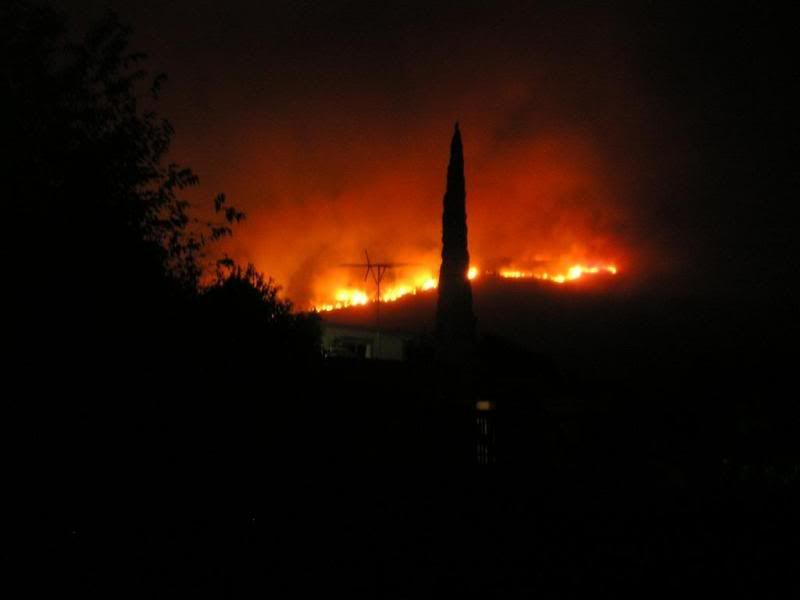
About 3 AM this morning when we left.
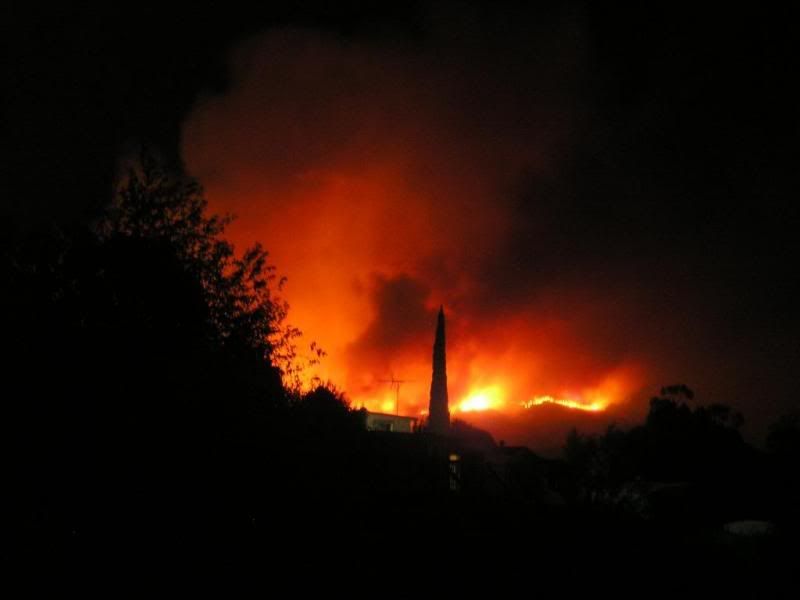
Another shot.
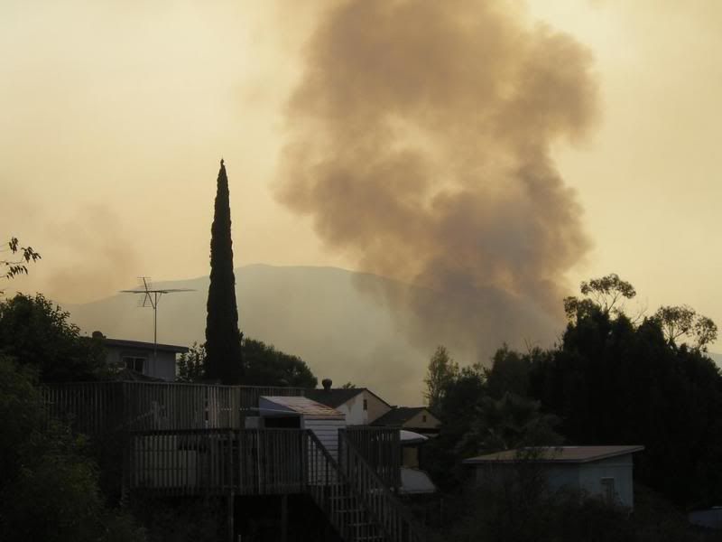
Currently.
-
Just some last minute info as we departed our neighborhood. The flames had passed the powerline road on the west side of Mt. Miguel and crept down almost even with the reservoir. They had also flared-up pretty good to the north side of the reservoir going near the newer housing development up on the hill near Jahoadi & Johns "Ugly" cache; not sure of the name of that residential area, it is the one on the east side of Jamacha Blvd/54, but they were under mandatory evacuation and we closer to Dictionary Hill were under voluntary evacuation.
The fire was still moving at a good pace down the west side of the mountain, in 30 minutes it had cleared the powerline road and was almost even with the reservoir, I was able to get some pictures of it from my home, just can't figure out how to get them onto this computer yet.
-
We live in Spring Valley on the north-west side of the reservoir just below Dictionary Hill and it appears the fire is making it down Mt. Miguel to the reservoir. Some parts of Spring Valley have been evacuated and our area is next. The fire has made it halfway down to the powerline road on the west side of Mt. Miguel and is continuing west at a decent pace. Although it seems for the moment the winds have died down considerably from last night. We are packed-up and will be moving out in a few moments.
-
Finding a number of caches in any one given day is not unheard of, my past month of caching once or twice a week turned out to be pretty good:
9-17 32 finds
9-18 25 finds
9-24 45 finds
10-1 10 finds
10-2 14 finds
10-8 30 finds
10-15 20 finds
10-16 12 finds
These numbers are by no means extrordinary or unheard of for my neck of the woods, but pretty good none the less.
It all depends on how cache-rich the area is and how well you plan your trips. Most of those days were done on desert runs to a great state park in California; encompassing much off-roading and days of 15 hours or more. Each trip would be on average about 250 miles round-trip. Very few of them were less than desirable locations and all of them encapsulated in the days adventure made each and every cache find fun.
So I guess labeling someone a liar or cheater, just based on where when they found caches on a particular day may be a bit harsh. And even so, what does it really matter as long on the day you choose to go caching you found something new, you met someone new or just plain and simple you enjoyed just one more day of life!
As far as team caching goes, I mean if that is the way they choose to cache and log and the owners of the caches have no problems with it then...
-
Just wanted to put a plug in for The San Diego County "Historic" Cache Adventure. This should be a rite of passage for all serious SD Cachers. The 30+5 caches listed on this cache page are all excellent examples of the early style of caching. Anyone who has visited all these sites will have experienced some of the best trails in the County. These are simply some of the better caches around and worthy of the "Adventure." Hope alot of you all out there take up the challenge!
A definate must-do cache; today I was lucky enough to knock-out another six on the list on a "historic" caching day with Miragee. Zipping all around from cache to cache with the goal to see how many we could get in a day! Still have quite a few more to do, but getting closer to finishing it.


San Diego Cache Events
in West and Southwest
Posted
I will be heading out there on Sunday the 11th somewhere between 4PM and 5PM. That night I will quick-camp somewhere near "The BRADSHAW TRAIL #1 GCMDJT"; I don't think it will be more than a three hour drive to there from the Spring Valley area. Monday morning early I am going to start at the southwest end of the trail and drive it northeast from "The BRADSHAW TRAIL #1 GCMDJT", stopping mainly for the drive-ups and the occasional walk {not too far}, complete the trail, turn west on the I10 near "Happy Meal McCache" GCE264 and then turn on Box Canyon Road near "See Me Not" GC10AB7 and do as many caches as time allows to get back near Salton Sea area and camp Monday night at the end of that road near "Cacheburger" GCTQKJ.
Monday night camp somewhere near the Salton Sea and then Tuesday morning do the caches just northwest of 66th Ave and the 111 starting with "Green Beer" GC11D31 and ending with "Rusty Rock Cache" GCHPE6, then come on home Tuesday evening.
If anyone is interested in joining up for all or any part of it let me know, it will be myself and Piglit in my truck and Boomer and the Cache Bandits are starting from the northeast end of the trail Monday, I think. I would have room for one in my truck, should anyone not have a high-clearance vehicle; and I wouldn't be bashful in offering to share the cost of gas for the trip! Be aware the geomobile is a tank, although the other day I replaced a bad o2 sensor and installed a K&N air intake system today, so maybe that was part of the poor gas mileage {the o2 sensor}.