

happycycler
-
Posts
296 -
Joined
-
Last visited
Posts posted by happycycler
-
-
Yes mloser, my circle is also expanding. I started searching by bicycling around my neighborhood but have long since found the easy ones within a bicycle ride of home. Soon I will need to drive and stay overnight in order to be in fresh territory. Enjoy your searches!

And congrats. NorStar on your first 100!
-
Thank you for bringing that to my attention. A new dimension to our hobby?

A conincidence: I was getting ready to search for benchmarks in Clinton county, IL and noticed that a couple might be inadvertant under water benchmarks. JB0836 and JB0837 were placed along a RR. Later Carlyle Reservoir was built. The RR is now crossing the lake, on a causeway and/or bridges. I am curious if the above benchmarks are now submerged? I e-mailed a sailboating friend, also told him about GCJTZD Boaters Only! Cache Strangely, he is ignoring my e-mail!

-
WOW!! mloser!! Way To Go!! Thank you for sharing your find with us via this forum.
-
Yeah fellow benchmarkers or anyone -- PLEASE feel free to rain on my parade! I have caught and repaired some of my early errors as I learned more about this hobby. But who knows what boners I am committing now, either through ignorance or haste. So "Bring It On"! (That should result in a BUNCH of corrections for my benchmark logs.)
I have met only three other folks who take this benchmarking seriously but would enjoy meeting some more of you. So when in St. Louis, MO area, look me up. I will even try to lead you to a couple of (drive-by) benchmarks, if I can.
-
I don't know USGS but I do know that the Missouri DNR (our state geodetic survey agency) continues to place survey markers around here. They were active through the 1990s and I believe that I have seen some from the 2000s. (The newer ones are not in our GeoCaching database though, thus I don't actively search them out.) I have also stumbled on some disks placed by other agencies around St. Louis -- probably not submitted to NGS however.
-
JC1585 is an example of some research by rogbarn & myself. We were able to do most of this on the internet but did visit some libraries without finding what we searched for.
-
Or maybe you could adde your GPS coordinate reading for a scaled mark. Thjings do change with time and with the seasons, thus photos in different seasons might be helpful for others? I look for marks that have been logged found by others and sometimes am unable to find them or vica-versa.
-
Or.... maybe it's God's way of washing the dirt off the disks to make them easier to find
...and rain softens up the ground for easier probes of the buried ones.
 Go for it, I say!
 -
CONGRATS!! ddnutzy!! Great finds!
-
YES!!!!!!!!!!!!!! Congrats on that search and that find!!!!!!!!!!
-
Thank you BDT!! Nice one!!
-
There is an example of a magnetic disk (at Univ. of Arkansas campus) atDusty Jacket's Webpage
-
Even if you are setting the altimeter (in a GPS which has an altimeter) it would probably make no difference. The altimeter will not be that accurate either -- but probably better than the GPS altitude (especially when you have recently set it at a know elevation, such as a benchmark).
-
Another example: A genealogy magazine had a link -- Library of Congress panoramic maps which led me to an on-line copy of an 1875 map of St. Louis which answered a question that I had about JC1585
See my logs for what I found.
-
To digress... I have noticed that most of the time my GPS will read with 10 to 20 feet of the ADJUSTED elevation for an elevation benchmark. Does this bode well for the accuracy of my GPS lat. & lon. or does it bode anything at all? I sometimes include my elevation reading even though I know that it is not as accurate as the listed elevation. I do this in hopes that it says something about the quality of my reading at that point on that day. Is this a foolish idea?
Thanks in advance for your knowledge about this!
-
I've been eyeballing a disc at the base of a lamp post I drive by on weekends; no great parking place nearby. And Ive thought: I see it; my GPS indicates I'm close to it; the pic would probably be very blurry ... Have I "Found" it? Oh, maybe someday I'll stop.
How about your bicycle VT ARL 784? I have found some marks with poor parking are easily visited by bicycle. Bicycles are very easy to park. Just a thought....
-
Now I'll go back and look for benchmarks (and the accompaning documents) along the way, and maybe some more clues will turn up!
Sounds like a great plan DixieRoo! I have found some benchmarks near and on county courthouses here in Missouri. And of course courthouses are good sources for many sorts of records of interest to genealogy....
I have also found several benchmarks adjacent to cemeteries -- but not near the cemeteries that we have visited for geneaolgy -- yet.

-
Welcome & CONGRATS DixieRoo!! I also enjoy the history that is connected with this hobby. I recently posted similar info. about a long gone village that was referenced in some genealogy document that we were looking at. (Hobbys can Intersect)
-
My wife wished to visit Callaway county, MO to do some genealogy research. I downloaded benchmarks for the county and had been reading a few of the datasheets. She mentioned that one of her relatives had moved to McCredie, MO which she could not locate on the current MO highway map. I was able to inform her that Kingdom City was formerly known as McCredie. (See PID JC1034 )
However my comment *Don't EVERYBODY know that?* did not go over too well.

-
TERRIFIC!!

-
Me & Bucky is obviously AWESOME!! (Over 3 benchmarks / day for a time period that I looked at -- 11/11/03 thru 5/20/04!)
I have seen lots of photos of his benchmark finds. He takes great photos also. And he has not been a member for as long as I have. My hat is surely off to him!! -
Great Job!! That is one that I have never gotten to look for yet -- BUT now, thanks to you, I know that it is there! Thank you for sharing your find with us.
-
Congratulations! and welcome to this hobby!! Please post here often and keep us up to date on your interesting finds.
-
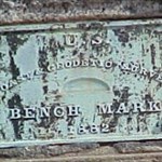
Sorry guy, I did not make myself clear! What I meant is that when I type JC0856 in the search box on the GeoCaching benchmark page, then I get the page for a 1935 disk: M 99 In MARIES county, MO. So do you have a typo on the PID? What is the PID for that great photo of that old USC & GS marking. Or I am doing something wrong here?
I would like to see your log and read the rest of the datasheet for that benchmark. ALso I am wondering where it is, in case I might get to visit it one day? BTW, I surely do appreciate your new camera -- your photos are now spectacular!


Photos Of Witness Posts And Markers
in Benchmarking
Posted
bump