

Holtie22
-
Posts
247 -
Joined
-
Last visited
Everything posted by Holtie22
-
Sorry, Harry, the OP did NOT bring it up. I simply responded to a post that DID bring it up to say that this thread is NOT about geocaching on the Appalachian Trail.
-
I am sorry that you apparently do not feel that the Appalachian Trail is a national resource worth protecting. While I do not support the Park Service's stance regarding geocaching, I do understand some of the reasons for it. But, at any rate, my post was not about geocaching. I am not aware of any prohibition against benchmark hunting on National Park lands.
-
For those of you who are close enough to the Appalachian National Scenic Trail, here is a story about a volunteer opportunity that involves many of the same techniques, but over much more challenging terrain. Another similar story recently ran in the local paper, and I was surprised to notice that the lead photo featured a monument with my LS number on it! I set this marker almost 20 years ago on the boundary of the AT Corridor just north of Pico Peak in Vermont. Now, volunteer crews from the Green Mountain Club are walking these lines to recover boundary monuments, repaint blazed lines, and replace boundary signs. Check out the ATC website to learn more about volunteer opportunities on the Appalachian Trail.
-
OK, you're going to have to look real close to make this out, but it was taken from a bus on the way to Mount Rushmore, many miles to the SW. Look on the horizon just to the left of the farm in the center. (You might have to increase the magnification - it looks more like a shadow)
-
1. You are correct 2. That's the way significant figures work in my world as well. And yes, they are quite capable of measuring the distance that accurately. 3. Unless otherwise specified, all surveyed distances are horizontal, ie. the short leg as opposed to the hypotenuse. 4&5. Swinging an arc over that large a distance is extremely difficult. You're better off trying something else first. In this particular case, (and frequently in many others), the easiest approach would be to examine the USGS Topo map of the area to see if the BM is depicted (it is) and then scale coordinates of the depicted location (N 35 23.314, W 094 25.989) to refine your search location. These coords appear to be about 500' north of the datasheet L/L, which is not that unusual for scaled locations, but I would be more inclined to rely on the topo map depiction than on the scaled datasheet coords. It is unfortunate that the previous GC finders appear to have had more of a geocaching mentality, trying not to "spoil" future hunts by not giving more specific information about where they found it. In Benchmarking, the whole point is to make it easier for the next person to find the mark, providing something of a public service for those who need the mark for professional purposes. Welcome to Benchmark hunting!
-
Are you sure you are looking around the right bridge? When was the highway relocated? Before or after 1974? Could the pole in this photo be U.P. 68?
-
nwaman, On which side of Highway 23 did you find AVEL? It looks like the coordinates fall on the northwest side of the highway, while the description places it on the southeast side. QO2222 was found (and a picture taken) just last year, so there's a good chance that it is still in place. Because the location is SCALED, the coordinates should not be relied on too heavily - the written description will give much better info on how to find the mark. Meanwhile, named stations, like AVEL are typically horizontal control markers. You can't log it here (try Waymarking), but you might be able to get more infomation about it from the agency marked on the disk, ie. MNDOT. If AVEL was found on the northwest side of Hwy 23, look across the highway for QO2222, at the end of a row of pine trees. Good luck with your search.
-
Imagine a road that ran from the ferry NW along the river valley. If you look at the current satellite images with the water receded on the west side of the UL Bend, you can almost see evidence of a roadway. Just a thought.
-
It appears to me based on the elevations (I concur with CallawayMT that these are more likely to be correct than L/L), that the level line was run down in the river valley and subsequently inundated, along with the road it ran along. Where was the Musselshell Ferry? Where is the Wilder-Legg Road? You'll need this information before you can begin to guess at the BM locations. If the Wilder-Legg road intersection is at Dry Lake as you suggest, then I would expect to find SQ0437 5.8 miles south of there and 3.0 miles north of the ferry, while SQ0363 should be another 0.9 miles south on the same road. If SQ0363 was in a fence line, it might have been a section line - the most likely candidate would seem to be the line between sections 21 and 28. Any evidence of a fence along that line? Can you estimate 30 feet below the highest pool elevation along the fence (if it's there) and near a fence corner? Good luck with the hunt!
-
Looking at the box score on the NGS Datasheet: AL0480|---------------------------------------------------------------------| AL0480| PID Reference Object Distance Geod. Az | AL0480| dddmmss.s | AL0480| AL0489 A 1943 APPROX. 0.7 KM 0892831.5 | AL0480| CW6724 B RM 2 36.208 METERS 34400 | AL0480| CW6723 B RM 1 23.430 METERS 34400 | AL0480| AL0483 C 409.387 METERS 3594258.9 | AL0480|---------------------------------------------------------------------| There are a couple reference marks located NNW of the station that might help you find it. They seem to be under the trees, so it is possible they are intact. There is also another station nearby: AL0489 It should be intervisible along the center of the road to the north.
-
Sorry for the confusing reply. When I said it was not in the geocaching database, I was refering to the main station (KS0923) that I linked to - not the azimuth mark. I can see how my misuse of pronouns could be misunderstood.
-
It appears to be an accessory to this station. For some reason, it is not in the Geocaching database, even though a couple of the reference marks are there. KS0925 KS0924
-
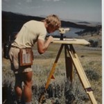
This Peanut's strip is from 1979 - about the time I started surveying.
-
I've been getting survey markers from Berntsen for nearly 20 years. Starting about 6 years ago, they have been using my disk in their advertising. Holt Survey Associates I wonder if I should be getting royalties - or just enjoy the free publicity!
-
This one was quite unique - haven't seen anything like it before or since. It's about 3 feet in diameter, and gives the direction and distance to prominent landmarks in the 360 degree view. It's located right next to the Lookout Tower (right of the steps) and causes confusion because the monument type is listed as tower. edit: oops - linked wrong one!
-
I tend to enjoy history-themed caches, and have created one myself: Golf, Anyone? It seems that the Wherigo platform offers a great opportunity for combining hisory with caching, in fact many of the existing Wherigo caches, at least in my area, are along these lines. Old Bennington WalkingTour Unfortunately, I don't think I have what it takes to implement a Wherigo adventure with the tools currently available.
-
Here's a video of the explosion: I was going to go watch it, but they kept changing the date. Maybe I can check on the BM. Edit: There is now a new cache to commemorate the demise of the bridge. It doesn't look too good for the nearest BM, but the Crown Point North Base and South Base look very interesting. Can anyone find a USC&GS publication that describes this Baseline?
-
Wow! Memory is a remarkable thing. While I struggle to recall things that happened last week, my memory is vivid of walking to school in the first grade, and my brother pointing out to me this shiny metal disk in a large rock. We didn't know what the heck it was - thought it might be the cap for a hole drilled through the rock deep into the earth. We were very intimidated by the message about a $250 fine for disturbing the mark, so I got nervous when my brother tried to remove the cap to see what was under it. Needless to say, he was unsuccessful, and we walked past that mark every school day for eight years. (1961-1969) I don't think it is still there, but will look more closely next time I'm in the area. It was a USGS mark, not in the NSRS, and it no longer shows up on topo maps, but here is a shot of the 1935 USGS topo which shows its location.
-
ZuZu comes with me nearly every time. (Even more than Mrs. Holtie!) She's not much good at sniffing out caches, but she is great company and loves being outside.
-
NGS measurements: Measured from nearest surface or center?
Holtie22 replied to TillaMurphs's topic in Benchmarking
When I was working for the National Park Service, their standards specified putting a nail and washer in the blaze of a bearing tree to provide a more definitive point to measure to. When I was working for the National Forest Service, their standards specified measurements made to the center of a bearing tree. Fast forward 20 years... If the bearing tree is still alive, the nail and washer will be covered over by new growth, but still very close to their original position. The center of the tree is also very close to where it was. If the tree has died, (or been felled) the position of the nail and washer is eventually lost. Evidence of the center of the tree, however, (stump, stump hole, tap root, etc.) will exist for much longer. When I locate these types of objects, (trees, utility poles, fence posts, manhole covers, etc.) for a survey, I always measure to the center of the object. All that being said, of course, the contrary can always be shown. -
It does not appear to be in the NSRS (National Spatial Reference System), also known as the NGS database. Here is one from the same series located a couple miles west. It is a USGS (United States Geological Survey) mark that was utilized by NCGS (North Carolina Geodetic Survey) in 1974. That is what got it into NSRS. The one you found appears on USGS topo maps, but was never entered into NSRS.
-
NGS (National Geodetic Survey) has a free program called "Inverse" that will do what you want.
-
So, I guess what this exercise has demonstrated is that a mathematical determination of the distance from RM2 to Anderson is not practical without some better data. Specifically, the distance between RM's, measured with care using proper techniques and equipment. Lacking that, your best bet, LSU Fan, is to correct a compass (that reads to the nearest degree) for magnetic declination, then measure the 64.53 feet from RM1 at a corrected azimuth of 218 degrees. You can sight to the same point from RM2 to see if you get a corrected azimuth of 296 degrees, as a check. This should get you close enough for probing/digging.
-
Here's my attempt at running some of the numbers given above... Better check my math!!!
-
Actually Guys, the Law of Cosines won't work for the example cited. The data you have can be formatted as Angle, Side, Side (or Side, Side Angle). The Law of Cosines only works on the Side, Angle, Side format. There are actually two solutions possible given SSA (or a**), as can be seen here. In some cases, you will be able to determine just by sight which of the solutions is the appropriate one, but there will also be instances where the two solutions are so close to each other that you won't know which to use - I guess you could always try both!