

Holtie22
-
Posts
247 -
Joined
-
Last visited
Everything posted by Holtie22
-
USGS is interested in getting recovery reports
Holtie22 replied to Black Dog Trackers's topic in Benchmarking
Well, at least now there is another mark in the area, and this one is listed in the NSRS. -
USGS is interested in getting recovery reports
Holtie22 replied to Black Dog Trackers's topic in Benchmarking
Looks to me like they built the interstate exit on top of that one, so they removed the X. Why they left the label, I don't know. -
Looking on Google Maps it appears that the RR tracks are still in place. If that is true, this should be a fairly straightforward search. From the description the mark should be very close to 2OF's red arrow, in the "Y" between the two tracks, 160.25 feet west of the junction switch (frog point). Find a point that is 20 feet S of the southerly rail of the straight portion of track that crosses the bridge a little further west, and 16 feet north of the northerly rail of the track that branches to the southwest. See if you can corroborate this location with the calls for the sign and telephone pole. Be careful, though, as you probably will be within the RR ROW.
-
Reviving this discussion, I'm with Harry again and also vote for Bridge B. The scaled coordinates seem to be reasonably accurate this time, as they put you on Highway 37 near a feature labeled Waiohuli Gulch on the topo, and also near a plotted BM. Unfortunately, the topo may have a typo as the printed elevation of 3225 does not match the contours at the plotted "X". These indicate an elevation consistent with the 2955 found on the datasheet, leading me to believe that this is P 23, TU0899. Let us know if you go look! BTW, try these coords - from Google Earth: N20 43.213, W156 20.714
-
I think this time Harry is steering you wrong. In the streetview you showed us, it was hard to make sense of the description - try this one: The semicircular lawn area could be the space between the two driveways, although by the location of the utility pole, the paved portion may have been expanded since 1979 to cover the concrete slab. Try looking 11 feet east of the pole, which seems to be consistent with the rest of the description, ie. 42 FEET EAST OF THE CENTER OF THE ROAD, 35 FEET NORTH OF THE SOUTH ENTRANCE ROAD, 100 FEET SOUTHWEST OF THE SOUTHWEST CORNER OF THE LABORATORY, AND 11 FEET EAST OF UTILITY POLE NUMBER 1. BTW, this location is also consistent with the BM elevation, unlike Harry's suggestion. It seems to be very close to the scaled coords for TU0902, S23, which should be found near Hwy 37, almost 80 feet lower. Another case of poorly scaled coords.
-
Harry got it right. Looks like somebody goofed in scaling the coordinates. Besides the Highway number, (which as Bill93 points out is subject to change over time), the datasheet elevation matches the BM depicted on the topo. The first bridge, on Lower Kula Road, is about 100 feet higher.
-
I have a picture but cannot post as i do not have an approved url for it. It appears to be this one.
-
Older and not so old Benchmarks of Hariman State Park
Holtie22 replied to woodstrider's topic in Benchmarking
You can also try this site, although it doesn't look like very many of them are in Harriman State Park. I would agree with Tillamurphs that your best bet would be to contact the USGS, since if they show up on their maps, they were probably used to control the mapping. -
Bill did a great job responding to your question. I just wanted to show you two (non-cadastral) cases where the USFS set marks that are in the NGS database. One is vertical control and the other is horizontal. QQ 35 QC0064: WILSON RD1646: Here's another: Linholm AA8201 Horizontal control for a cadastral project
-
Paul, Maybe this will help. (I also put it on the GC Page) When intersecting distances from a distinct point, like an RM, you would swing a tape from the RMs to see where the arcs of the record distances meet. To intersect "normal" distances from a linear feature, such as the edge of the gun emplacement, you would offset the linear features by the record distances to see where those offset lines meet.
-
In this context, normal simply means perpendicular to. (ie. the shortest distance from the station to the linear feature being measured to.)
-
From the perspective of a surveyor, the functionality of this mark as a third order intersection station is not diminished by the replacement of the lightning rod. It is obvious that the steeple remains in its original location. Although the likelihood of its being used by a surveyor is low due to changing technologies, it is certainly capable of serving its original purpose. I would go ahead and add to it's impressive smiley collection.
-
Mike, I found this reference to POSTED elevations on the NOAA website here Begin C/P Benchmarks in other categories were not retrieved: P - POSTED - Force Fix to NAVD88. N - Determined by Single Spur. O - From Horizontal Branch but Other Agency. Briefly, "adjusted" benchmarks form the bulk of NGS data. Using more recent software, these level surveys were checked and adjusted into the network. "Hand keyed" benchmarks refer to historical data (typically associated with the NGVD 29 datum) that have been adjusted and keyed manually, but have not been processed through the full set of more recent data checking and adjustment software. "Computed from nearby bench marks" refers to the same historical data as "Hand keyed", but are incomplete in some respect, most likely due to superseded and/or missing adjusted heights. "Reset" benchmarks denote geodetic leveling over short distances to establish a replacement mark for a benchmark, and usually have only one network point connection. "Readjusted due to earth movement" benchmarks have elevations computed from the most recent leveling measurements in areas of known vertical motion. "From horizontal branch" benchmarks represent short level tie data measured by NGS in the course of performing horizontal control surveys. For the categories that were not retrieved: "Posted" benchmarks were withheld from the NAVD 88 general readjustment due to excessive misclosures. After the readjustment, the troublesome survey lines were fit to the network, and the points were flagged. "Determined by single spur" benchmarks are established from only one network point, and are not considered sufficiently reliable for this data set. "From horizontal branch but other agency" benchmarks are short level ties performed by other agencies when conducting horizontal control surveys. Due to issues of data reduction, this category was not retrieved. In addition, control points obtained from standard trigonometric leveling were not considered to be of sufficient accuracy. And, benchmarks established from GPS surveys were not used. While such orthometric heights can be accurate, a data set independent of any underlying geoid model was desired. End C/P So, what I gather from the above is that POSTED elevations would fall below GPS obs. on PapaBear's accuracy list. I would surmise that D 67 has the most accurate elevation of the three, and that if it was used to level to Etna Reset, that information did not make it onto the Datasheet. Instead, the published Etna Reset elevation was derived from GPS observations. As for the original Etna elevation: it is based on vertical angle observations, probably from distant locations, which cannot be relied on in many cases. Applying the Vertcon correction to this value was probably not a good idea, as it gives a false sense of the elevation's accuracy. So I guess the lesson here is don't put too much faith into elevations that are POSTED.
-
Mike The significant figures give an indication of the accuracy, although with Vertcon the accuracy is stipulated as +/- 2cm. Vertcon is a transformation program to convert values from one datum to another, as opposed to recomputing values in a newer datum using raw field observations.
-
After reading this article in American Surveyor, I checked out the website mentioned and found this page. I tried it in Google Earth and it works great. Have not yet tried it in the Android
-
Found a survey disc - can't find it in database
Holtie22 replied to JeepFreak81's topic in Benchmarking
You might want to start with Monument 45 and State Line Marker 5: I suspect that 46 & 47 are on Power Co. property, so tread carefully! -
Found a survey disc - can't find it in database
Holtie22 replied to JeepFreak81's topic in Benchmarking
JeepFreak81, What a great find! As others have pointed out, this is not a geodetic marker, but rather a cadastral marker to delineate the Vermont - New Hampshire state line. As ArtMan and LSUFan discovered, the boundary was adjudicated by the U.S. Supreme Court in 1934, and survey markers were placed shortly thereafter: This publication lists all of them with descriptions, sketches and Lat/Long (in an obsolete datum). The marker you found is somewhat unique for a couple reasons: It is located on the NH side of the boundary, (because the boundary is the historic low-water mark on the west side of the river, the other markers are all in Vermont), and it was set at a later date. The latter was due to the building of the Samuel Moore Dam, completed in 1956. As you can see below in the 1936 publication, although a dam at this location was already contemplated, no construction had been begun. Judging from the sketch, the monuments on the VT side, 46 & 47, may still exist, but someone must have felt it necessary to add the one you found. I don't think they point to the same place on the boundary, but I don't know the coordinates of the marker you found, only the bearing and distance stamped on it. Very few of these monuments are included in the NGS database used by Geocaching, so if you want to log it, Waymarking is your best bet. -
Yup
-
Can I submit a report for a benchmark with no database?
Holtie22 replied to snowfreak37's topic in Benchmarking
The mark you found was placed by USGS, probably to facilitate their topographical mapping program. It is not in the NGS database, the one used by Geocaching for Benchmark Hunting. It does show up, however, on the USGS topo map: Alder Bend Topo (Click on My Topo - Upper Right) It is the "x" labeled "BM 1087" in the lower left part of the map. There is a previous thread (quite long) about reporting USGS marks if you are so inclined. -
Don't forget the elevation of the mark, itself. At 430 ft. it is 7 ft. higher than the level of Water Street where it crosses the creek, and only 4 inches lower than the top of the levee. (Those x's on the topo are most likely spot elevations, not BM's.) I think I would focus further NW of Water Street - closer to the 1000 meters from Route 3. (You're right, though about the margin of error) A metal detector would surely help. Do any of the other marks in this series (steel rods) have any sort of housing?
-
BigRedCliff, The marker you found is actually a cadastral (property) survey marker on the Exterior Corridor Boundary of the Appalachian National Scenic Trail. The stamping indicates that it is marker number 3 on Segment 404 in the State of Maryland. Only very few of these marks have been included in the NSRS (National Spatial Reference System), maintained by NGS. Here is one in Vermont.
-
flask, Found this station on the Maine DOT survey control points map It appears that the original USGS disk froom 1927 has been broken off, but the location can still be found and was used by Maine DOT to derive more accurate, GPS coordinates. From the Maine DOT database: Description for Station HAYSTACK (USGS); Owner: DOT STATION NAME: HAYSTACK (USGS) These coordinates are MDOT derived as NGS publishes the coordinates to 3rd Order. Located about 5.63 km (3.5 mile) west-southwest of Mapleton, 13.68 km (8.5 mile) east-northeast of Ashland, 0.32 km (0.20 mile) north on State Route 163; on top of Haystack Mountain. To reach from the B&A Railroad tracks crossing State Route 163 in Mapleton, go west along State Route 163 for 0.97 km (0.60 mile) to a fork at the Dudley Road, keep left and continue west for about 5.15 km (3.2 mile) to a turnout on the right with a road leading north into the woods; park here and walk north to the top of the hill and the station as described. The station is a broken off shank of a U.S.G.S. disk cemented into a drill hole in the balding rock at the top of Haystack Mountain, on property owned by Town of Castle Hill. It is: 9.02 m (29.6 feet) north-northeast of a 0.30 m (12 inch) spruce tree, 2.41 m (7.9 feet) east- southeast of a old anchor bolt. RM-1 is a standard disk cemented into a drill hole in ledge, 5.43 m (17.8 feet) north of an old anchor hole 3.66 m (12.0 feet) southwest of a 0.30 m (12 inch) spruce tree.RM-2 is a standard disk cemented into a drill hole in ledge, 8.56 m (28.1 feet) south of a 0.08 m (3 inch) white birch tree, 6.25 m (20.5 feet) south-southeast of a 0.15 m (6 inch) spruce tree. The reference marks were set in August 1993 and the original station mark was set at a previous time.
-
It certainly is! - but then, this forum does tend to generate some interesting discussions. This looks like an interesting part of Colorado - just north of Buena Vista. I looked at pictures of Elephant Rock in Google Earth. From the coordinates you posted it is evident that you found the section corner monument common to sections 29, 28, 32 & 33. (circled on map) I didn't get the Township #, but it is Range 78 West. This marks the NE corner of the property you mentioned: the NE 1/4 of the NE 1/4 of Section 32. Since this corner is four miles west of the Range Line, and one mile north of the Township Line, you could expect to find another chiseled mark in addition to the four depicted. It looks like the quarter-corner between sections 29 and 32, which is 1/2 mile west of the corner you found, is located close to the road you would have used to access this property. (It is labeled 8350 on the map - the elevation of the marker). Sorry for the redundant info - it took me a long time to post (had to bathe the dog!)
-
Try this link.
-
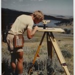
Here's a photo from the cache page - it's a USGS triangulation station, not included in the NSRS. You can log it on Waymarking.com if you like.