


Left Coast Labs
-
Posts
22 -
Joined
-
Last visited
Posts posted by Left Coast Labs
-
-
Don't give up on Waymarking just yet. It isn't the same as GC and the website/interface does seem to be more crude in many respects but once you get going you might really enjoy it. We've found it much easier with the kids on trips and much more informative. We have not stopped GC, just added more WM
 .
. -
Sounds like a great time! If we're still here, we're IN!
-
Navy range....Bravo-20. The heavy impact area is about 3.5mi to the east at Lone Rock. What they are looking at is a light-inert/urban training area, nothing big lands in there so no craters. Not sure why the boxes were arranged the way they were there, but my guess is because we didn't say how we wanted them so the range guys just made stuff up.
Wait until they find the boxes stacked to look like a submarine, that one should drive them nuts.
-
This location is designated as "Area 52"

Aliens don't stop here, it's just a billboard as they pass by enroute to 51.....
......or it could just be large shipping containers arranged for bombing practice.
-
I put some in last night.....hope they took.
The normal path (via the "datasheets" link) did not work, but there was a link on the bottom of the main page that did. Don't use any of the "go directly to" links. It appears that something did not get updated when they did the tech refresh.
Hope this helps.
-
There is a "5" in the second line to compare and, assuming they wear the same, I'm sure the number in question is a "3". I guess a better question would have been how do I submit the log for this one? Say nothing, say "the mark is worn and resembles...." or the "stamping actually reads..."?
I have found transposition errors and other typos in datasheets before, we're human. I would like to clarify an issue and not add to it if possible.
Edit: Concrete age is hard to judge, at least for me. There is very little to weather except for the sun, so some look almost brand new but will have a BM or other marking showing it to be from 30's. The old metal corrugated pipe leads me to believe this is the original culvert. Thanks again.
-
Station KR0137 in Nevada. The Datasheet says it should be stamped as: 86.75 0.270+06.58, but the mark appears to be stamped as 86.73 0270+06.58. I can see where that 3 could have been taken down as a 5 "back at the office".
The station I found is in the correct area and the measurements are good from the culvert wing wall (this is the only culvert along this stretch of road with a N-S wing wall) and highway centerlines. By good I mean within a foot for the centerlines and about four inches from the wing wall end.
I'm 99.99% sure I have the correct one.....just looking for some input from the pros (or at least very experience amatures
 ).
).Thanks in advance....Chris
-
Bill93,
I ran a rectangular search and printed off the summary sheet. When I first looked at data sheets I only had the "D" note. I just ran the data sheet search again for just those two PIDs and now see the "N" codes. Thanks for catching that one. Don't know why the rectangular search did not show the "N"s.
Still a bit strange to have three distinct PIDs for the same site. I'm sure there was a reason at some point.
-
That is really amazing! Will this update with the other data you put together on your site? It would be interesting to watch this change over time.
-
Looking at a new grid to search in the desert east of Fallon, NV, I found three PIDs with the same designation: KR1510, KR1845 and KR1846 all called BORAX. 45 & 46 are at the same location with 0.3m difference in elevation and neither have any descriptive text available. 1510 is adjusted and nearly exact WRT location and about 0.8m difference in elevation. They all seem to be the same mark.
Why is this? Should I look for three marks when I climb this hill or is it just one duplicated over the years? Am I having NooB syndrom again and missing something simple here?

-
I went back today and re-measured everything. This plate is within a foot of both road measures and from the witness post and stop sign post. I went out about 3-4 feet from my expected point and found nothing. This just has to be it.
It does have a different "sound" when tapped on the edges and in the center. As an aside, I found two other marks today that had the same kind of plate but with a hole in the center: KR 1829 & KR1838. I'm beginning to thinks somebody just forgot to use a plate with a hole.
edit: typo
-
Thanks for both answer and correction.

-
I'm just getting serious about benchmarks (convert from caching, thanks guys) and have found the radial and box search functions on the NGS website very helpful. I took an old TPC I had, gridded it up and then did the box search. Since you control the inputs, you know exactly how much area you are getting. Plus, since it is coming right of the NGS site it is (I assume) the latest data available. There are probably other/better ways, but this is working for me.
-
I read the USGS FAQs page so I have a good idea of when to submit updated coordinates and the actual coordinate format. Is there any standard phraseology for how to word the input? Do I need to include type of GPSr? Should I include the satellite and error data at the time of my mark? I envision something like:
SCALED COORDINATES UPDATED AS DD MM SS.S / DDD MM SS.S WITH GPSR (X SATS/ XXFT ERR).
Just wondering what everyone else has done in this respect.
-
I am going to go back to re-measure and poke around some more this weekend. I'll post up anything new that comes up. Thanks for the inputs.
-
Sorry, overlooked the details. This is KR1832 (B446) near Fallon, NV. Checked the current data sheet on the NGS site which showed installation in 1991 and it made no mention of a plate being installed. As I mentioned, I have seen others locally that have similar plates, but they all have holes so you can actually see the mark. Even these have no record of a protective plate being installed, so I'm not sure who has done this or why. I have a call in to a local surveyor to see if he has any information.
For now, I'm just going to leave this one as a note on the reference page until I can get something more solid.
-
Used GPS and measures per the description, dug down about one inch and found this plate. I have seen some local like this, but they have a hole cut out so the mark is visible. Any reason why it would be completely covered?
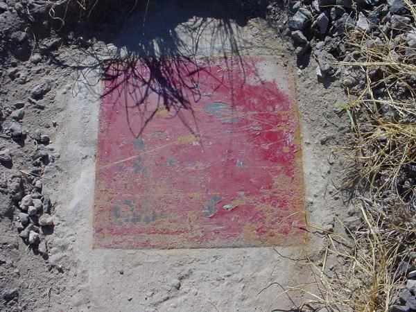
I'm not going to pry this thing up which leads to the question of a found or not found. Location matches up, but I can not POSITIVELY ID the mark.
-
Sorry for the late chime in on this one, I'm just learning the value of the forums.
The two-digit lettering system looks just like (but doesn't match) the Military Grid Reference System and World Grid Reference used on ONC, TPC and other charts. In the MGRS, the two letters identify a 100,000m square.
Not the same, but at some point somebody may have modeled after it to create their reference system.
-
Thanks all for the inputs. I didn't go to the NGS page for the latest datasheet info and thus missed the 2001 entry. I'll use the direct link in the future.
The "new" building is being renovated to become a restraunt, so with a little luck I might get a peek at the old wall and maybe the true B344. Until then, I'll post a note and go from there.
-
While looking for B344 (TR0332) I found a disk stamped B344 RESET 1965. The data sheet shows 1965 as the last time the mark was found and makes no mention of a RESET being placed
 .
.The original mark was on the side of a building which has had another building built next to it, covering the mark. The description fits the physical location of the RESET, now in the sidewalk instead of on the building.
Question is, how should I log this one? Do I log B344 as found or just make a note since I didn't find the actual mark and the RESET doesn't have a PID?
 .
.
 .
.
Yet another rating system
in General geocaching topics
Posted
It is possible, Deep Southwest Geocaching Project has been doing it for some time. Caches are "scored" on time since publication over total finds to provide a score to each finder and a next value to the next person to find. If a cache gets found all the time it might be worth 1pt or less but one that rarely gets found will be worth a lot. D/T has nothing to do with it, you assume that a high scoring cache is harder to get .
.
It is a great concept and a pretty cool site. I don't know how much time/effort goes into maintaining the project, but it is possible.