

shepdog
-
Posts
12 -
Joined
-
Last visited
Posts posted by shepdog
-
-
DECLINATION DIAGRAM
Declination is the angular difference between any two norths. If you have a map and a compass, the one of most interest to you will be between magnetic and grid north. The declination diagram (Figure 6-8) shows the angular relationship, represented by prongs, among grid, magnetic, and true norths. While the relative positions of the prongs are correct, they are seldom plotted to scale. Do not use the diagram to measure a numerical value. This value will be written in the map margin (in both degrees and mils) beside the diagram.
Figure 6-8. Declination diagrams.
a. Location. A declination diagram is a part of the information in the lower margin on most larger maps. On medium-scale maps, the declination information is shown by a note in the map margin.
b. Grid-Magnetic Angle. The G-M angle value is the angular size that exists between grid north and magnetic north. It is an arc, indicated by a dashed line, that connects the grid-north and magnetic-north prongs. This value is expressed to the nearest 1/2 degree, with mil equivalents shown to the nearest 10 mils. The G-M angle is important to the map reader/land navigator because azimuths translated between map and ground will be in error by the size of the declination angle if not adjusted for it.
c. Grid Convergence. An arc indicated by a dashed line connects the prongs for true north and grid north. The value of the angle for the center of the sheet is given to the nearest full minute with its equivalent to the nearest mil. These data are shown in the form of a grid-convergence note.
d. Conversion. There is an angular difference between the grid north and the magnetic north. Since the location of magnetic north does not correspond exactly with the grid-north lines on the maps, a conversion from magnetic to grid or vice versa is needed.
(1) With Notes. Simply refer to the conversion notes that appear in conjunction with the diagram explaining the use of the G-M angle (Figure 6-8). One note provides instructions for converting magnetic azimuth to grid azimuth; the other, for converting grid azimuth to magnetic azimuth. The conversion (add or subtract) is governed by the direction of the magnetic-north prong relative to that of the north-grid prong.
(2) Without Notes. In some cases, there are no declination conversion notes on the margin of the map; it is necessary to convert from one type of declination to another. A magnetic compass gives a magnetic azimuth; but in order to plot this line on a gridded map, the magnetic azimuth value must be changed to grid azimuth. The declination diagram is used for these conversions. A rule to remember when solving such problems is this: No matter where the azimuth line points, the angle to it is always measured clockwise from the reference direction (base line). With this in mind, the problem is solved by the following steps:
(a) Draw a vertical or grid-north line (prong). Always align this line with the vertical lines on a map (Figure 6-9).
Figure 6-9. Declination diagram with arbitrary line.
(
 From the base of the grid-north line (prong), draw an arbitrary line (or any azimuth line) at a roughly right angle to north, regardless of the actual value of the azimuth in degrees (Figure 6-9).
© Examine the declination diagram on the map and determine the direction of the magnetic north (right-left or east-west) relative to that of the grid-north prong. Draw a magnetic prong from the apex of the grid-north line in the desired direction (Figure 6-9).
(d) Determine the value of the G-M angle. Draw an arc from the grid prong to the magnetic prong and place the value of the G-M angle (Figure 6-9).
(e) Complete the diagram by drawing an arc from each reference line to the arbitrary line. A glance at the completed diagram shows whether the given azimuth or the desired azimuth is greater, and thus whether the known difference between the two must be added or subtracted.
(f) The inclusion of the true-north prong in relationship to the conversion is of little importance.
e. Applications. Remember, there are no negative azimuths on the azimuth circle. Since 0 degree is the same as 360 degrees, then 2 degrees is the same as 362 degrees. This is because 2 degrees and 362 degrees are located at the same point on the azimuth circle. The grid azimuth can now be converted into a magnetic azimuth because the grid azimuth is now larger than the G-M angle.
(1) When working with a map having an east G-M angle:
(a) To plot a magnetic azimuth on a map, first change it to a grid azimuth (Figure 6-10).
Figure 6-10. Converting to grid azimuth.
(
 To use a magnetic azimuth in the field with a compass, first change the grid azimuth plotted on a map to a magnetic azimuth (Figure 6-11).
Figure 6-11. Converting to magnetic azimuth.
© Convert a grid azimuth to a magnetic azimuth when the G-M angle is greater than a grid azimuth (Figure 6-12).
Figure 6-12. Converting to a magnetic azimuth when the G-M angle is greater.
(2) When working with a map having a west G-M angle:
(a) To plot a magnetic azimuth on a map, first convert it to a grid azimuth (Figure 6-13).
Figure 6-13. Converting to a grid azimuth on a map.
(
To use a magnetic azimuth in the field with a compass, change the grid azimuth plotted on a map to a magnetic azimuth (Figure 6-14).Figure 6-14. Converting to a magnetic azimuth on a map.
© Convert a magnetic azimuth when the G-M angle is greater than the magnetic azimuth (Figure 6-15).
Figure 6-15. Converting to a grid azimuth when the G-M angle is greater.
(3) The G-M angle diagram should be constructed and used each time the conversion of azimuth is required. Such procedure is important when working with a map for the first time. It also may be convenient to construct a G-M angle conversion table on the margin of the map.
NOTE: When converting azimuths, exercise extreme care when adding and subtracting the G-M angle. A simple mistake of 1° could be significant in the field.
-
depending on what kind of compass you have the functions are different. There are 3 norths. True North (what the north pole is), Magnetic North (what your compass points to), and Grid North (what the maps north dictates). These different norths are useful because grid north, magnetic north and true north are all different. You need to know the Grid to Magnetic (GM factor) conversion on you map located in the declination diagram. It looks like a triangle at the bottom of your map with a degree between all three of the norths. That is what you use to make sure you do your conversion correctly. When you convert grid to magnetic you subtract the number and magnetic to grid you add the number. There is a note about that conversion if you are in the eastern hemisphere. When you get your desired method there are some different holding techniques to obtain this information. I will try to get you some visual aids to help you out if you are interested.
-
I have been in the prediciment you were in just this past weekend. I had a travel bug and was helping it get some mileage by putting in my cache in Texas before travelling to Oklahoma. I logged it in in TX. and then placed it in a cache in OK. I neglected to get the number the second time. I had to go back to the cache and get the number. It was an inconvenience and I was cussing it at the time but it was my fault. I usually write down on the paper what I took and left at that cache and then download everything on my computer while everything is fresh in my head. I agree with the procedure and it will help control the travel bugs journey and safeguard it from getting lost.
-
I had made contact with Todd earlier today and was on my way to the Cabelas store in Kansas City. He called me back and I stopped-by his house on the way back. There were a good amont of ammo cans in his garage. They were all in good shape too. Man, he has a better variety than many army surplus stores and a lot cheaper. Contact him and he will hook you up. He was a really super person and you wont go wrong if you stop-by.
-
very good humor
-
I am from Arkansas and currently live in Texas. I have been in the Army for almost 13 years and get a chance to visit other caches in different states. I would like to organize some groups to promote caching in Arkansas and thoroughly enjoy the sport. It teaches a good message for children and adults. I visit my family all the time who live near Devils Den State park in northwestern AR.
-
I dont think that this is the problem but since Dept. of Defense operates the sattelites in the sky. In time of a conflict they will input faults in the system to prevent other countries from attaining accurate readings from civilian GPSs'. Therefore the only accurate GPS will be the military PLGR (precision lightweight GPS receiver). Other countries do not have dependable systems such as the U.S.
-
I am in Kansas right now on business and here until Christmas. Is there a way I can find your location to look at the ammo cans. I have a friend who caches with me. He would be interested in these cans too. Pleas contact me at darenshepherd@hotmail.com
-
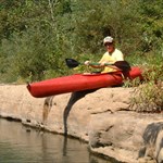
I dont know about the Black Lab story but I have a story of my own about an unusual cache hunt. I noticed a cache on a lake on a small island. I dont have a boat or canoe but want this one for a long time. I thought about buying a rubber raft but didnt want to spend a whole lot of money doing so. I frequent Wal-Mart a lot and love the outdoors so I at lease drop-in the sporting good section to see what is on sale. I noticed a one-man inflatable raft on clearance for around $5 and couple of weeks later ran into a pair of oars for $4.50 (also on clearance). I gear up and drive my Jeep to the closest spot to hike in to my launch area. I park, hike about 1/4 mile gear up and start paddling out. I get drenched in a bad thunderstorm so I terminate my adventure and head back. It is about 1/4 mile of a hike to the launch area, and over 1/4 of a mile to the island. I thought about the "what if" factor of the possibility of my inflatable becoming deflatable. It seemed like a bad possibility. I found an inflatable air mattress in another cache and decided to take it along as a back-up floatation device. I set out and started paddling. It was a long way to paddle out. I was also in the inflatable raft the wrong way and was overpaddling the whole way out. I spend 30 plus minutes getting there and seriously thought about coming back. I eventually made it. Spent about 3 minutes finding the cache. It was a let down. I thought about taking the marbles inside because I thought that I had lost mine. I get in the raft and make it back. Even thought the cache was a let down, the challenge alone was worth it. I guess us cachers are a different breed. The name of the cache is "thicket island" near zip code 76543

-
I have a powerpoint presentation on the GPS systems. It is not specifically on Caching but more so on education on the GPS systems. If you want it e-mail me at darenshepherd@hotamail.com
MapSend Topo for Sportrak Pro
in GPS technology and devices
Posted
try ebay