

Dr Jeckyl and Mr Hide
-
Posts
807 -
Joined
-
Last visited
Everything posted by Dr Jeckyl and Mr Hide
-
Unless CN is on the gps, and topo is on the card, then there won't be any swapping to do. The 60CSx has zilch onboard memory, so yes, you will be swapping.
-
You use the term "Battery Save Mode" and I think we've all fallen for that trap since all Garmin's have a BSM, even my Nuvi. We've all experienced the Hard, vibrator, and soft off modes, but I don't think Montana has a BSM that we're used to. I wonder what soft off truly does? Perhaps Montana can awake from soft off on WiFi or some other signal. I have not figured it out. If I go for a hike tomorrow I will test NEVER. The Battery Saver mode of the Montana is actually called "Auto Lock".
-
I'm sure "someone" knows. Google it and you'll find many references. Asking here is like opening your front door and hollering the question, when you have an encyclopedia (Google) at your fingertips.
-
It's got nothing to do with 'Secure Digital'. The maps are locked by Garmin using technology which has nothing to do with the card type.
-
Sounds likely to me. That was my thought when I asked earlier if the tracking continues when the unit goes into battery save mode.
-
This might have some impact on people who are noticing the Montana taking a while to acquire satellites: There is a software update for the 295W which you'll be offered if you register at my.garmin.com - it's very slow, probably take about 45 minutes to download and update, but it is worth doing. Once you start the update it just sits there at 0% complete for about 20 minutes, but let it go. It will work, it's just painfully slow. WebUpdater does not seem to know that there is an update for the unit - you must use "My Dashboard" on my.garmin.com This is separate from the map update, which I suggest you hold off on, since the maps are already pretty good. I created a Google calendar reminder which will let me know to update the map 59 days after I registered the unit.
-
Also, letting it shut off on its own is the equivalent of pushing the button quickly. Battery power goes down faster but I find it's a good idea to plug this device into a charger every day anyway. Doesn't take long to recharge. But when you let the unit go into battery saver mode, does it still record a track when it's in Pedestrian mode, ie not plugged into the cradle or charger?
-
I'll look for the "x", but I'm relatively sure I enabled geotagging. Beside, when I pressed the thumbtack, Montana placed the photo name on the map where I took the photo, must have the info to do that, I just want to read the lat & long numbers. Did you know that screenshots taken by Montana can be viewed on Montana, what a concept, OR & CO can't do that. Thanks for starting this thread, I like my new toy. If you view the picture, select the Thumbtack, then select the menu and choose "Save", you can then go to "Where to/My Pictures" and select the one you just saved to see the Lat and Long details. Here's what you see there. And I sure do like the way Google's Picasa web albums allow you to send directly from the Montana to an online album! For details on that service, check this out: http://picasa.google.com/support/bin/answer.py?answer=83342 Here's a bit of the description from the site: Use the email "Subject" line to add captions or to include the photos in a specific album. If the email "Subject" line matches an existing online album title, your photos will be uploaded to that album. Otherwise the 'Subject' line will instead be added as a caption and the photos will be placed in the Drop Box album. Learn more about the Drop Box album.
-
Not sure how you see Lat and Long directly on the Montana but if you click the menu button while you are in the thumbtack map view, you can "Send Location" in an email, and see the location in Basecamp or Mapsource.
-
Which coordinates? Current location?On reread my question wasn't clear. I'm looking to read the geotagged coordinates of each photo. Thanks Duh, I should read properly before I try to respond. The Geotag info of the photo is found through the thumbtack in the upper left of the picture, when you have it displayed on the screen.
-
BTW, How do I access the coordinates? Which coordinates? Current location?
-
Garmin 60cx vs Garm eTrex H
Dr Jeckyl and Mr Hide replied to Switch1625's topic in GPS technology and devices
That would be a real backwards step, compared to a 60CSx, and would certainly be a disappointment. Unless you're really strapped for cash, keep looking. Better to get a cheap Dakota, or even another 60CSx, IMHO. -
I don't think the Montana is a very suitable geocaching gps. I wouldn't want to use it for that, myself, but then I do have many other options... And it should be at least as good as any other Nuvi which some people make do with for caching.
-
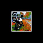
That's an awesome picture - glad you like the unit!
-
Look for the Garmin 295W. You can't add programs to it like you could on a Palm, but it would satisfy all your other requirements, and for only about $80 before taxes and shipping. It has Wifi, a fairly rudimentary web browser, pretty good email, and it also has a geolocating camera too. Check out this thread: http://forums.Groundspeak.com/GC/index.php?showtopic=265480 Many people are excited about this little gem. I know I am, anyway.
-
Colorado software version 3.52 Beta
Dr Jeckyl and Mr Hide replied to allory's topic in GPS technology and devices
I'm sure this will make many Colorado owners happy! -
GPX files from iPad to GPS
Dr Jeckyl and Mr Hide replied to Boost's topic in GPS technology and devices
The camera kit does not allow you to connect a gps to the iPad. I tried. Depending on what you plug in you either get "This device uses too much power so you can't plug it in" or "This device is not supported". The message language will be a little different from what I wrote as it's been a while since I tried and I can't remember the exact message. It might work if you "Jail Break" the iPad, but I'm not going to try that on mine, for now anyway. -
Yes those two holes are the lanyard attachment point. You can see the satellite screen this way. On the map screen, click the vehicle icon and that takes you to the "Where I Am" screen, then click the menu icon on the right. Select "Satelite Info".
-
Yes, there is a lanyard attachment point on one of the edges. That's one of the features I think make it a handheld unit. That and the landscape/portrait orientation of the screen. And speaking of keeping the unit in your chest pocket, check the last page of the manual for a warning about doing just that.
-
Don't know if this applies to a 62 but on my Venture I can go Find/Waypoints which shows a list of all waypoints on my machine. There is then a menu selection for Delete which brings up a sub-menu of Symbol type. Scroll down to you get to the Geocache Found symbol and select. This does not apply to the new generation of gps like the Oregon, Dakota and Colorado. Or the 62/78.
-
You don't upload your field notes to the Geocaching site? Your method of logging the finds is very outdated. Try this instead: http://www.geocaching.com/my/fieldnotes.aspx
-
are 24k topos from gpsfiledepot routable?
Dr Jeckyl and Mr Hide replied to Z06_Pilot's topic in GPS technology and devices
You have to click the Find button once you're navigating to get 'Recalculate Onroad'. Have you tried going to 'Routing' and select 'Guidance Method/Prompted"? -
are 24k topos from gpsfiledepot routable?
Dr Jeckyl and Mr Hide replied to Z06_Pilot's topic in GPS technology and devices
When you select a geocache to go to, then select 'go', try going back to the 'Where to' screen and see if you can choose 'Recalculate onroad'. -
Changing the Garmin 62s Position Icon
Dr Jeckyl and Mr Hide replied to eharston's topic in GPS technology and devices
Sorry, you can't change it on the handhelds. Bummer. Maybe Garmin will change that in a future FW update. It would be nice to be able to customize the position icon. Or minimally make a "large" or "small" choice available in setup. Thanks for the quick reply! You can wish all you want...but it's been that way on the Colorado, Oregon, Dakota and now the new 62/78 models...I seriously doubt they're going to change it, so I wouldn't recommend holding your breath. And all the models that came before like Legends, 60/76, etc. In fact the only handheld on which you can change the icon is the Nuvi 295W. -
How is the camera on Garmin 550?
Dr Jeckyl and Mr Hide replied to TexasCacheCrew's topic in GPS technology and devices
Here are examples of my 550 camera.