


Team LaLonde
-
Posts
426 -
Joined
-
Last visited
Posts posted by Team LaLonde
-
-
I can't pick between the loose razor blades that we found or the blue liquid that smelled like rotting shrimp. Both were shocking in their own unique way.
-
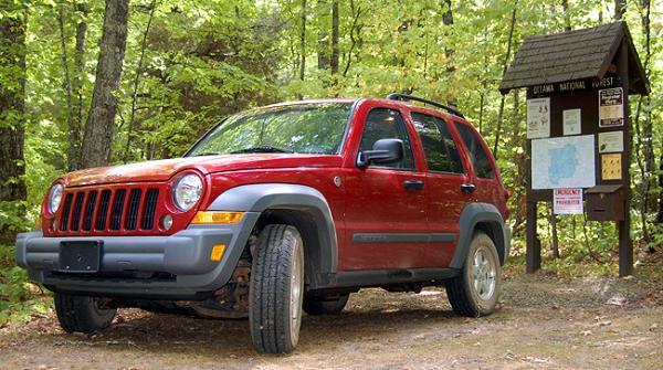
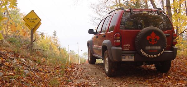
At first this looks like a standard Jeep Liberty, but in reality it is diesel powered! I can't tell you how many "Hey, buddy!!" comments we get at the filling station. Everyone tries to stop us from putting diesel fuel in our Jeep. The great mileage is a blessing. We can drive to Detroit, MI and and return home to Ishpeming, MI on less than two tanks of gas. That includes driving to malls and doing some caching over a long weekend (just over a thousand miles/30 MPG). We are thinking of doing a vegetable oil conversion in a few years depending on how much long-term damage is done on other vehicles.
-
If they would of updated the google maps before TDE disabled this cache, you could off seen it. I visited it and it would of been the first cache seen from space!
You must be referring to this one?
-
We got in the habit of dumping the contents out of the container. Good thing, too, since one cache had loose razor blades. I can't imagine someone reaching in there. The cache was an hour from any hospital.
-
Hehe, 50" for me is swimming. Being only 5' tall it creates an interesting cache.
Be sure to waterproof it well!
I don't know how thick the ice gets in your neck of the woods, but it gets pretty thick here, so be sure to place it deep enough that the ice does not damage it.
Yeah, probably swimming. I am still debating about the depth. I want to go do research now but i don't really want to go out in that cold water.

Put on some insulated/neoprene waders?

Take Me To The River - GC107F5: Beat ya to it!
 We placed this cache on January 2nd, 2007 when there was already ice in the river. I used waders to put the container at the bottom of a waterfall.
 -
I've spent as much as three hours at ground zero during one visit. Some other folks showed up and helped for about an hour.
The most time we've invested in finding one cache is 16 hours. That only includes hiking and searching - not driving to the area.
-
Absolutely!! We are simple country mice and while caching in Detroit recently, we were very frustrated. Having parking coordinates in areas with heavy traffic is a bonus.
-
My company's IT guys block geocaching.com so I have to wait until I'm home.
-
There's an underwater cache in lower Michigan that was sought after last winter by a group of cachers. They took a fishing camera to identify it. I'll see if I can find the cache page.
Edit - Here it is: GC10PNA. It was listed as an event.
-
We have been on a couple of hunts at night.
One was by accident - Treasures of the McCormick. We got lost at sundown without flashlights. The tree cover was so heavy that we hardly ever registered a trail on the GPS and we didn't mark the car. We had a choice of bedding down for the night or walk a mile and a half in the pitch black. We walked, using the backlight on the GPS as a flashlight. Our dog's sense of smell was the real reason we made it back to the parking area. The location of the mishap was a wilderness area in Michigan's Upper Peninsula.
Another somewhat scary night hunt was on purpose. I went solo on this cache because Mrs. L. had to go to work in the morning. I drove forty minutes from home and arrived at an unfamiliar lake shortly after midnight. The cache was hidden in mossy roots in what used to be a swamp. It was one of the creepiest settings I've ever seen in my life. What made it worse was the fact that every time I went into the woods I walked in a circle and ended up back on the roadside about 150 yards from my Jeep. I did this for about an hour and gave up.
-
The biggest danger here in Upper Michigan is the amateur hunters from Detroit. October and November become 'city caching' months.
As for reaching into stumps and dark holes in rocks, look for fresh piles of dirt around a hole or at the base of a tree that indicates a burrow. Fresh droppings or nut shells piled at the base of a tree indicates that something lives higher in the tree and may still be inside. There's no point in jabbing a stick into a hole that is obviously occupied. You could inure the resident or cause them to exit suddenly. The last thing you want is a porcupine in your lap or a skunk stinking up your clothes and skin.
-
I find this very interesting - just two weeks ago we purposely placed two wheelchair-friendly caches. We did this for two reasons: To encourage the disabled to go geocaching and provide a couple of easy finds for travelers and newbies.
-
We now look at the world in a manner in which nothing is impossible. Those hills and mountains are climbable. The waterways can be canoed or kayaked. We've put ourselves in situations that most people think are completely crazy and we LIKED IT. Thanks to all our fellow cachers who challenged us!
-
Nicholas Cage solves the hardest puzzle cache in the U.S.
-
Here's one: GC1048Y
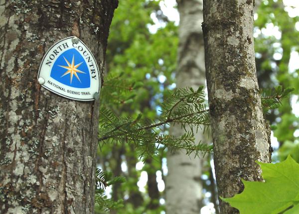
I know we have done more along the route but I just can't remember them right now. We own a cache a couple of miles off the trail in the McCormick Tract: GC14QQJ
EDIT: Upon looking at the trail maps for Marquette, Michigan, there are many caches along the trail. Look at Marquette in Google Earth to see them.
-
Do you have a list of the caches that you want to hunt?
That may give us more info about the roads.
Another thing you may want to do is contact the owner of the cache jus to make sure still there. I noticed lots of vacation caches, which need some maintenance or are completely gone.
I noticed a couple to the northeast, one to the east and several to the northwest on the other side of a mountain. We are most interested in anything near ruins, volcanoes or away from cities in general. We'll be staying with our daughter and son-in-law in Cuernavaca.
Anytime I try to get driving directions with Google Earth I get a 'no results' message.
-
I am sorry I do not speak Spanish, but I would like to ask a question about geocaches in Cuernavaca. No caches show on Google Earth in the city but there are many within an hour of driving. What are the roads like in the mountainous areas around Cuernavaca? Many of the geocaches have not been visited in more than a year. Are they difficult to get to or is there a lack of geocachers to find them? We will be visiting in April 2008.
Feel free to reply to me by email if it is easier - teamlalonde@charter.net
Thanks for any information you have to offer.
Thom of Team LaLonde
-
What's missing here, and what's sad about it all, is that the online log you leave isn't necessarily for the cache owner. It's for you. Do you really want to go back over a year of caching that you've done and see just "tftc" - ? No - those online logs tell the story of your experiences with those caches, and the audience that is most likely to appreciate them most is you, a few years from now.
Beyond that, good logs build community. It's how people caching in the same area get to know each other, for better or for worse. (literally - cache logs are how I first met my wife.)
Exactly. Logs and pictures are an online journal. I can't count how many times I was able to remember crucial events or trips by looking up my past cache logs.
I agree with this completely. Mrs. L has been keeping a notebook when we go caching on day trips or vacations. It's a lot like a photo album. She'll make notes about anything unusual, humorous, etc. and we write our online logs from this notebook. We keep the notebook in the Jeep and when a non-cacher gets in and thumbs through it they take an interest in caching. Sometimes we'll flip through it ourselves and talk about certain caches and experiences. If we wrote TNLNSL then we obviously missed the entire point of geocaching.
-
It seems that we found this one the morning that it was retired. We were on vacation and this one was on our 'to do' list. It's quite possible we were the last to log it. Glad we found it when we did!
-
Usually I prefer to cache with my wife and dogs, but there are times when a good long hike alone is a welcomed change. Being by yourself in the woods can do wonders for balancing the mind. Caching alone in the city is just boring.
-
I live in the Upper Peninsula of Michigan, so there are probably 1,000 trees for every person living around here. I'm not one to be super-environmentally friendly ALL the time, but if I see some trash along the trail or things floating in the river I'll pull out a CITO bag.
One of my caches got flamed for being in a high erosion area. The whole island it is on is a high erosion area and if you stick to the paths it's not a problem. The problem comes into play when you take the direct route straight up the slope instead of the trail around it. The deer in the area that run up and down the hill and the waves of Lake Superior (which are incredibly powerful year-round) are doing far more damage than the couple dozen geocachers that have found the caches in the area.
Hundreds of people visit that park every day. Your cache wasn't causing any harm. What's ironic here is that Marquette County hired skilled archers to thin the deer population in the park. Someone decided the deer were doing too much damage to their own environment.

-
Haven't found anything hiding yet. My biggest fear is reaching in and finding a porcupine.
-
The last time we ran into someone on a trail we had a cache in hand that we were going to hide. It was clearly marked with a MIGO sticker. The hiker observed it and asked if we were 'the ones that hid the geocache at Rocking Chair Lakes'. As it turns out, this particular hiker uses gc.com to scout hiking trips and has found that cachers know all the best trails!
-
We use the discovery feature to let the TB owner know that their bug is still in one of our caches. Some of our caches go extended periods without finds so it's a courtesy thing.

Looking at the world through GeoCaching colored glasses
in General geocaching topics
Posted
Oh how true! I recently took an outside sales position and was given about 185 addresses of current customers and prospects. I used the internet to convert the addresses to waypoints. Then I mapped the waypoints into routes and loaded my GPS.
Sometimes being a geek pays off.