

Rotareneg
-
Posts
191 -
Joined
-
Last visited
Everything posted by Rotareneg
-
http://www.geocaching.com/mark/#lognotin
-
I think I'll get a couple of the new NetR9 receivers, they should help with both geocaching and benchmarks.
-
Unfortunately RK0194 appears to have been destroyed.
-
The hole is big enough for it to fit without being squeezed shut. You first fill the hole with cement and then place the mark. When the cement sets it bonds to the sides of the hole, with the split end of the mark ensuring that it can't be pulled out. Also... Holy thread resurrection, Batman!
-
Python program to trim PIDs from datasheets embedded in GPX files
Rotareneg replied to Rotareneg's topic in Benchmarking
You can run it from a command line, like this for example: F:\GPS\Benchmarks>C:\Python31\python trim_pids.py trego.gpx -
Python program to trim PIDs from datasheets embedded in GPX files
Rotareneg replied to Rotareneg's topic in Benchmarking
The forum broke it by capitalizing the 'Groundspeak:cache' string on lines 17 and 18, something that the " " block is [i]supposed[/i] to prevent. To fix the program just make the G in Groundspeak lower case and it'll run. -
I made this little Python script to process the GPX files output from NGS»GPX 2 and strip out the PIDs that head each and every line in the embedded datasheet, making them much easier to read on a hand-held GPS. First, you need Python 3.x installed. Then copy and paste the script into a text file and rename it with a .py extension. Then you can just drag a .gpx file onto the script to run it. A console window will appear and show the PIDs as it trims them, and then it will overwrite the .gpx file with the trimmed version. Don't run it more than once on the same file or it'll trim actual text from each datasheet line. Also, you probably shouldn't feed it really huge files unless you've got plenty of memory: a 90 meg GPX with all the marks in Kansas peaked at 3 gigs of memory while running. And, of course, the disclaimer: If the program causes problems which end up with you thinking "I have no mouth, and I must scream" or somthing even worse, don't blame me. import io,sys,time from xml.dom.minidom import parse if len(sys.argv) > 1: print('File to read: '+sys.argv[1]) else: print('No file to read.') time.sleep(3) quit() doc = parse(sys.argv[1]) gpx = doc.getElementsByTagName('gpx')[0] wpts = gpx.getElementsByTagName('wpt') for i in wpts: disc = i.getElementsByTagName( 'Groundspeak:cache')[0].getElementsByTagName( 'Groundspeak:long_description')[0].firstChild if disc != None: print(disc.data[0:8]) txt = io.StringIO() out = io.StringIO() txt.write(disc.data) txt.seek(0) pid = txt.readline()[0:6] txt.seek(0) for line in txt: if line == (pid + '\n'): print('\n',end='',file=out) else: print(line[7:len(line)],end='',file=out) disc.data = out.getvalue() o = open(sys.argv[1],'w') o.write(doc.toxml()) o.close() doc.unlink()
-
Your Best/Favorite Benchmarking pictures.
Rotareneg replied to 2oldfarts (the rockhounders)'s topic in Benchmarking
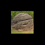
Here's a few found among the rugged peaks of Kansas: KG0657 KG0658 KG0718 KG0764 -
Oops, I think I miss-read your post and thought you meant you were having problems loading the GPX files, I see now you meant the custom icons.
-
After closing and then reloading Firefox the site stopped redirecting to that page, though I'm not sure if that was what fixed it or if it was just a coincidence. I had more than one tab open, one on the new beta map, another on the forum, and another trying to look at a cache, so perhaps the site saw all the extra connections and assumed I was a bot or something.
-
It seems to be stuck in an infinite loop for me as well. I guess I must be answering the captcha faster than a human should be able to...
-
Slow/No speed posistion averaging on PN-40
Rotareneg replied to Rotareneg's topic in GPS technology and devices
Did a more extended test the other day with just my PN-40: After 25 hours the recorded positions, which have a resolution of 0.000001 degrees, were all in a rectangle only 0.000002 degrees in longitude and 0.000001 degrees in latitude, or 6.78x4.37 inches. The PN-40 was was set to record a point every two seconds, the resulting GPX track logs each had 9951 points, and thus were about 5.5 hours long. Two of the logs didn't show any movement at all. Oh, and the GPS was indoors, hooked up via a powered USB hub for continuous power. Here's a sample of the kind of reception the PN-40 gets at that spot: -
Look closer at the second thread where caseyb asked for an experts opinion in this post, and you will find (trimmed for conciseness) this answer:
-
Did you use HTDP to convert from NAD83 to WGS84? If not, then your coordinates were already off by 1.25 meters: TRANSFORMING POSITIONS FROM NAD_83(CORS96) (EPOCH = 01-01-1992) TO WGS_84(G1150) (EPOCH = 12-08-2007) INPUT COORDINATES OUTPUT COORDINATES INPUT VELOCITY LATITUDE 35 49 54.04858 N 35 49 54.06516 N 1.35 mm/yr north LONGITUDE 111 26 13.35218 W 111 26 13.39761 W 1.14 mm/yr east ELLIP. HT. 1380.500 1379.648 m -1.09 mm/yr up X -1892475.274 -1892475.973 m 1.67 mm/yr Y -4819852.924 -4819851.586 m 1.14 mm/yr Z 3713874.250 3713874.166 m 0.45 mm/yr Ellipsoid : GRS80 / WGS84 (NAD83) Equatorial axis, a = 6378137.0000 Polar axis, b = 6356752.3141 Inverse flattening, 1/f = 298.25722210088 First Station : NAD83 ---------------- LAT = 35 49 54.04858 North LON = 111 26 13.35218 West Second Station : ITRF00 ---------------- LAT = 35 49 54.06516 North LON = 111 26 13.39761 West Forward azimuth FAZ = 294 8 25.3681 From North Back azimuth BAZ = 114 8 25.3415 From North Ellipsoidal distance S = 1.2495 m
-
Here's some more photos: http://www.penryfamily.com/surveying/missile.html
-
Your Best/Favorite Benchmarking pictures.
Rotareneg replied to 2oldfarts (the rockhounders)'s topic in Benchmarking
It's got five spots on its abdomen (if it were visible) while the Carolina Sphinx has 6. Gardeners probably know them better by their voracious caterpillars, the Tomato Hornworm and the Tobacco Hornworm. -
Your Best/Favorite Benchmarking pictures.
Rotareneg replied to 2oldfarts (the rockhounders)'s topic in Benchmarking
Here's a Five-spotted Hawk Moth I found right next to KG0121: You can see it on the shaded side of the corner at the bottom of the picture: And the mark itself, so well camouflaged that I couldn't find it the first time I checked: And the grain elevator itself: -
While it's not in the same category as an R8, the GeoXH is a dual frequency receiver, and can connect to a VRS network.
-
The last two I submitted (found on the 14th, but I think I submitted them on the 15th) have shown up.
-
Because everyone just has 6 grand laying around. I was just saying it's cheaper than a new car, not that it's actually inexpensive.
-
They're not really that expensive, a Trimble GeoXH is less than $6000 and will do real-time 30cm with the internal antenna and 10cm with an external one.
-
It's a tile probe, I'd like one too.
-
I'm not sure if this is just a temporary side-effect of the maintenance they did over the weekend or what, but for now, you need to change the "www" to "nweb": The original address http://www.ngs.noaa.gov/cgi-bin/ds_mark.prl?PidBox=KG0657 returns an SQL error, http://nweb.ngs.noaa.gov/cgi-bin/ds_mark.prl?PidBox=KG0657 works fine.
-
Your Best/Favorite Benchmarking pictures.
Rotareneg replied to 2oldfarts (the rockhounders)'s topic in Benchmarking
I found something somewhat amusing this afternoon: The witness marker for the azimuth mark for KG0718 was missing its post, the sign was just jammed into the ground right next to the mark: And a while back, when I parked in the entrance to a field to go find the azimuth mark for KG0717 I noticed something furry in the field. Turns out it was a very, VERY dead Coyote (posted tiny as to reduce the gross-out factor): -
Yes, use NGS»GPX. The link to v2 is right below the "NGS»GPX v3" title.