


Colorado3G's
-
Posts
43 -
Joined
-
Last visited
Posts posted by Colorado3G's
-
-
This was in our Travel Section Today in the Sunday Denver Post!
-
Thank you everyone for the replies - I do appreciate it and won't report anything as it looks to be normal! Thanks!
-
Just wondering if others are seeing this too on their Montana's....I'll probably send a bug report to Garmin. The Satellite screen displays a different Elevation than the Elvation Profile and Waypoint screen when saving the waypoint. See my pictures below - 5629 on the Sat Screen and 5651 on the elevation screen(ignore the 1' difference on the waypoint...I moved) Its almost always has about a 25-30' difference.


-
My recommendation would be the 20. I have the Dakota 10 (along with a Montana 650).....granted the touch screen is very nice and I do like that feature over the Etrex...but IMHO when comparing features and price between the two units which are very close - the touch screen is actually a negative when comparing the units - I've done the comparison because I have two close friends looking to buy in that same price range.
The Dakota is pretty much worthless in anything other than direct sunlight (even more so for those of us that need reading glasses) and even then you are constantly trying to adjust the angle so you can read it - the backlight is so weak that you need direct sunlight on the unit to be able to read it....although when it is in sunlight, it is very readable then...but you don't always cache on sunny days or without trees overhead. For about the same price you get a small bump up in features and a screen that is readable with the 20....the touch screen is just not worth the pain of not being able to read the darn thing and if you mount it on something like a bike - you can't move it around to see the screen - you have to move your head around to get the right angle - don't crash into a tree while your trying to do that
 . I still use it when I need something smaller than my Montana (like skiing last weekend) - but other than that it stays in the car most of the time and is just a backup!
 BTW - why did I even buy it - I got my Dakota new in the fall on the cheap through Qbids for $5 - you can't beat that price.....otherwise I would not have purchased it.
-
I also found that using basecamp if I installed all the maps at once.....you could not turn off and on specific maps depending on if they were transparent etc...... For Instance - installed 3 maps at once (Streeet, Trails, and Topo) and it was only seen as one full map and I could not turn off Topo and leave streets on etc.....so separately was the only way to go...
-
According to the documentation, I should be able to change the colors of my Montana's satellite strength bar graph. But when I click on MENU when viewing the satellites page, I don't see an option to change the colors. I'm running firmware 3.70.
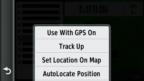
Anyone know the answer?
I thought it was an option too....but I can't find it either....
-
it was 34 feet away from where it should have been.
That's not uncommon at all. There are so many variables from your GPS to another GPS to how did the CO enter them and obtain them (Averaging) etc.... I've had caches that I'm right on the nose and several that ar 40+' off......just yesterday I had one that was 36' off from my Garmin 650.....that's the fun part of the hunt - if you don't find it - expand the search the GPS is just to get you in the vicinity!
-
I went through the same exercise this entire fall too. I stuck with Garmin and really didn't consider other models though. I ended up with the Montana 650 and simply love it - of course I got a great holiday deal and paid less than $450 for it - so that helped. I also ended up with a Dakota 10 through Q-bids and it has good functionality - but I really hate the screen on it and I would probably not recommend it at all nor the Oregon (although I think the Oregon has a little better screen from my comparisons). I have a friend looking too and I know he can't afford the Montana and I am recommending to him the Etrex 20/30 or 62s.... IMO - unless you can afford to get the Montana - the touch features don't justify the poor screen visibility in varying light conditions and the button versions and brighter screens far outweighs the touch screen. If you can afford it - I'd go with the Montana series hands down.
-
Ipad
Blackberry
Dakota 10
Montana 650
Just got the 650 and absolutely love it....but albeit it's pricey but got a greal deal on it!
-
Could it be a home location setting was not set correctly in Basecamp and therefor passed data over from a different home location/coordinates.....5000 miles away? Like in GSAK you have a home location. I'm trying to remember if that was a setting in my 650 where you set a home location in the settings!
-
I have 3.7 on my new 650 and it's dropping graphics like the clock on the main menu or the compass after about 15+ minutes of use.....sending a note to Garmin today!

-
Awesome! Thank you so much!!!!
-
I have a quick question....I'm trying to load via BaseCamp two GPSFileDepot maps.....one is CO TOPO and the other is the popular transparent Trails maps.... I'm trying to load these onto my SD card on the Montana and Basecamp is combining them into one file so when I go to select maps....CO TOPO and Trails are combined and not individual choices... When I just done one of them - the other is wiped out....should I load one and rename it then load the other and rename it??? Any idea how to make them individual selectable files so that I can have both on my GPS but only load my City Navitgator and Trails.....and not TOPO....which is pretty much a stand alone map.....
Thoughts? Thanks!
-
Oh my, you let a $500 GPS set on your windshield for 1 hour while eating lunch? A couple years ago I learned the hard way. I had a cheap $100 nuvi sitting on my windshield. I pulled into a hotel after work in broad daylight for 35 - 45 minutes to shower and change clothes for dinner. I came out to get in my car and the door lock was damaged, the window smashed and the nuvi gone! They did about $500 damage for a $100 nuvi. Luckily my insurance covered it all including the GPS.
Me too - I lost a Tom Tom in Hawaii on Vacation....simply popped the top off my rental Jeep!
-
We live in Colorado and I spell my name Gregg with 3 G's and there are also 3 "G"irls in our Family!
Colorado3G's
-
Awesome...I tried one of those but missed the other.... Sweet! Thanks!
-
There is a great series of videos to help take the fear out of GSAK on Youtube.... Just search in Youtube for "Geocaching with GSAK" and there is an 8 part series there that really helps get you started....I'm new to GSAK and really starting to understand the power of it.
The one thing I'm still looking for is how to view all of my points on a single map....so I'm playing with Macros for now....but not sure if I've found the right one yet...
-
Is there a work around process so that it doesn't do this.... Like remove it or turn it off before you turn the vehicle off... Suggestions? Got one for the family for Christmas...! Thanks!
-
Best bet is to make a visit to the local enforcement office with some Geocaching info or a brochure and just make sure they become "aware" of it.
I guess we should start carrying these in our packs!
http://www.geocaching.com/articles/Brochures/EN/EN_Geocaching_BROCHURE.pdf
-
EMS ROCKS!
They found one at a local store and had them hold it for me. They, they put me in touch with the store (in NYC). They are shipping it to me next day air for the same price as the second day air I was paying for yesterday. Should be here Friday.
Now to get a 16gb Class 10 MicroSD card at Best Buy Thursday night.
Awesome!!!! Glad it worked out!!!!
-
I ordered earlier this afternoon for the Montana 650 and it was cancelled as being out of stock 9 hours after I placed the order.
Bummer - I was just a few hours before you and I just got my shipping notice! Whew!!!
-
At that kind of discount it is kind hard not to go ahead and splurge the extra $40 w/ free shipping for the 650t.
Thought about that - but I think for geocaching and hiking the 100k topos really don't do anything for you....you really want the 24k topos....IMHO
-
eTrex Venture HC is on sale today only at Amazon for $99 under the Gold Box deals......13 hours left at the time of this writing....
-
All,
Eastern Mountain Sports has a 20% discount on one item promotion going on right now. Expires 22 Nov. The coupon reads not available for Garmin, but if you call and ask for it they will honor it. If you live in a state where they have an actual store you have to pay tax though. They have 650 and 650t available. Although they have one less 650 since I just ordered myself one. They also have a really good no questions asked return policy if you don't like the unit.
Make that 2.....I just called and they also honored the 20% off with free shipping even though the policy says no....I just asked nicely for the 650 (provide them with the online product ID) and it would be great if they could apply the 20% coupon....they did....that's a great price for the 650 since they have one of the lowest prices to start with in the first place!!! I wanted the 650 but had been hesitating price wise....it's on its way! Thanks for posting!!!

 . I still use it when I need something smaller than my Montana (like skiing last weekend) - but other than that it stays in the car most of the time and is just a backup!
Geocaching.com site update Feb 14th, 2012
in Geocaching HQ communications
Posted
Already said - but I'm just venting too!!! The MapQuest Aerial simply does not work and is worthless!!!! You only get half the tiles and if you zoom in you get nothing. Google Earth still is okay though to view by aerial images. Typical Google though - heck their map services have slowed down so much over the past year - they aren't as reliable as they used to be either!