

flipflopnick
-
Posts
199 -
Joined
-
Last visited
Posts posted by flipflopnick
-
-
New ZIP file with new categories, also cleaned by removing duplicates.
-
.png) 1
1
-
-
Added newest categories, new south America only idea
-
The icon is not in our control. HQ have an in house artist who will create one soon after category passes.
Now open and accepting pigeonniers!!
And -- we need a specific category icon, not just the generic one we have now. Calling pixel artists!! I do not have this talent

-
Not sure we can stipulate category group. PTB choose in the end IMHO We just suggest
-
Suspect may not be global. Let us see whether outside France examples are found.
Also suspect on our island (UK) Victorians rendered everything, sealing all gaps. Converting dry stone construction to mortared buildings.
Personally have no photos of dry stone huts and have walked extensively on our island.
By "dry stone" means "constructed without mortar". <-- use that in your description if you want.
Also none of your examples have glass in their windows. <-- use that in your description if you want.
Plenty of dry stone walls round here.
-
many thanx. Phew it was not something I had done. Let us hope it comes back.
-
On GC listing page the map near top of listing page is missing for me in all browsers. Have turned off all proxies. Not map replaced by GME near the bottom but map which shows where in world GC is. Has anyone else got this problem?
-
DO NOT USE OSGB given on geocaching.com as it is inaccurate as are coordinates taken with a phone. Use your phone to find caches only. Streetmap convert coords better than Groundspeak, more accurately. Grid refs are converted from another system. Your GPS converts from lat long given by satellites. OS have their own software to download for free which converts many ways.
Groundspeak use WGS84 datum, which thinks the globe is round, where as OSGB think the UK is flat, IMHO. OSGB use a datum in Newlyn, Cornwall.
Generally Groundspeak grid refs are approximate , they get you near the GZ whereas lat long gets you exactly to GZ.
The further away from Newlyn, the more inaccurate the conversion by Groundspeak, IMHO. So GCs near Thurso ...
-
Yet more. Categories added in May, new Categories before this were added in March.
For some unknown reason North American and African Categories completely omitted. Now included. Still no specific South American categories. Saopaulo1?
-
Newest categories added
-
More countries and categories
-
I actually paid PM fee to help run WM category, then when smartphone could GC used PM to cache as well.
Active WMs - ask HQ. There are probably 50 prolific Waymarkers, but many who dip in and out.
According to http://Waymarking.altervista.org/stats/WaymarkerStats-4Columns.html
there are 202 WMs with over 500 postings.
DougK does a ranking.
I'm guessing that there are less than 50 active Warmarkers world wide. It's geocachers like myself that support Groundspeak with our PM's. I'm like you, I would not renew my PM either just to keep my Waymarking benefits, but as a geocacher I will maintain my PM for the benifits of PMO geocaches.

-
Make sure you have installed latest version of JRI's script, 0.7.3 from https://openuserjs.org/scripts/JRI/Geocaching_Map_Enhancements otherwise the drop down menu to right of your GC name does not have "Geocaching_Map_Enhancements".
There are 2 places to insert Custom Map info. One through drop down menu next your GC name, other on "Geocaching.com Map" link. Once that new tab opens, find the "Configure Geocaching Map Enhancements" icon. Was bottom left. Add a Custom Map source in both cases.
Now to do that on all my devices!
Now, how do I insert the custom map bit into the http cache page bit? Can't see where I do that. I assume it needs to be done on the "view larger map" but there's no options apart from choosing map.
If you go to your normal profile page,(or normal cache page) just to the right of your name in the top bar there is a pull-down arrow. GME settings for the cache pages are there.
-
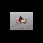
Not sure whether this is what fits this month's theme.
This is my kayak on the beach to Hestan Island Hop
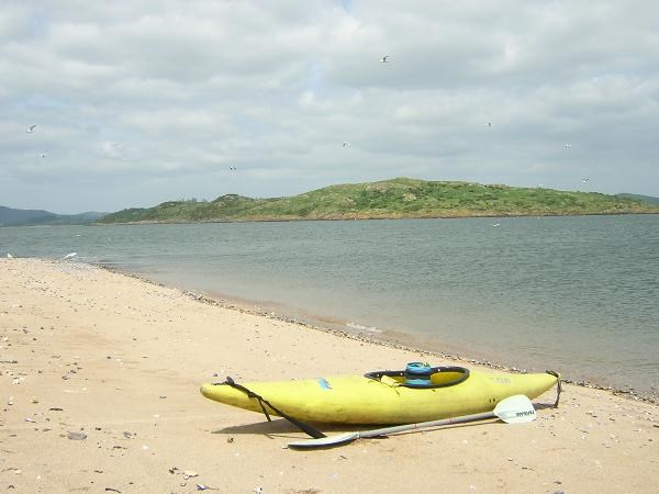
which I had to paddle back to Balcary Bay. Read log.
Basically planned a four day holiday, booked accommodation, drove 150 miles then kayaked across.
-
New categories added in Germany and Portugal and non country specific.
-
Have changed hosts. Categories.zip now at new server.
Also added new Category, first since March!
This bundle of text files are sorted by country and universal ones which can be used in any country. Can be loaded on to your tablet or smartphone when out of wifi or 3g range to read category descriptions.
quote name='flipflopnick' timestamp='1394451753' post='5359338']
Some recent Categories added to zip archive in first post. Possible use for paperless Waymarking.
Unarchive zip file of text files to a mobile device and search for specific words in the field to see what is needed by Category Managers.
-
Some recent Categories added to zip archive in first post. Possible use for paperless Waymarking.
Unarchive zip file of text files to a mobile device and search for specific words in the field to see what is needed by Category Managers.
-
-
Use your phone to store the GCs offline. c:geo will store GCs for finding later. Use phone's GPS to get near then use cacher's sense to home in. If all fails, turn on etrex and use that.
-
An ordinairy USB to serial cable may not work. No idea why. I have always used a dedicatd USB to Garmin etrex cable. This is the old etrex not the new model with same name. Other posters may not be aware of this old Garmin GPSr. I still use mine with the special cable. The software is set to etrex yellow using serial connection of COM:1 to 8 depending on what port your cable software chooses as virtual COM port. Look in system properties for COM ports, not USB.
I have and still use my etrex yellow as it is more accurate and quicker than my smartphone.
EasyGPS software (free version) will load multiple GCs on to an old etrex, assuming you get right cable. So will GSAK. Only load today's intended finds or etrex will fill with unfound GCs. Only 500 GCs capacity. Delete GC once found or delete all before loading more. Can always load more in the field, manually. USE GSAK or EasyGPS as master database.
NB Always plug USB end of special cable in to same USB port to use same COM port number. Saves time looking in System Properties each time. In UK I buy special cable mail order.
The old etrex yellow is running software version 3.1 Also ensure you have set coordinate system on etrex to DD.MMMMM or DD MM.MMM this sets datum to WGS84, which is what you aiming for. You can not set datum, but coordinate choice chooses relevant datum. Groundspeak use WGS84 datum. Other mistakes will occur.
Oh and use rechargeable batteries and carry spare batteries. NiMh or eneloop 2000 mAh are preferred.
HTH
My etrex old records my Track to save using EasyGPS and then stitch in to photos taken, called geotagging. Yes I know my phone will do that but camera is better optics.
If any further help wanted please feel free to contact me through profile.
-
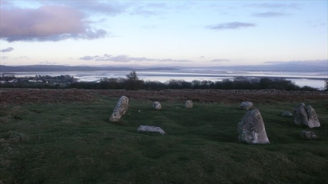
Sunbrick,Druids,Birkrigg(,stone circle)
The cache is up the slope from the stone circle and not very photogenic. Nor is the stone circle.
Archived in October 2009. You are looking at a stone circle with Bardsea to left and Morecambe Bay beyond with tide out.
-
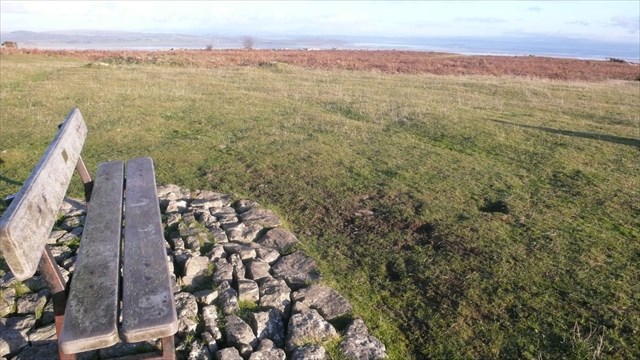
This is the view from POINTS OF VIEW STAGE 3 A BENCH FOR BIRKS which was archived in April 2007. Birkrigg Common is usually covered in people. Note shadow on right. Birkrigg has many GCs now, but this may have been the first.
-
Creating this cache was a long process. It all started in early July 2012 when I started to compile the Fred Whitton Challenge Bookmark list.
The cache followed later and took several days to write. I changed the date so that the cache appeared in the review queue as normal or so I thought. It still took 48 hours for reviewer to reply with some alterations needed. For a start they suggested this was not an ordinary Multi but a special Challenge Cache. Never heard of Challenge caches. Quickly came up to speed on Challenge Caches. And the cache type for Challenge Caches is Unknown not Multi.
Also I had to assure the reviewer that I would check each Found log that the finder had satisfied the Challenge criteria. Several changes later.
This dialogue took a week before the reviewer approved the Fred Whitton Challenge Cache on 20 August 2012.
-
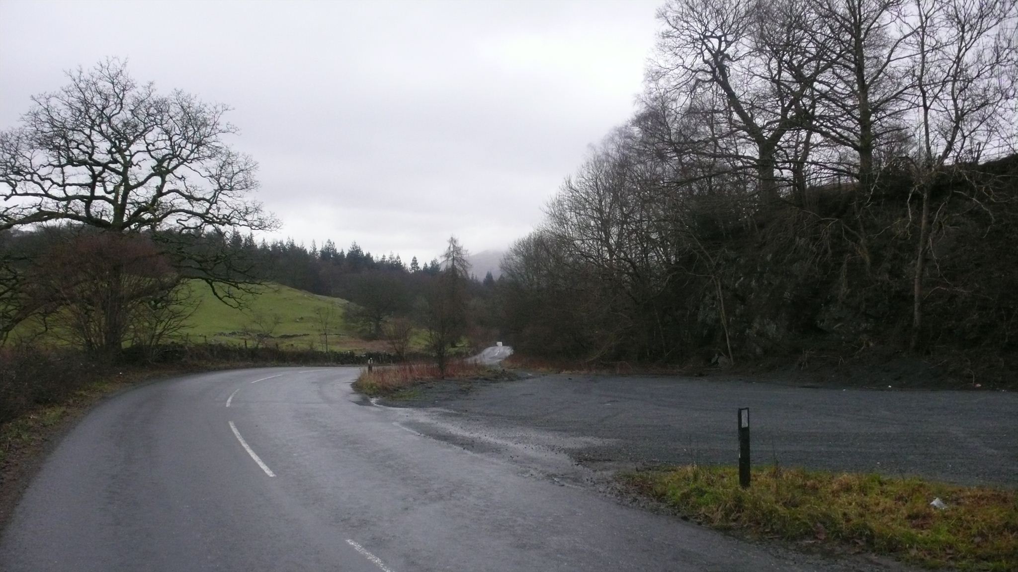
Here is the scene on B5286 today at Spicka Coppice GC which was archived in August 2009.
.png)

Plastic roads as New Category
in Recruiting and Category Proposals
Posted · Edited by flipflopnick
addition
This is an easy one for the Waymarking community to get behind. Plastic roads are just being introduced. Mainly in small sections. Ideal for us to locate and photograph. The UK developer is based in Southern Scotland, but other countries have their own promoters. Proof of plastic being used in construction of the carriageway might be difficult. Photo of inaugural sign, perhaps, or article promoting Plastic road section.
eg
https://www.gazettelive.co.uk/news/teesside-news/how-a689-motorists-driving-plastic-15060957
and
https://www.transport-network.co.uk/Cumbria-trials-plastic-road/13616
and
https://www.cumbriacrack.com/2016/12/13/cumbria-first-trial-new-plastic-road/
How else do we provide proof plus any other ideas?