

Ernmark
-
Posts
533 -
Joined
-
Last visited
Everything posted by Ernmark
-
I don't think this one has been posted yet: Colorado WM12FJ posed by Team Nin Dawg
-
Thanks ! The team is beginning the planning stages!
-
Greetings! EOA season is coming up again & I was still wondering if anybody has run across any notes on MARYLAND HEIGHTS S or the nearby referenced unpublished station PIVOT - JV4627 ?
-
Found a benchmark that no one seems to know about
Ernmark replied to tachoknight's topic in Benchmarking
Story update - it made it into the Waymarking database: WM7P62 and there's now a day pic to boot! -
BDT - can he waymark those disks........individually?
-
Your Best/Favorite Benchmarking pictures.
Ernmark replied to 2oldfarts (the rockhounders)'s topic in Benchmarking
..there's always HV4442 -
Apparantly most of the 'major' brands did this - I have a 7up & Coke marker myself & see Grapette markers on Ebay all the time. Interestingly I've never heard of or seen an example in my part of the country..
-
Really want to log Benchmark not in the system
Ernmark replied to snowball's-keepers's topic in Benchmarking
..looks like it isn't in the GC database. You could create a waymark in the U.S. Benchmarks Category on Waymarking.com -
..another nice one from AZ: USGS R13 1933 by dcrep
-
..if you'd like, you could also post the mark in the U.S. Benchmarks Category over at Waymarking.com
-
Before you submit recoveries to the NGS, you'll want to do a lot of reading (FAQs, many threads on this forum). Since the NGS database is really meant to be used by professionals, we don't want to introduce mistakes into their database that may outlive us! That being said, they do welcome our input & once you feel comfortable w/ terminology/identification - go for it! I do it, because if I've spent the time & resources engaging in the hobby, perhaps someone can benefit by knowing that a mark nor uptated since 1935 is still intact for professional use. Many new submitters will post their finds here for advice on submitting to the NGS - that may prove beneficial for you. Go forth & hunt!
-
..over at the Canadian Benchmarks category on Waymarking.com, there are a number of databases listed which might be a good place to start.. PS - the Newfoundland and Labrador flag is ont of the nicer-looking ones out there..
-
..as m&h implied, it looks like the part that would've most likely have been the intersection point (the vertical pole supporting the blades) appears to be intact. Geocaching doesn't make a distinction between 'Found Good' & 'Found Poor' (I usually do in my logs) - although the US Benchmarks category over @ Waymarking does..
-
..sorry about November - I finally got 'em all in! I think I've singlehandedly kept Horry County, SC lit for 4 months...and I live in PA!
-
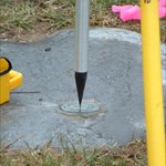
..regarding the drill hole - I've seen the same thing (even the diameter looks the same) in 2 huge boulders on top of the ground in a park in town in an area where sewer lines were buried. At first I thought 'core sampling', but I ended up suspecting it could be for blasting....
-
..regarding PIVOT - at least I will be able to project some decent coordinates from the MARYLAND HEIGHT S datasheet
-
Regarding the potential MARYLAND HEIGHTS S revisit - both ArtMan & mloser had expressed interest in possibly joining forces to ascend to the summit (sounds like something from Pixar), but I haven't heard back from either of you yet - how's May looking? (here in Southern PA the mountain tops above 1000' are still relatively devoid of leaves) I'm also wondering if anybody has run across any notes on the referenced unpublished station PIVOT - JV4627? Looks like a nice 1000' vertical elevation change hike..but at least it's not all at once!
-
That reminds me of a book by a local PA author titled "Return to WELLSVILE" - where a BM hunter returns to get photographs and has an 'unfortunate' experience...
-
..being a PA boy - I'd peek at the 2 bridges over the stream to the SE of the tracks (Mt Bethel Hwy & Ye Olde Hwy). Most of the PADH* disks I've found were on wingwalls of bridges over streams & usually on the wingwall nearest the Keystone plaque indicating the bridge construction date.. - E * PA Dept of Highways in the middle of the 1900s & stamped P.D.H. (P.S.H.D in the early days & P.D.T. in the late 70s & 80s) ..although you may have found a few of these on previous 'incursions' into PA
-
..I might be interested in joining you for that project - I've had HU1290 programmed in to my GPS for 3 years now! (I always have passed on that due to time constraints) I usually get to do recoveries, I mean vacation, there in the fall. A good 2nd location could be HU1295. (Am also still determined to find the one @ the library in C.M.C.H. - you know which one I'm talking about;) Incidentally, my daughter's 5th grade science project (How Accuate is a Handeld GPS) consisted of taking 3 units to a tri-station near our house on 8 different visits, (boy, did I love helping w/ that one!) where the average of the individual results were nearly spot on & individual readings probably covered a queen size, except for 2 anomalous readings on a day w/ really lousy weather. Calculations were '5th grade math', but she did win 1st place! (she still refuses to go on 2 mile hikes to the mountaintop tri-stations, tho..)
-
I seem to remember something similar showing up in the BM forums before but can't find any examples - they are a bit like the piers at the Hoover Dam: GR1855 These have a regular disk in the middle, however.. ..I do seem to remember a large grooved flat disk somewhere though..
-
I was pleased to assist in PFF's NCCP (North Carolina Colorization Project) by filling in the first GEOCAC recovery in far-flung Columbus County. Maybe I can help again this fall!
-
Well that would rob us of all the recoveries done by those who do not report to the NGS and that includes some good recovery people ..I took it to mean the "all capped" NGS info from the GC page. Also - in the GC page, if a mark WAS destroyed, it would be nice for the GC listing & logs to remain, instead of 'archived' like NGS datasheets.
-
"USCS" - it's on the SE side about chest level.
-
..and it has this cool 'bench' carved into the side: Edit to add this pic as well: (I'm a big fan of this benchmark - try to climb the 199 steps at least once every year!) PS still haven't recovered HU1294 ..although 2 RMs are alive & well.