

Ernmark
-
Posts
533 -
Joined
-
Last visited
Posts posted by Ernmark
-
-
the one I checked was Niagara County, NY
-
I checked one I submitted in NY a few weeks ago and it is in the current datasheet...
-
Here's one that I just ran across today: OG0992
DESCRIBED BY INTERNATIONAL BOUNDARY COMMISSION 1941 (JGH) ON THE DECK OF THE RAINBOW ARCH BRIDGE ACROSS THE NIAGARA RIVER BETWEEN NIAGARA FALLS, NY, AND NIAGARA FALLS, ONT. THE STATION IS ON THE RAISED CURB SECTION THAT SEPARATES THE EAST - BOUND TRAFFIC FROM THE WEST - BOUND TRAFFIC, ABOUT 145 FEET WESTERLY FROM THE EASTERN OR UNITED STATES END OF THE ARCH SPAN. IT IS 4.25 FEET WESTERLY FROM THE CENTER LINE OF THE FOURTH MANHOLE FROM THE UNITED STATES END OF THE SPAN, AND 0.58 FOOT FROM THE NORTH EDGE OF THE CURB. THE LINE---RAINBOW-ARCH---IS PARALLEL WITH THE CENTER LINE OF THE BRIDGE. STATION MARK, AN IBC STANDARD BRONZE - DISK STATION MARK SET FLUSH WITH THE SURFACE IN A DRILL HOLE IN THE CONCRETE.
Then there's this one: JV5574
A little tougher - but a clear read of the references + the adjusted coordinates proves that the original mark is gone. Unfortunately one of our own submitted a 'good' report to NGS after finding the cross on the SW side about 150' away..
-
Hi - I'm an officer in the U.S. Benchmarks category - please fowrard the waymark in question so we can take a look at it. We do have the ability to reevaulate waymarks & if one made it through that was incorrect, we'd like to correct it.
-
-
Whatever happened with VEX ?

-
HU0266 (SPEICHER)
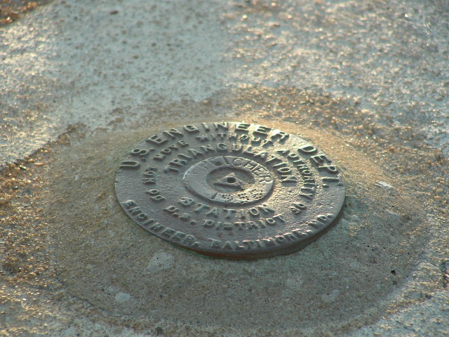 in Ocean City, MD
-
Interesting read - thanks!
-
I've found that 'simpler is better' - http://www.harborfreight.com/6-function-metal-detector-43150.html I've used this one specifically for BM hunting for about 7 years & it still has life left to it!
-
-
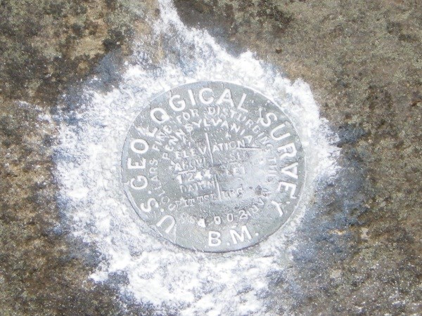
..funny thing was every disk for miles around had white powder on it!
-
Haven't been lurking here for a long time, but just saw this thread ...and having just gotten an Optimus V, I'd love to try this - it pains me to drive through new areas just knowing I'm missing gobs of marks!
-
Scaredy Cat's Benchmark Viewer seems to be down (no map pins appear). Life as I know it has come to an end.....
PA is working - don't be scarin' us like that !

-
I'll send an email - I'd like to nab one of these!
-
-
Nothing beats the reward of a hard-won find! Congrats!
-
Thanks - I'll have to get a copy! Kinda figured that was gonna be the title

-
..I stumbled acoss the show about 1/2 way through - although a bit light & airy, it sure beat whatever else was on!
What was the book it was based on? (I'm guessing that's a dumb question & the title's obvious
-
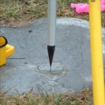
..the drill hole shown was actually at the possible location of PIVOT - we were unable to scrounge up a drill hole for our target. On the way down we stated no interest in ever going back up there...but.. ...we did muse that having a professional-grade GPSr would certainly narrow the search area! I also would like to see Harpers Ferry from the 'official' overlook (which was a seperate offshoot trail) someday, which we didn't have time (energy) to do at the time...
Edit to mention the I didn't realize there were 2 more posts after #25. I'll go back! We may have missed our vegetation window by now...we were probably only a few days ahead of the vegetation
Fall/spring again?Would give me time to 'go into training' for the hike...at least we know what we're in for!
-
I'd hate to see the NPS perceive benchmark hunters as disturbing cultural or natural resources.
..just to allay any concerns, we did no wholesale excavations or 'tossing' of stones (PIVOT shot was the most intense 'excavation' which encompassed pulling back a small layer of accumulated 'recent' debris) - that's why this one will probably remain unfound. With another good mark 200 meters to the N, if anyone would want to do any surveying, 'RESET' would do just fine.
PS - we actually thought about contacting you to join us as if I remember correctly, you've had some good luck w/ marks along the Potomac

-
Following is an update on the MARYLAND HEIGHTS S (JV4626) project:
Ominously, the date selected for the 4 1/2 mile round trip, 900+ elevation change quest was April 1st. The team consisted of myself & mloser (ArtMan was on assignment). We planned to search for this mark as well as the elusive non-published PIVOT (JV4627).
Having stocked up on supplies (water, soda, peanut butter/bologna sandwich, peanut M&Ms, camping fork, measuting tape, camera, wi-fi enabled benchmarking phone we began the ascent. At one point (although I missed it) it was marked that President Lincoln was being taken on a tour up this trail to an over look & having looked up at the trail from that spot said something to the effect of 'that's far enough'.
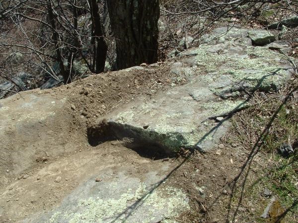
Passing several remains of gun emplacements, etc., we continued beyond the more traveled trail to the overlook and headed farther up the mountain - stopping occasionally for quick brakes earned by middle-aged benchmark hunters. The trail lead us first to the projected coordinates of the unpublished PIVOT. After a few minutes we found the closest thing we could vind to a 19th Century station:
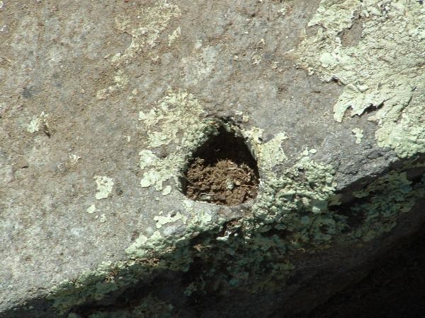
The problem with this (barring whether this is actually what we were looking for) is that it is oddly-triangularly shaped & it is too close to an an edge for both of us to feel confident that this is a man-made drill hole:
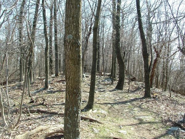
After a good 45 minutes or so, we proceeded N for 221 meters to search for our main target - MARYLAND HEIGHTS S. Mloser will have to confirm, but my guess is that we spent at least an hour scraping rocks, overturning & inspecting stones for any sort of markings. Due to the fact that vegetation was still dormant at 1381 feet & had a decent satellite signal, we were able to keep our search area to a roughly 30' oval resembling a loaf of Italian bread oriented just to the E of the trail. Our only clue to this was that it was a drill hole in a boulder - however, every logical exposed boulder had no drill hole. We excavated as much as was logically possible, given being on park grounds, and with a curious visitor or 2 happening by every 20 minutes or so. We spent at least an hour scraping, looking, moving, thinking, before finally coming to the conclusion that without completely scraping a entire 30'x15' section of the trail & E shoulder, this will remain unfound.
Perhaps a professional-grade GPSr and good constellation could reduce the search area - although 3 HH2 GPSr units gave us similar results..hopefully we were close.
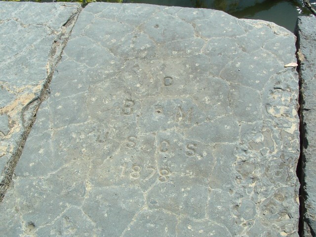
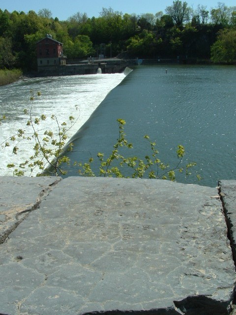
We had one more place to go while up there - MARYLAND HEIGHTS RESET
Here we were able to locate the station and all three Reference Marks quickly. We attempted to locate the five chiseled reference marks from 1871, but were unsuccessful - we did locate the cross found by BDT in 2004.
After milling around the fort for a few minutes, we began the return trip - stopping again at MARYLAND HEIGHTS S ..just in case. After returning to Harpers Ferry (with 15 minutes to spare to catch the last shuttle to the parking area), we opted to head E to look for a few marks along an abandoned RR line until dark...with much greater success.
Not every find results in success, but you're never sure what's up there until tou check it out yourself
The search to complete the E.O.A. continues...
-
-
-
I ran across one of my favorites:
Mason-Dixon West Line Stone #111 on the PA/MD border which sports a RM for station MYERS


Intersection stations... still no report?
in Benchmarking
Posted
I notice that a lot of intersection station reports submitted as GEOCAC lately are being submitted by individuales who weren't lurking here (ore even benchmark hunting) back when that info from Deb was posted here..