

OFF RODE
-
Posts
182 -
Joined
-
Last visited
Everything posted by OFF RODE
-
Indiana Boy need Advise On Geocaching Out West?
OFF RODE replied to Zig and Zag's topic in How do I...?
Well from an Az desert dweller/cacher all the above is good advice...we like to plan on a gallon per hour for tough hikes in the desert at 105-110. BUT drink as much of it BEFORE you set out (within an hour or so) so you are fully hydrated when you start. And dont take along just what you think you need for the amount of time planed to be on the hike...what if you get lost? theres no such thing as toooooooo much water in the desert. And one other thing dont put your hands or feet where you cannot see! Good luck! "You've got to be very careful if you don't know where you're going, because you might not get there." Yogi Berra -
Unit to Unit Transfers on Garmin?
OFF RODE replied to jollybgood's topic in GPS technology and devices
You could also just upload them to EasyGPS or a similar Program then download them. I do it with NG TOPO! takes a few seconds longer but it works. of corse it only works when you have a pc available. "You've got to be very careful if you don't know where you're going, because you might not get there." Yogi Berra -
Try MS Streets and Trips 2002....It has motels and gas stations but I dont know about 7/11s. "You've got to be very careful if you don't know where you're going, because you might not get there." Yogi Berra
-
I have a factory refurbished III+ that I paid 200$ for and find it an excellent unit. Rarely loses lock even in tree cover or canyons. Far better then the old Garmin 12 I had that I lost inside my house somewhere...still havent found it. "You've got to be very careful if you don't know where you're going, because you might not get there." Yogi Berra
-
After comparing Natl Geo Topo! software and Delorme Topo I was so sold on the NG that I put my original copy of my Delorme in our 1st Cache FORE! ( I didnt even copy it!) and it was a big hit...disappointed a few who thought they might be 1st. "You've got to be very careful if you don't know where you're going, because you might not get there." Yogi Berra
-
I dont think you could load Natl Geo Topo Software to a palm...I use the Az state version and its 8 CDs although there is some file duplication from CD to Cd, to load the entire state takes about 3gig. I use a laptop with a Cd for live tracking on Topo while in the Jeep, can D/L all the cache pages I want to the laptop, reveiw them before I head out on foot, then just pull the GPSr (G3+) when I get as close as I can and use the stored waypoint to get the final distance to the cache. But my primary use isnt geocaching (BLASPHEMY!) its offroading in general. You dont really need a super laptop if it has a CD, the base program is pretty small and if you are only in one area you can upload only those maps...I think it will even run on an old 486 but at least a P1. The only drawback is when you leave the vehicle you only have the GPSr. "You've got to be very careful if you don't know where you're going, because you might not get there." Yogi Berra
-
Im guessing you mean cemetaries of a historical nature...or perhaps you just like cemetaries. Anyway National Geographic Topo! shows all the cemetaries that are on USGS 7.5 min topos. For Arizona they list 168, including Boothill in Tombstone. So that might be worth look for software. "You've got to be very careful if you don't know where you're going, because you might not get there." Yogi Berra
-
Garmin Etrex Venture and DeLorme Street Atlas
OFF RODE replied to mackey's topic in GPS technology and devices
In National Geo Topo! you need to set the interface to NMEA "You've got to be very careful if you don't know where you're going, because you might not get there." Yogi Berra -
National Geographic Topo! software will allow you to place all the waypoints on a topo map. you can do it manually by entering the lat/lon or you can use EasyGPS to download all that you want then upload those to your GPSr then download them to NG Topo or if you have a site like we do here in Az, SnapTek, you can D/L all the caches already formated for Topo!.I have all 500+ caches in Az on a map, Its great! "You've got to be very careful if you don't know where you're going, because you might not get there." Yogi Berra
-
You can see all of your posts here. "You've got to be very careful if you don't know where you're going, because you might not get there." Yogi Berra
-
Going in 2 weeks. I think reception should be fine in the valley but probably wont be too good under heavy tree cover, and three are some BIG trees there as well as high peaks that might reduce the amount of sats seen at times. As far as Geocaches...its a national park...they arnt allowed. "You've got to be very careful if you don't know where you're going, because you might not get there." Yogi Berra
-
GREAT suggestions from Skydiver! I Concur. "You've got to be very careful if you don't know where you're going, because you might not get there." Yogi Berra
-
North-Alaska West- Alaska South- Key West Fla East- Maine "You've got to be very careful if you don't know where you're going, because you might not get there." Yogi Berra
-
1st...Yes tree cover will alter your reception and can make your GPSr act wacky, some models more than others. models with external quad helix antenea seem to do better. 2nd...2 and both were missing??? if you are sure they are gone Id say thats a bit high on the odds chart. Id keep an eye on the cache logs and see what happens ( note from the owner or possibly a find or another not found) 3rd Sure some people dont even use a GPSr just a topo and a compass. Some use all, some 2 and some just a GPSr. PS sure there are alot of underwater caches....just be sure the terrain difficulty is a 5 (special equipment) "You've got to be very careful if you don't know where you're going, because you might not get there." Yogi Berra
-
National Forests are OK. "You've got to be very careful if you don't know where you're going, because you might not get there." Yogi Berra
-
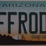
When I got this plate (see avitar) it just seemed like the name to use. "You've got to be very careful if you don't know where you're going, because you might not get there." Yogi Berra
-
When I got this plate (see avitar) it just seemed like the name to use. "You've got to be very careful if you don't know where you're going, because you might not get there." Yogi Berra
-
Ill second the NG Topo! recomendation. Ive used it here in Az for 3 years and find it excellent for backcountry navigation...not real good in the cities but then it isnt meant for that. I use it for live tracking with a Garmin 3+ in the Jeep when offroading and find it very accurate. "You've got to be very careful if you don't know where you're going, because you might not get there." Yogi Berra
-
quote:Originally posted by PDOP's: So I wonder what their velocity readout is? It would probably be the fastest ever measured by GPS. As well as altitude! "You've got to be very careful if you don't know where you're going, because you might not get there." Yogi Berra
-
quote:Originally posted by PDOP's: So I wonder what their velocity readout is? It would probably be the fastest ever measured by GPS. As well as altitude! "You've got to be very careful if you don't know where you're going, because you might not get there." Yogi Berra
-
Here in Az are stickers are GIANT...they are called Cactus....and unfortunatly gaiters wont help much "You've got to be very careful if you don't know where you're going, because you might not get there." Yogi Berra
-
Here in Az are stickers are GIANT...they are called Cactus....and unfortunatly gaiters wont help much "You've got to be very careful if you don't know where you're going, because you might not get there." Yogi Berra
-
National Geographic/Delorme - Which is most accurate?
OFF RODE replied to DD214's topic in GPS technology and devices
quote:Originally posted by Alan2: Whiloe the detail is better than the 100,000 scale that comes with the manufacturer's software, the problem with all of the 24,000 scal software (I have NG Topo) is that they are based on USGS 7.5 quads many of which are ten, twenty or more years old. I just got back from Florida, and some areas are being built so continuosly, the maps are way obsolete. Alan I agree that the maps are not much good for areas being developed but for the backcountry this really isnt a factor...the canyons are still canyons and the mountains are still mountains etc. Sure some newer logging roads arnt there but overall they are pretty good for navigating "offroad" "You've got to be very careful if you don't know where you're going, because you might not get there." Yogi Berra -
Here in Arizona we almost EXPECT to see a rattler now and then....especially out in the desert. As everyone has said the #1 rule is DONT put your hands OR feet where you cannot see! That and dont keep your eyes fixed on the trail 2 feet in front you...try to scan the trail and sides 8-10' ahead of where you plan to walk. Those 2 things and water and you should be fine. Have Fun! "You've got to be very careful if you don't know where you're going, because you might not get there." Yogi Berra