


turbosnail
-
Posts
44 -
Joined
-
Last visited
Posts posted by turbosnail
-
-
turbo, what evidence do you have for surveying with this object?
I use the info posted at JUPEM Geoportal website as my reference. No coordinates are given. But they do provide the description of the location(in Bahasa Malaysia, an official language of Malaysia). Here is the url:
http://www.jupem.gov.my/sppmg/dv/geodaticSearch.aspx?p=g
If you were refering to my last thread, no I do not have any. That's why I don't know if it were an old BM or not.
Someone whom I know works in JUPEM commented in other forum that it was probably an old Ordinance Surveying BM left during the British Colonial era. See here.
-
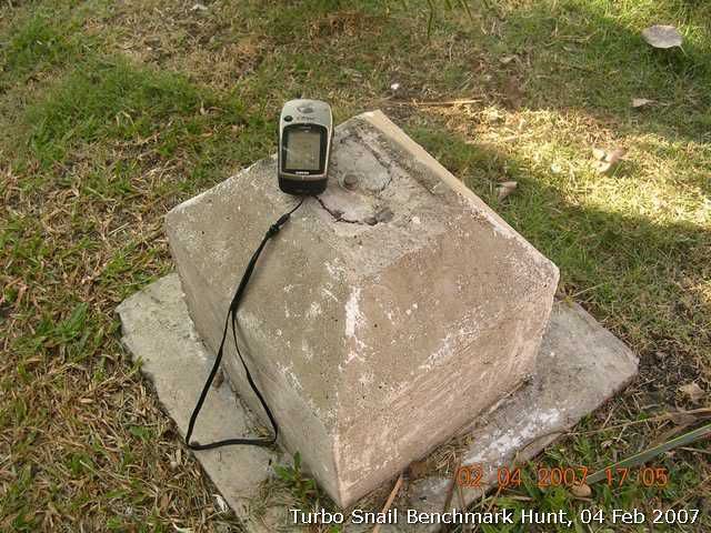
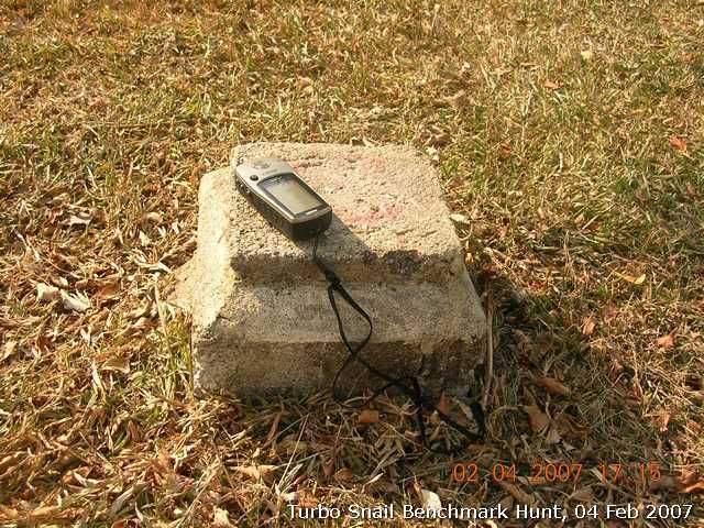
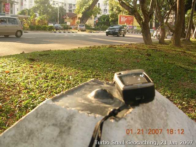
Stumbled upon this structure along Jalan Baru, Perai. It has been there quite some time. I don't know whether it is an old benchmark. I was shock to see it has been knocked down. I decided to pay it a visit before it goes disappear forever.
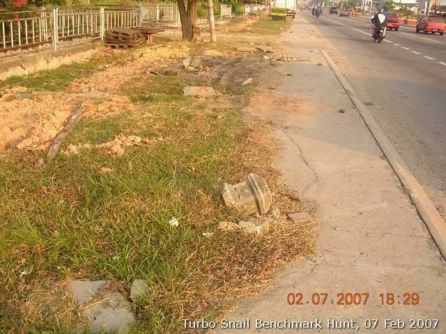
The land was cleared probably for laying water pipe or new drainage. Too bad, this old Benchmark will have to go too.
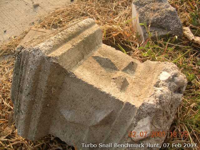
A closer look at the block. Nice three diamond marks on the surface.
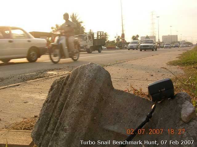
The view of busy afterwork traffic on Jalan Baru from the fallen "BM".
The coordinates: N05° 22.3045' E100° 24.7148'
No record on JUPEM GEOPORTAL search.
-
Update on reported destroyed BMs after JUPEM Geoportal back online:
PP0379. N5°25.254' E100°20.681'
Old SBM(not destroyed). N5°25.294' E100°20.572'
P 0515. N5°25.260' E100°20.405'
P 0514. N5°25.388' E100°19.991'
-
Benchmark hunt updates.
I decided to roam around Georgetown area to see if I could spot one or two BMs. I wasn't dissappointed!
TBMs
I spoted this one at the York Garden, a midle-upper class residential area near Penang turf club. I still try to figure what TBM means. N5°24.882' E100°18.377'
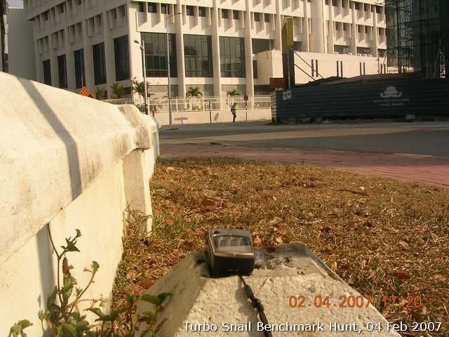
This was spotted along side the destroyed BMs near Fort Convallis. N5°25.253' E100°20.688'
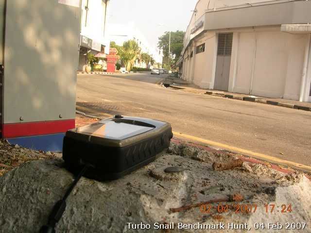
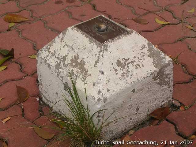
BMs (destroyed)
These BMs have their metal plates removed, probably by drug addicts to sell as scrap metals to scrap metal merchants.
Beside Fort convallis. N5°25.254' E100°20.681'
Esplanada playground. N5°25.294' E100°20.572'
Somewhere near Dewan Sri Pinang. N5°25.260' E100°20.405'
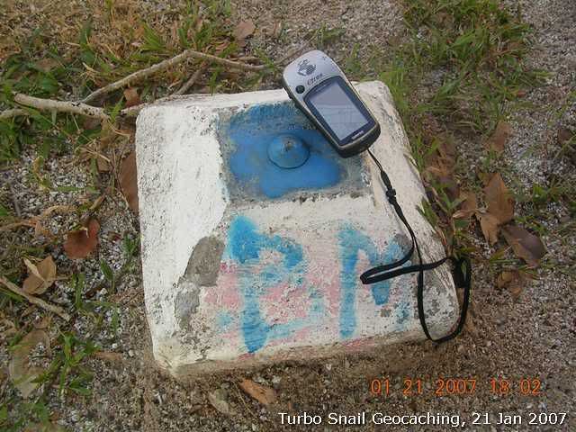
I also spotted this near to Mansion 32. The coordinates is a way off since I could not get a good lock. You can see here the same BM was planted twice.
N5°25.388' E100°19.991'
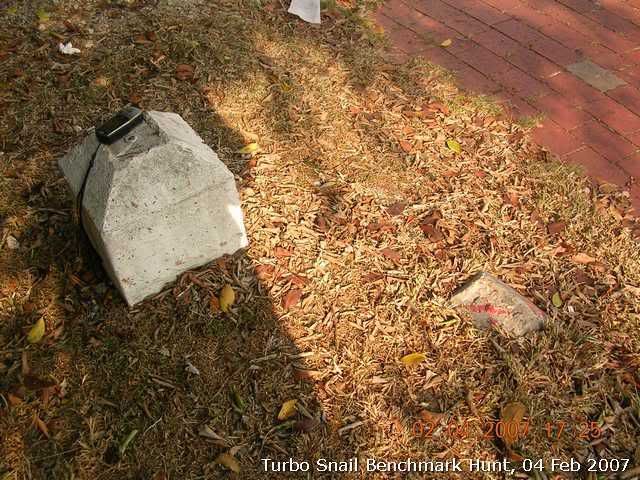
BMs that are still intact:
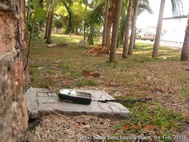
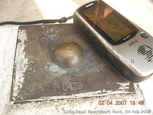
P0479. N5°27.134' E100°18.369'
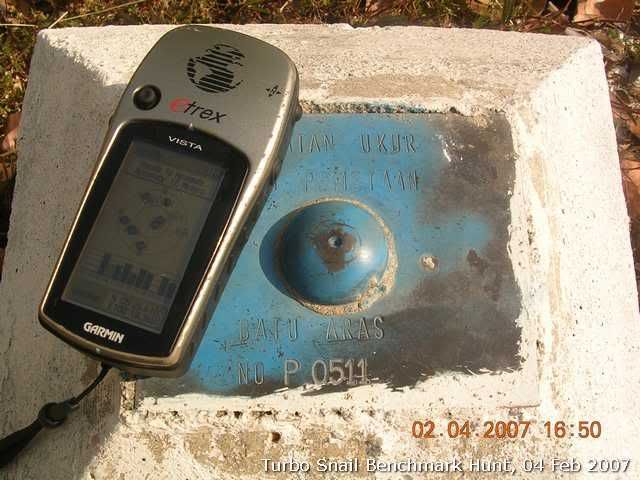
P0511. N5°26.611' E100°18.362'
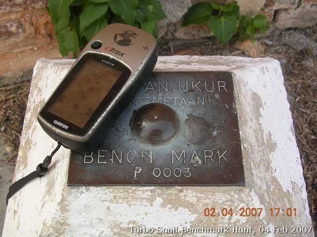
P0003. N5°25.176' E100°20.658'
I can't get the BM PID of the destroy one since the JUPEM Geoportal cannot be accessed today.
-
Ehh...Any bro & sis wth premium membership willing to create a group for Malaysia Benchmarking & update the above discoveries?....

 ..It is better to have it logged rather than logged the findings here.....
No luck I think. We will have to wait until one of us decide to be a premium member...
As of moment I guess this is the way we can post our findings.
-
I am re-starting the malaysin benchmarking thread in the Benchmarking section of this forum.
I will also update my benchmark findings from time to time. You can do so too if you have found any.
The thread is here.
-
I went to try hunting for benchmarks after I obtained the coordinates of the benchmarks from the calibrated map image screendump that I copied from JUPEM Geoportal. I managed to located 3 out of 5 searched. The coordinates as expected were out by fairly large margin(ranges from 180m to 700m).
Benchmark not found
P0125(N5°24.820' E100°18.852')
P0126(N5°24.553' E100°18.317')
Found benchmarks:
PP0014(N5°22.985' E100°18.486')
actual=N5°23.247' E100°18.757'
Difference=696m
It was at the compound Jelutong Post Office. The office was close today since it was Sunday.
P0103(N5°25.792' E100°19.101')
actual=N5°25.743' E100°19.119'
Difference=182m
My GPS pointed me to another direction. Luckily the benchmark was easily spotted at the roadside.
P0512(N5°26.295' E100°18.484')
actual=N5°26.128' E100°18.568'
Difference=346m
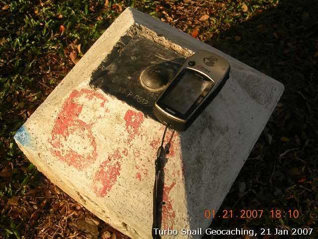
Same as P0103. P0512 was spotted at the roadside.
-
Hello Malaysia - I'm coming to Malaysia next week (Coordin8z and Sweepy) armed with loads of geocaches to do in KL, Penang (Turbosnails ++) and one or two other places. I am having trouble locating caches on the East coast (Kota Bharu, K. Terengganu, Kuantan, Mersing. I have the one for Tioman. Are there any there? If so could you let me have the waypoint numbers - GC******.
We are on driving ourselves so will we have trouble with floods?
Hope you guys are OK it doesn't look good with the flooding.
Hope you can help.
Happy Caching.
Coordin8z
Visit this website, http://www.malsingmaps.com if you need Malaysian maps for your Garmin GPSr(if you use one of course) or maps for Mapking V10.
Flood areas are limited to certain areas in the state of Johor. Other areas should be ok.
I don't think there are any in East coast since geocaching is still new here.
-
Thanks, Dave.<BR><BR>Will try to contact these people.
 <!--graemlin:-->
I have few at Malsingmaps forum would like to know where to find the benchmark info in Malaysia too. Have you managed to find out where to get the benchmark info?
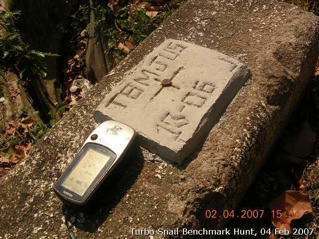
I was by chance found these near my work place:
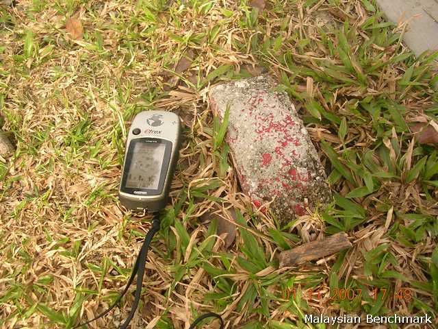
This was planted by land office. The coordinates can be found at JUPEM's topo map, I was told.
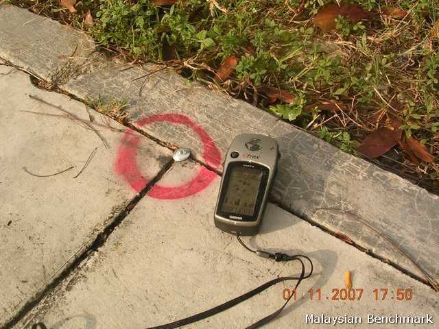
This was planted by land surveyer when they did QS.
I found it. It's here.
-
Thanks, Dave.<BR><BR>Will try to contact these people.
<!--graemlin:-->I have few at Malsingmaps forum would like to know where to find the benchmark info in Malaysia too. Have you managed to find out where to get the benchmark info?
I was by chance found these near my work place:
This was planted by land office. The coordinates can be found at JUPEM's topo map, I was told.
This was planted by land surveyer when they did QS.
-
Good to see you here. At least we can get thread going now.
Geocaching is not a rocket science. Just go through the Geocaching.com Lets get started section and you are set to go!
-
:-) Thanks. But it only accept *.img
I can see that you are in Malsingmaps forum now. Browse through the forum's Help/FAQ/Wiki section. You may find your answer there!
-
You may need to convert the loc file that you downloaded from geocaching.com to the formats that are recognized by your iQue. Have you done that?
I use gpsbabel to do that before I load the waypoints into my Vista.
yes, but I dunno what format should I choose in babel as it seem to accept *.img only
Just convert it to any of the below formats:
gdb, mps, gpx
I don't know how to upload the files to ique but I guess you need Mapsource to do so too.
Give it a try.
This is how I upload loc file to my Vista
1. Use GPSBabel to convert loc to garmin accepted format, i.e. gdb
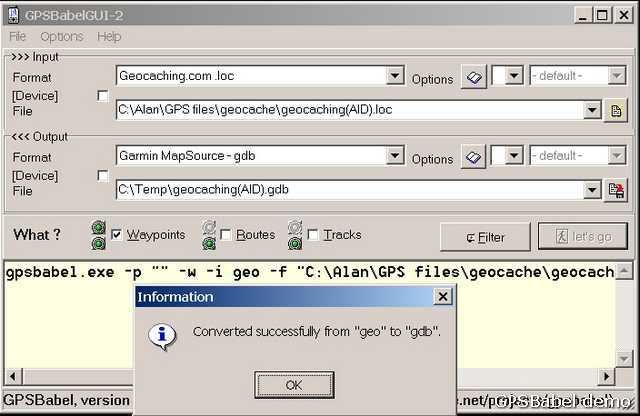
2. Activate Mapsource, go to File/Open to load the converted gdb file into Mapsource
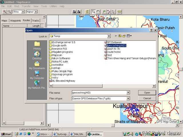
3. At Mapsource, go to Transfer/ Send to Device
Good luck!
-
Just a note to Malaysian cachers or those who may visit ...
I dropped a Green Jeep Travel Bug into GCKEK5 Taman Negara II cache hoping it will move around the country and thru southeast Asia.
while you are there visiting this cache, be sure to enter the park and go to the canopy walk. It is awesome ...
Afraid it's gonna stay a while there. Do keep your finger crossed though.
-
Not sure where to post this question.. but I am struggling to go paperless.
I am using a Garmin iQue with map from malsingmap during my geocaching hunts.
I have been trying to load the waypoints of the caches into iQue, but no matter how I try, I can only add them in by keying them 1 at a time manually.
I seem to be missing something.. does anyone knows (espcially SG geocachers/Malaysia Geocachers) how can I load in the cache locations into iQue without having to key 1-at-a-time-manually?
You may need to convert the loc file that you downloaded from geocaching.com to the formats that are recognized by your iQue. Have you done that?
I use gpsbabel to do that before I load the waypoints into my Vista.
-
Just wonder if any geocachers from Malaysia visit this forum.
Ok let me start. Turbosnail here, born and bred in Penang, a place where one of the earliest cache planted in Asia. Current a proud owner of 14 caches in the island. I would like to see this f8un and exciting sport grows in Malaysia and would like to meet any like minded Malaysians here.
Also an active member of malsingmaps.com, a place where you can get free Garmin maps for Garmin GPSrs.
-
If I had read this two years earlier I would tell you that there are two in Langkawi.
-
Hi
Can any Malaysian cachers recomend a map of KL and the surrounding area which I can use with OziExplorer ? I hope to get a chance to cache in that area in the future and would like to do some forward planning
Regards
Zensunni ( Ken )
Do visit http://www.malsingmaps.com if you own a Garmin GPSr. You will find detail map of Kuala Lumpur in img or Mapsource installer formats.
Best of all, you can download them FREE.
 ..It is better to have it logged rather than logged the findings here.....
Any Benchmarks In Malaysia?
in Benchmarking
Posted
Benchmark hunting updates:
Found this when I was coming down from Tanjung Bunga area. The metal plate has been stolen. Later I checked JUPEM Geoportal. Think it should be P 0101. Coordinates: N5°27.877' E100°17.935'
Another view from the BM. Longest flag painted on the wall, I was told. Another Malaysia Boleh thingy. Can't they think of something else?
And I found a TBM at the location where I thought P 0101 was located. I mistook the location of P 0101 as in km6("Di kiri jalan Bt.Feringgi - GeorgeTown, di km. 8.- On the left of Bt.Feringgi - GeorgeTown, at km. 8."). Actually this TBM was located about 100m from the km6 milestone. Coordinates: N5°27.705' E100°18.427'
Another view to the road from the TBM.