


turbosnail
-
Posts
44 -
Joined
-
Last visited
Posts posted by turbosnail
-
-
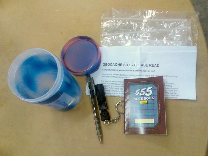
Just a quick update on my earlier note, as I prepare to head out the door for my trip. In short order, I will be staying for over 2 weeks in a hotel just two miles from the location of Tiara Premier Cup (GCGE09), near KL, and this is one of the caches in the KL area which I plan to hunt. And, at the request of a cacher from another part of Malaysia who has alerted me to the fact that this cache may need maintenance, I will bring along my cache maintenance kit as well when I visit this and any other caches in Malaysia, and I will try to perform any maintenance as needed, and will also note any such activities in my online log entries. --Vinny
Weclome to Malaysia. Hope to see your updates soon!
-
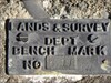
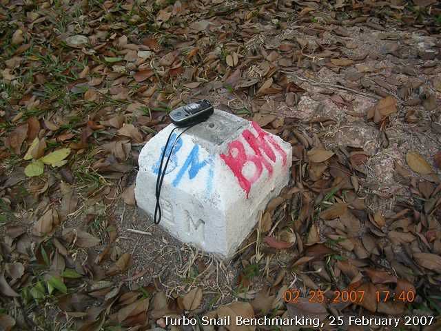
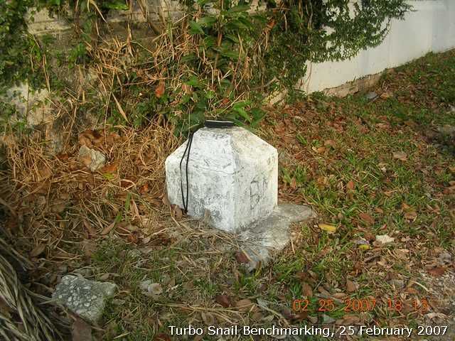
Decided to take my BH and junior to "scale" Bukit Jambul. Also at the same to take down the coordinates of the trigpoint up there.
The point is next to the tea kiosk built by the volunteers.
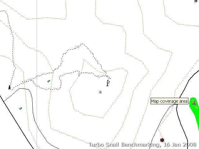
Coordinates:N5°20.587' E100°17.187'
Elevation: 253m ASL
The location is 47m (direction: N48°E from the georef point) away from the recorded georeference point. Looking at the topo line, the peak is supposed to be 47m from the point too. I checked it out. It is the highest peak at where the pole is erected.
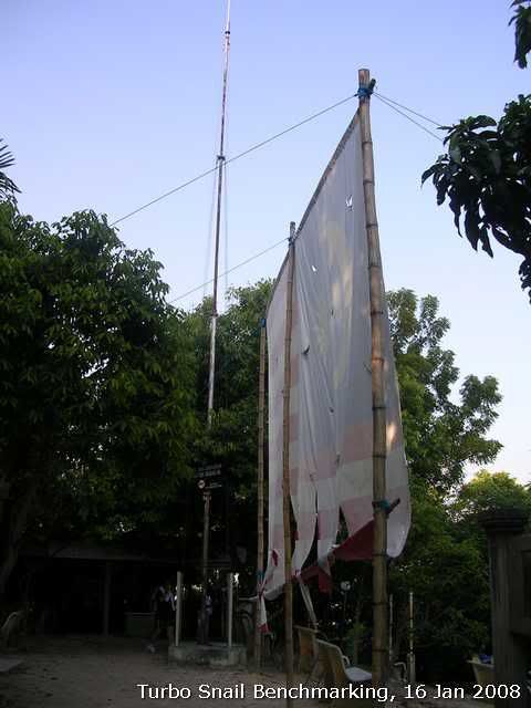
The trigpoint.
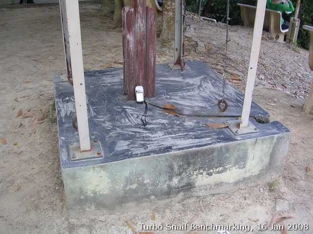
The base. No sign nothing to tell the exact coordinates.
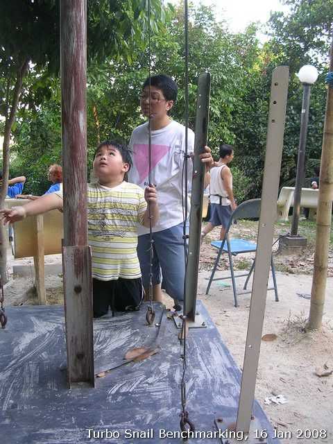
Turbo Snail junior and Mrs. Junior Snail checking out the trigpoint.
-
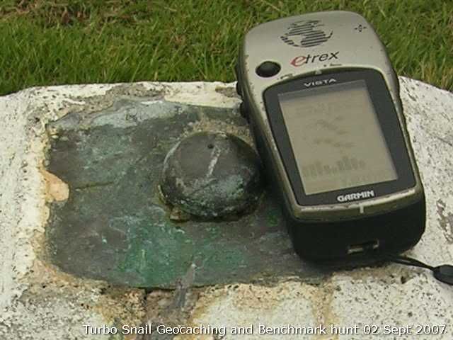
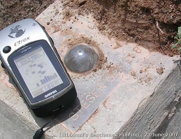
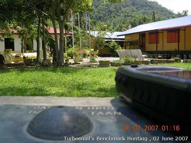
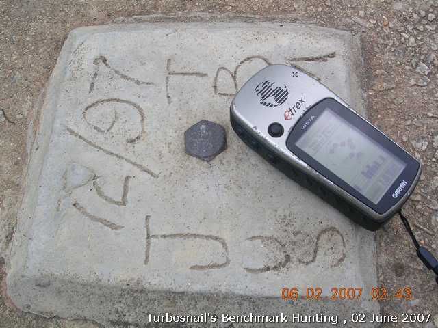
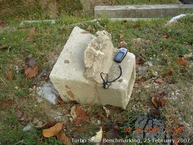
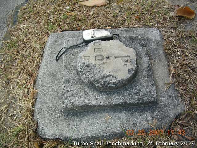
Found this when I was at the peak of Penang Hill on Sunday morning. Just out of curiosity to see if I could find any marks for the georeference/summit points that posted on NPM map. My Vista HCx led me to a non-descript concrete slab on the side of the Summit road.
Coordinates: N5°25.340' E100°15.944'
Elevation: 762.0m
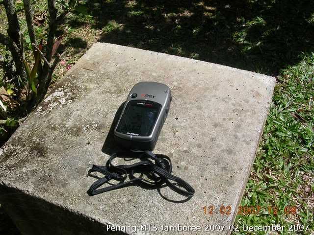
It is a non-descript concrete slab. There was some writing on side of the slab but un-readable now.
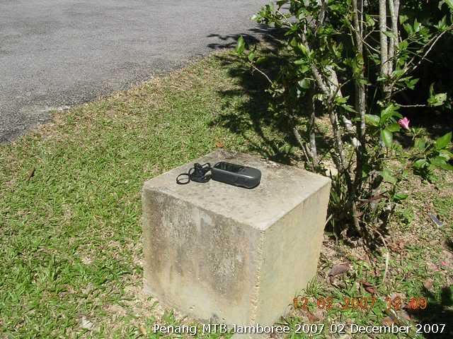
Another view of the slab.
-
We have updated our new BM finings in MSM Wiki page. Interested parties can visit the updates as the following link:
http://www.malsingmaps.com/wiki/index.php/Benchmarking
Thanks.
-
Thanks for the edit - I struggle a bit with photos. I will check out the links as time permts. have still benn unable to find this bencmark on any site as yet. A bit wierd.
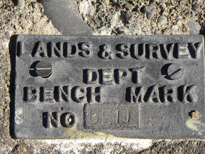
See if this is the info of UE10 that you saw during your last Geocaching hunt?
http://www.linz.govt.nz/apps/geodeticdatab...=16481190263480
Geodetic code: AFB0
Latitude : 43° 31' 07.53571" S
Longitude: 171° 39' 35.03787" E
Orthometric Height: 278.1812
Order Height order:51V
Land District: Canterbury
Name: UE 10
-
Hi cwyap, turbosnail, stimix, robojsl -
Excellent pictures! Seeing all your interest in finding and recording your benchmark finds in Malaysia, I suggest you start a waymark category for Malaysian benchmarks. The Waymarking site is also made by Groundspeak and there are already benchmark categories for Australia, Canada, Portugal, the UK, and the US in Waymarking.
The place to read about starting a new category such as Malaysian Benchmarks is here and click on "Category Creation Guide". If you need any help on this, let us know.
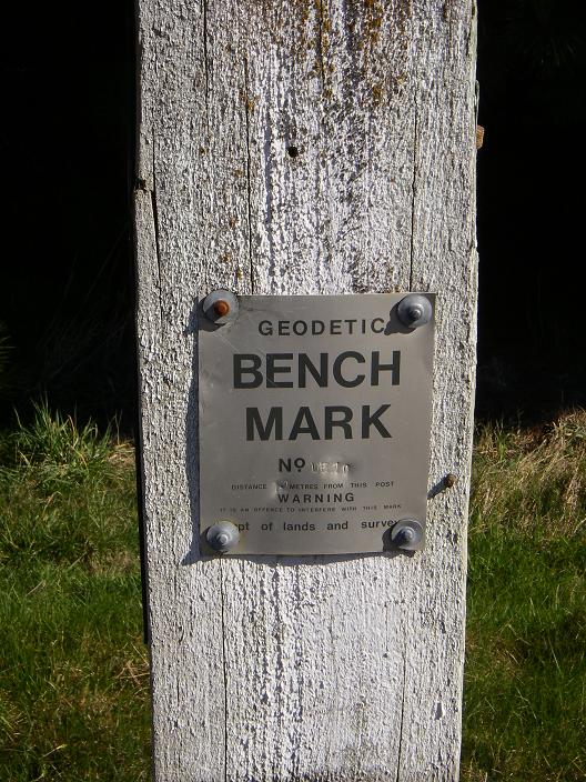
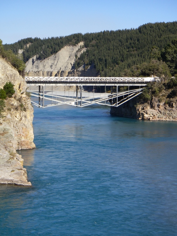
Hi there, unsure if this is the thread to raise this, but we are in NZ, and while searching for a cache (twin bridges (GCA065)) came across UE10, a New Zealand benchmark. We could not see this (obviously) on the websites but would be keen to find a way of logging them - anyone out there know more than the attached - where maps are etc. We are relatively new, but in some ways the benchmarks are the beginning of location by GPS. Anyone able to help? And by the way - I love the images on this thread - it is very interesting perhaps for those of us unfamiliar with your country. Cheers.
I am glad you find our findings interesting. We also log and discuss our findings at malsingmaps forum, a place where you will find free Malaysia and Singapore maps for Garmin units. You can find them at the following links:
http://forums.malsingmaps.com/viewtopic.php?f=6&t=188
http://www.malsingmaps.com/wiki/index.php/Benchmarking
The reason we post our findings here instead of create a category is because none of us are premium members and we are still looking for someone that is premium member is willing to help us create one at Waymarking.com.
You can try your luck at the following links for Kiwi BMs:
http://gwprojects.org/forum/index.php
http://www.linz.govt.nz/home/index.html
http://www.linz.govt.nz/apps/geodeticdatabase/index.html
Good luck.
Thanks for this -have had a look and might try to find a few - we dont see the one we found in the database, so some more research needed. I am unsure what is required to start a Waymarking.com category - i see a committee is required to stop the extra work falling on one person. I will see how our benchmark hunts go here, but might start a category - I wonder if you can do an general one for outside the US?

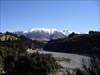

These are views from close to the benchmark. Heart of the South Island. Small cos I grabbed them off the Groundspeak website
Cheers Chaps.
It's really kinda small for me to have a close look on them. So i take the liberty to report your pictures here again(pictures were copied from rchdlyn's post on GCA065:

I would suggest you to see how it goes and decide later if create a general category for Asia Pacific region were a good idea or not.
There is an example of general category for benchmark hunting in Waymarking.com, i.e., European Historic Survey Stones, Monuments and Benchmarks.
FYI, Australia has its category already(see here).
-
Hi cwyap, turbosnail, stimix, robojsl -
Excellent pictures! Seeing all your interest in finding and recording your benchmark finds in Malaysia, I suggest you start a waymark category for Malaysian benchmarks. The Waymarking site is also made by Groundspeak and there are already benchmark categories for Australia, Canada, Portugal, the UK, and the US in Waymarking.
The place to read about starting a new category such as Malaysian Benchmarks is here and click on "Category Creation Guide". If you need any help on this, let us know.
Hi there, unsure if this is the thread to raise this, but we are in NZ, and while searching for a cache (twin bridges (GCA065)) came across UE10, a New Zealand benchmark. We could not see this (obviously) on the websites but would be keen to find a way of logging them - anyone out there know more than the attached - where maps are etc. We are relatively new, but in some ways the benchmarks are the beginning of location by GPS. Anyone able to help? And by the way - I love the images on this thread - it is very interesting perhaps for those of us unfamiliar with your country. Cheers.
I am glad you find our findings interesting. We also log and discuss our findings at malsingmaps forum, a place where you will find free Malaysia and Singapore maps for Garmin units. You can find them at the following links:
http://forums.malsingmaps.com/viewtopic.php?f=6&t=188
http://www.malsingmaps.com/wiki/index.php/Benchmarking
The reason we post our findings here instead of create a category is because none of us are premium members and we are still looking for someone that is premium member is willing to help us create one at Waymarking.com.
You can try your luck at the following links for Kiwi BMs:
http://gwprojects.org/forum/index.php
http://www.linz.govt.nz/home/index.html
http://www.linz.govt.nz/apps/geodeticdatabase/index.html
Good luck.
-
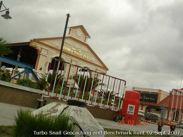
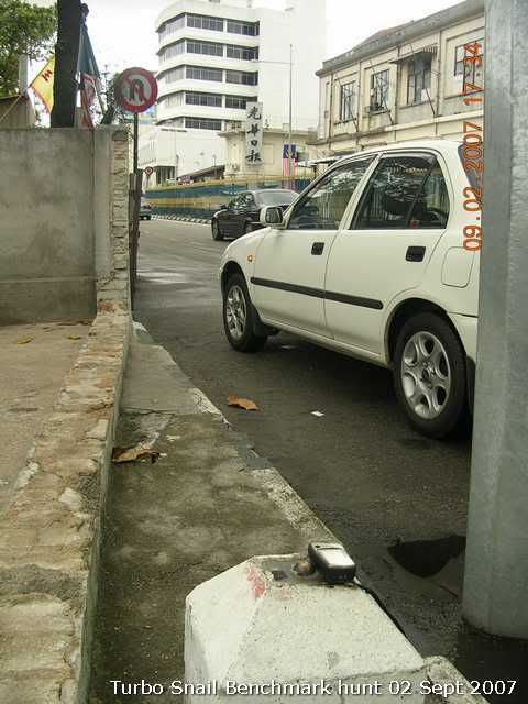
My turn. Found these two when I was geocaching there.
P0431, N5°24.949' E100°20.623', 12.1m elev
This BM is in front of the Church Street Pier(established 1897)
P0432, N5°24.828' E100°20.477', 12.1m elev
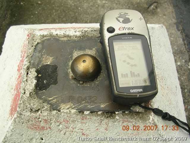
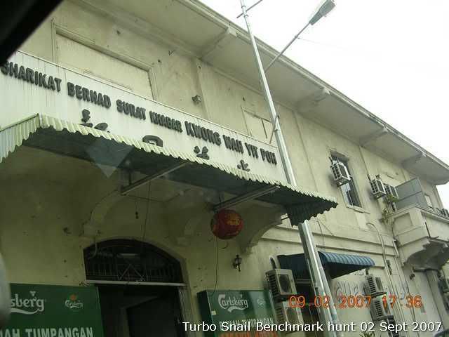
The old building of Kwong Wah Yit Poh, reputed to be the oldest Chinese newspaper(established in 1905 by the founding father of modern China, Dr. Sun Yat Seng) in the world is not far away from this BM.
They have moved to their new building and this has rented out to become a B&B guesthouse now.
-
Also, we are putting our finding in MSM Wiki page. You can also refer to our findings at the following page:
http://www.malsingmaps.com/wiki/index.php/Benchmarking. This will be our official Benchmarking page until we could find someone who is willing chunk out USD108.00/year for premium membership in order to create a category in Waymarking.com.
I think the 'USD108.00' that you refer to RM?
oh shoot my mistake.

Thanks buddy.
-
Due to the recent Malsingmaps forum migrating to better phpBB software, the Malaysian BM hunting thread in old MSM forum has been locked and archived. I have since created a new threads in the newer MSM forum. Interested parties can have a look at it at http://forums.malsingmaps.com/viewtopic.php?f=6&t=188
Also, we are putting our finding in MSM Wiki page. You can also refer to our findings at the following page:
http://www.malsingmaps.com/wiki/index.php/Benchmarking. This will be our official Benchmarking page until we could find someone who is willing chunk out USD108.00/year for premium membership in order to create a category in Waymarking.com.
-
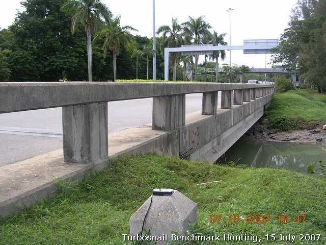
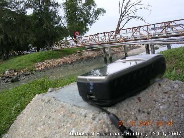
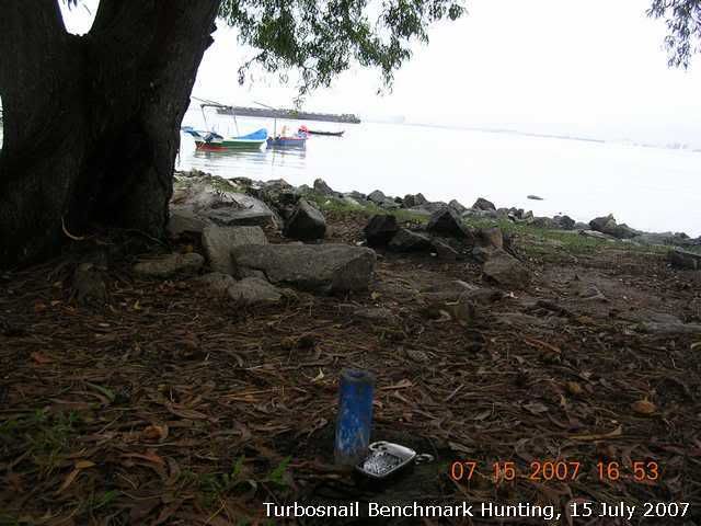
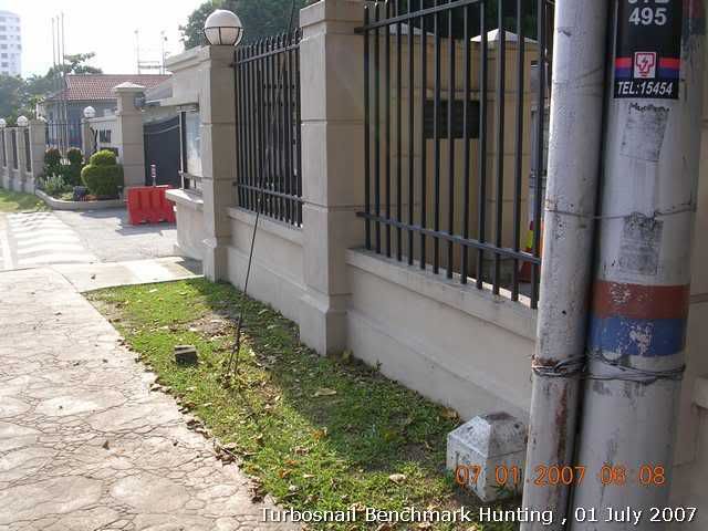
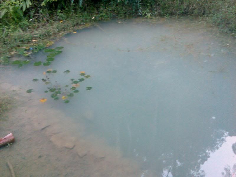
Found these two when I did my routine on my Jelutong Expressway geocache. Since the site where the cache is location is currently active in land reclaimation project, which will be the site for housing estate, I have no choice but to archive it!

PG0058, N05° 22.030' E100° 18.861'
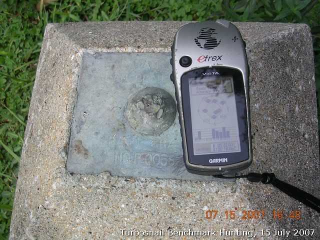
It was located next to the bridge
Another view from the BM to the Penang strait.
And this is interesting.
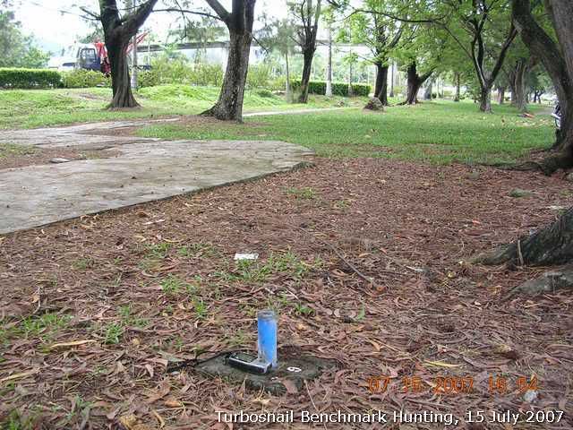
PG9, N05° 22.076' E100° 18.870'
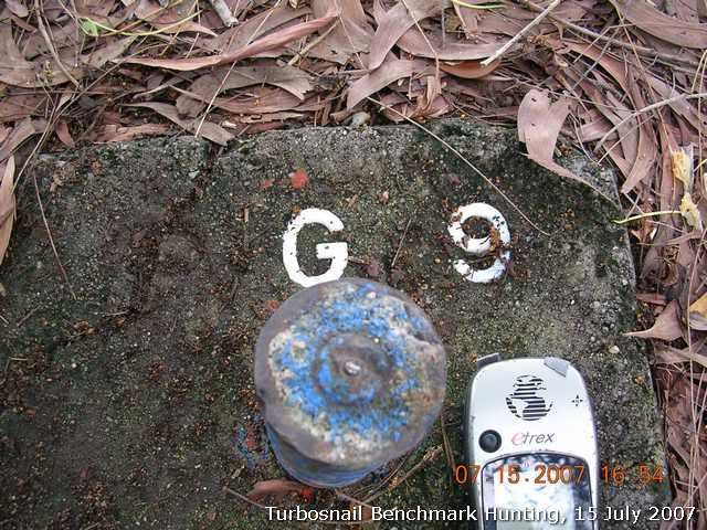
A stand pipe type BM. I don't think it is a TBM. btw, I can't find its record at JUPEM Geoportal.
It's very close to the seaside
Another view of this BM
-
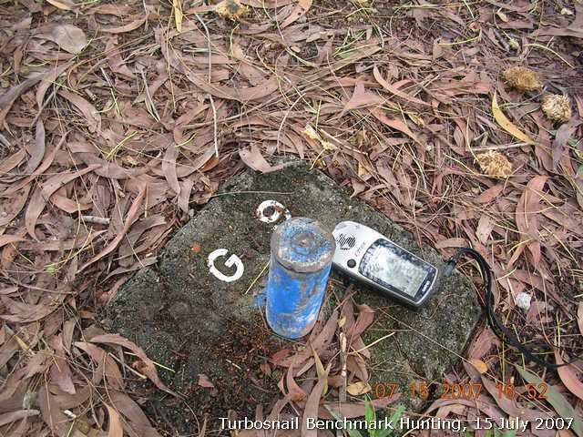
P0476, N5°27.974' E100°17.391'. No I did not check its location on JUPEM portal. I saw it when I was my back from Batu Ferringhi.
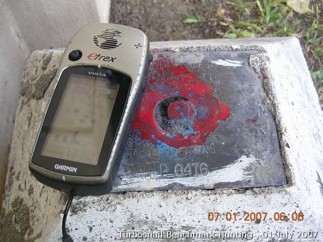
The view of benchmark
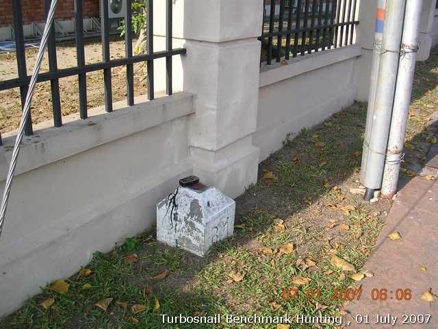
It was located by roadside of busy Jalan Tanjung Bunga
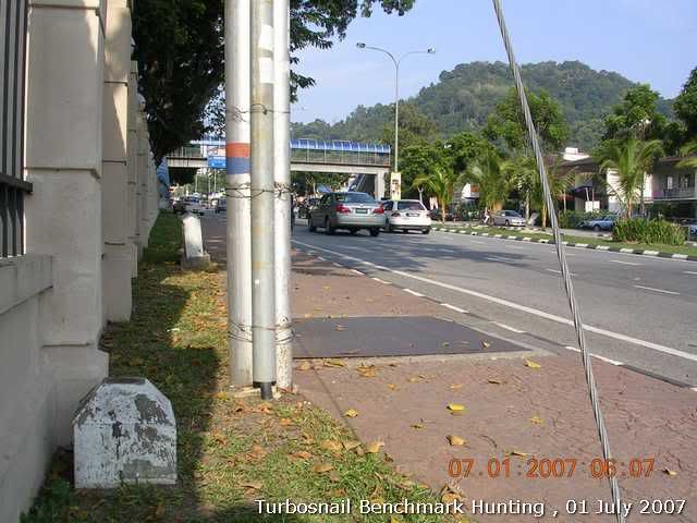
The benchmark is not far from the entrace of Dalat international school
-
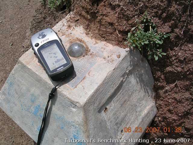
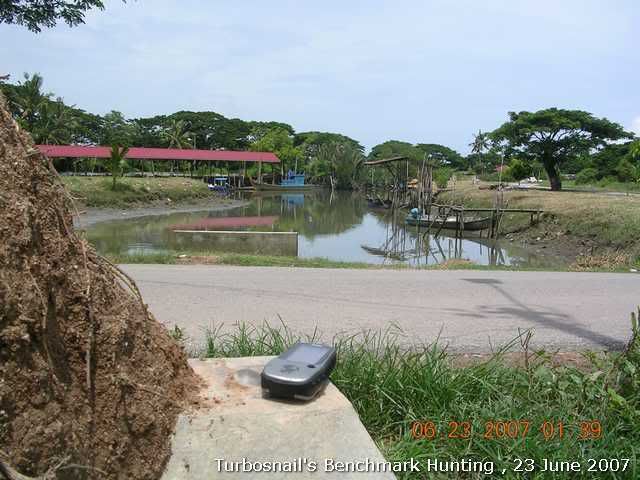
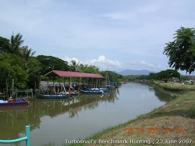
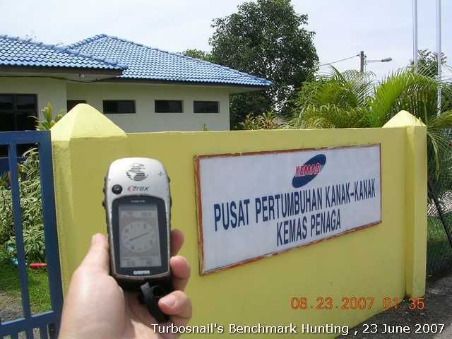
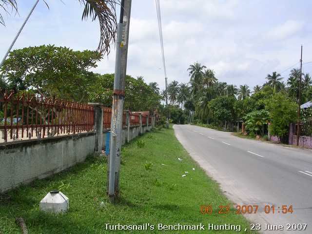
Found the GPS station at Teluk Ayer Tawar. It was within the vicinity of Penaga town area.
GPS Station P288. N5°31.925' E100°22.711'
Calibrated coordinates from JUPEM Geoportal map: N5°31.923' E100°22.731'
GPS accuracy: 7m
Offset: 36m East (N95°E)
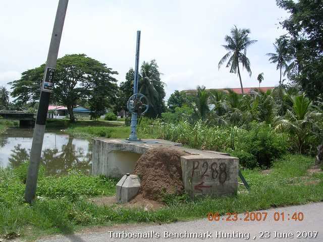
The GPS station was half buried in an ant hill. Require a pair of sharp eyes to spot it.

Nice views to the fishing jetty
Actual location is 36m from the calibrated coordinates.
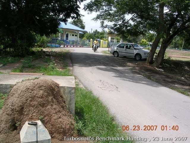
It was a children activity center. N5°31.923' E100°22.731'
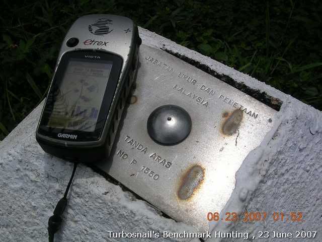
On the way back I found this benchmark as well.
P1550, N5°30.997' E100°22.982'
-
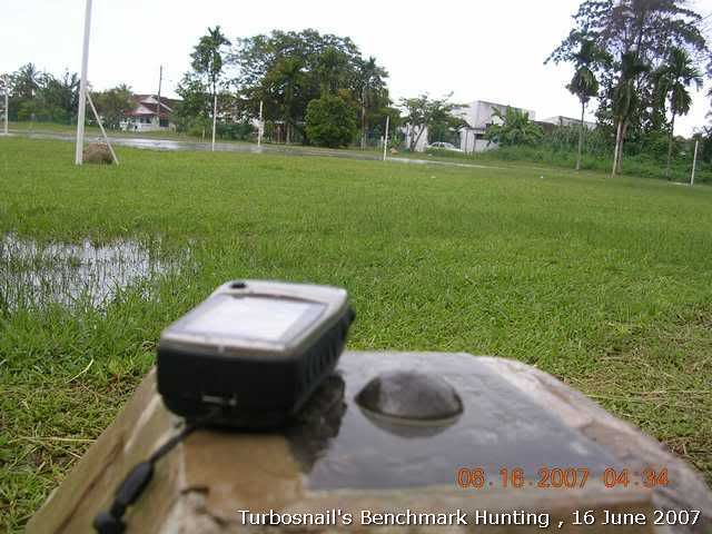
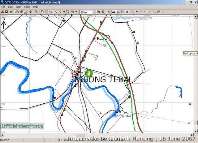
Another GPS station found. It was in Nibong Tebal area.
P282 N5°10.058' E100°29.137'.
The calibrated coordinates from JUPEM's portal map image is N5°10.041' E100°29.087', which is about 97m N70°31'E off. The accuracy of signal reception was reported 12m.
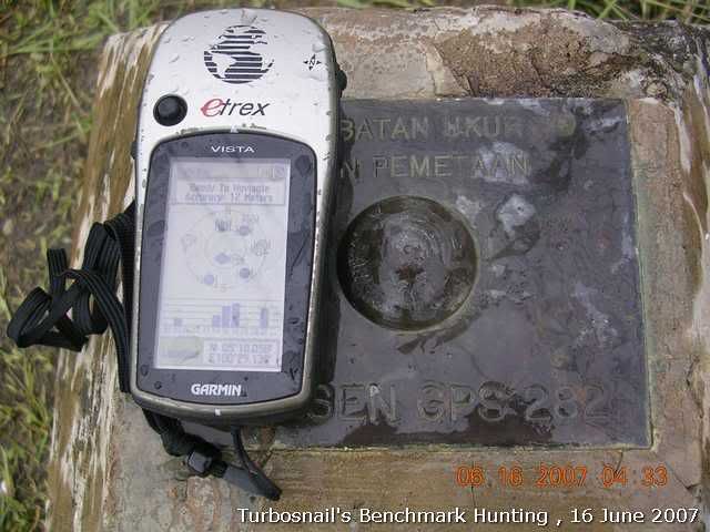
Again, no brass plate to tell JUPEM's measured coordinates
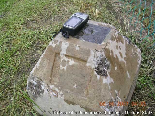
A view to the location that I thought the GPS station would be.
This is how I calibrated the map image that I copied and pasted from JUPEM Portal.
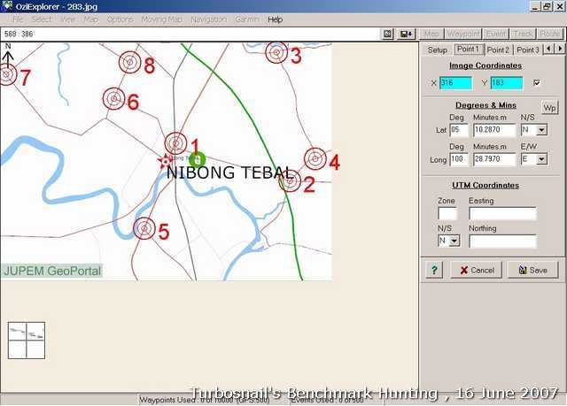
Once it was calibrated I overlayed it with Malsingmaps' NPM. Not really accurate but close. Created a POI at the center of the G symbol and copied and pasted the coor on G7toWin to create a waypoint.
-
I like to plug your coordinates into Google Earth and see where they are. Unfortunately the TBM thingy by the river is in a low resolution area. And Google Earth shows it to be in the water.
Stesen GPS 283 also seems to be off by about 30 feet on GE.
With 10m accuracy on my Garmin Vista when I waypoint the GPS Station, 30 feet offset seems reasonable to me.
We don't have access to WAAS or its compatible DGPS service in Malaysia btw. The reported location will be some way off from the exact locations even with newer and high sensitive GPSrs.
Btw, the TBM(Temporary Benchmark) is by the riverside.
-
It's always interesting looking at your pictures - it looks like Malaysia has quite a different approach to monumentation. Plus, the surroundings look so interesting!
We say the same thing about BMs in US as well...

-
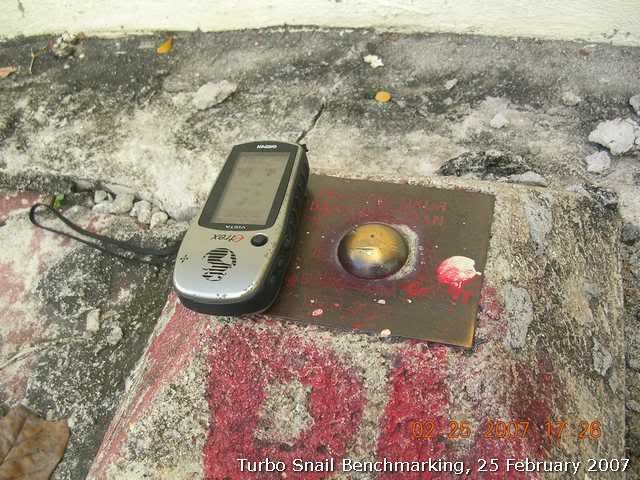
Found my first GPS station(Stesen GPS 283). Coordinates: N5°15.952' E100°25.254'
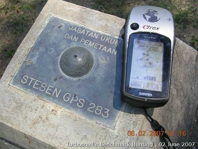
The brass plate that I suspected to have coordinates stamped was missing. I think this is the marketing strategy by JUPEM to make sure that the user will have to pay for the info. Hmm... :-k
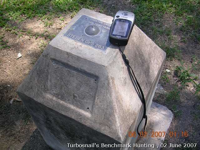
This GPS Station is located inside the Klinik Desa of Batu Kawan.
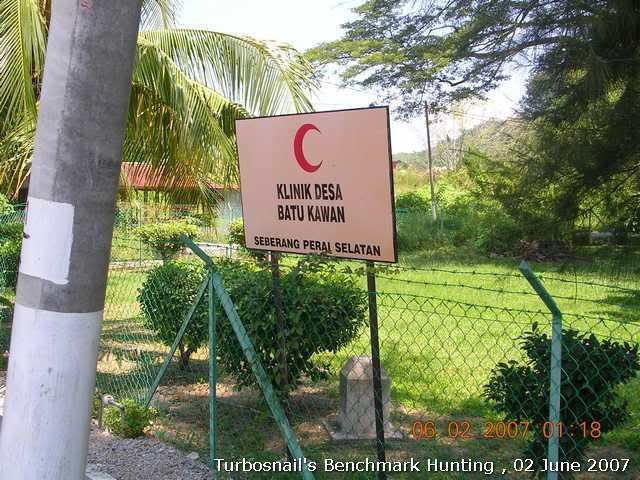
Clean and quiet clinic. Of course, it was a weekend.
Afterwards I went to Bukit Panchor area to find another GPS station. Another GPS Station I didn't get. But I got this TBM thinggy at the riverbank. Coordinates: N5°08.661' E100°30.041'
Beautiful view at the Krian river.
But it seems MPSP, the municiple council of Seberang Perai has forgotten this recreational park.
The JUPEM website seems to be down again when I tried to access just now. Anyway, I will try to locate the Bukit Panchor one again next time!
-
Just planted my first cache.
Some photos to share......
The cache
The surrouding.....
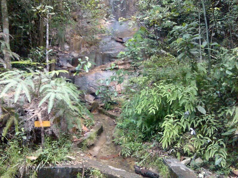
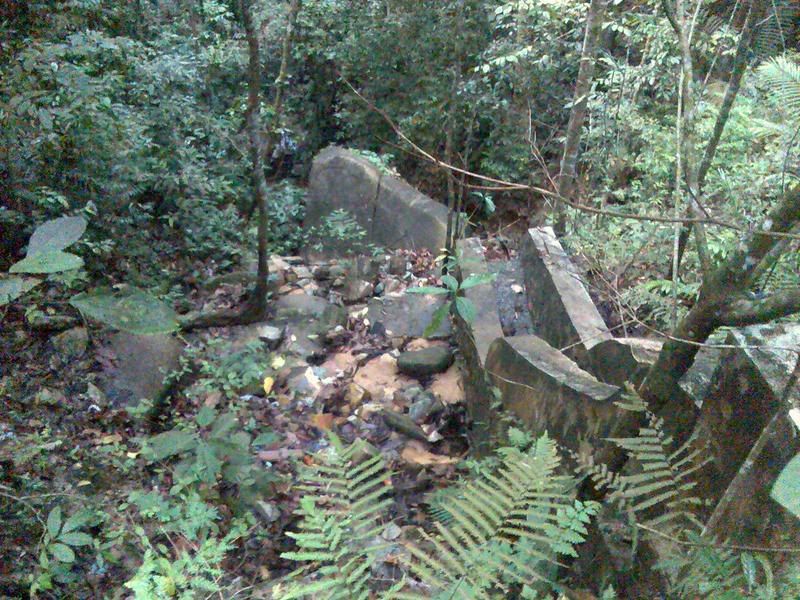
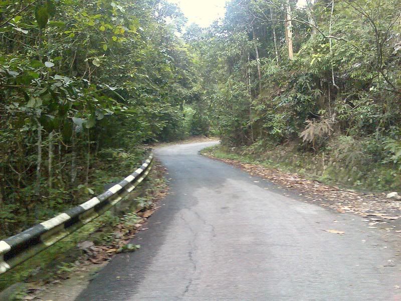
Gunung Pulai, Johore (GC12KH8)
Altitude : around 295 meter from sea level.
This is the second cache posted at Geocaching website(I am sure there were others but were archived for some reasons). Just few days after you planted it was already being visited, a sign shows that geocachers are craved for more caches in Johor!
-
-
JUPEM Geoportal has been back online for a week. I just have a time to to update on the BMs that I previously was not able to identify.
Updates on Destroyed BM
P0055 N5°23.084' E100°18.571'
P0513 N5°25.527' E100°19.503'
P0056(?) N5°22.811' E100°18.720'
Curious, this doesn't have any record at JUPEM
P0005. N5°23.073' E100°18.545'
-
More details of the findings can be found here too.
-
I have been having problems to log on to Jupem website since this Sunday. I think they are in the stage of upgrade the homepage now.
Here are my finds this Sunday. I will update the PID once the Geoportal is back on line.
P0126. N5°24.633' E100°18.457'
P0005. N5°23.073' E100°18.545'
Destroyed BM
Found in front of Pepsi Squash center, Jalan Jelutong. It's across the street of P0005.
N5°23.084' E100°18.571'
This one is at the Northam Street or Jalan Sultan Ahmad Shah. N5°25.527' E100°19.503'
There is also one in the junction of Jalan Williams. I don't know if this is the one, or it has been missing. N5°22.811' E100°18.720'
-
I am ok with the idea of creating the category on waypoint.com. But I would like to see if I could stir up more people to be in to benhcmarking. So far I see two other active members.
I would suggest to wait a little longer and see what happen.
Why don't we use this forum to log our findings first? Also, as temporary measure a wiki section has been created at malsingmaps.com. You can also log your finds there.
Creating a premium membership is a good idea. We have to explore how are we going to do when it is due to update the membership. Do we have a long term commitment to keep it active after one year? I think we need to explore that too.
Anyway, lets get ball rolling first.
-
John -
Yes I noticed that, but if any of them would become a premium member and be the category leader, I and some of us here could join in and help them start the category.
 A person doesn't actually have to live in a place to help start a waymark category for it. For instance, I'm part of the Canadian Benchmarks category and for Historical Markers categories of 3 states that I don't live in.
As one of the members pointed, none of the posters from Malaysia here are premium members. Since this is pretty new in Malaysia, we would like to see what is the response like after we posted our findings here.
Of course, if any of premium members can help to create a category at Waymarking.com that would be great!


 A person doesn't actually have to live in a place to help start a waymark category for it. For instance, I'm part of the Canadian Benchmarks category and for Historical Markers categories of 3 states that I don't live in.
Malaysia Geocachers
in Asia
Posted
Have been missing in action. Now looking some time to have some house cleanings for my caches in Penang! ...