

lucyandrickie
-
Posts
347 -
Joined
-
Last visited
Posts posted by lucyandrickie
-
-
Lucy went up and replaced Iron Horse today. That's one less can that needs to be carried up the hill.
-
We are very saddened by this, Cristy. It was always nice to run into Bob on the trail. He was a great guy.
-
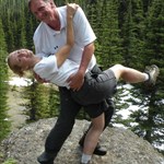
Best poses yet!
-
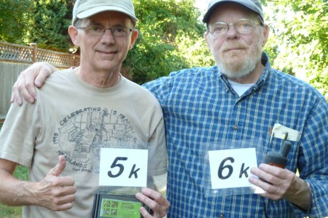 Congrats to the Brothers McKinley (Team Sagefox & Wienerdog)on hitting milestones together!
-
-
He's guarding the black nano to his left

-
Now for the important stuff......what color did you get!
-
Go for the Cooper. It's small enough to navigate & weave around the pot holes on logging roads

-
Rickie wants to play golf but I'd like to do this hike again.
-
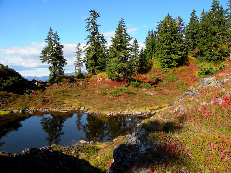
Our favorite hike was to CBWA Cache. The cache hadn't been found in three years and we hit it at the peak of fall color.
-
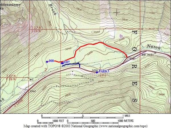
TotemLake, my origional thought was that we could hike up beside the freeway on the north side of the barriers, it is mostly flat and grassy there, then drop down across the creek. It would cut out a lot of time trying to bushwack across all the scrub brush.
Back in 2004 Runhills, Nolenator, Lucy and I basically did this exact thing on the way to the old Geo Stumpy cache.
We parked on a logging road on the south side of US 2 at approximately N 47 46.848 W 121 02.877. This is less than half a mile from the cache. We then crossed to the north side of US 2 and walked west until we found an open rocky slope that led down to the creek. Once at the creek it was about 500 or 600 feet of creek walking to the area of the cache and about 100 feet of some of the toughest bushwhacking we have ever down. We did get to ground zero but didn't find the cache.
Here is a rough map of the trip. the red line is the normal winter route and the blue line is the summer route.
Good Luck!
-
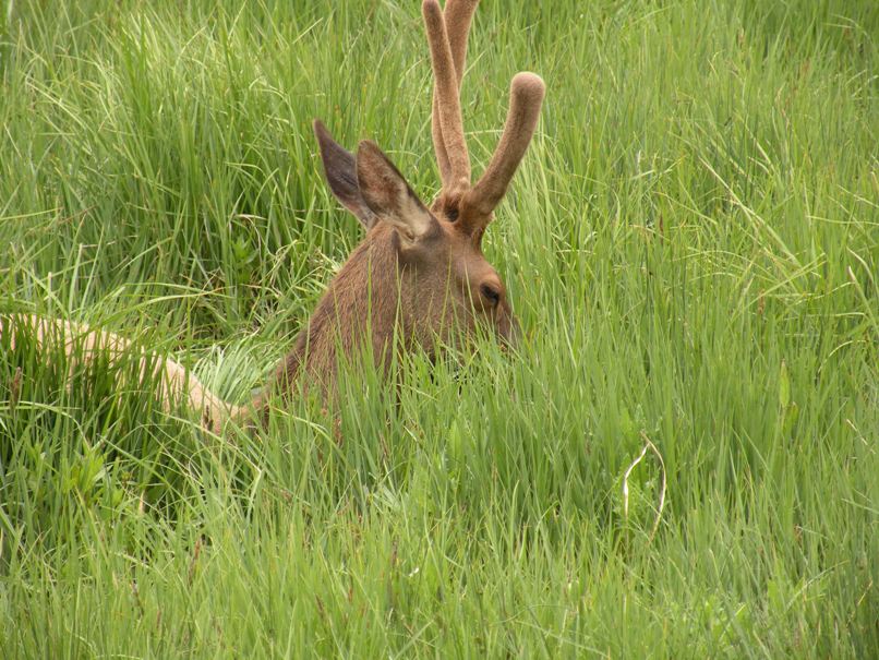
We saw this guy and a whole bunch of his wives and kids while on vacation in Colorado.
-
We'll join in, too.
-
We were alerted today about this this podcast.
Listen to it and see what it's like to find a cache on the radio courtesy of KUOW.
"Curses, Wienerdog"
-
Sorry if I missed it in this thread, but is there a direct link to upload data? I cannot attach a file through the board emailer app, so if you want to message me, Moun10Bike, I can reply to that mail with the .gpx file.
Its just a small set of trails in a nature park in Abbotsford, B.C. collected with a Colorado, on 4 separate occasions, manually averaged in mapsource.
The email address for data contributions is info@switchbacks.com.
-
Greg, I think that they are more interested in going to the Ape Cache. If that is true then everything you need is below.
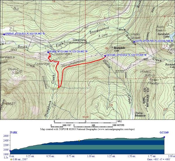
* Exit 47 from I-90
* Large well signed parking area on the south side of the highway
* Less than 4 miles round trip
* Around 600 feet elevation gain, almost all of it in the first mile.
* The trail is in good shape as it has been worked on in the last few years.
* Another half mile up the railroad grade is the second oldest cache in the state (Iron Horse).
-
Look what we saw out by the Hood Canal Bridge on Saturday.....
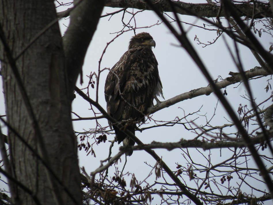
A juvenile bald eagle!!!
-
Bummer. I was looking forward to seeing you again.
Ditto! Sorry to hear that, Allanon.
 More importantly, who will heat up the chili for the Frito pies now?!
 We have a stove and fuel already in the car. We'll run back and get the food heated up before everyone else gets back.
-
We'll join in this one.
-
Thank you!
-
I hear Wenatchee was a happy place yesterday. Robinego is a grandma

Welcome to the world, Ella Nicole!!! (I forsee a trip over the mts. in the very near future)
-
Lucyandrickie have a black Honda CR-V with a TB sticker. Don't know where they are this weekend, though.
It wasn't us. We spent the entire day in Redmond at the REI scratch n' dent.
-
Based on the description by Marcus, this is what I have for a route:
I see four caches along the route:
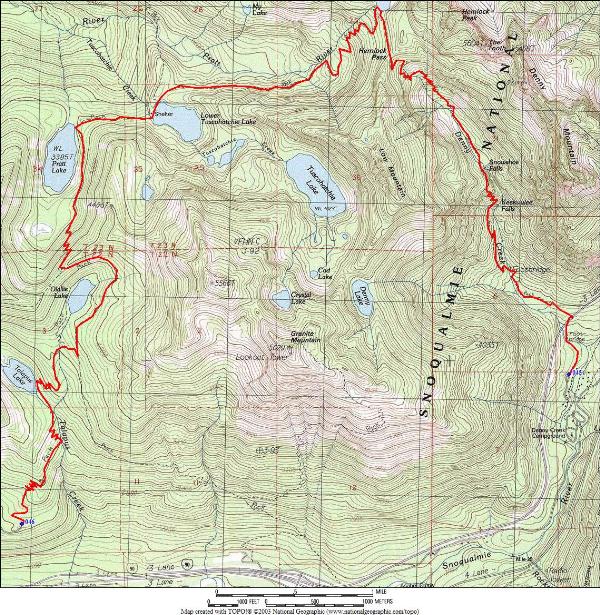
Melakwa Heaven is do-able with another two miles and thousand feet.
-
Do you know the approximate distance and elevation change for this hike?
Thanks
Appoximately 12 miles and 3000 feet.

Milestone Congratulations
in Northwest
Posted
After 11+ yrs of caching, Eraseek hit 4k yesterday. A regular numbers hound, that man